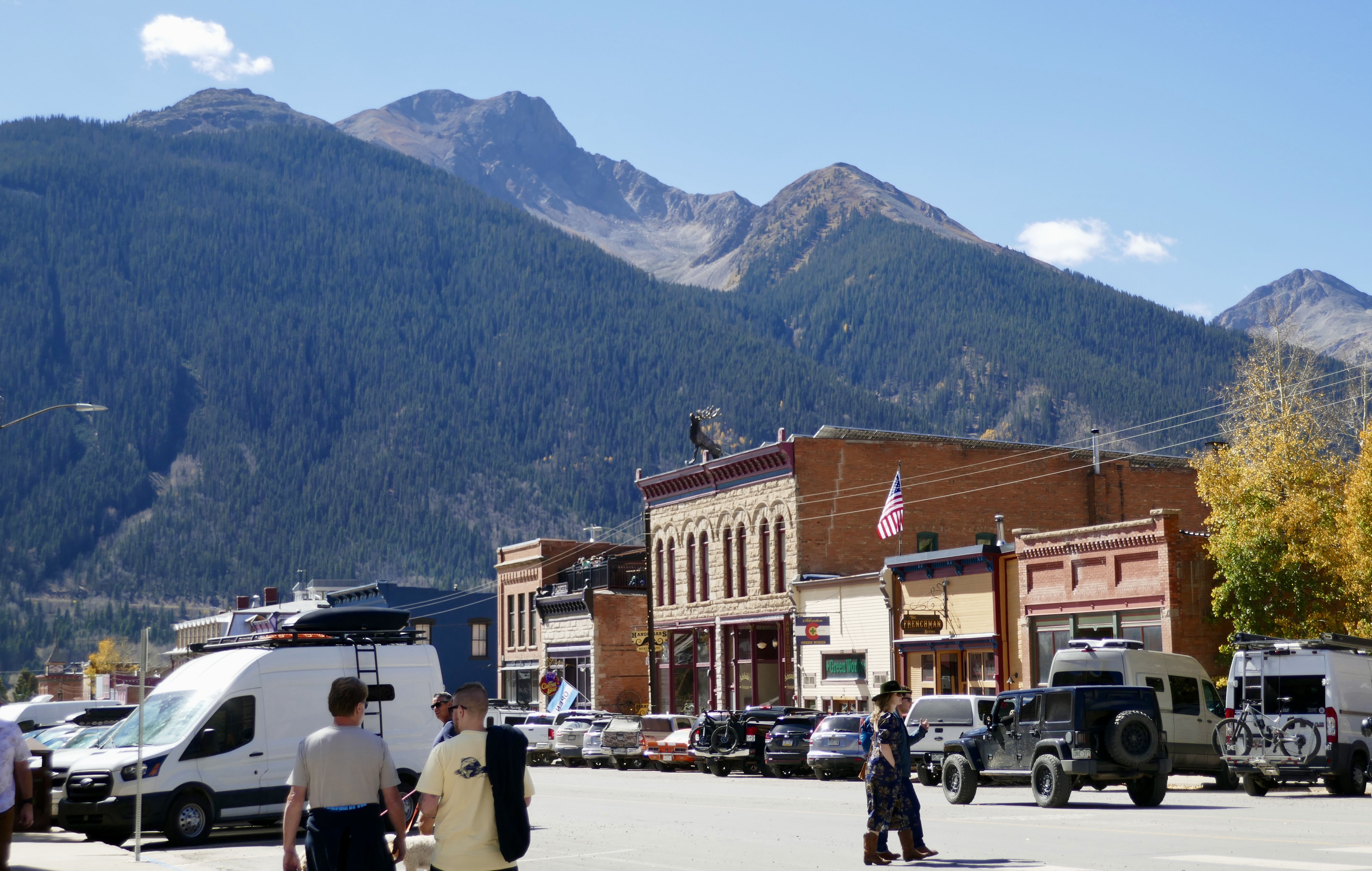
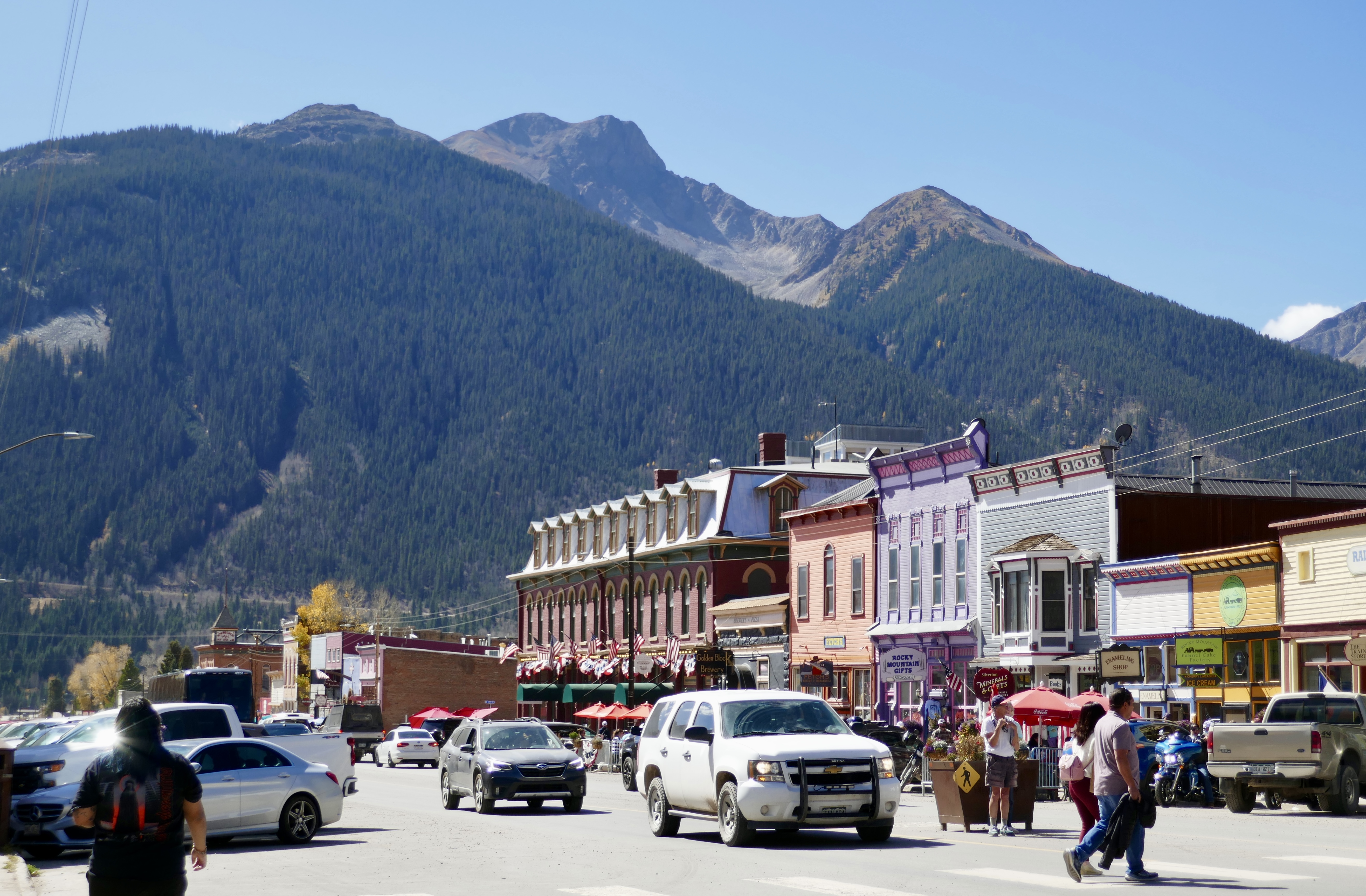
We spent our two-hour layover in Silverton looking around in shops and enjoying local barbecue and ice cream.
And then we headed back to Durango.
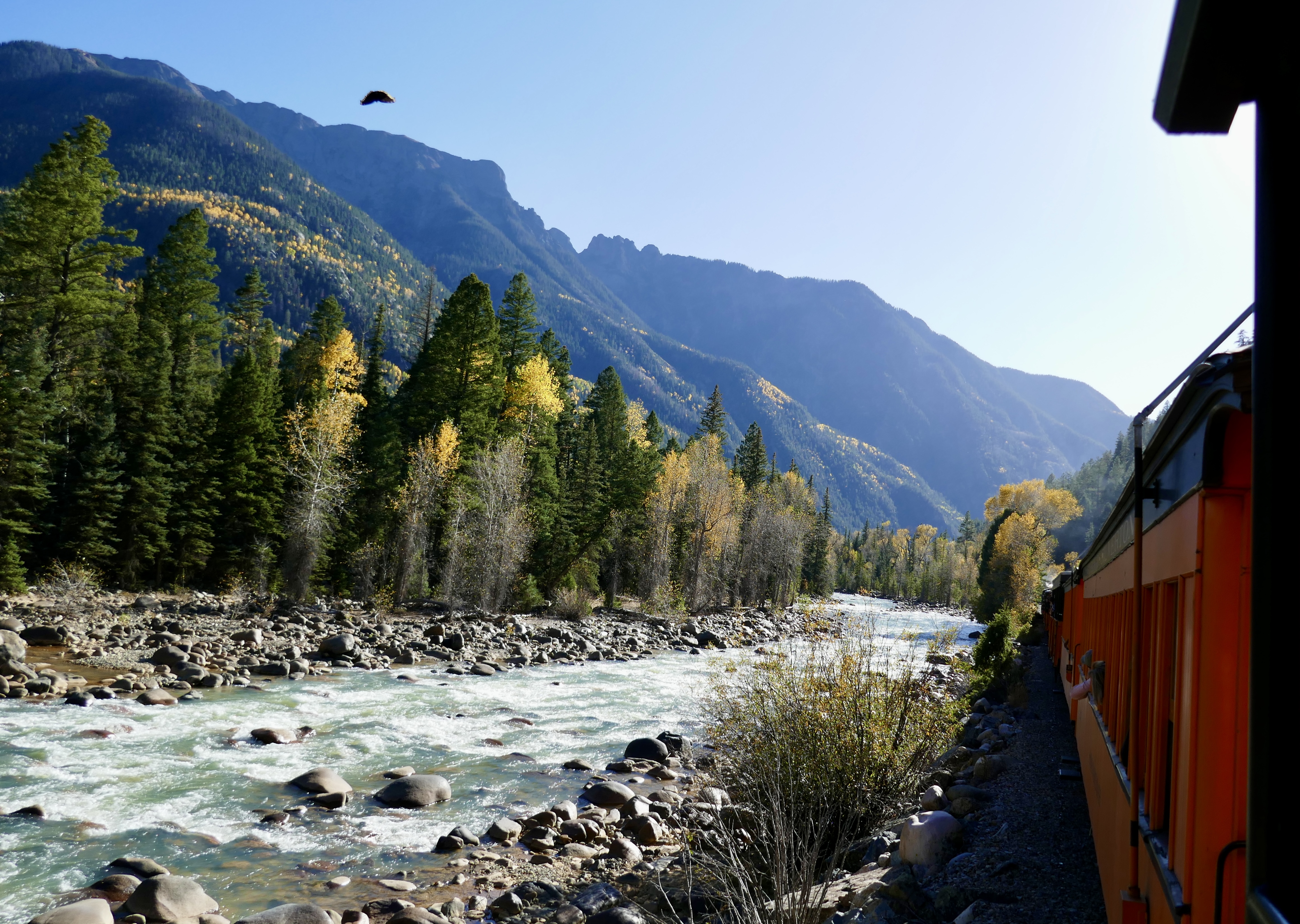
Moth on the window looks like a hang glider.


This is a really nice way to spend a day. Recommended!

We spent our two-hour layover in Silverton looking around in shops and enjoying local barbecue and ice cream.
And then we headed back to Durango.
Moth on the window looks like a hang glider.
This is a really nice way to spend a day. Recommended!
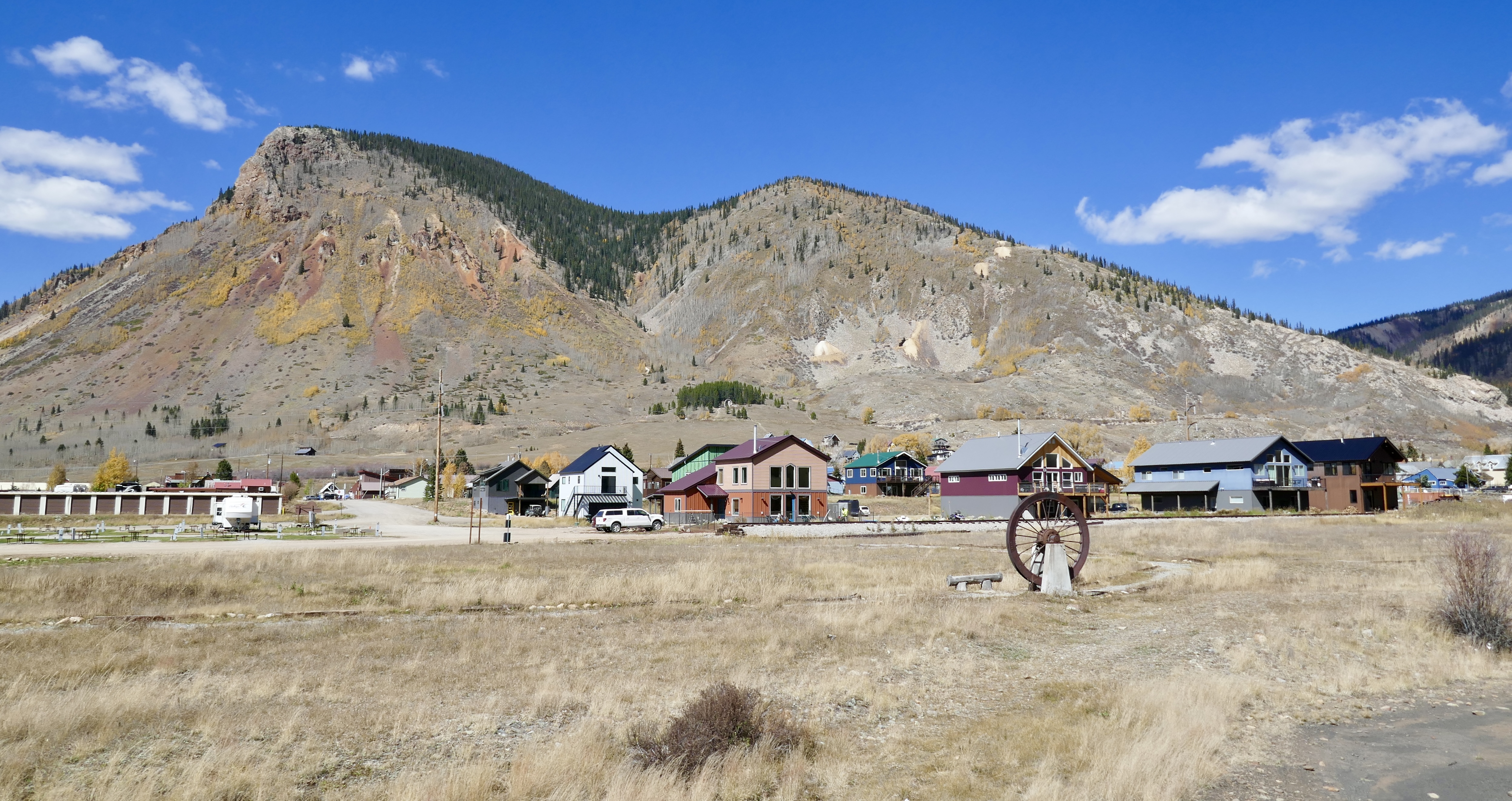
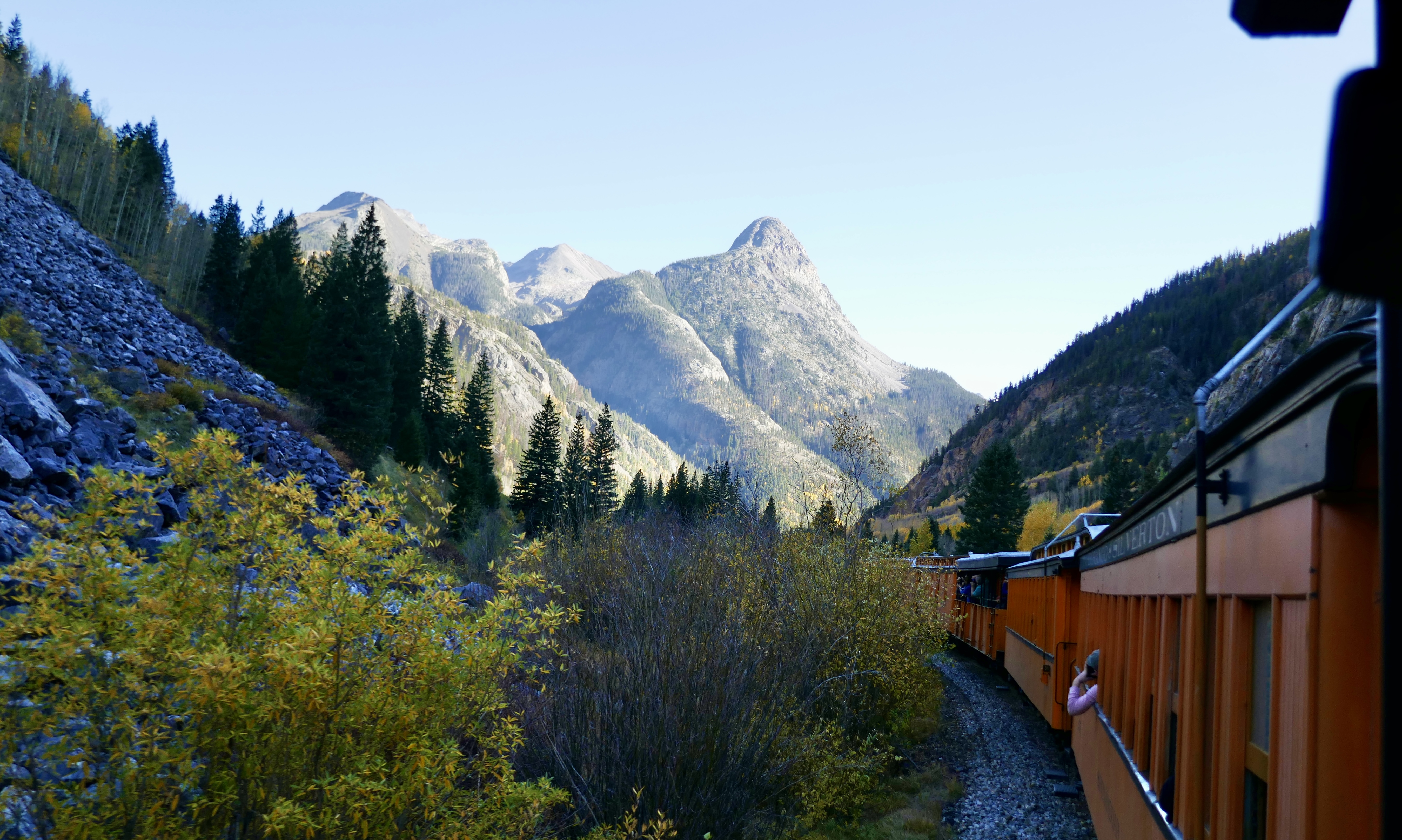
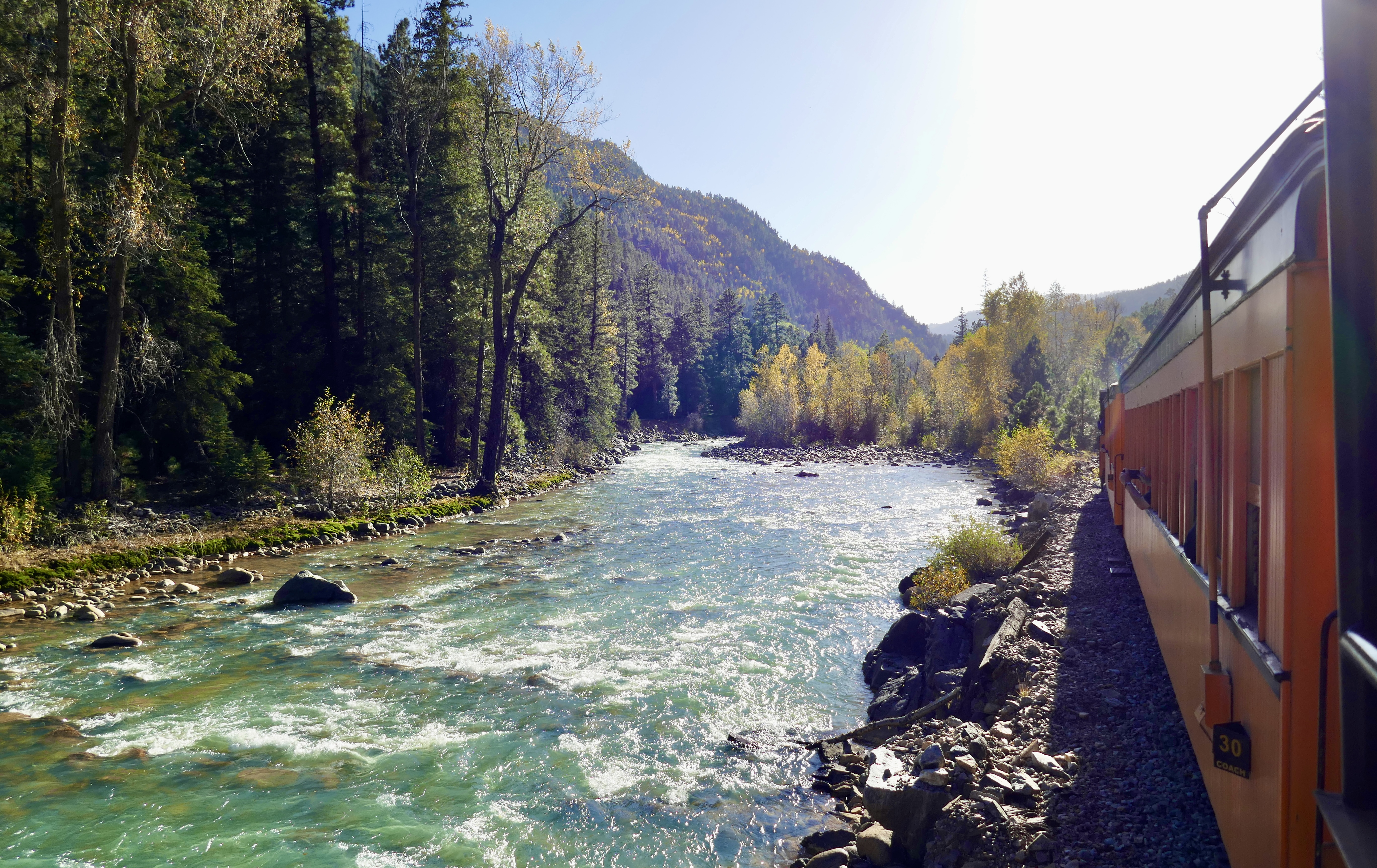
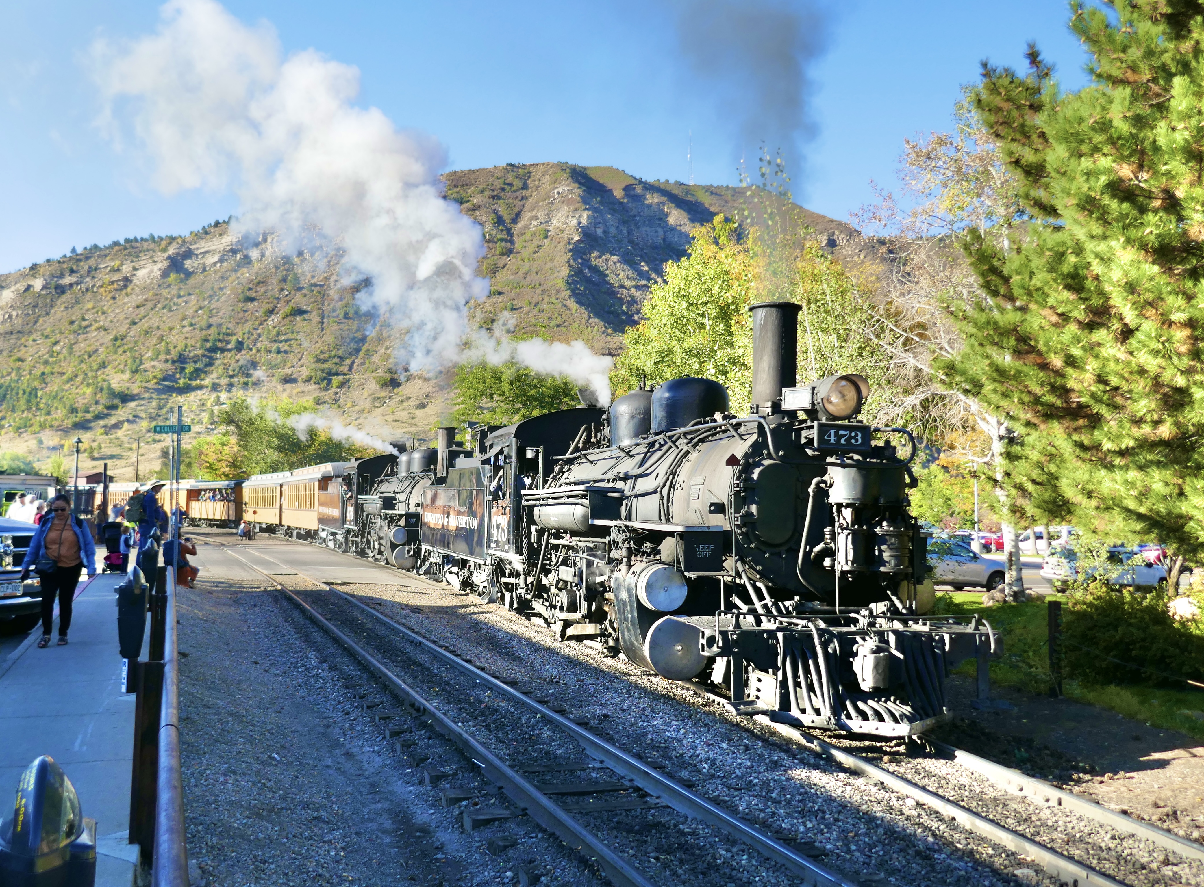
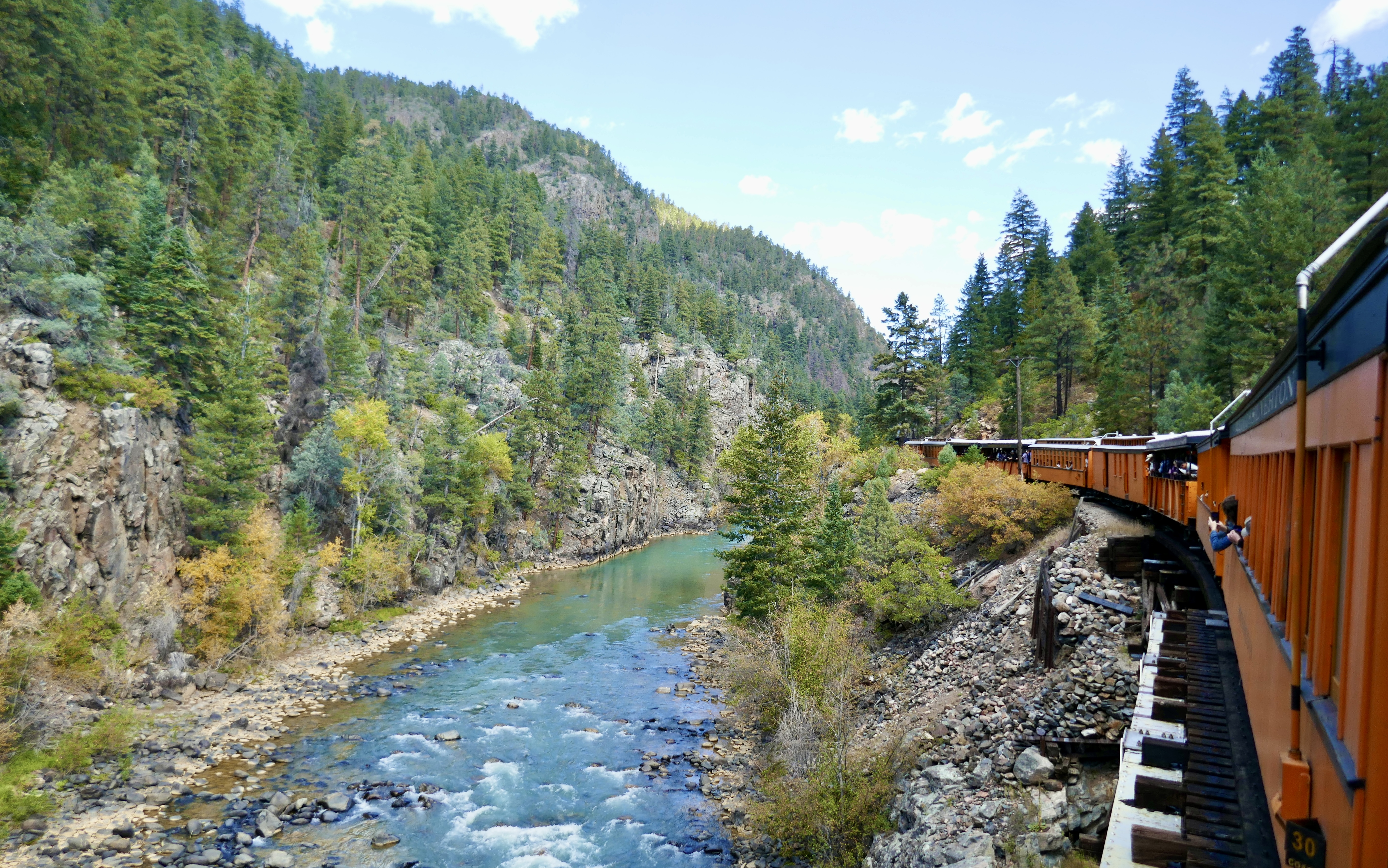
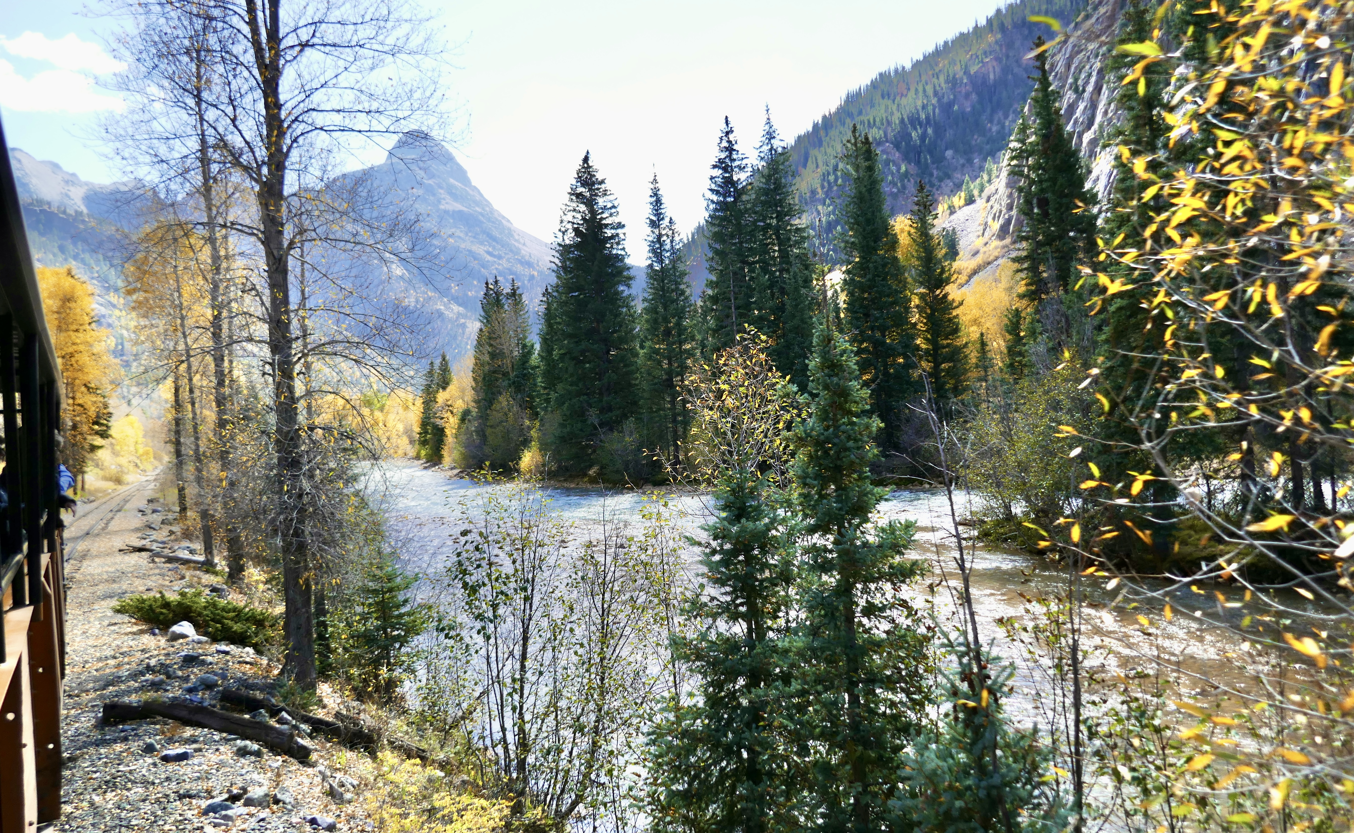
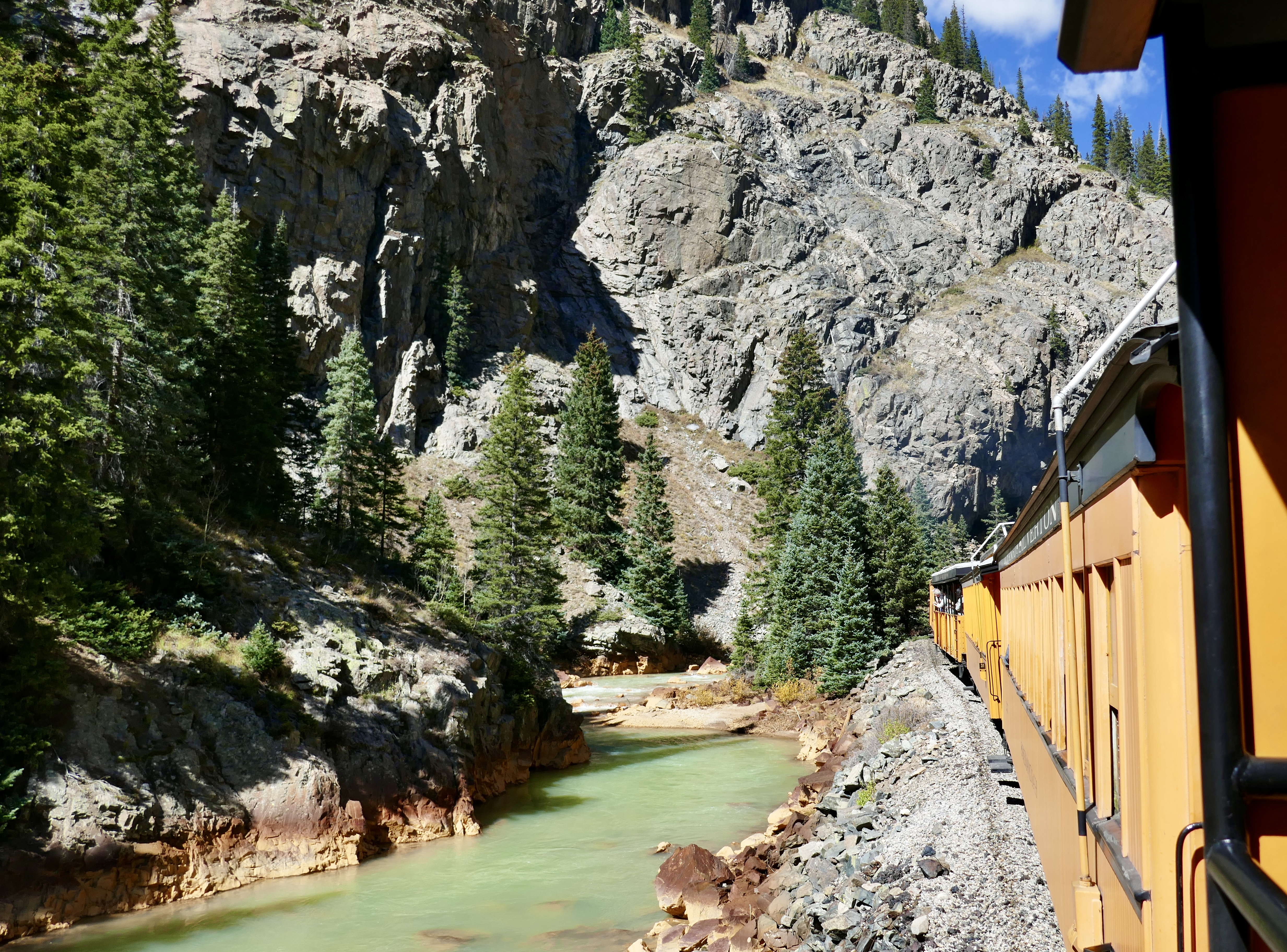
In early October of 2024, we took the Durango & Silverton Narrow Gauge Railroad from Durango to Silverton and back. It’s a gorgeous ride and I would recommend it to anyone, especially in the fall.
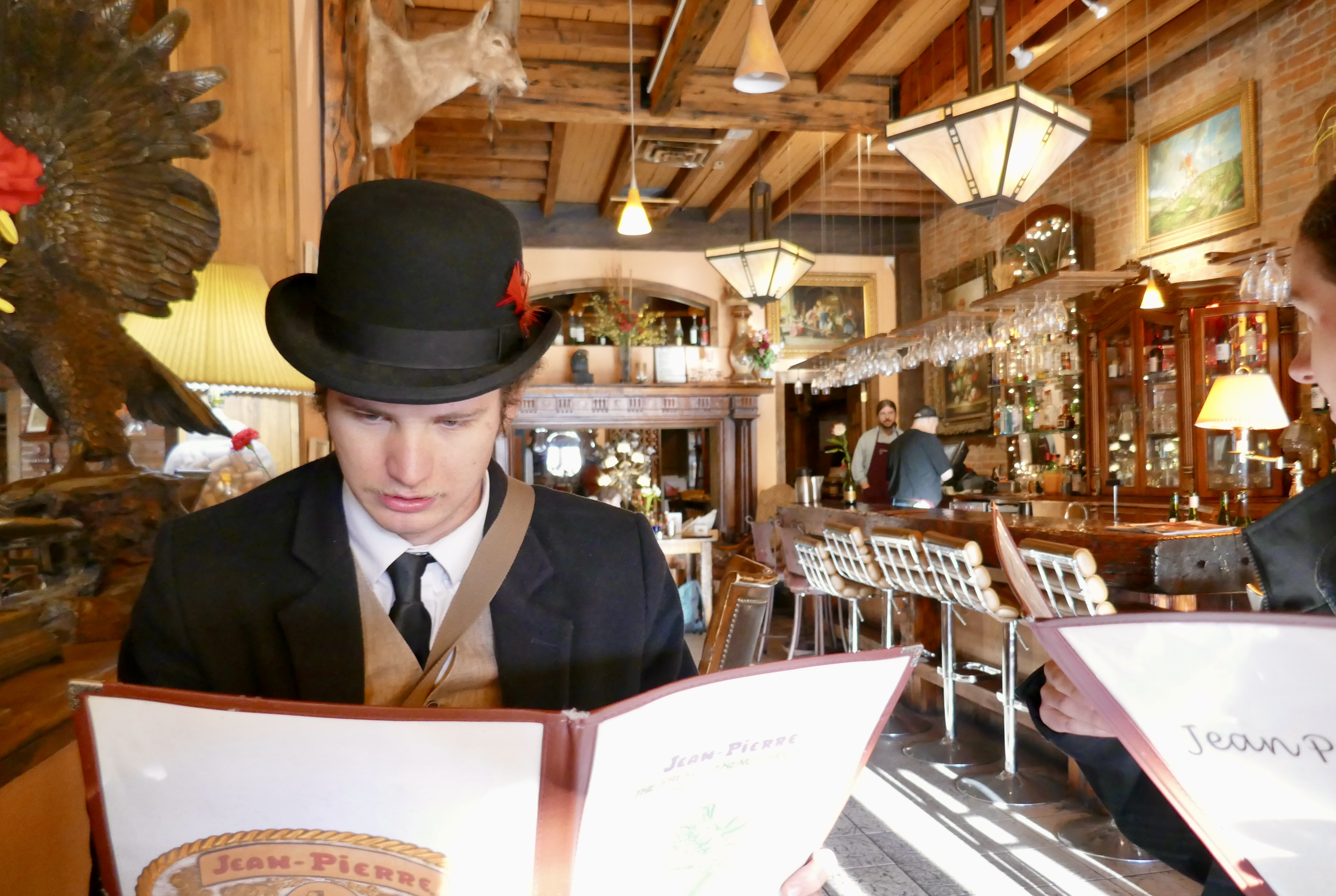
We drove into Durango with plenty of time to spare, so we started off with a delicious breakfast at
Jean Pierre’s French Bakery.
Then we walked to the depot…
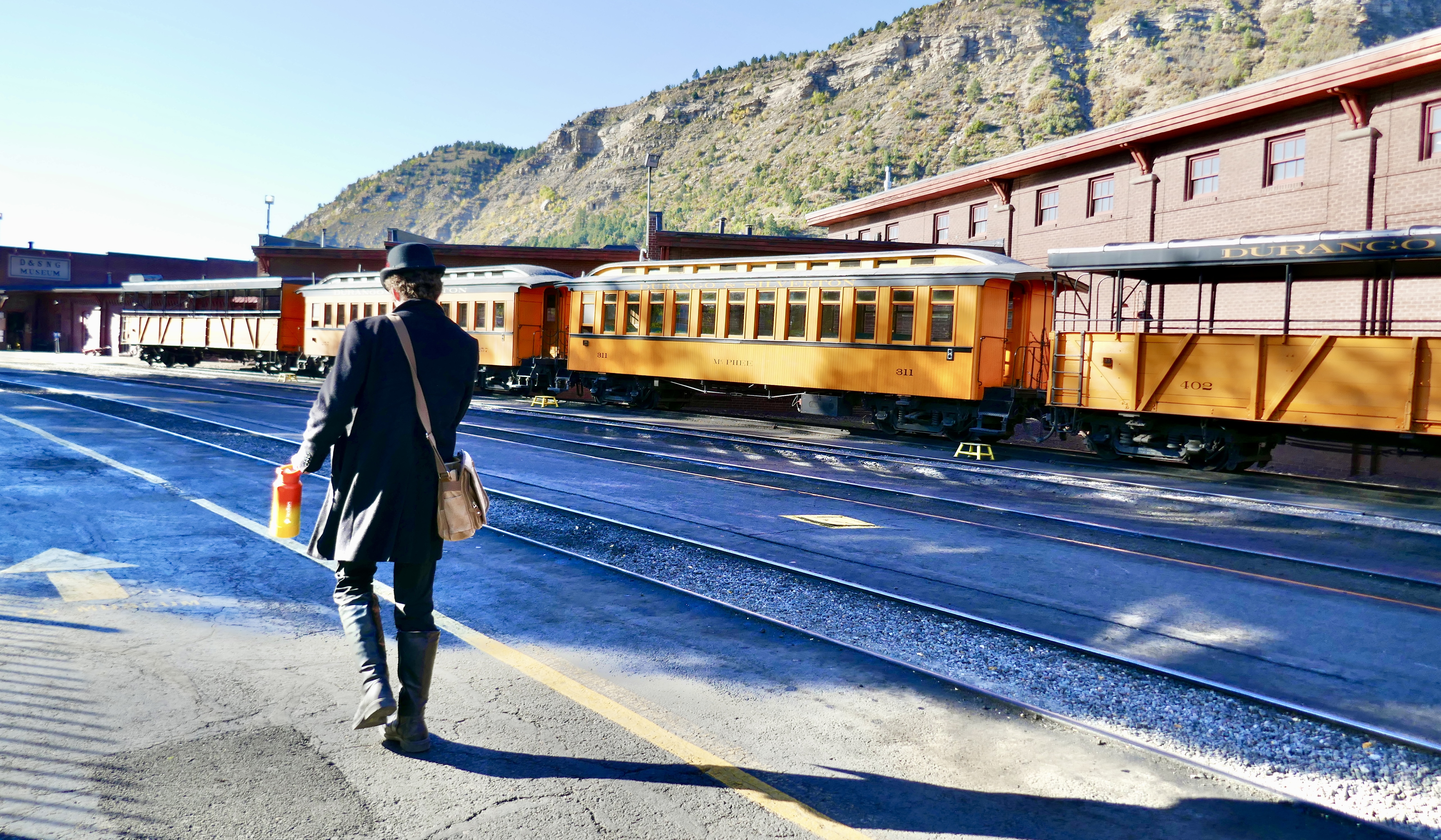
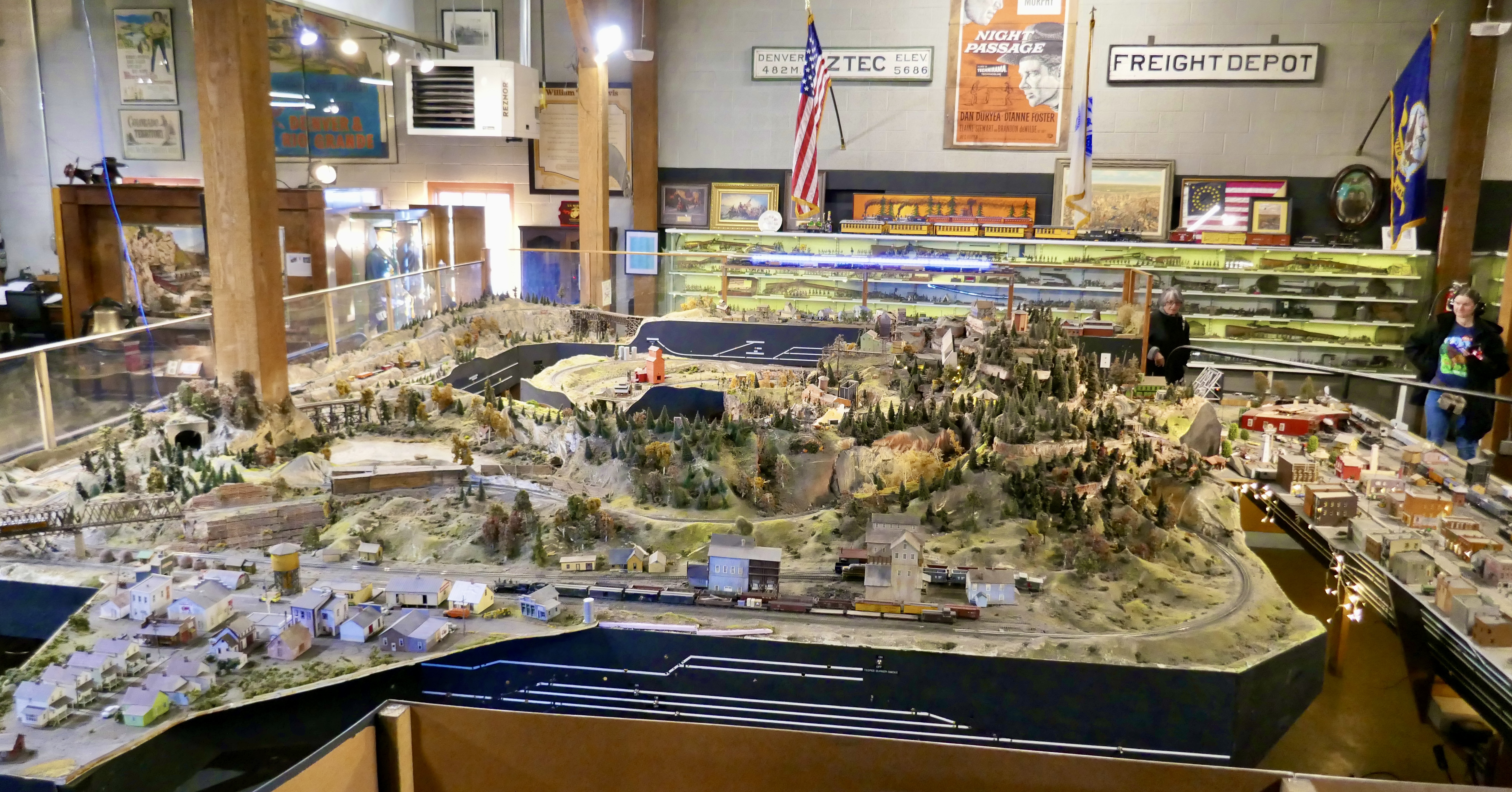
and checked out the D&SNG Museum.
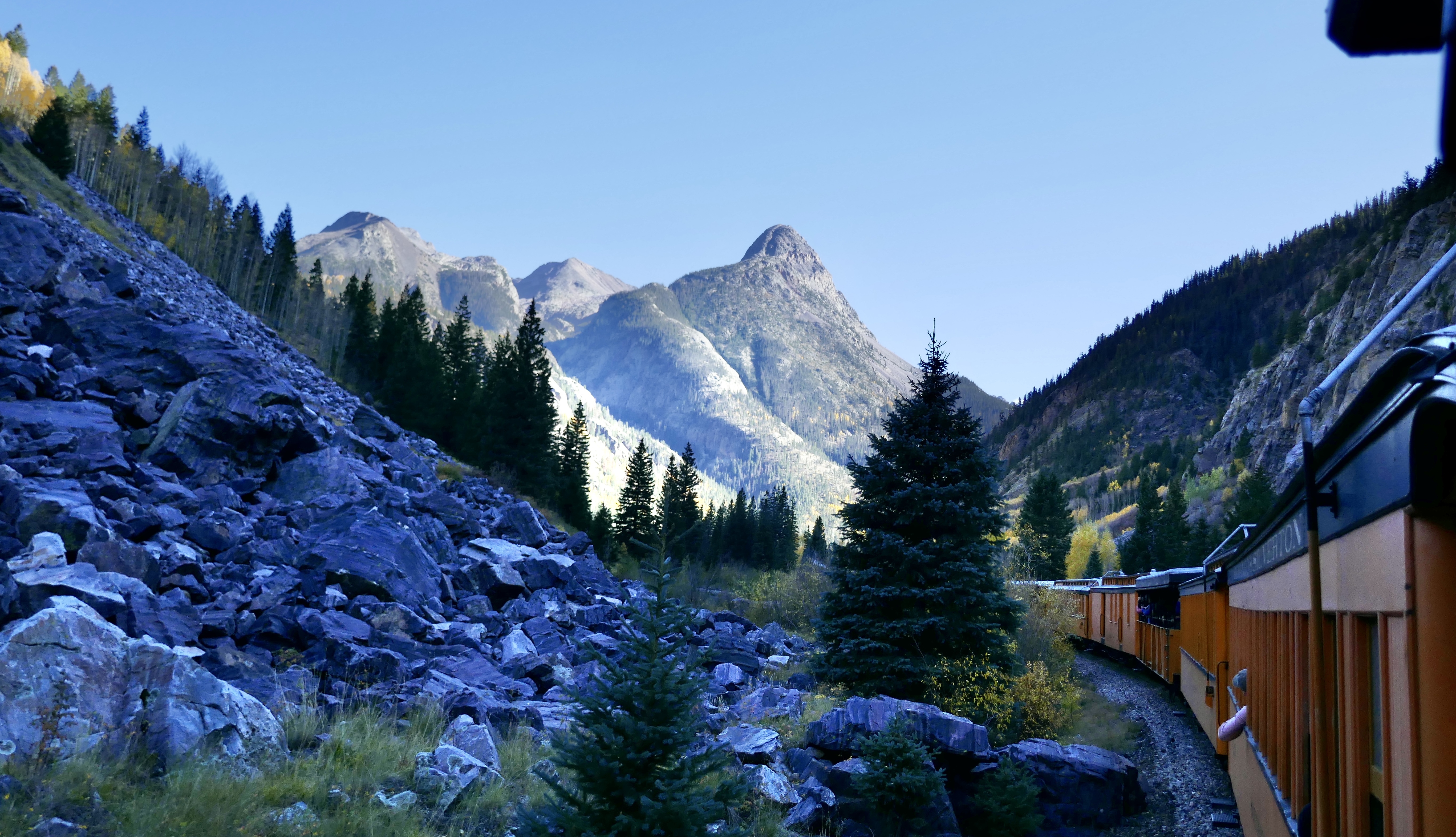
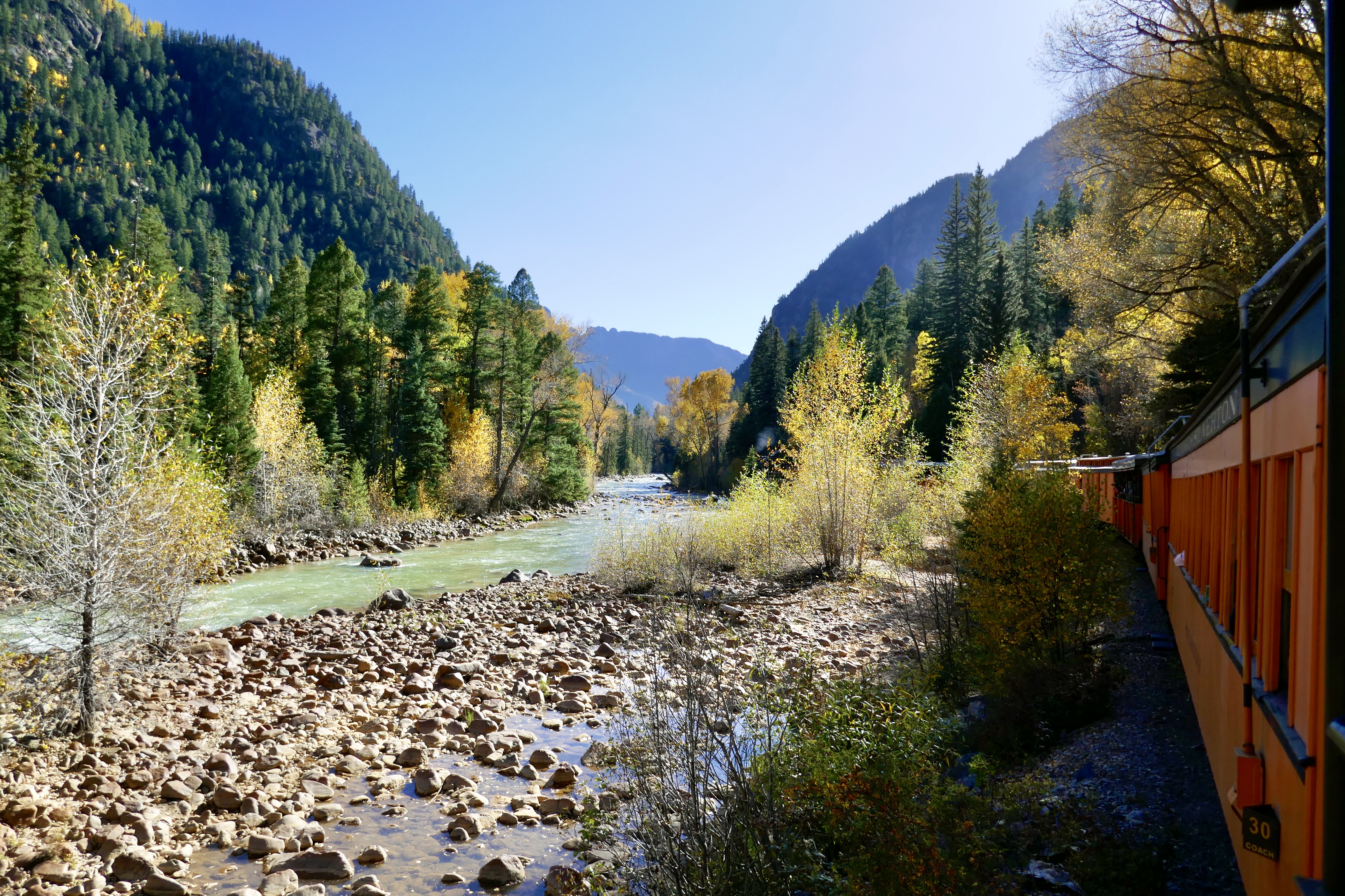
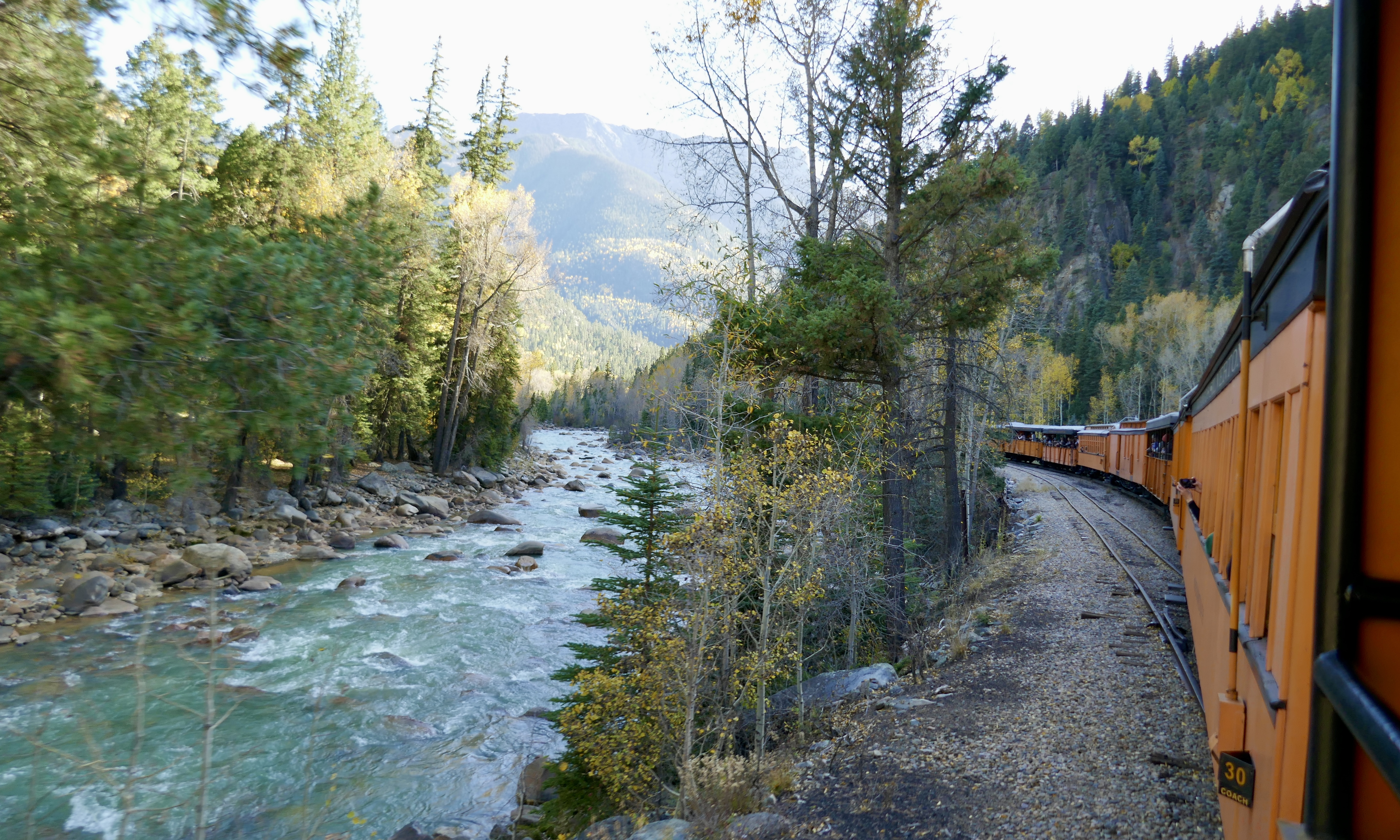
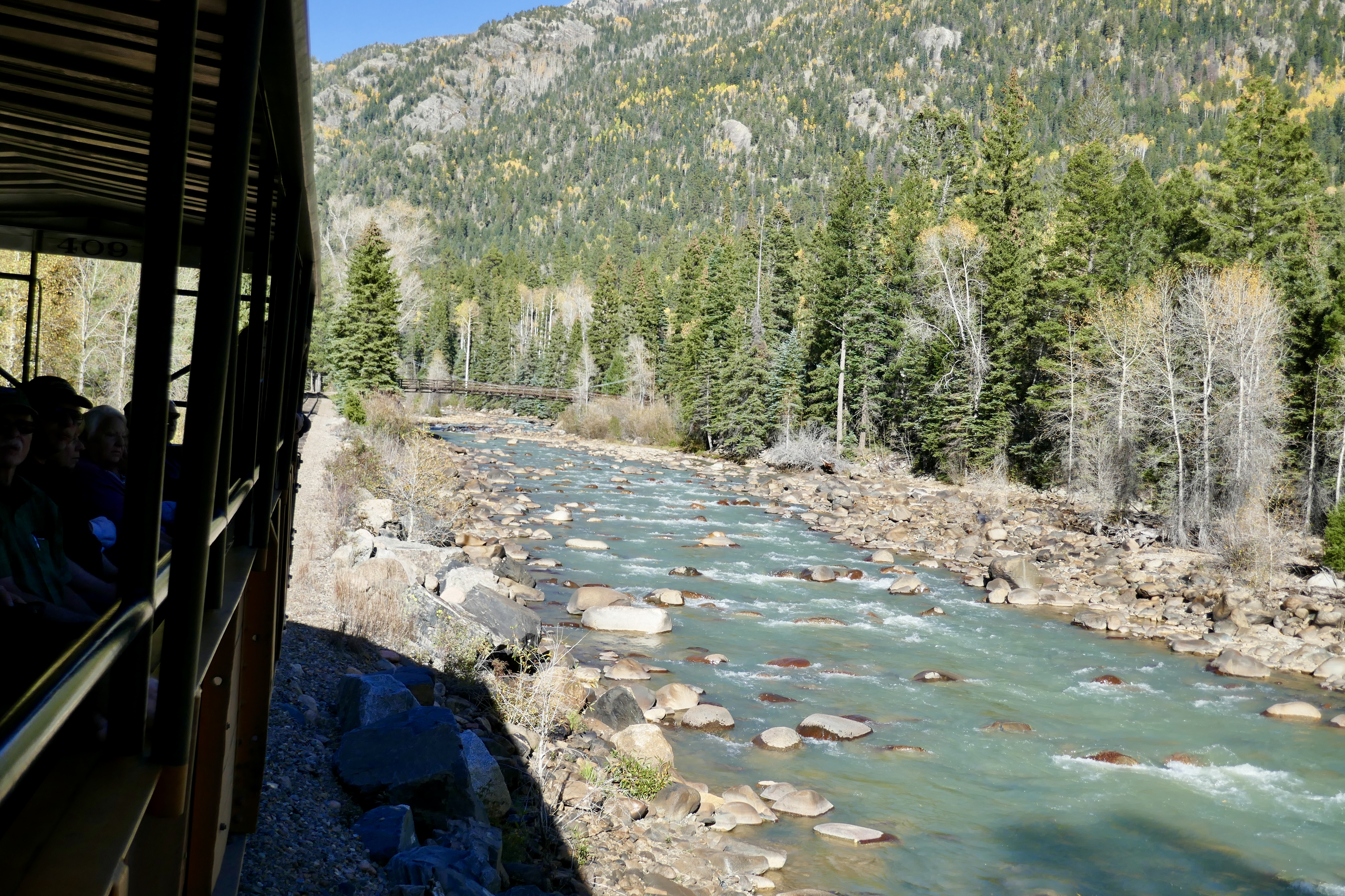
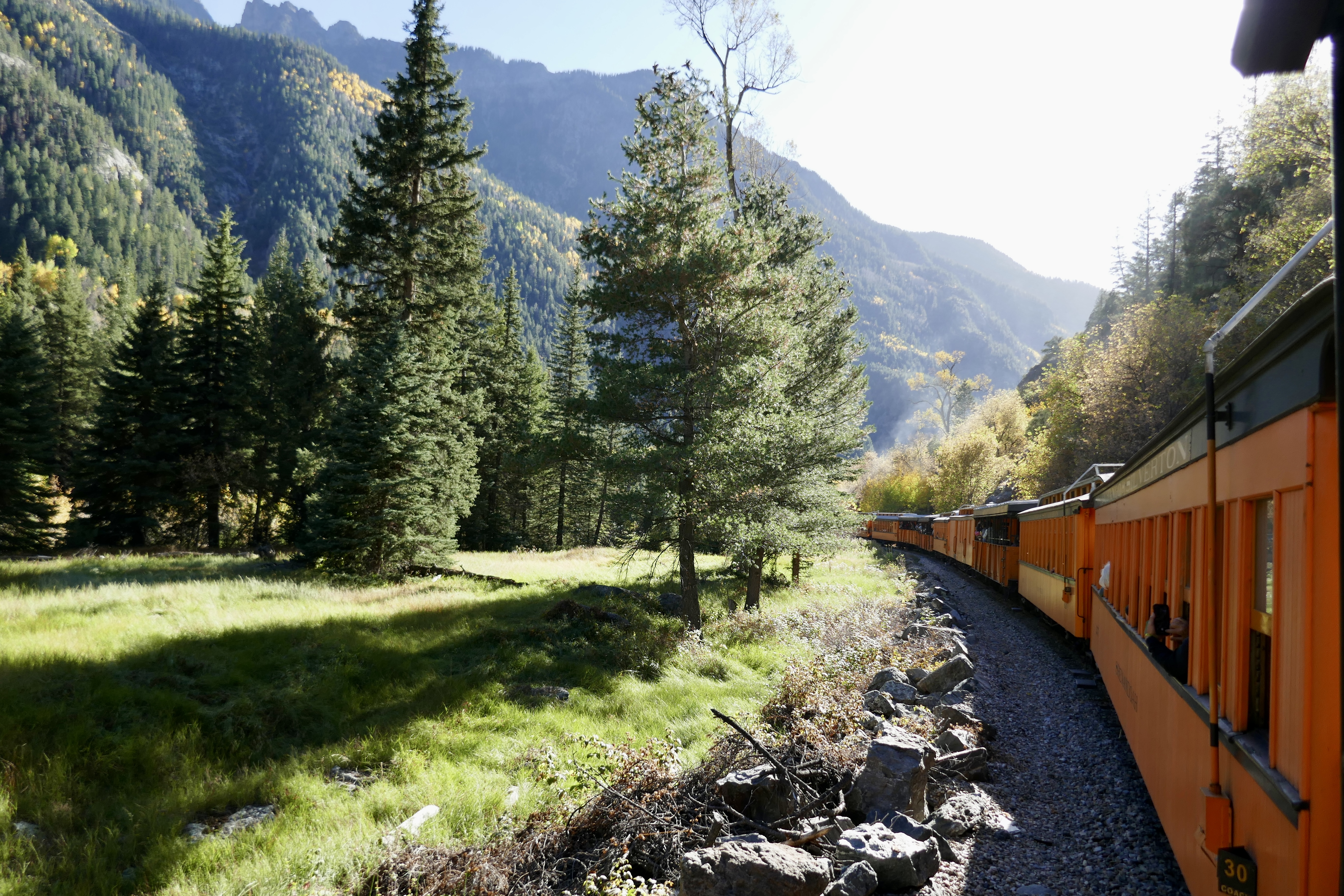
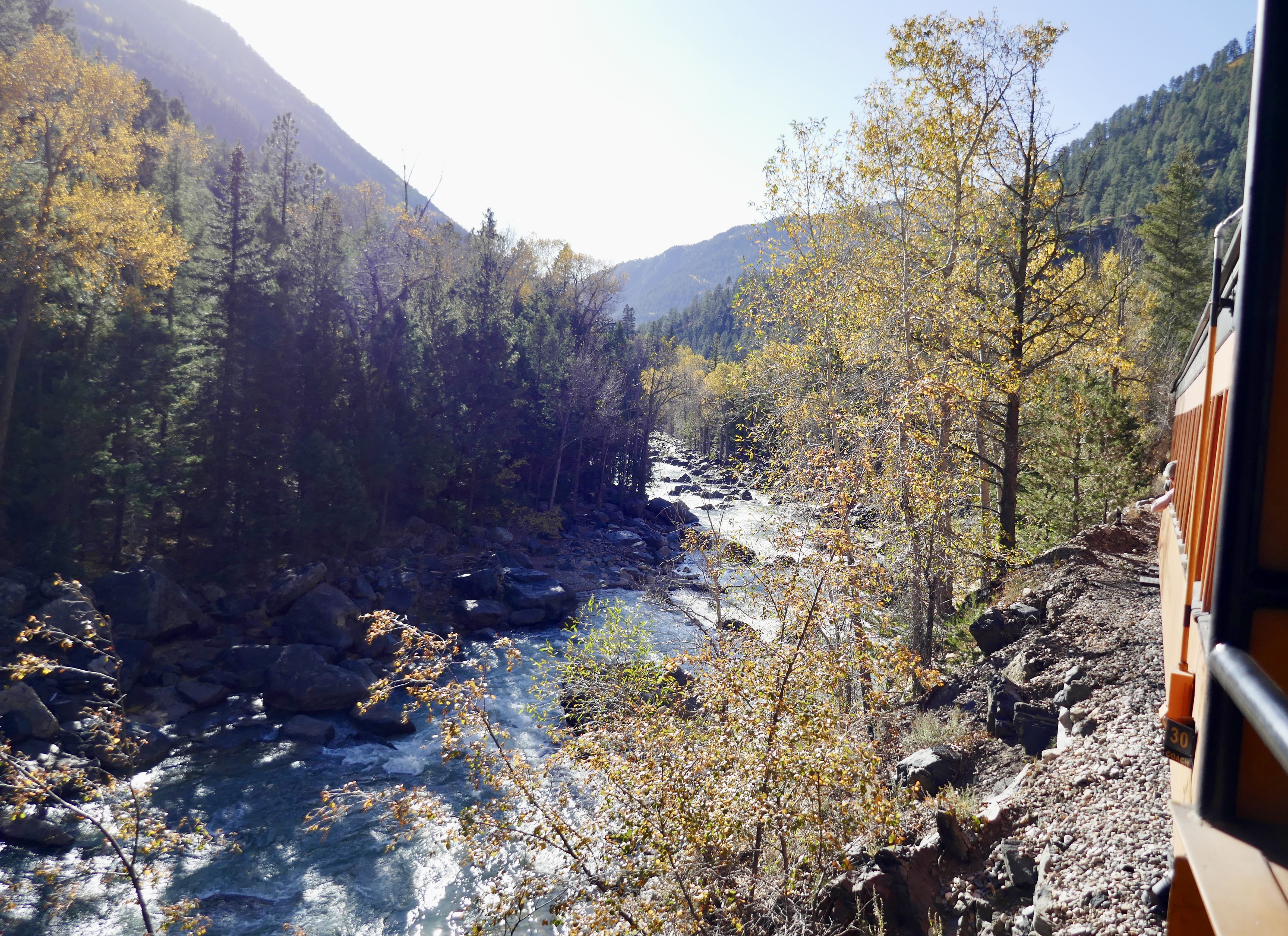
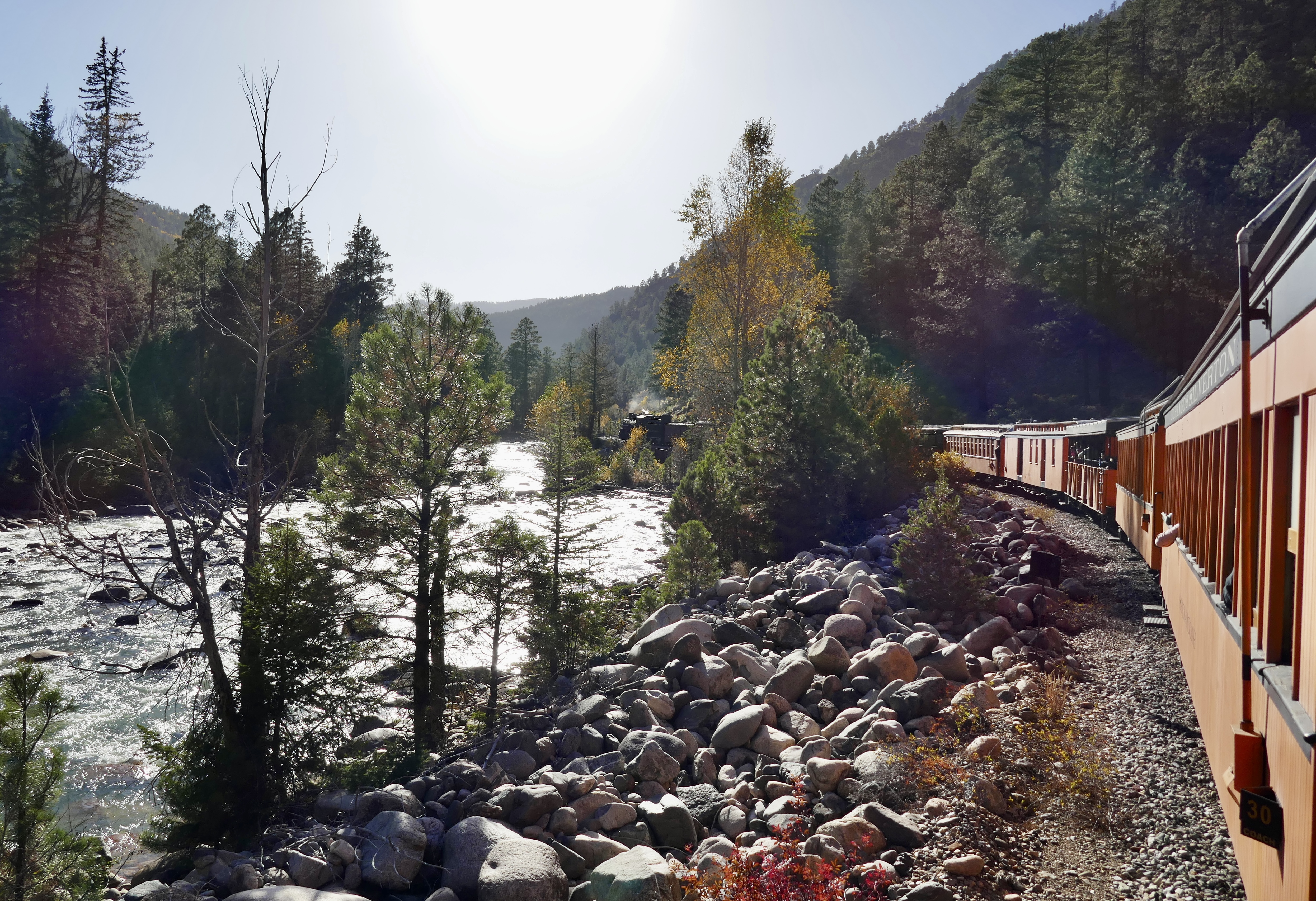
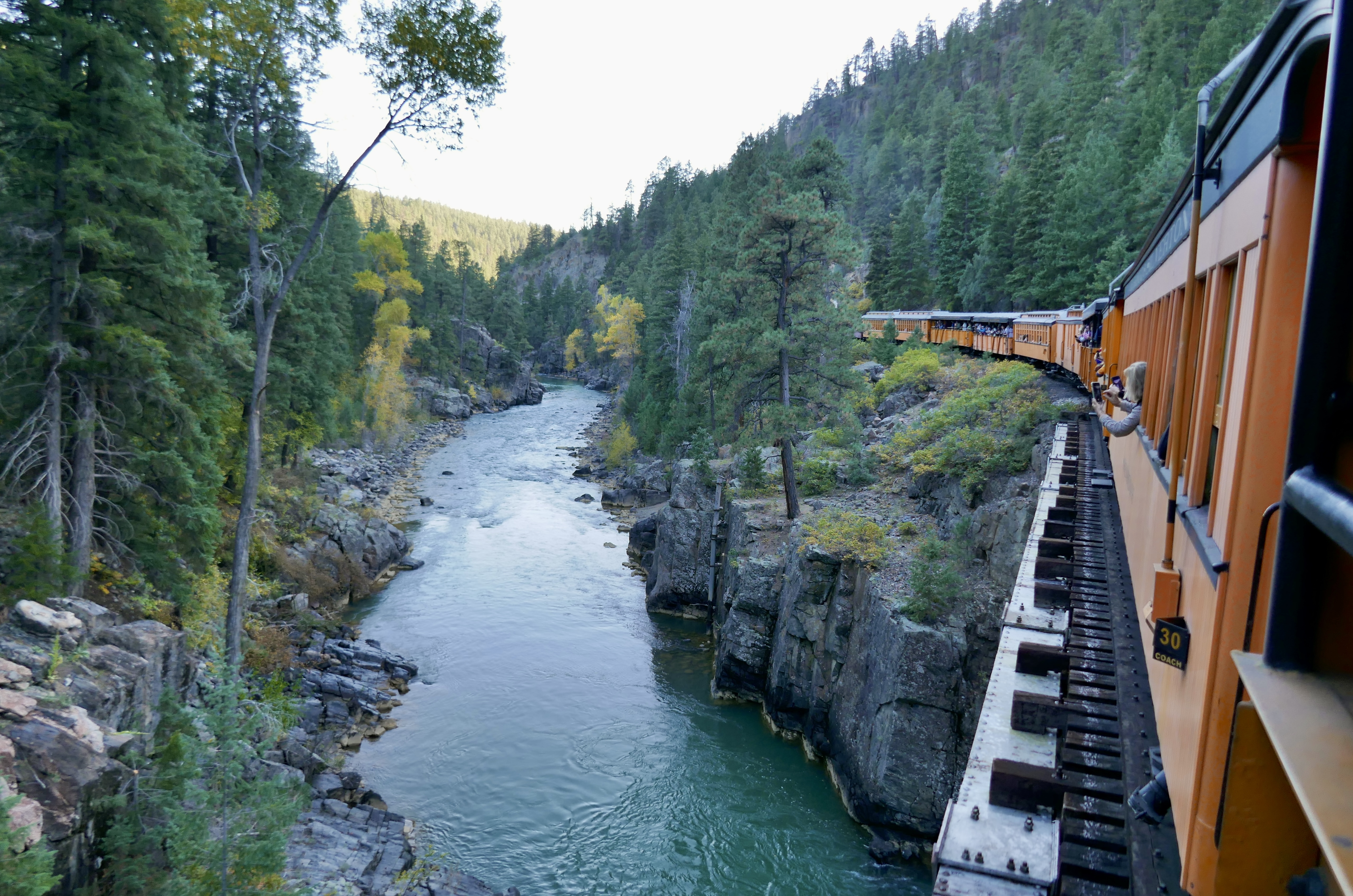
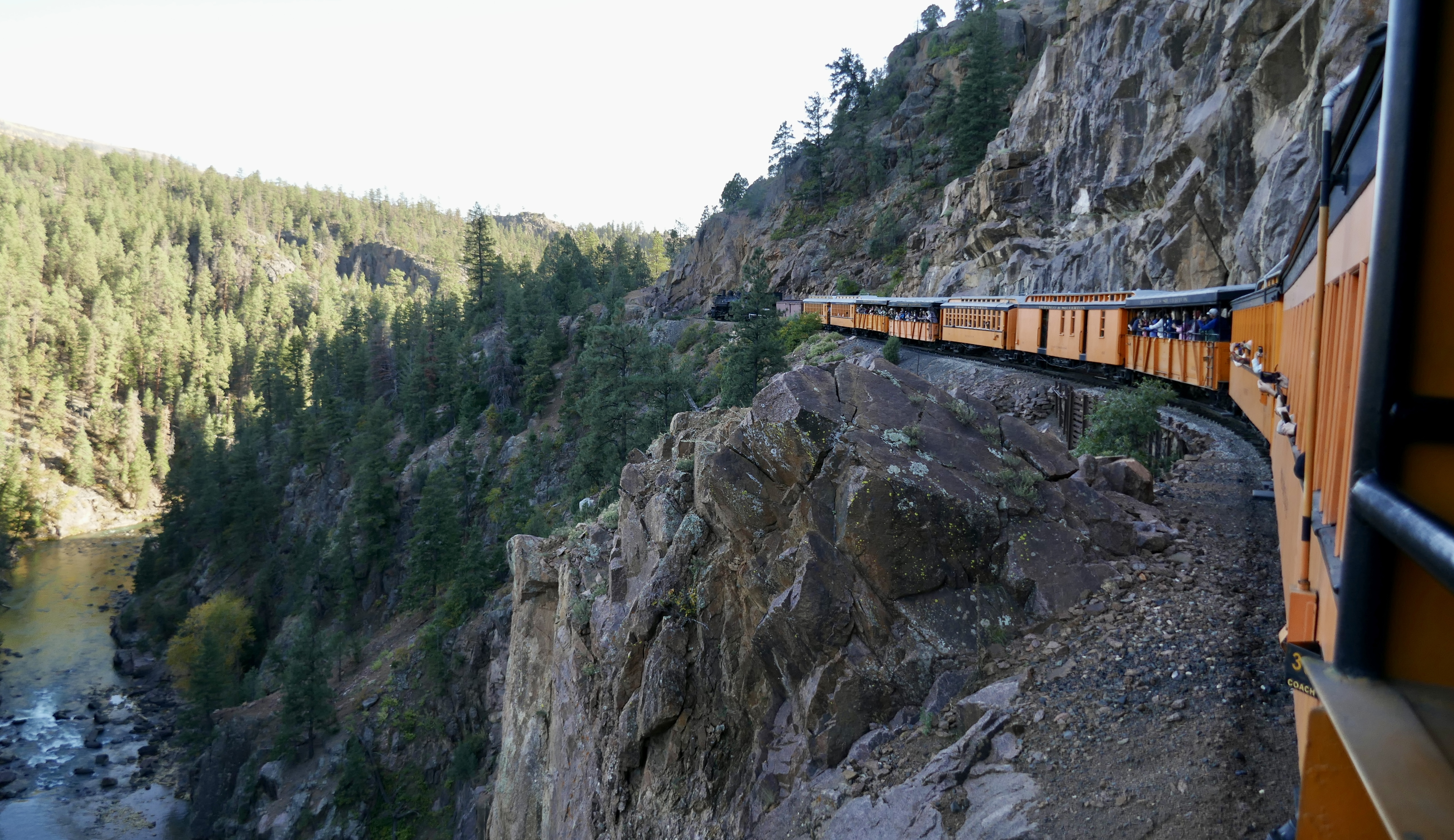
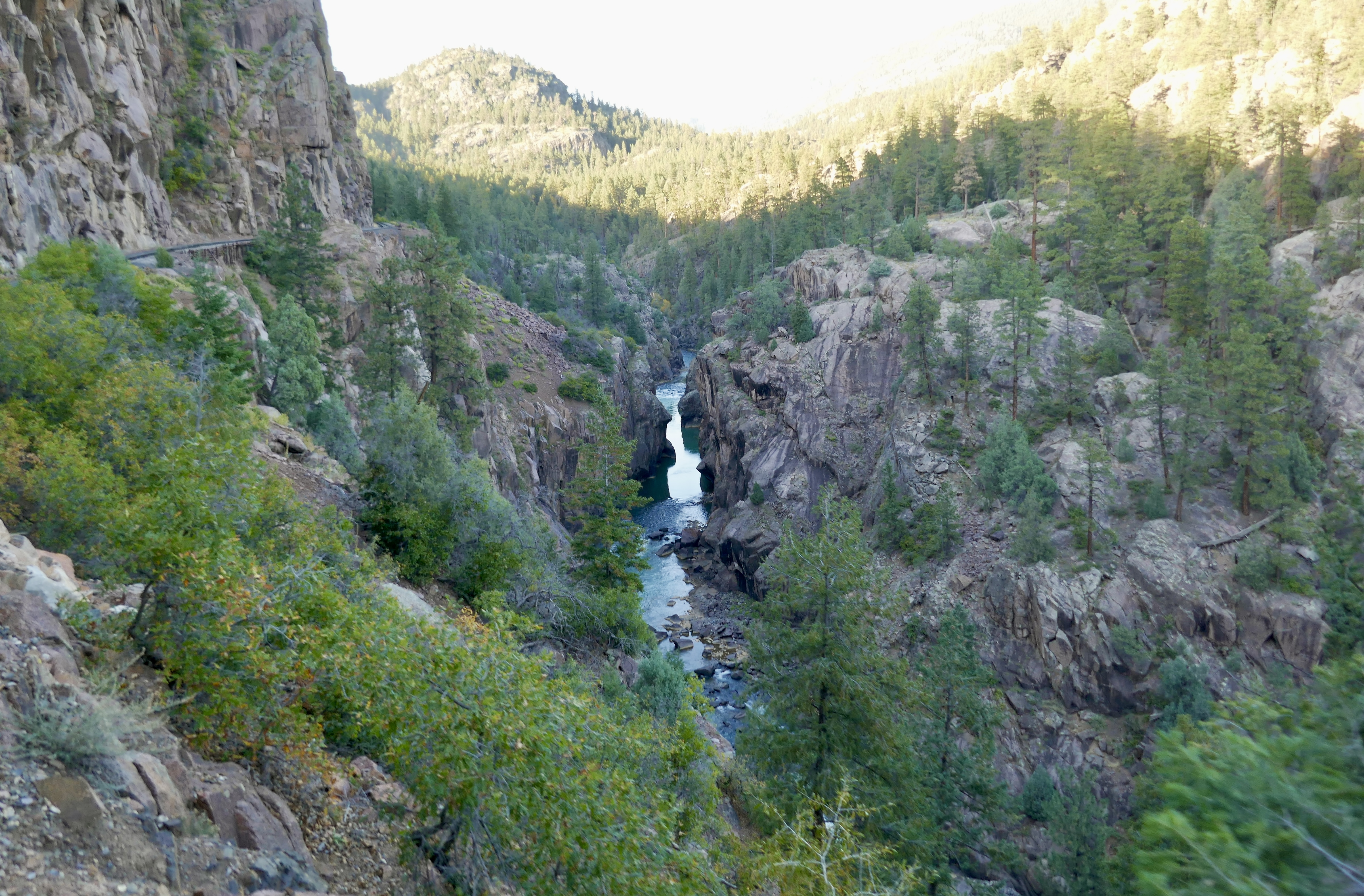
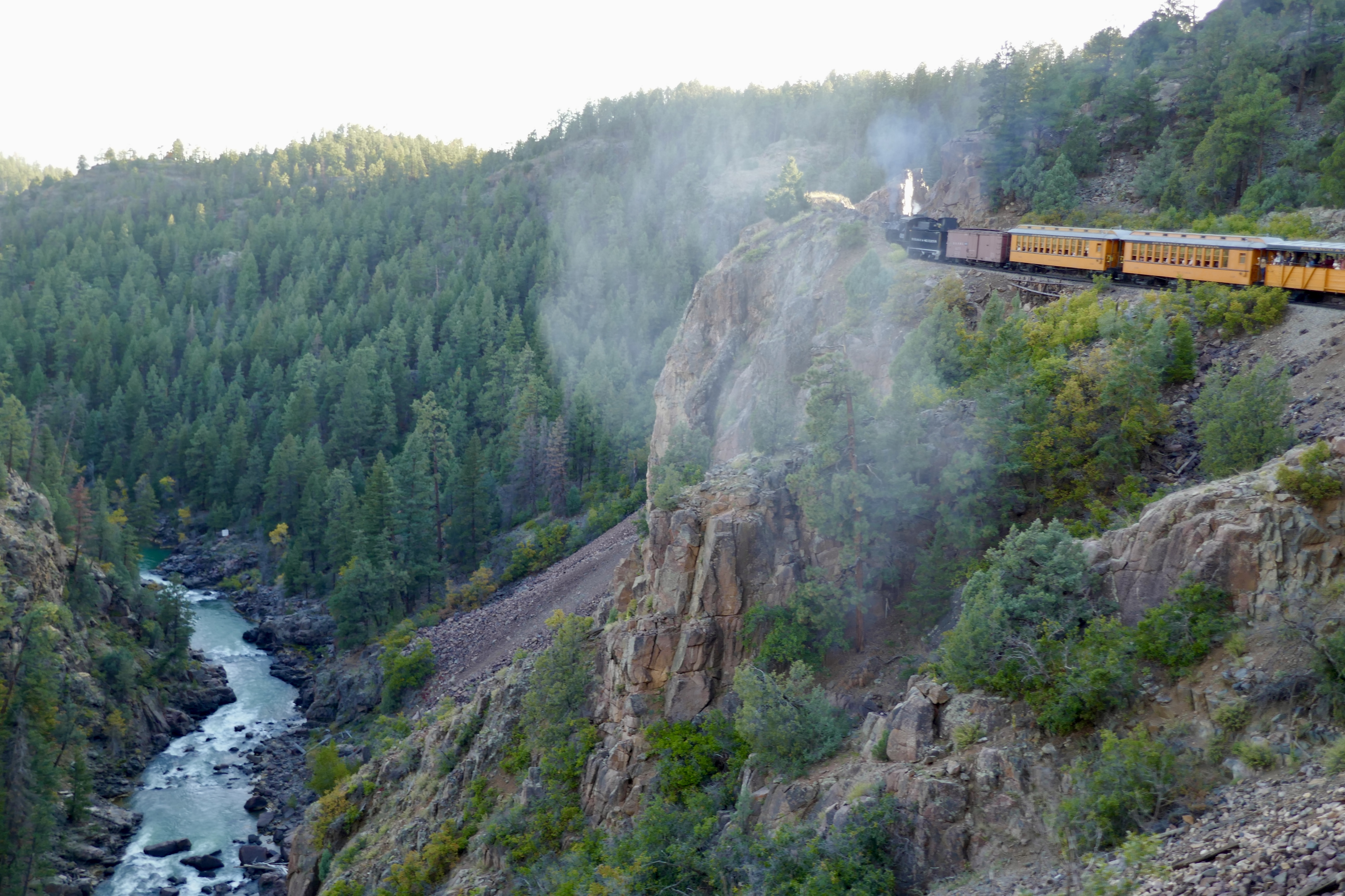
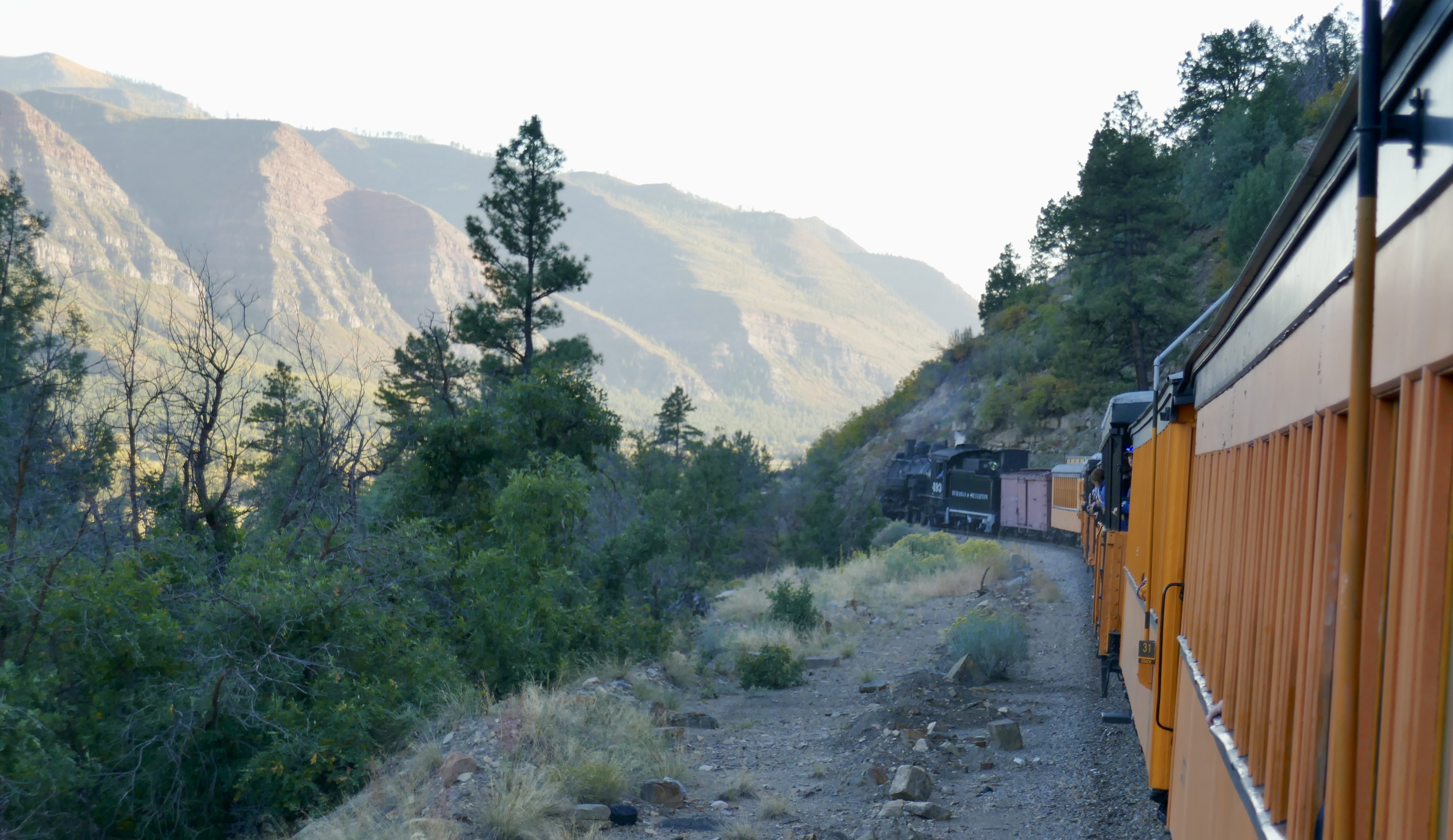
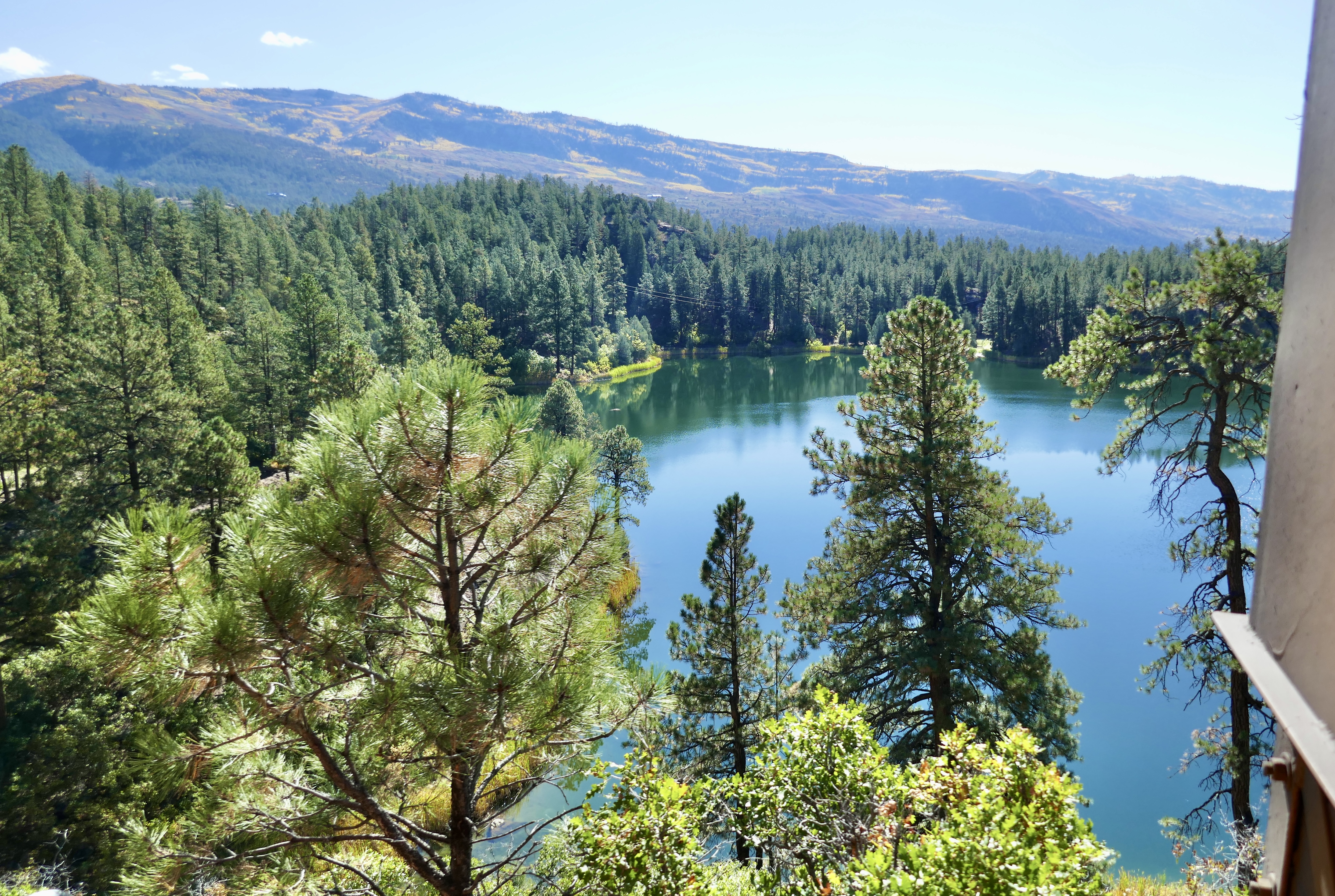
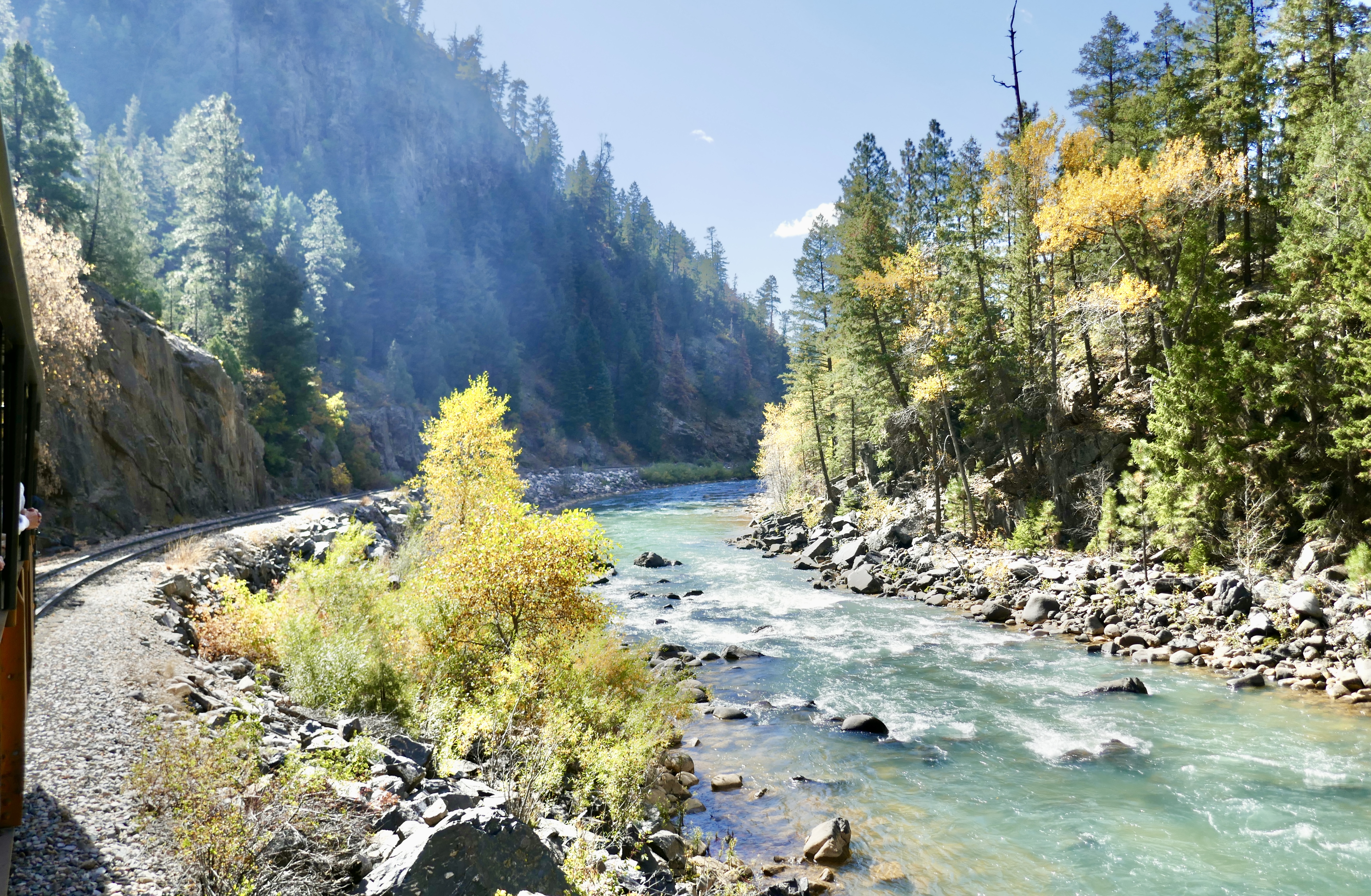
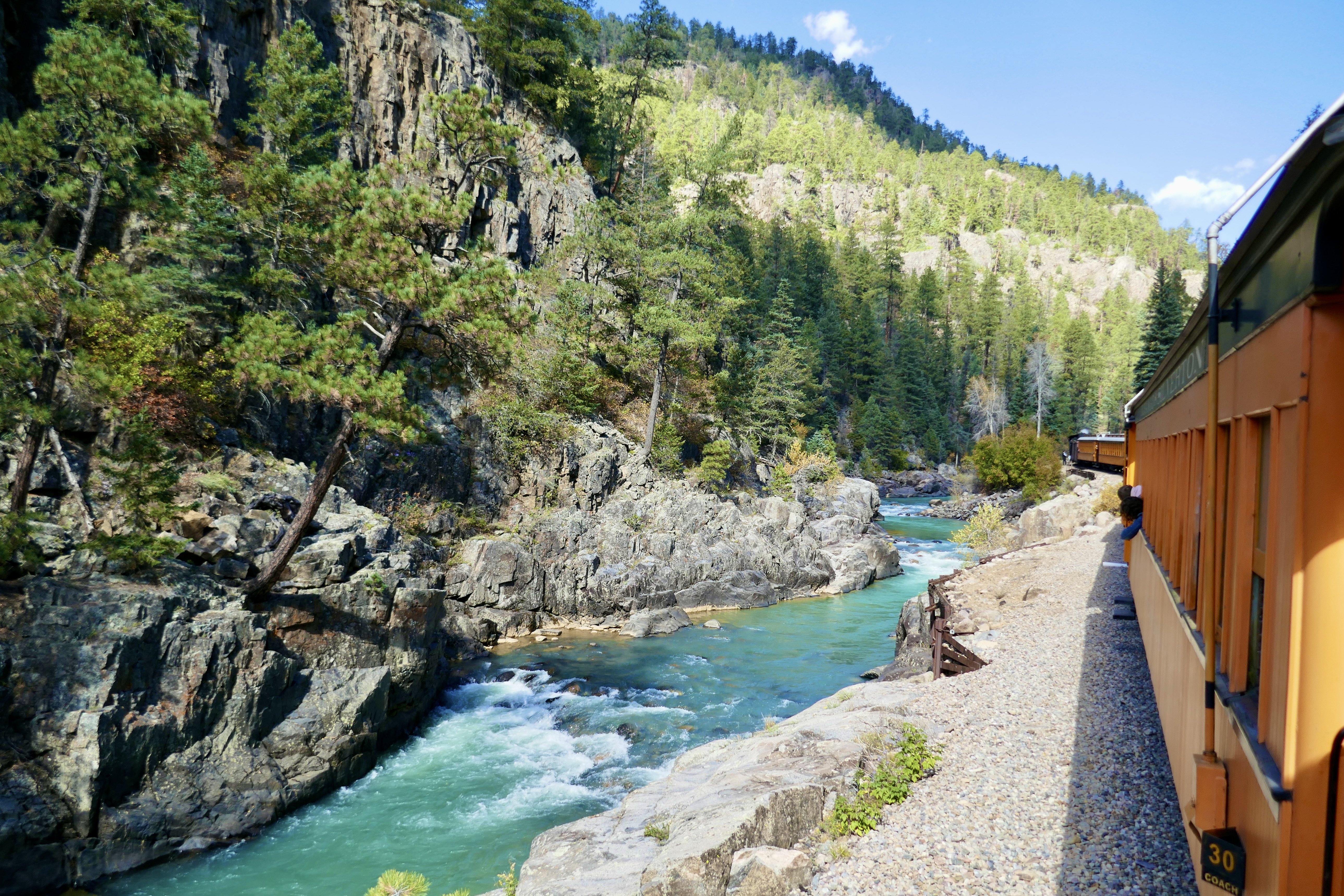
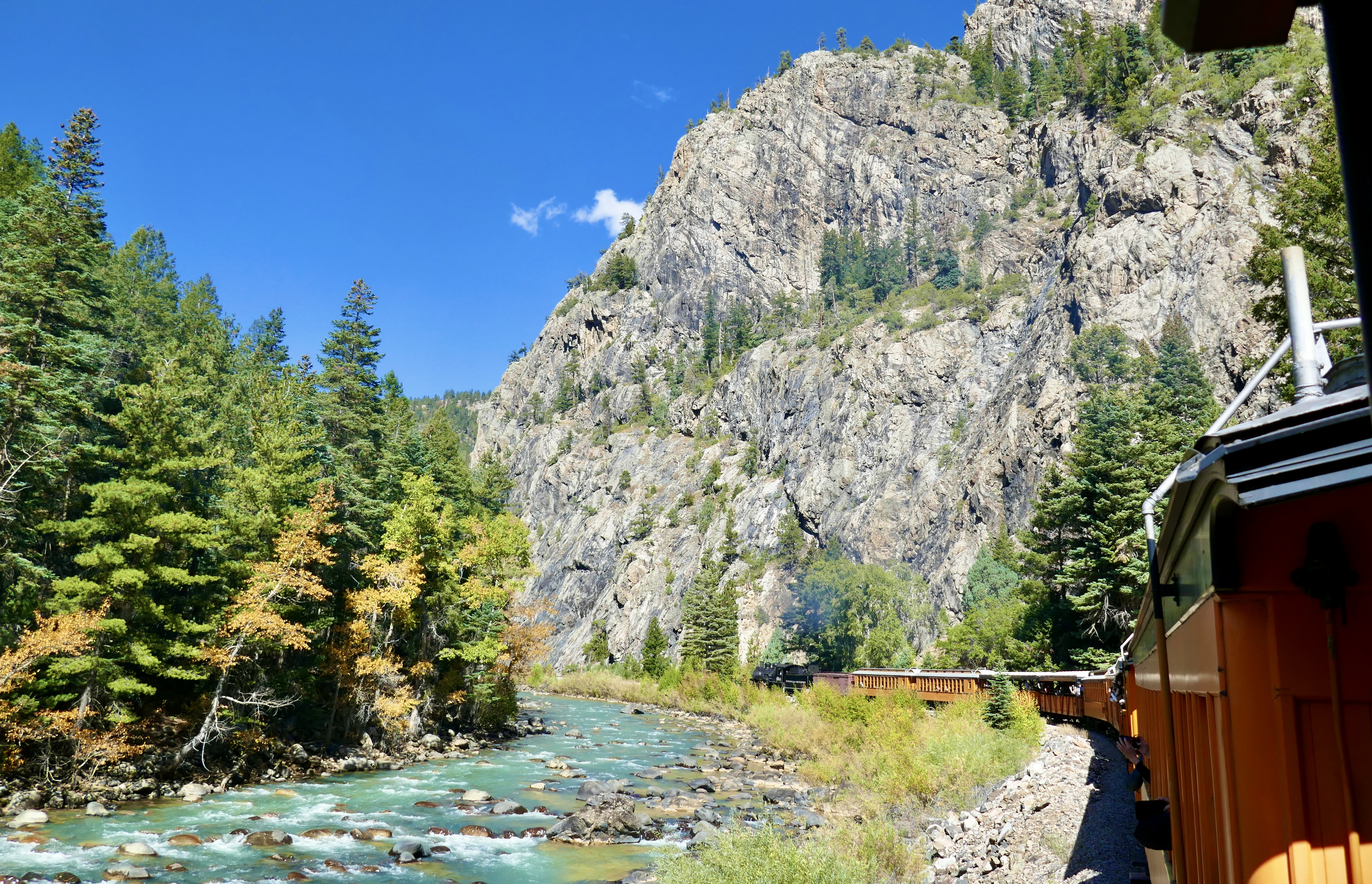
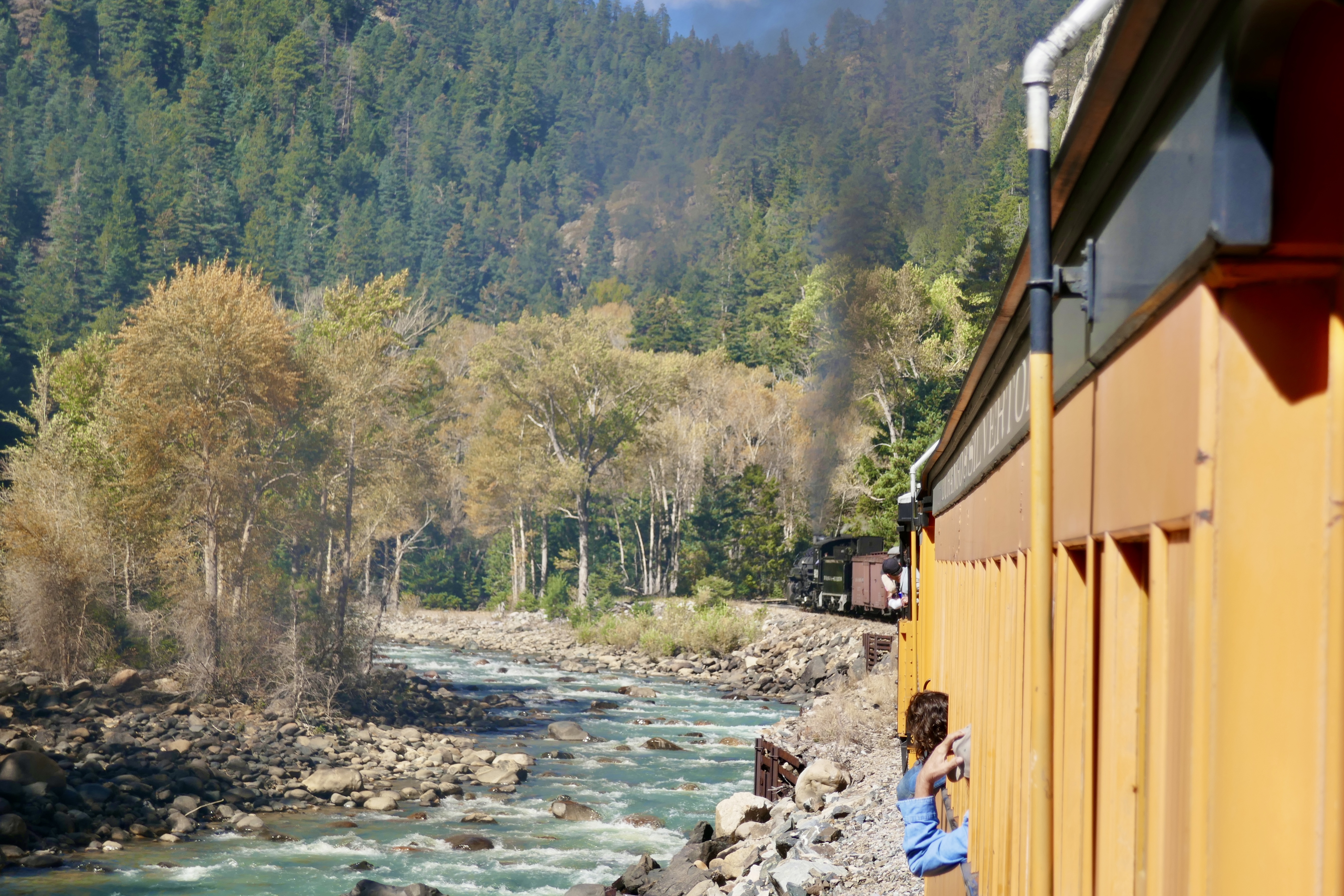
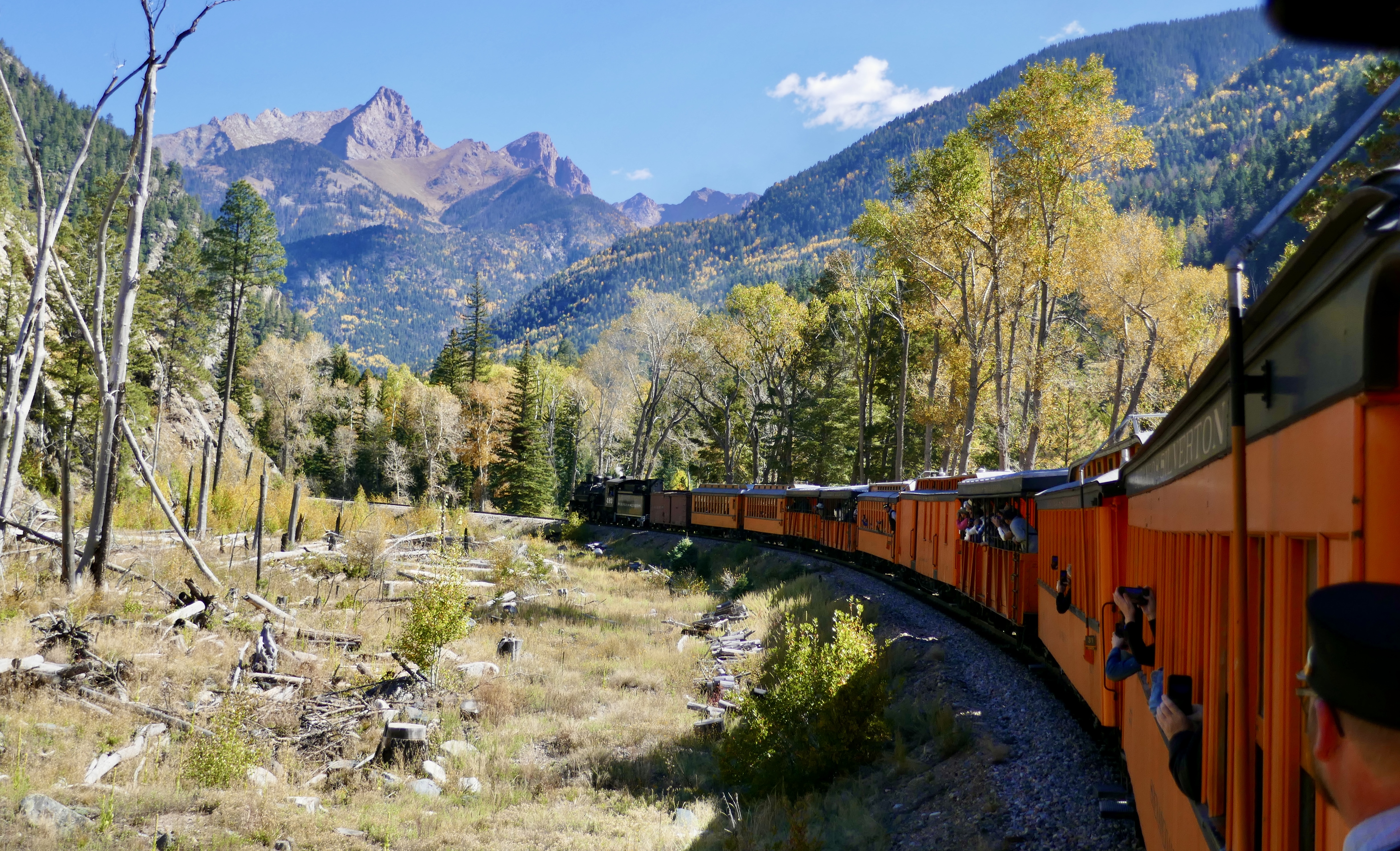
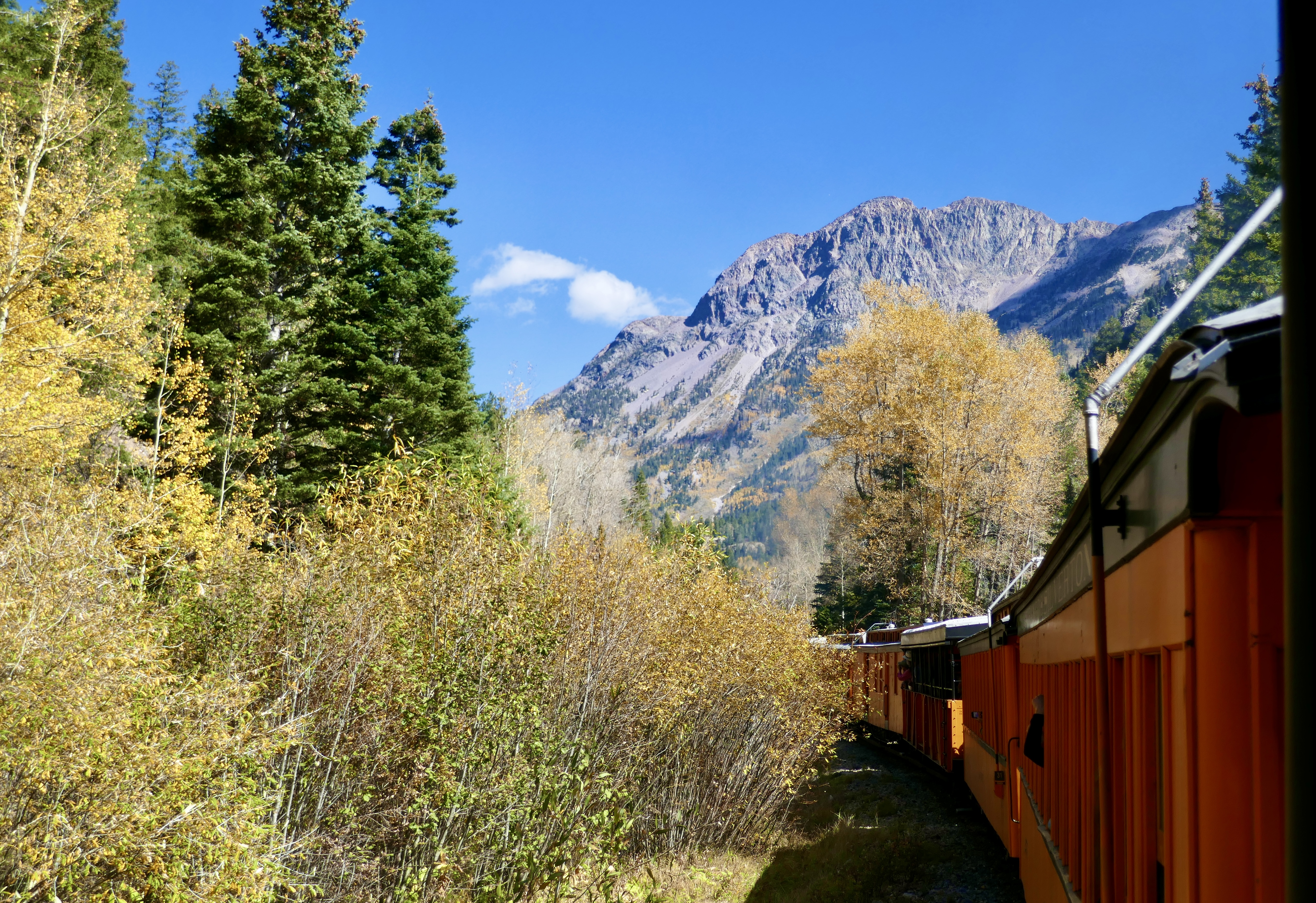
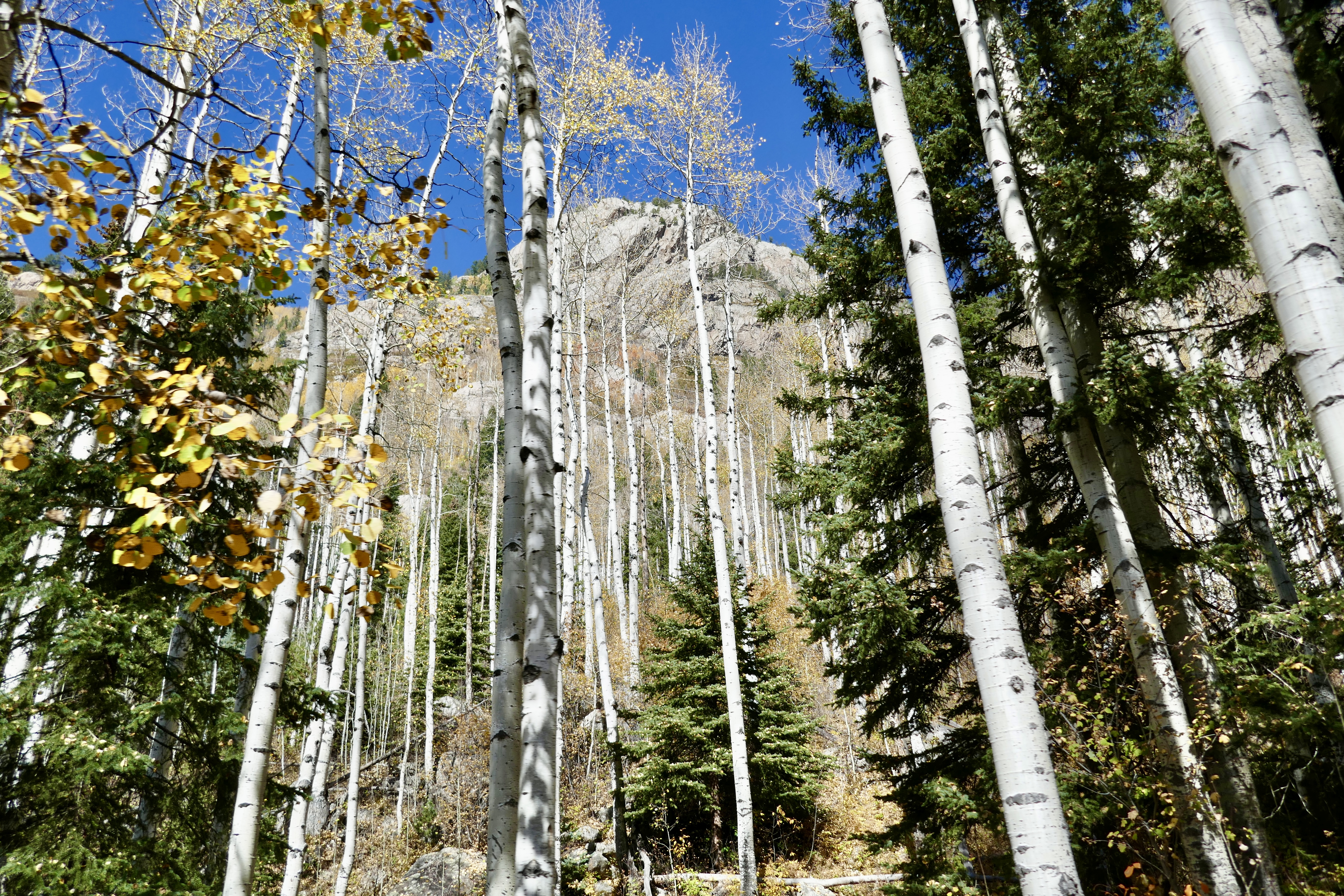
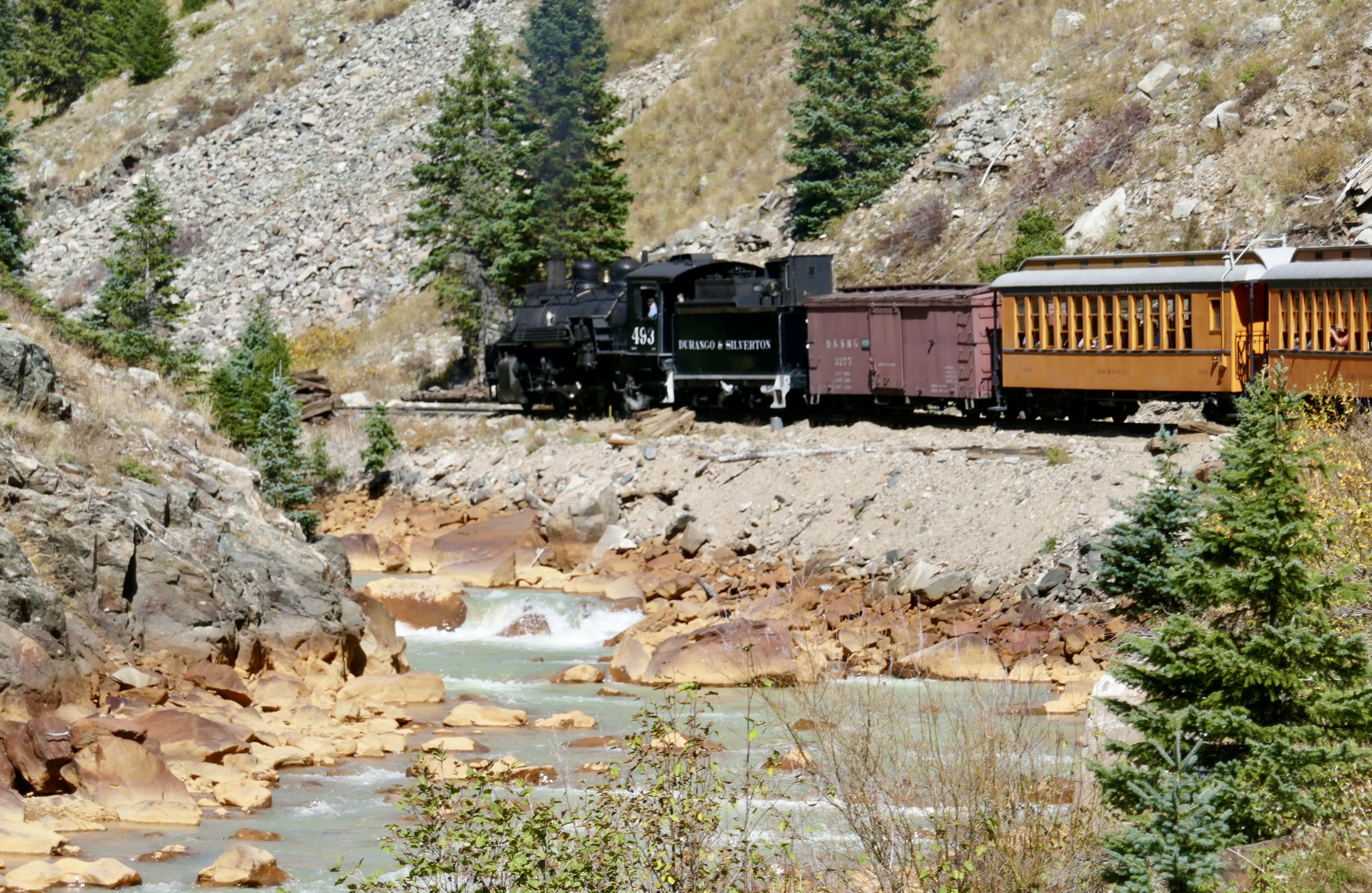
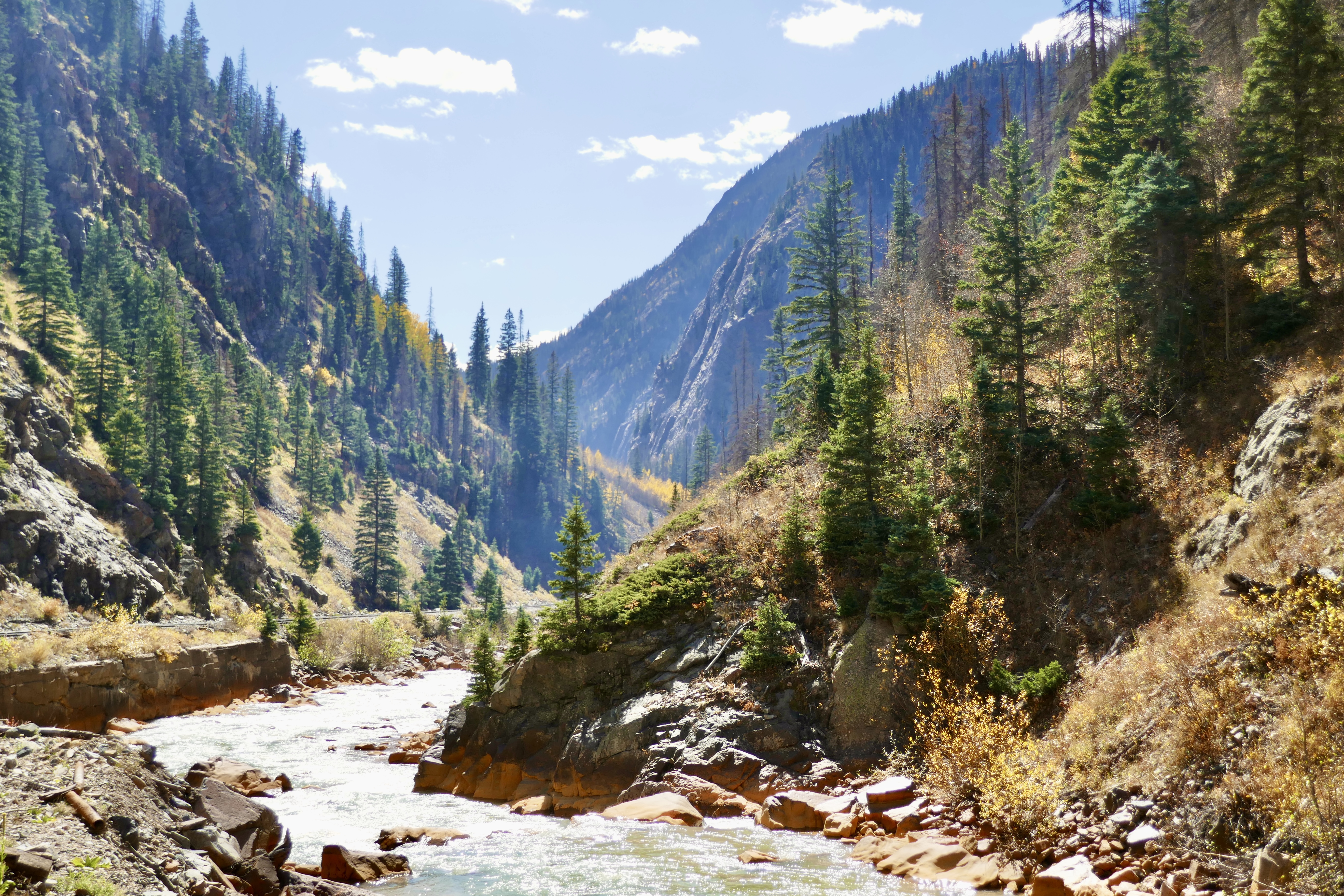
They called for boarding around 9:30 am. We found our reserved seats and the train departed at 9:45, following the Animas River north. The views are soul-nourishing.
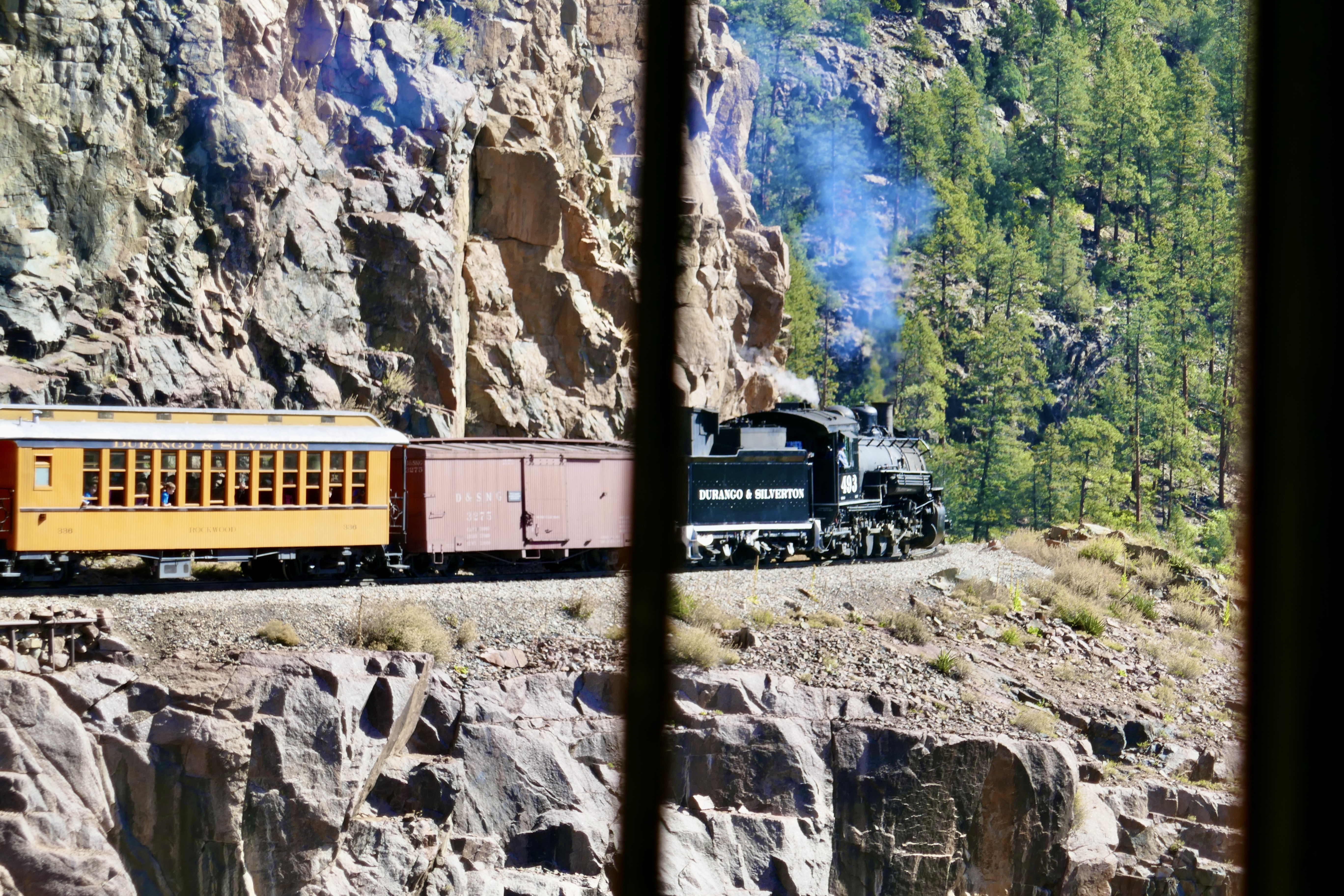

Since the line uses a steam locomotive, we replenished the water supply at an old tower along the way.


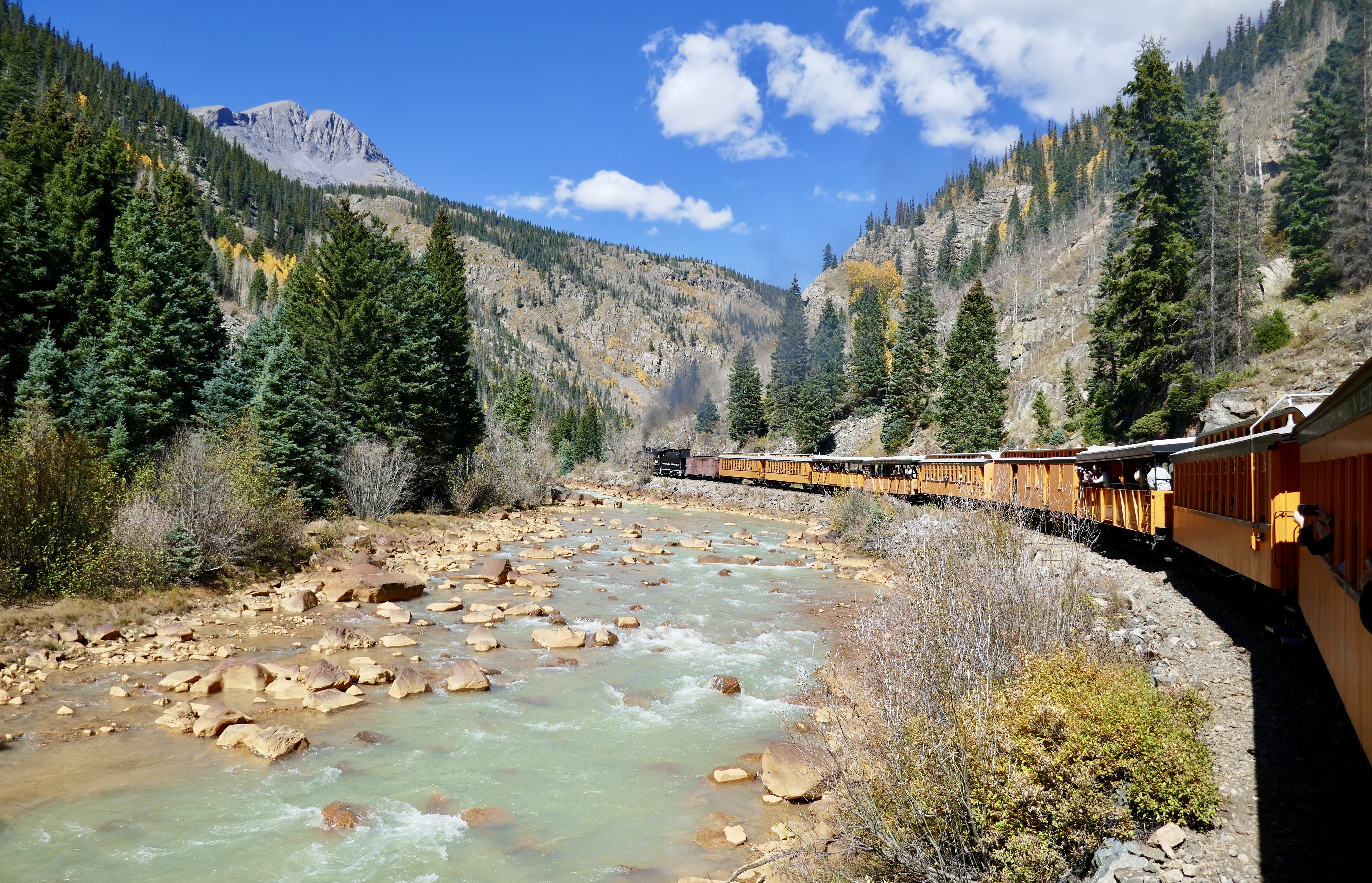
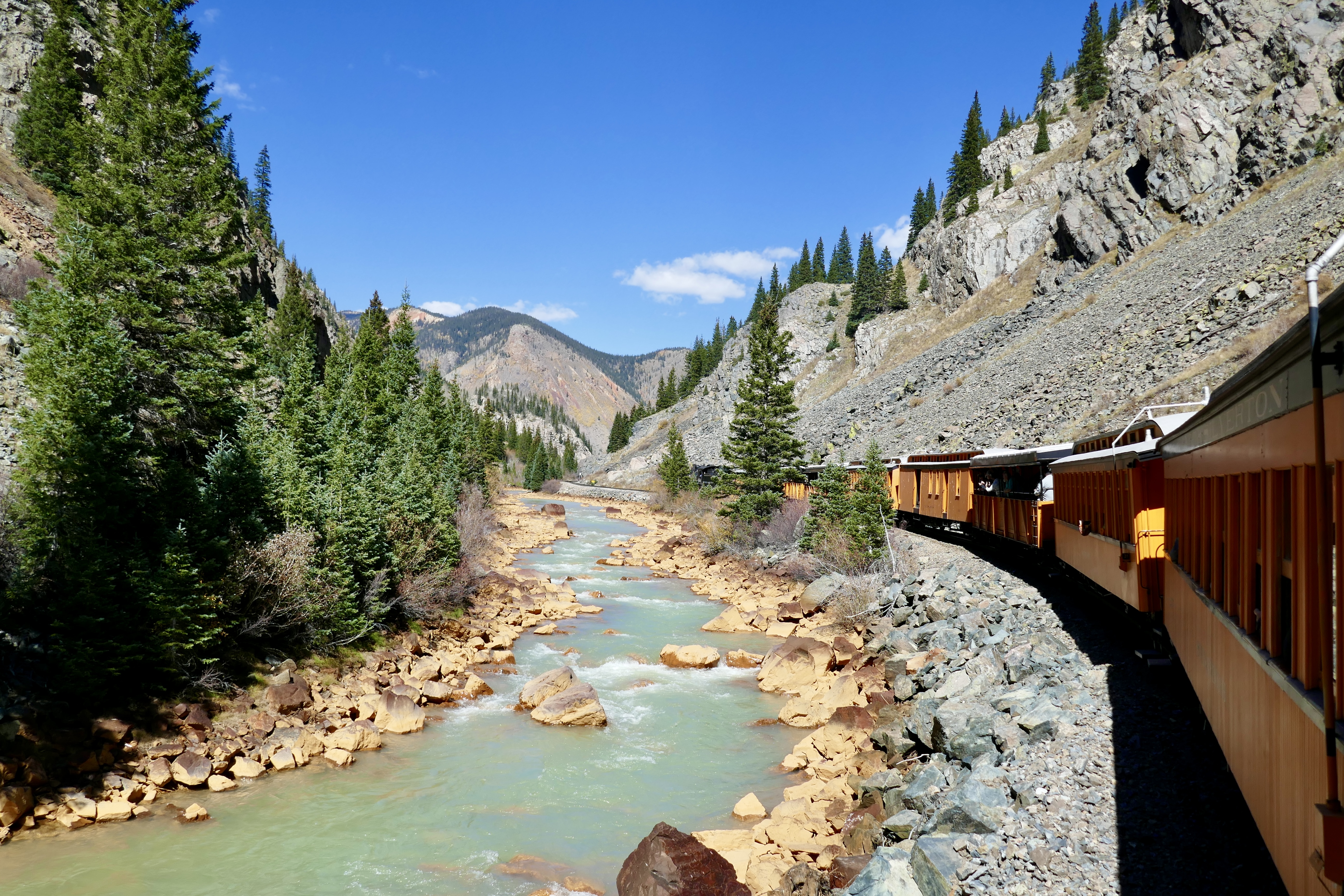
At about 1:10 pm, we rolled into Silverton for a two-hour layover.
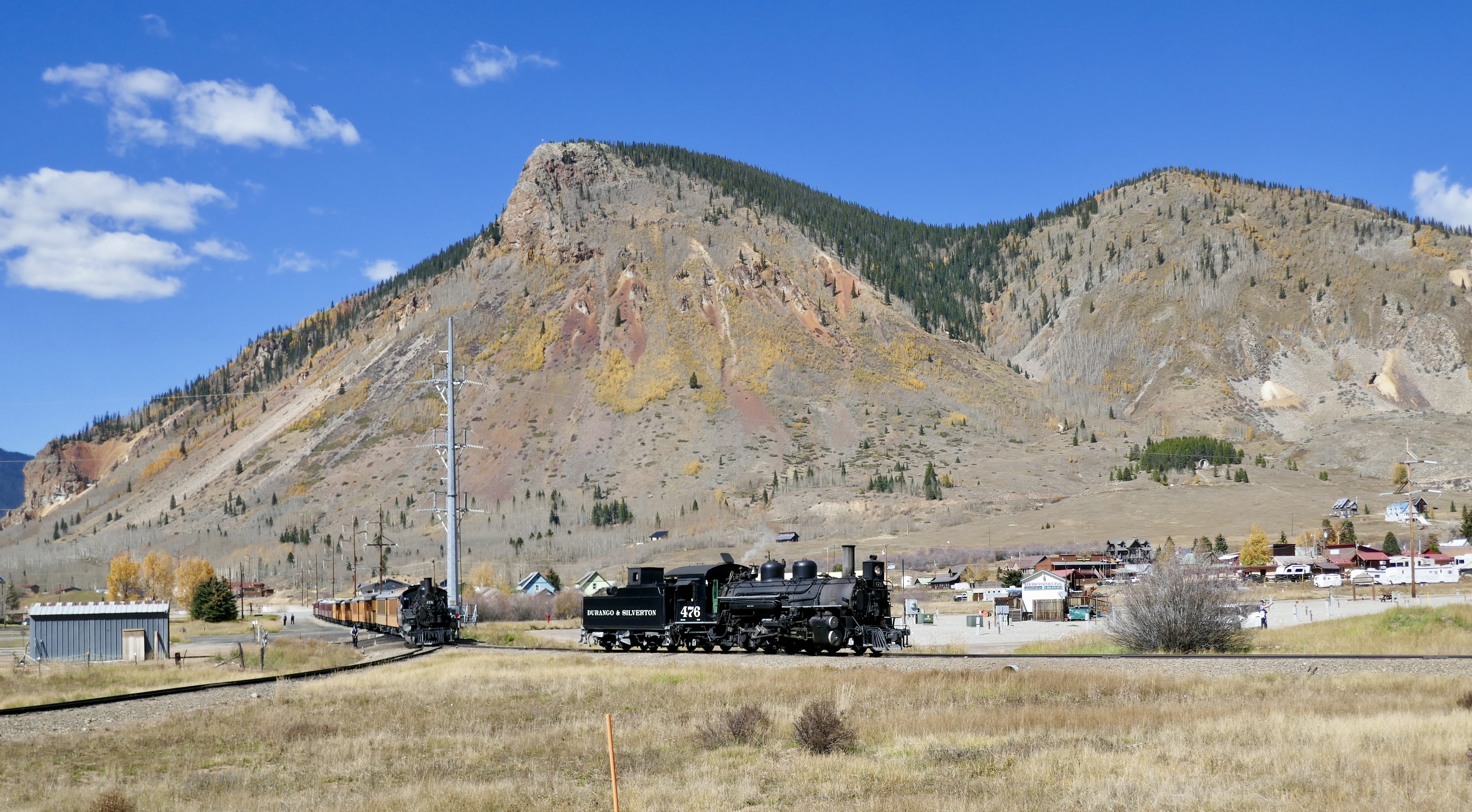
Next up: Silverton and the return trip.
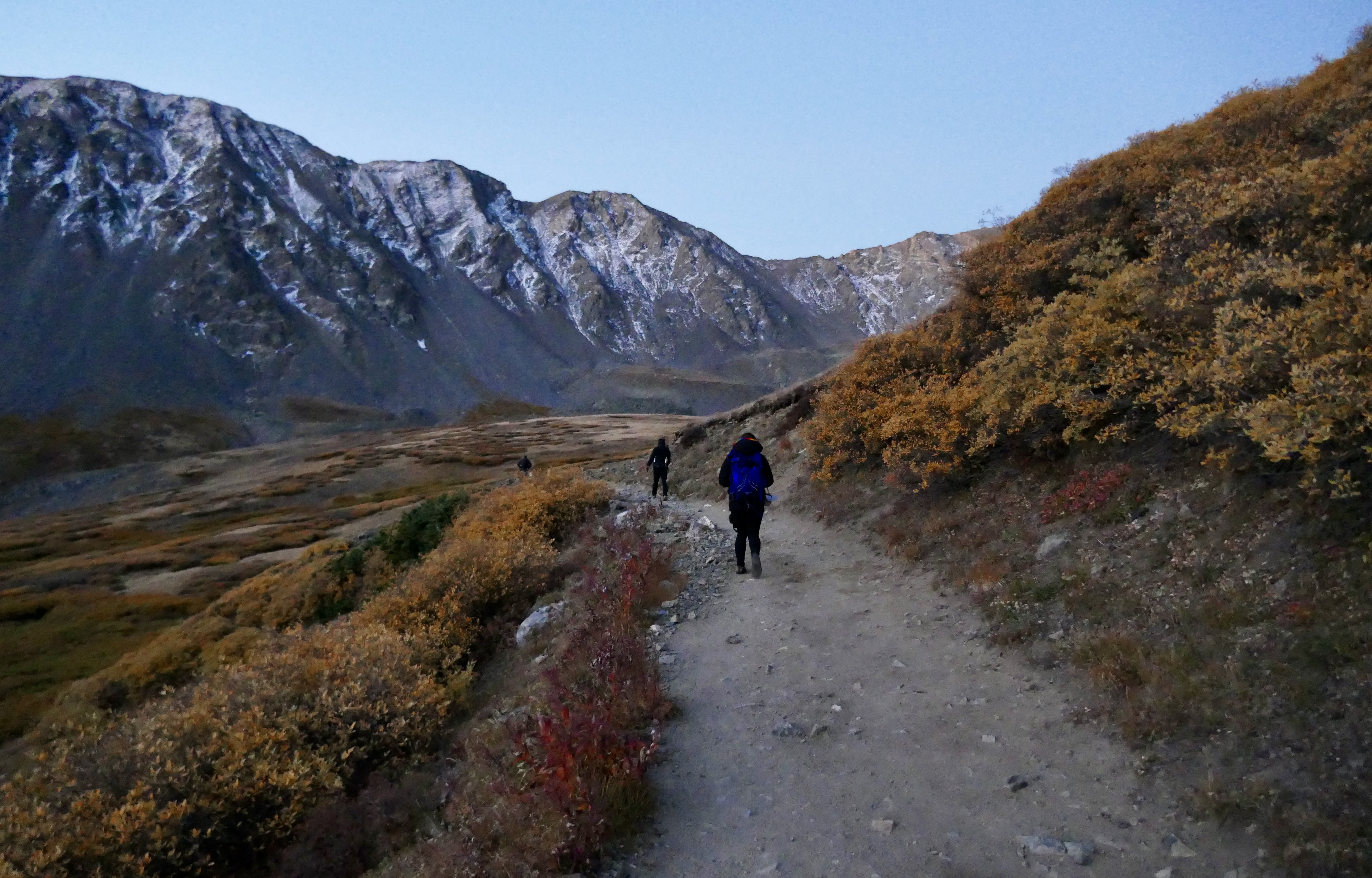
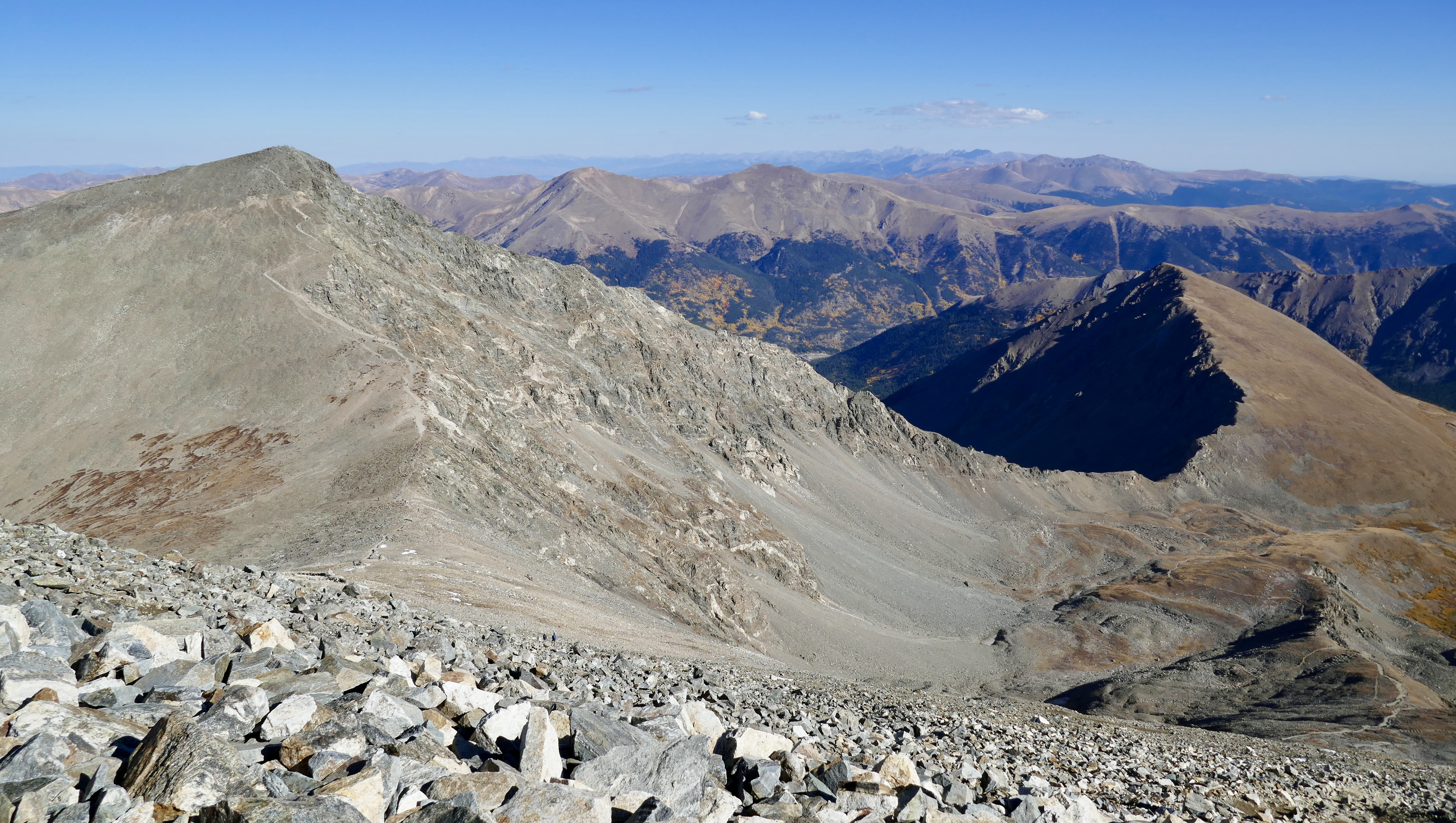
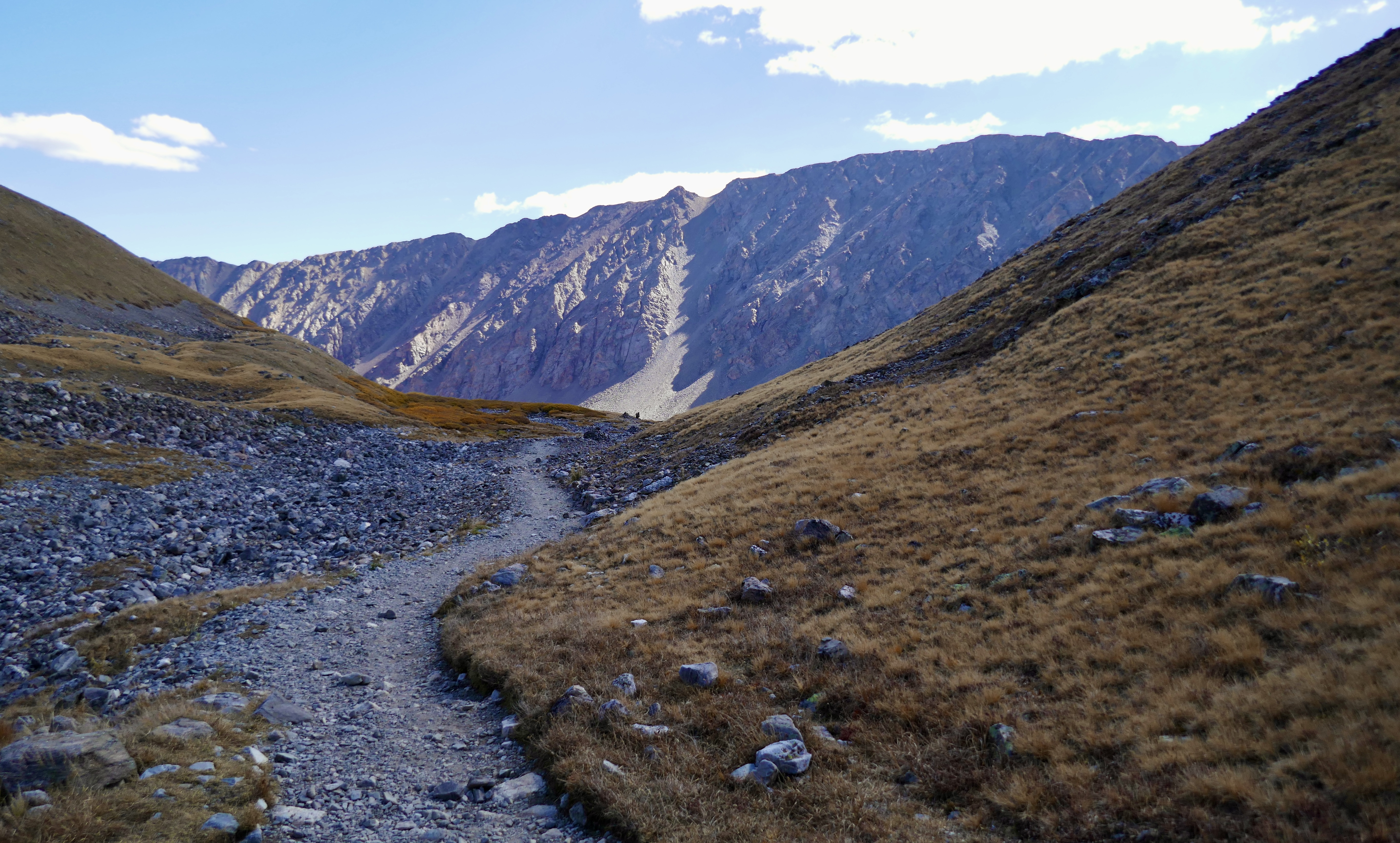
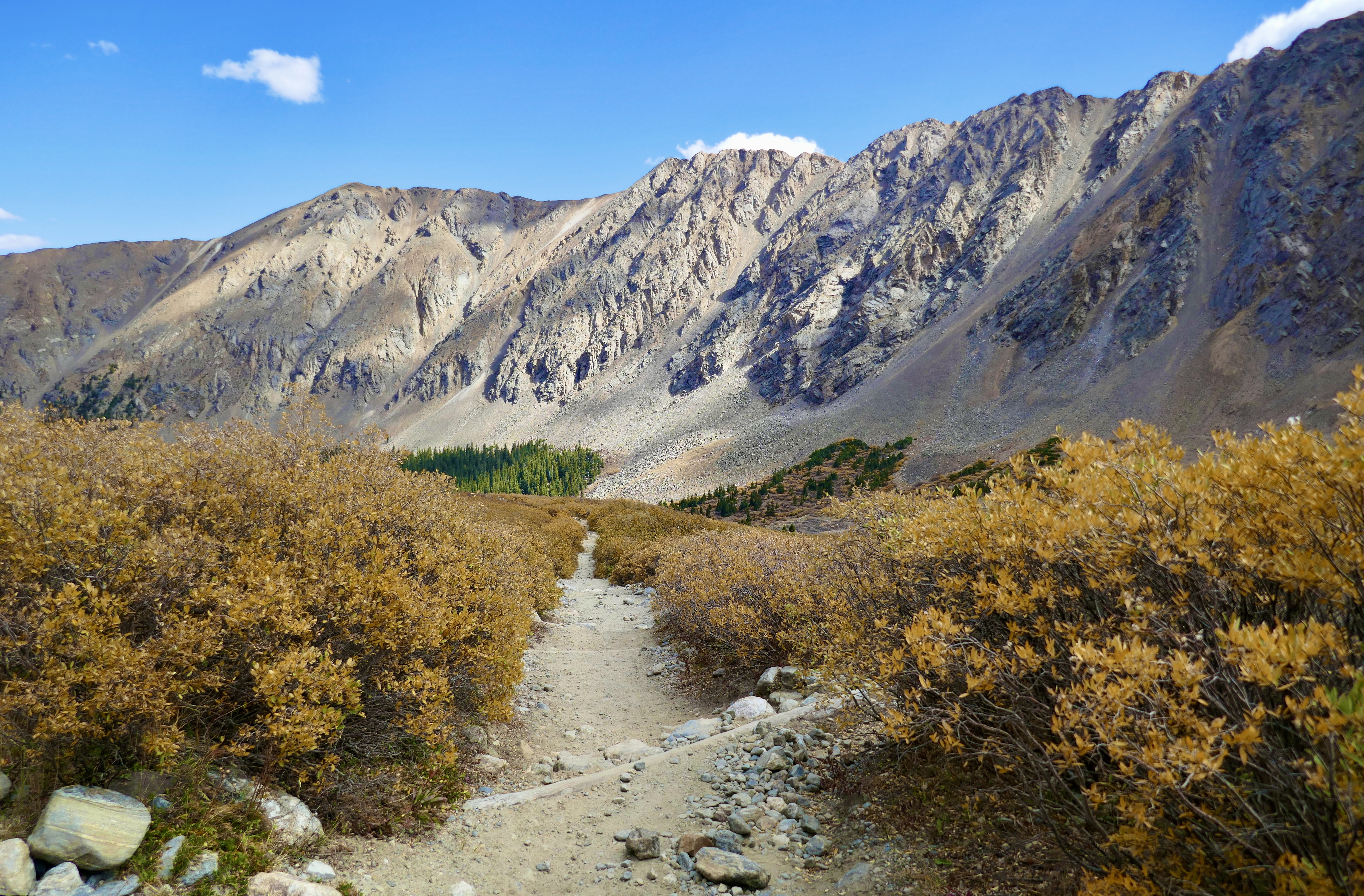
My New Year’s resolution for 2024 was to summit a Colorado 14er. So on a gorgeous fall day in late September of last year, we made it happen. We picked one of the “easier” ones, Grays Peak, with the idea that we could maybe cross the saddle to Torreys Peak and bag two 14ers in one day.
It was very dark at 6 am when we set off up the trail, with a crescent moon shining bright against the black sky. But by 6:30 the predawn light was seeping into the landscape.
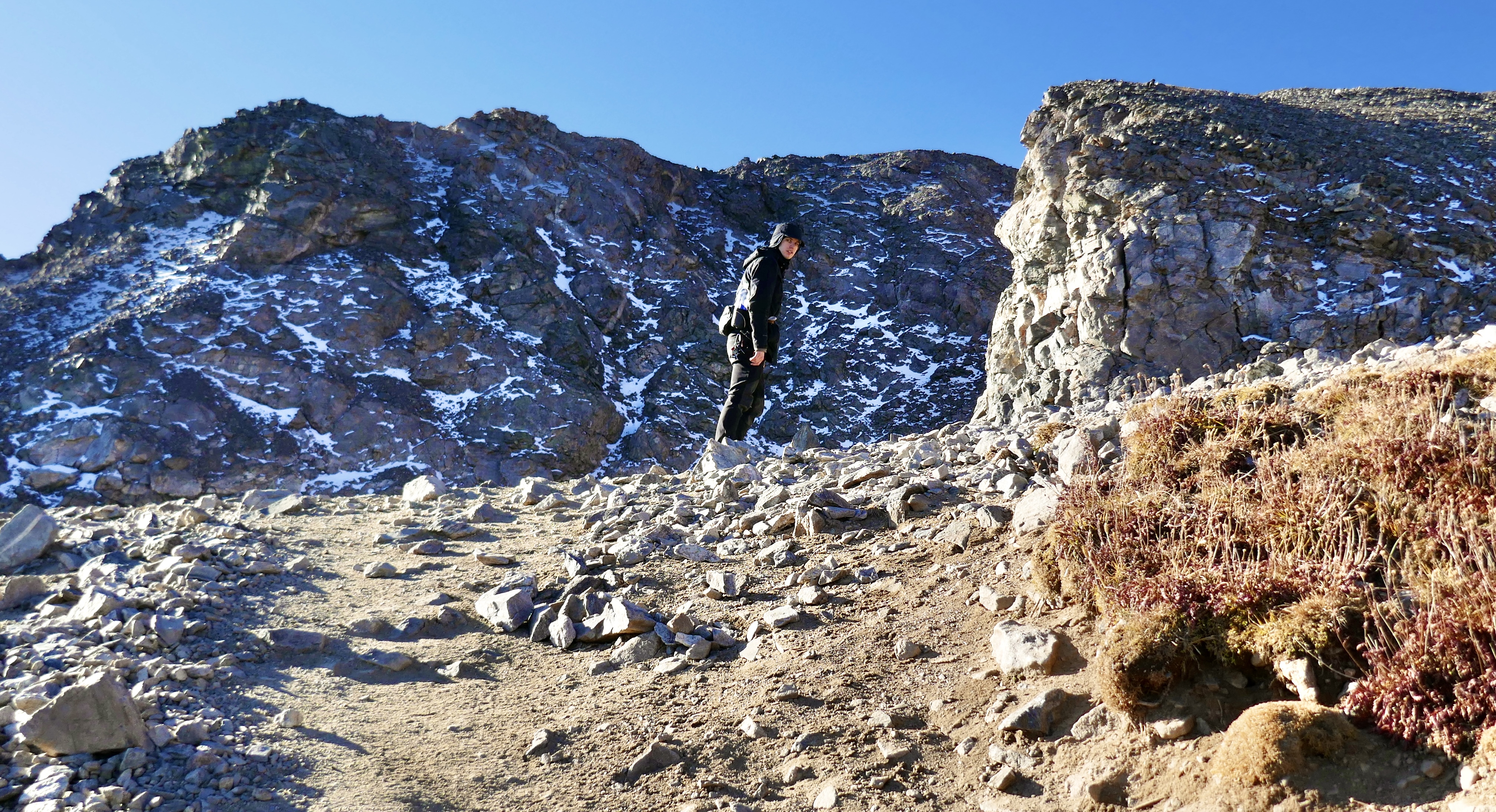
I don’t have a lot of pics from the ascent, probably because I was focused on climbing. Gray’s might be an easy climb by Colorado standards, but it felt like hard work to us.
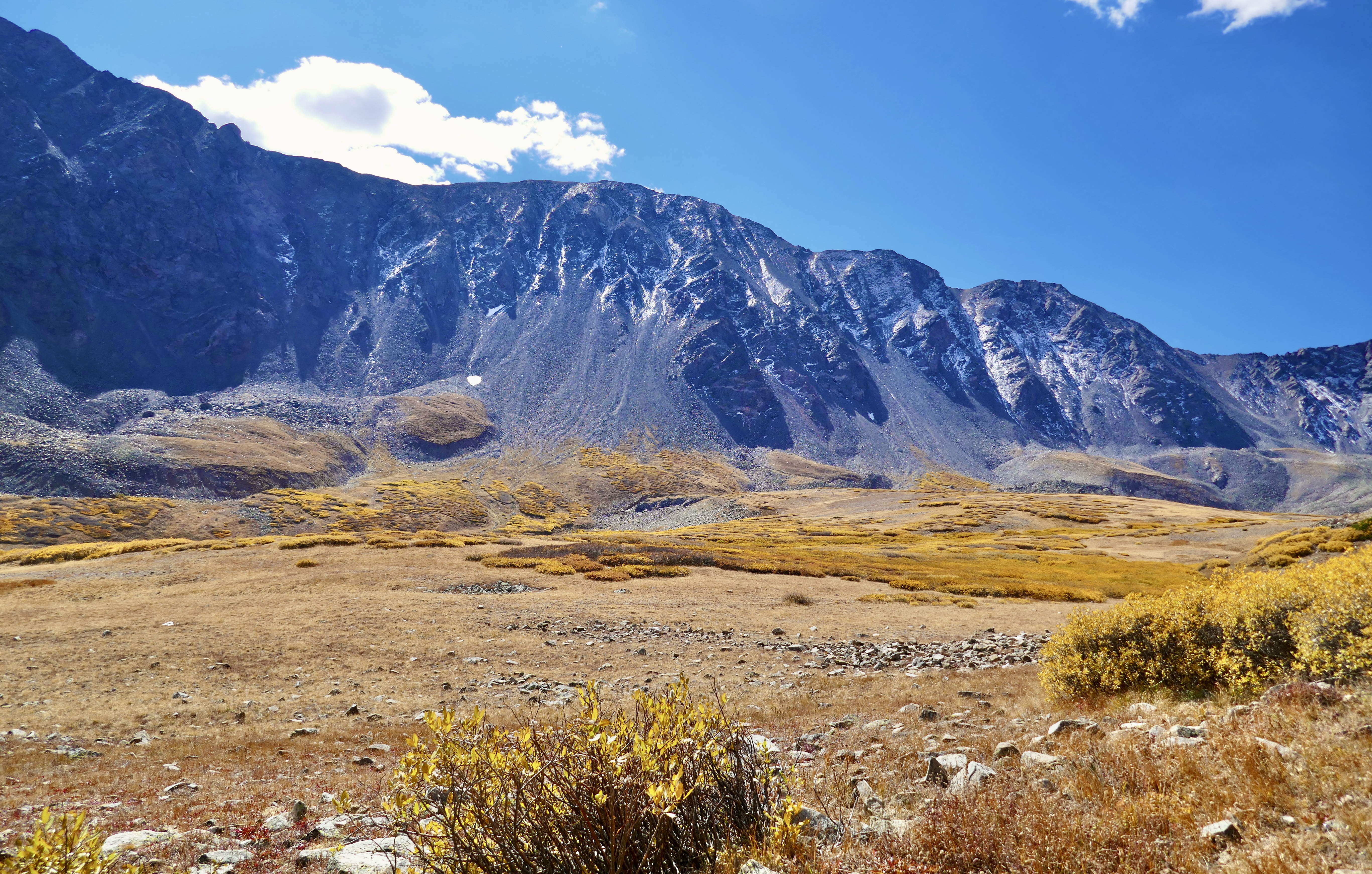
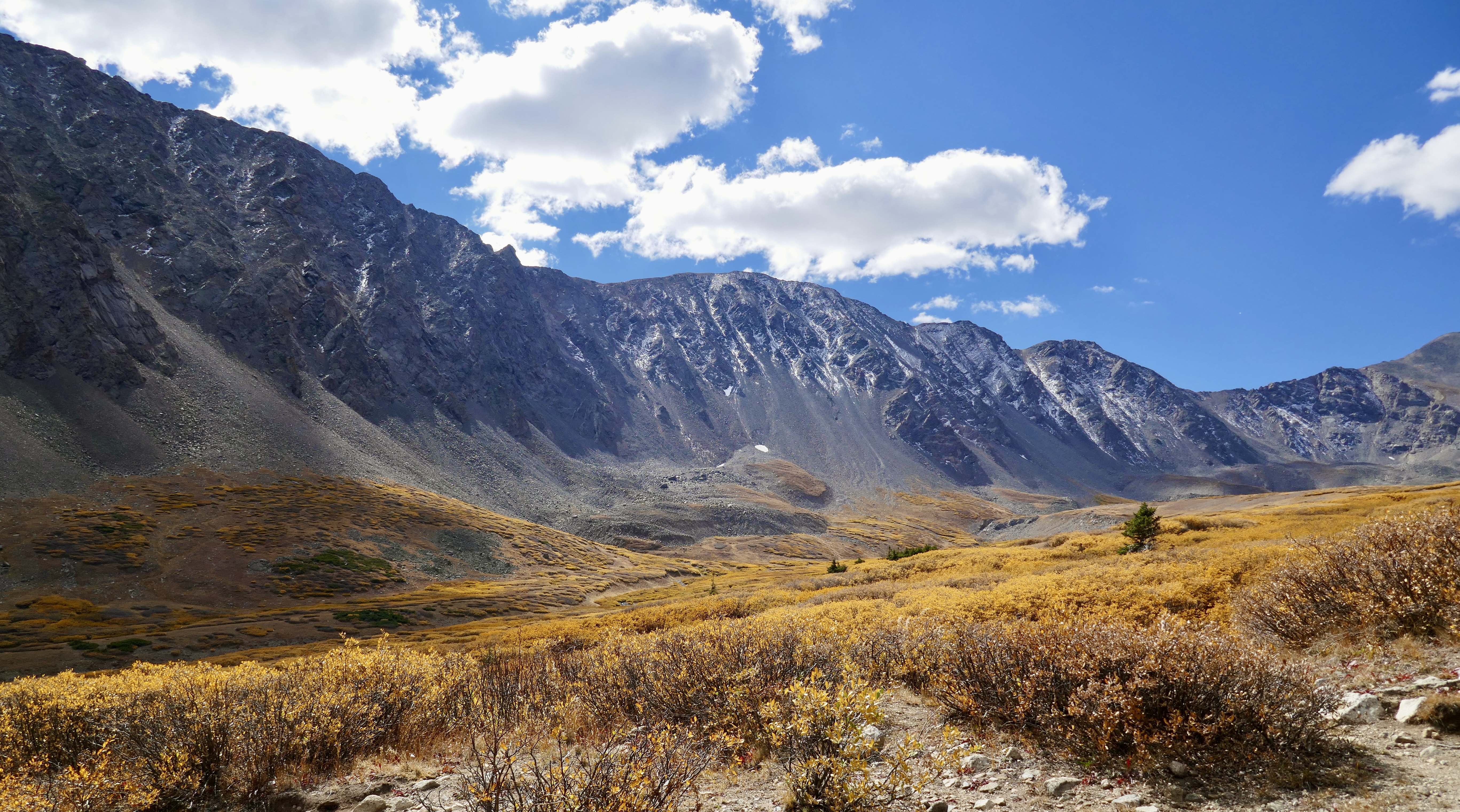
By 8am we were above the tree line, and the long shadows threw the mountains into sharp relief.

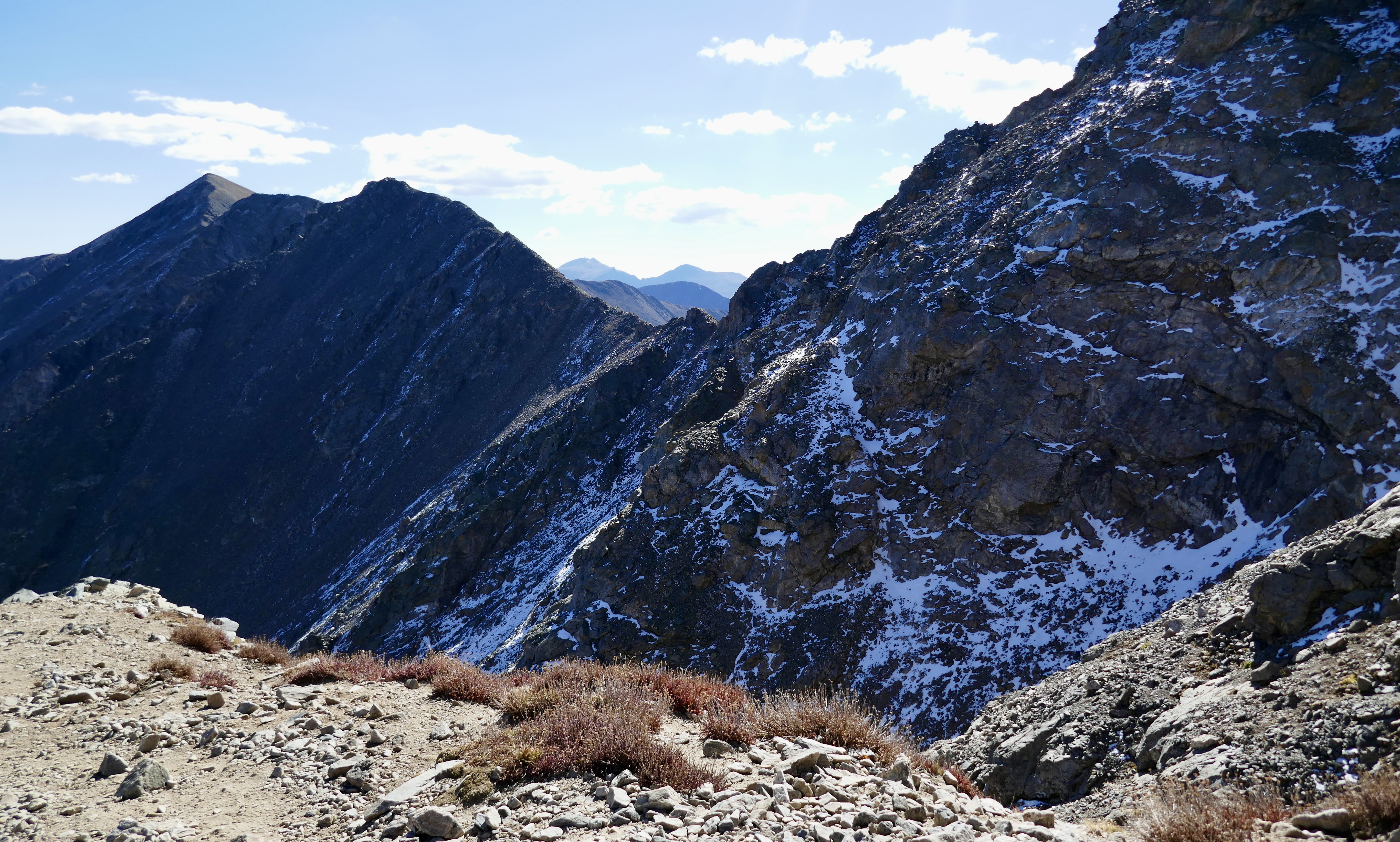
I’m not sure if the snow in the north-side shade was left over from the previous winter or fresh that fall. Maybe a little of both.
Gentle reader, that climb wore us out.

But we made it to the top!
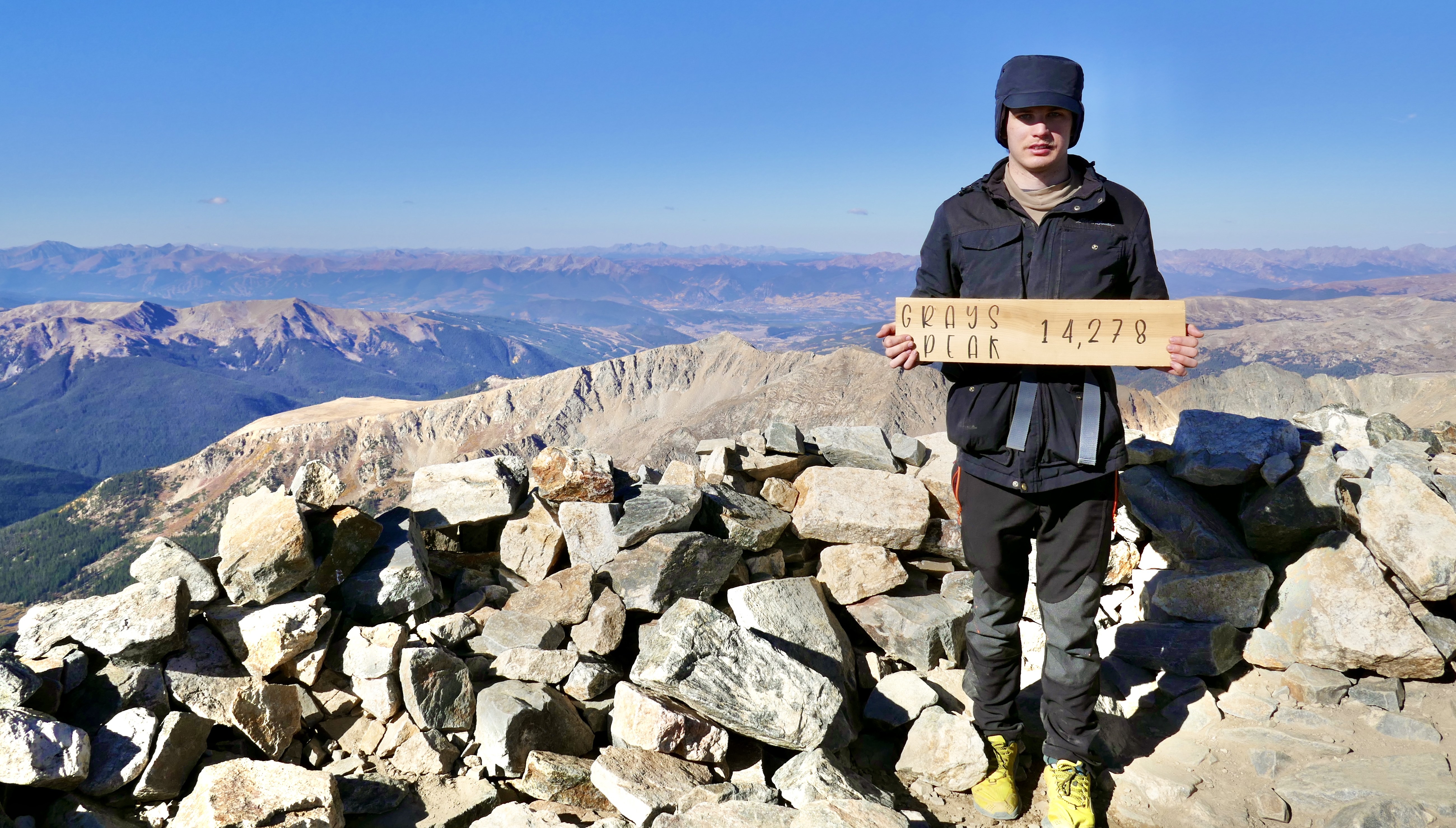
I reached the summit at about 9:40 am. Luke had gotten there way before me, and Elizabeth was still making her way up.
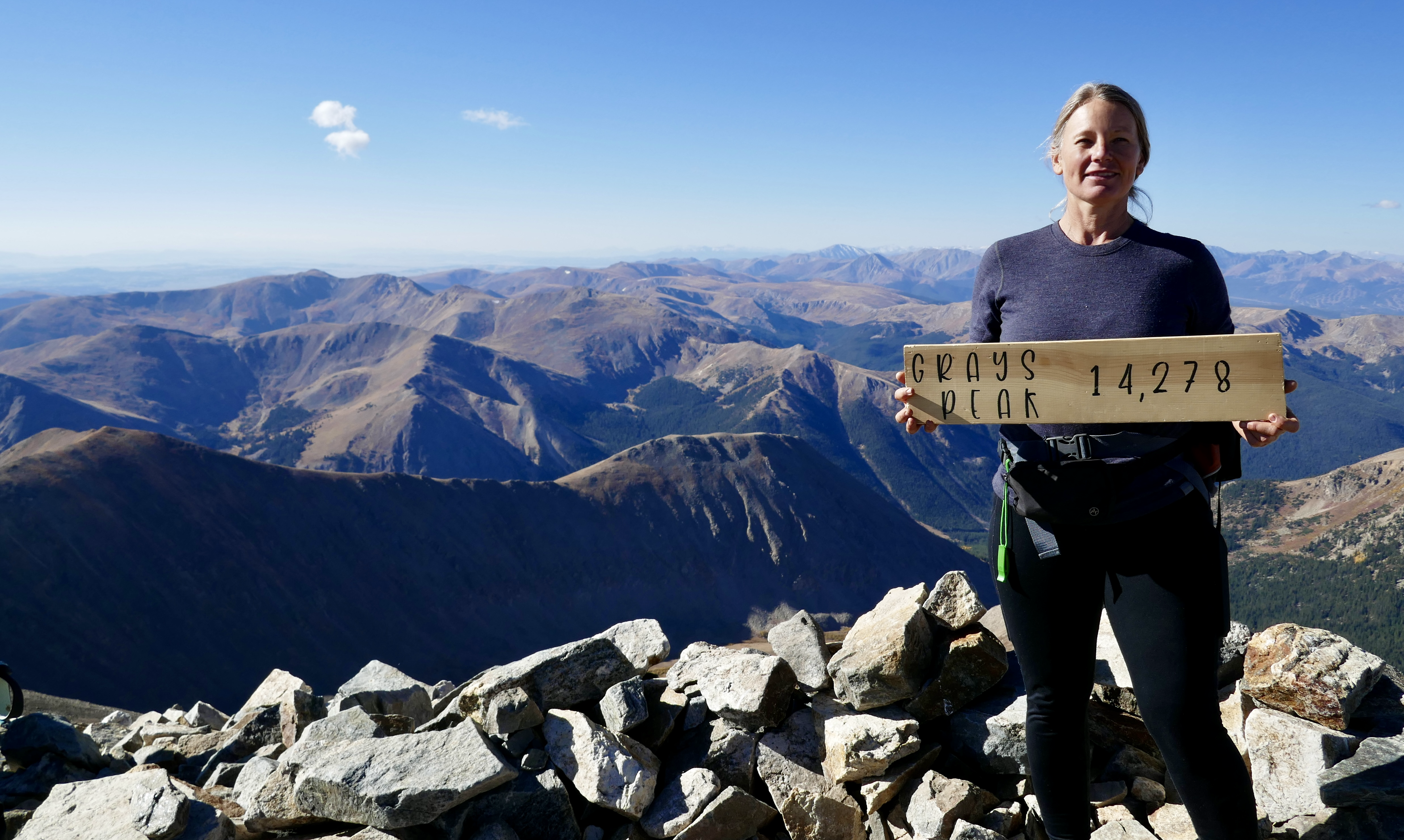
I don’t have a pic of Elizabeth on the summit, I think we were just too spread out at that point.
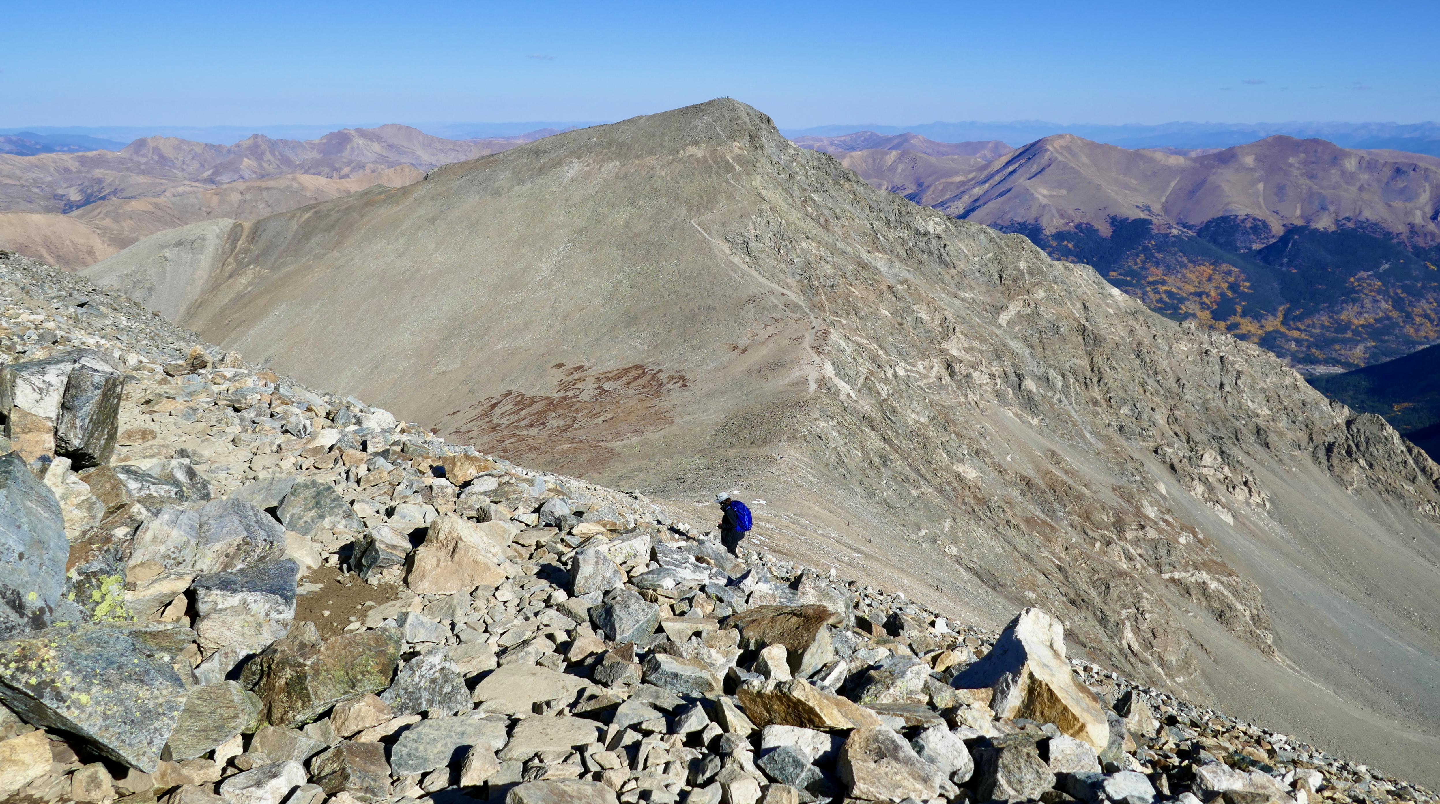
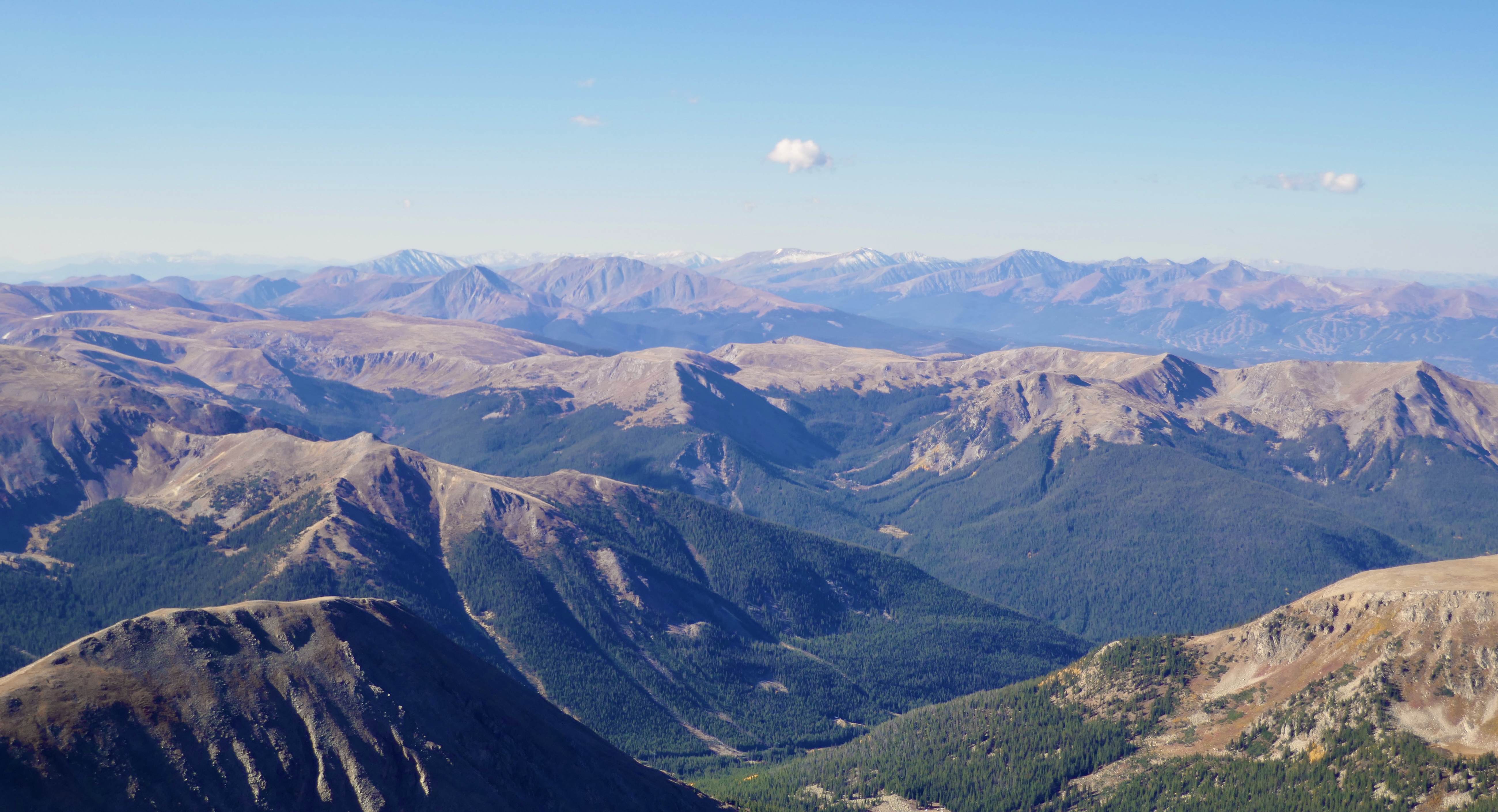
The views, of course, were incredible. You can see the whole world from up there.
We unanimously decided against continuing on to Torreys. One mountain was enough for us that day.
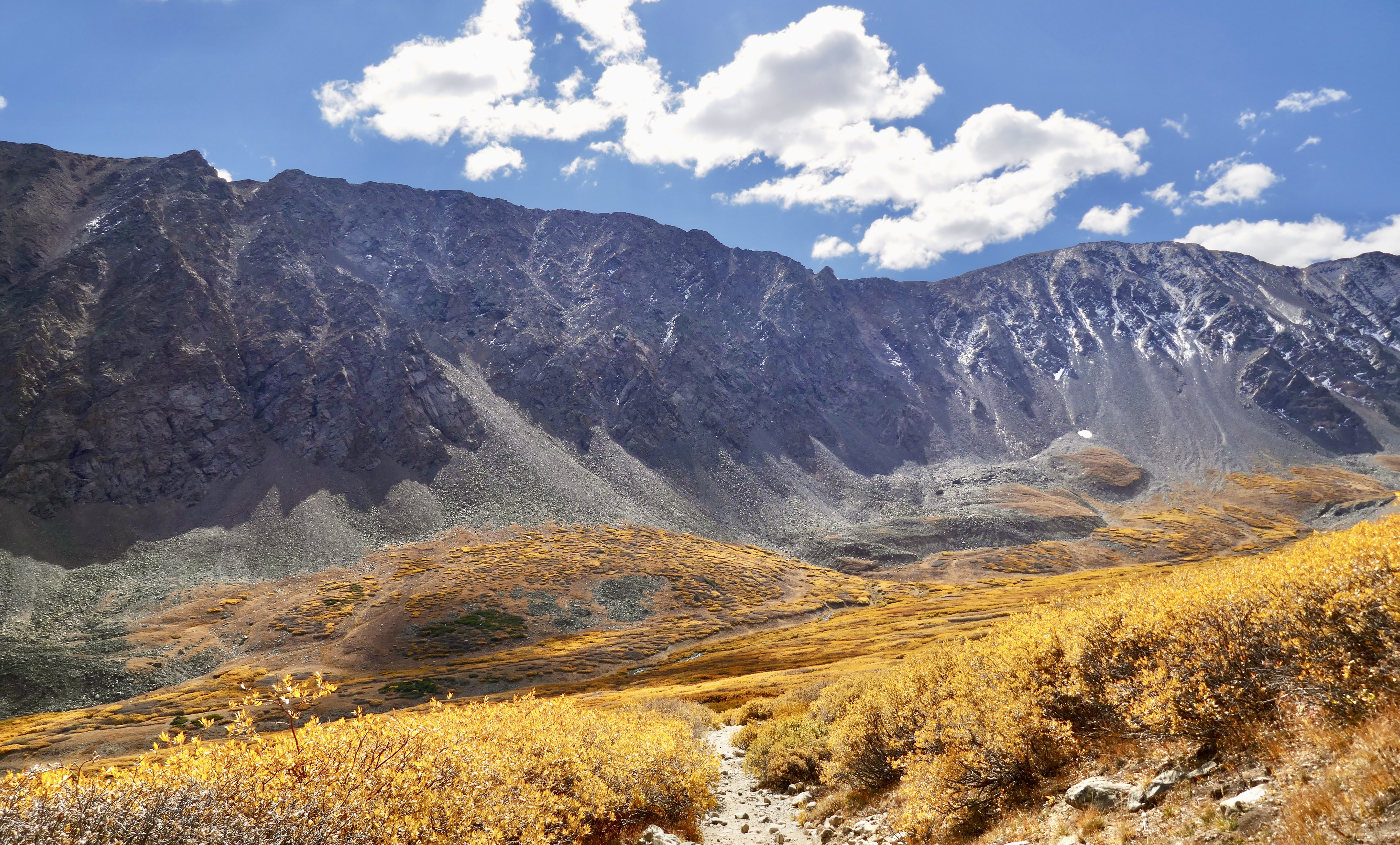
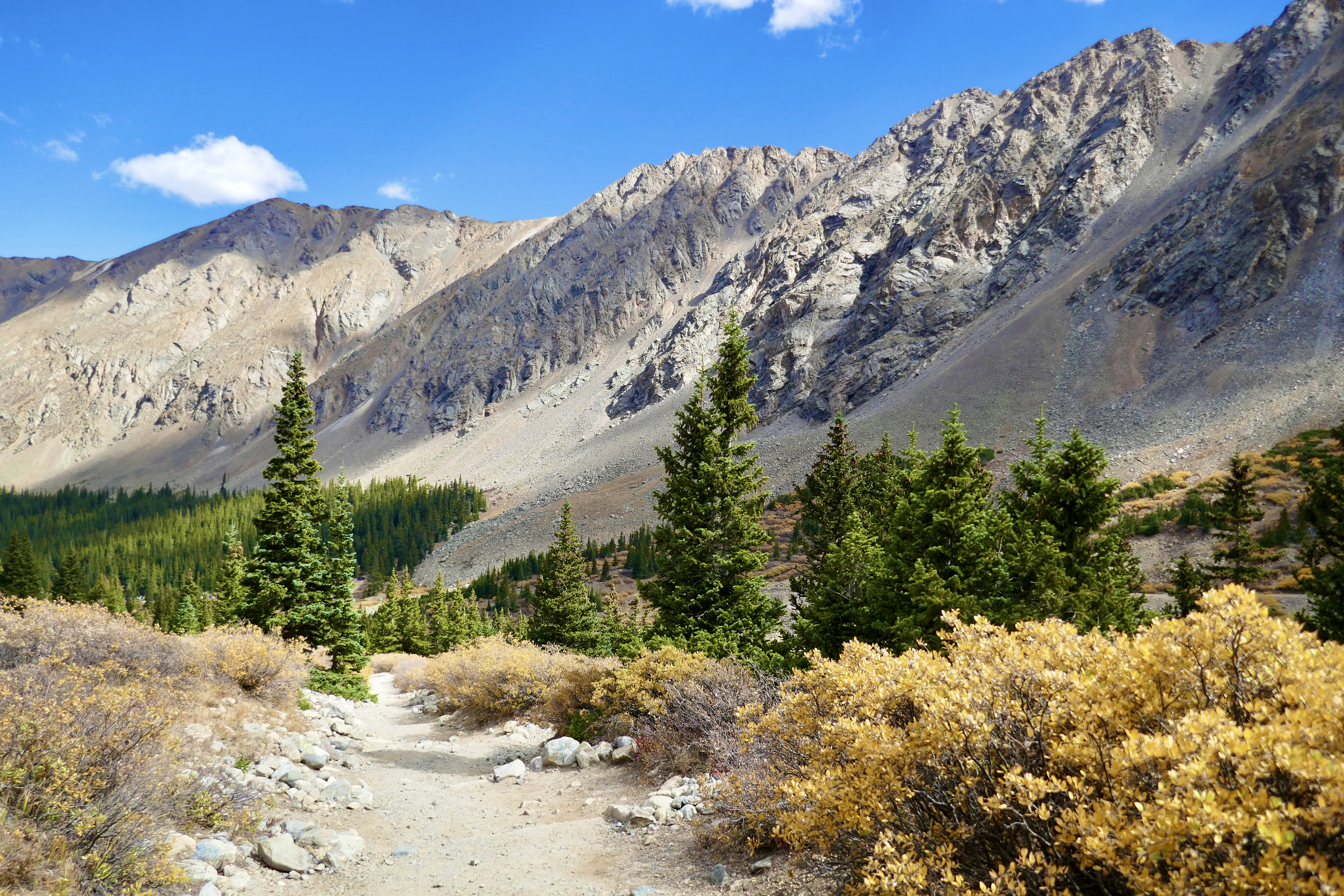
Most of my good pics were taken on the way back down. I could breathe again, and appreciate the landscape.
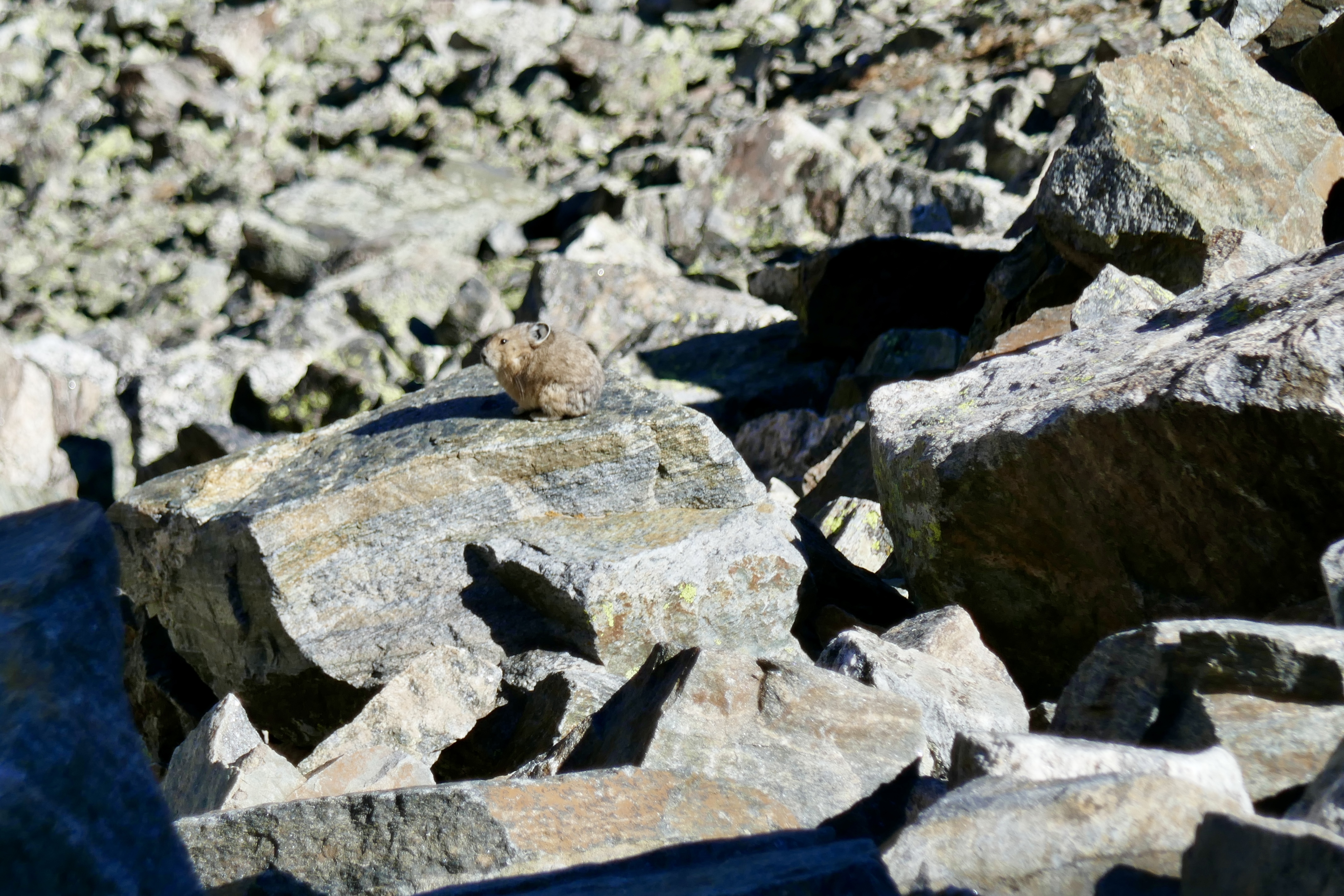
Pika!
You can see the piles of scree on the mountainsides from old landslides.


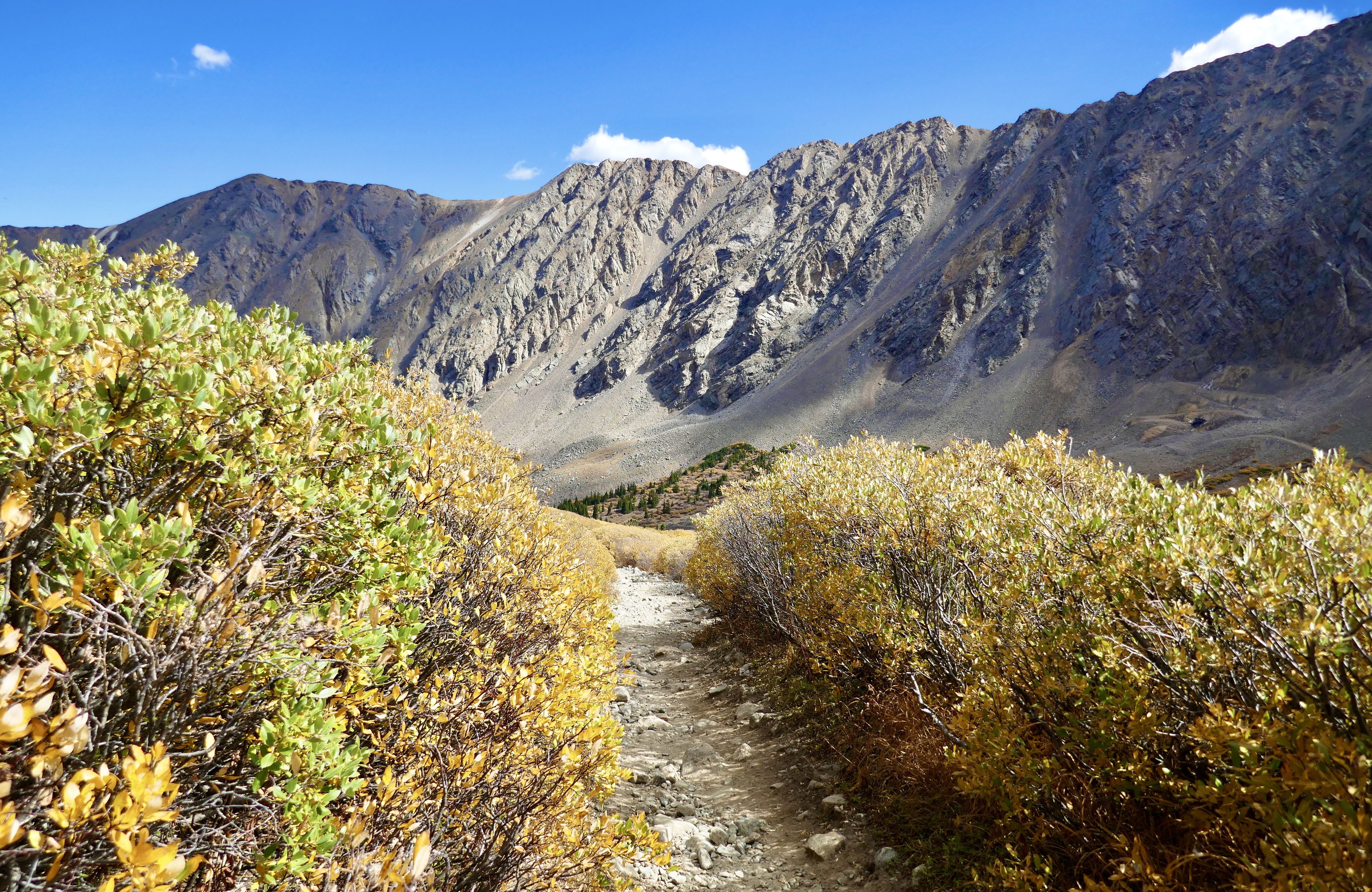
Finally made it back down below the tree line around noon…
…and made it back to the trailhead around 12:30 pm.
And now that I’ve checked “summit a 14er” off my bucket list, I’ve come to terms with the fact that I’m not as young as I used to be, and exploring on a bicycle is more fun for me these days than hiking up really high mountains.
Glad I did this one though. Looking at the world from a mountaintop is something everyone should experience at least once.
Each loop I charted on this project was longer than the one before. For the last one, I went back to the Ridgegate Station in Lone Tree, rode south to reconnect with the DOT at the beginning of Segment 11, and then curved up through Parker and Cherry Creek State Park and back into Aurora, through segments 12, 13, 14 and halfway through 15, where I had started my journey back in May. Roughly 35 miles, give or take a couple. I need to start tracking my mileage on these explores.
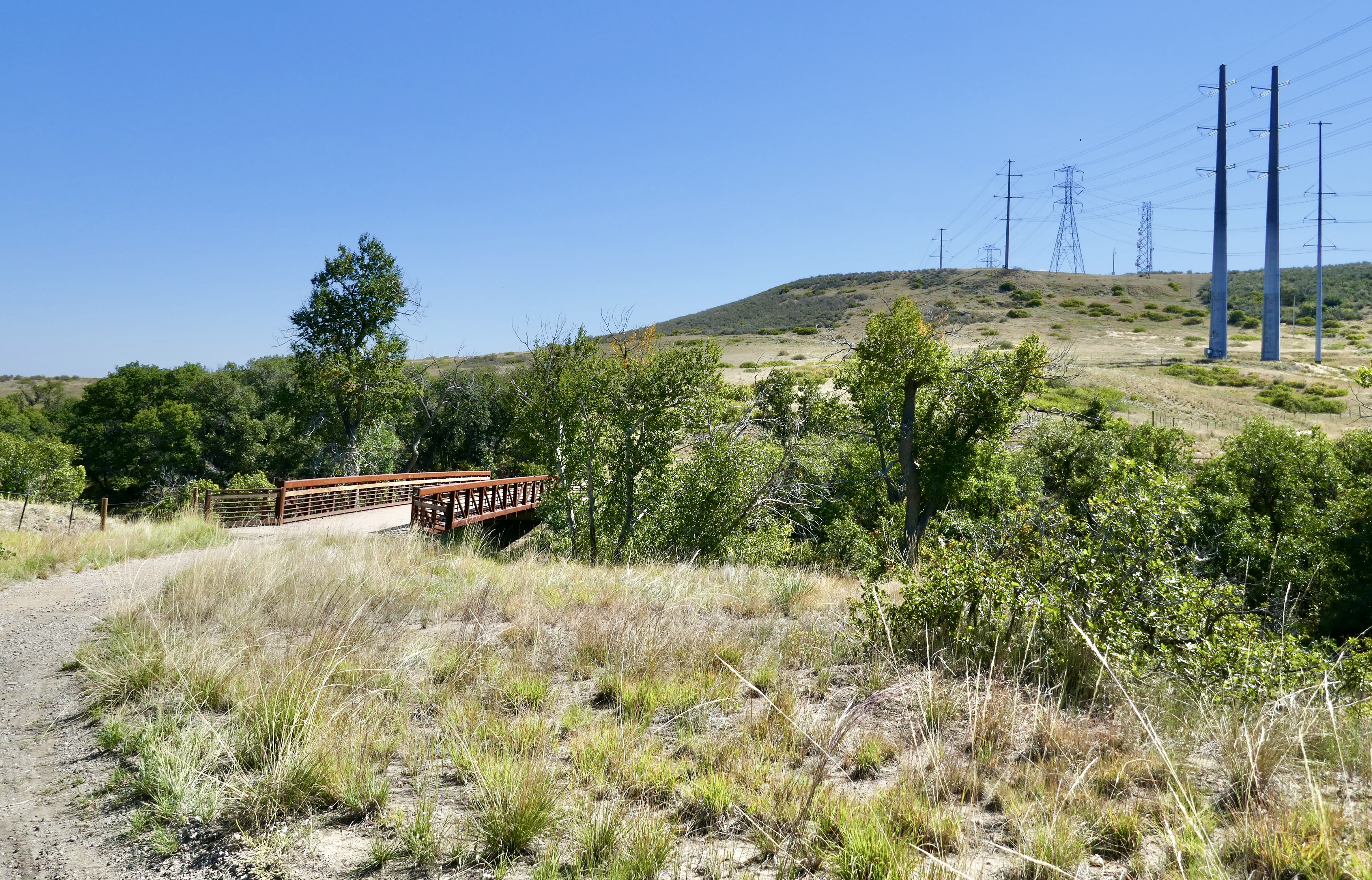
Segment 11 winds east on the East/West Regional Trail.
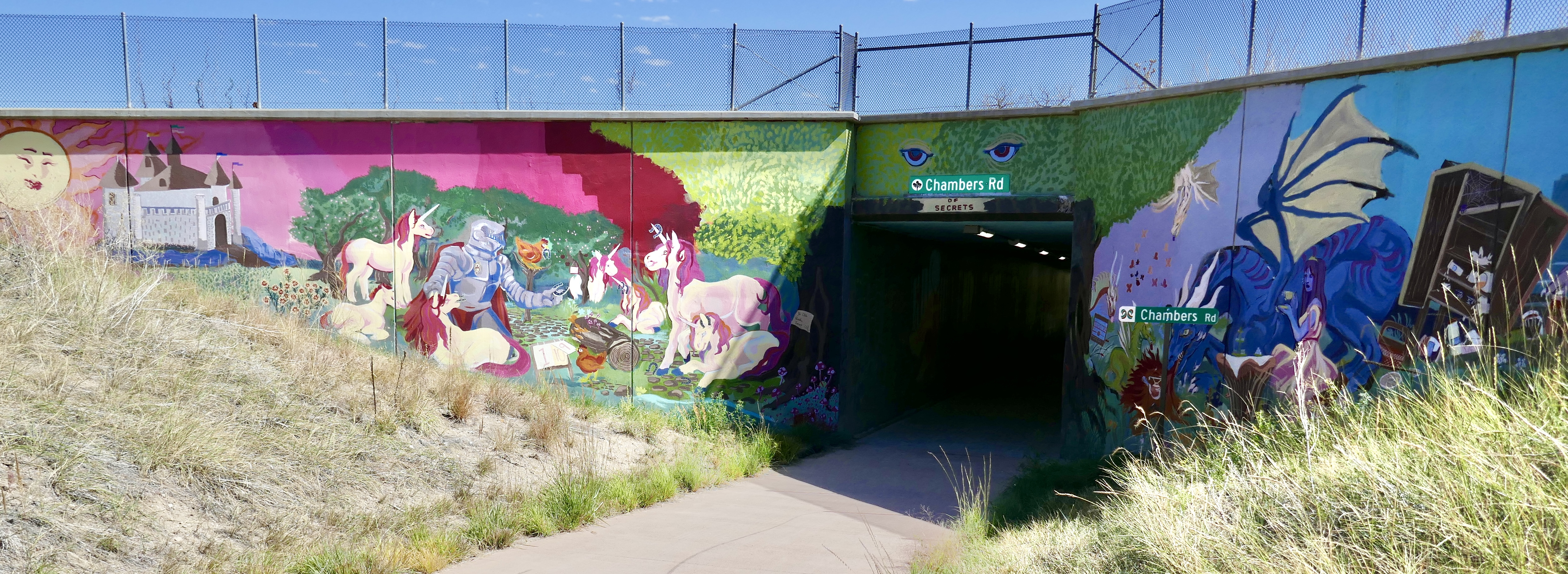
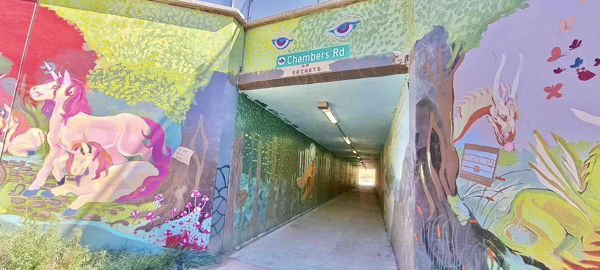
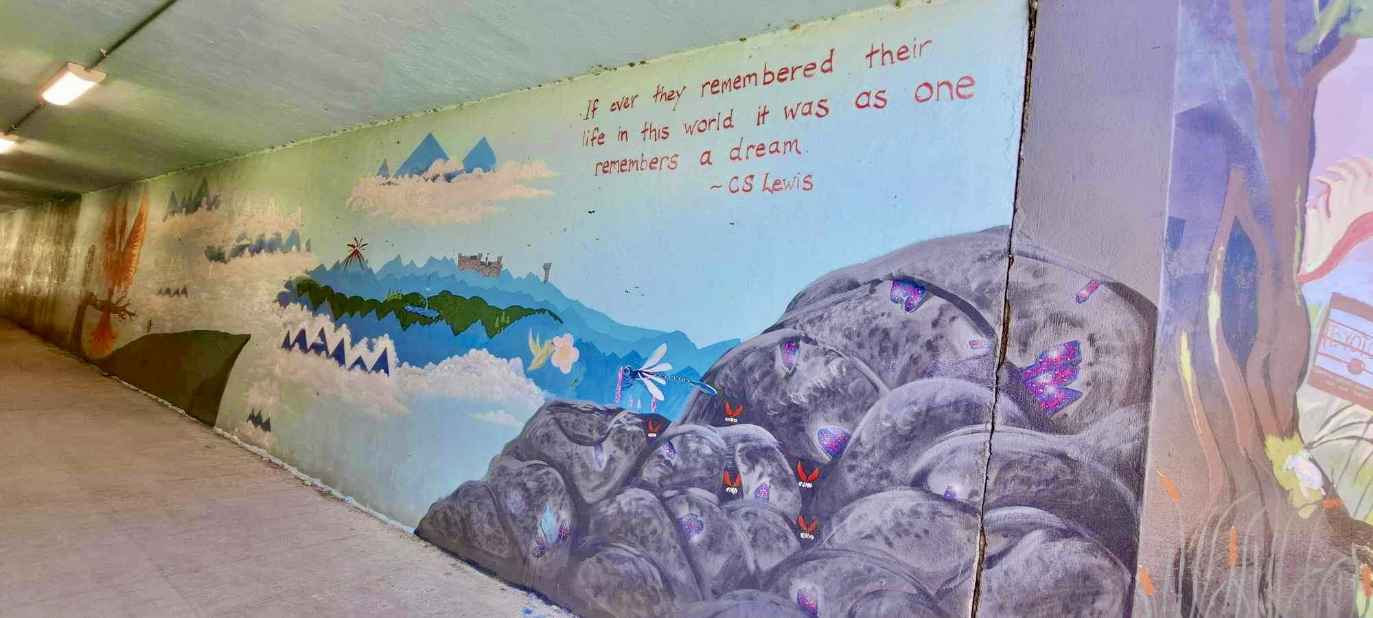
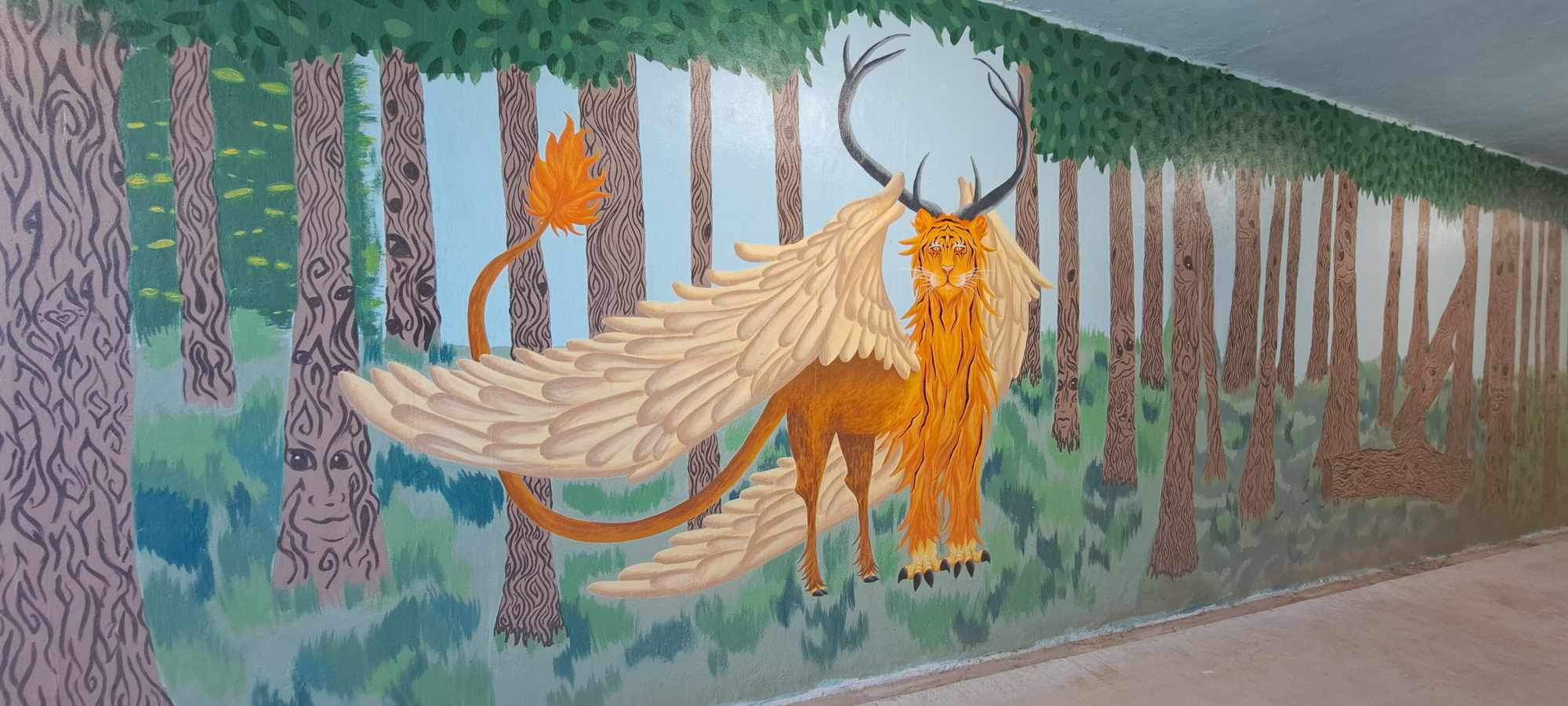
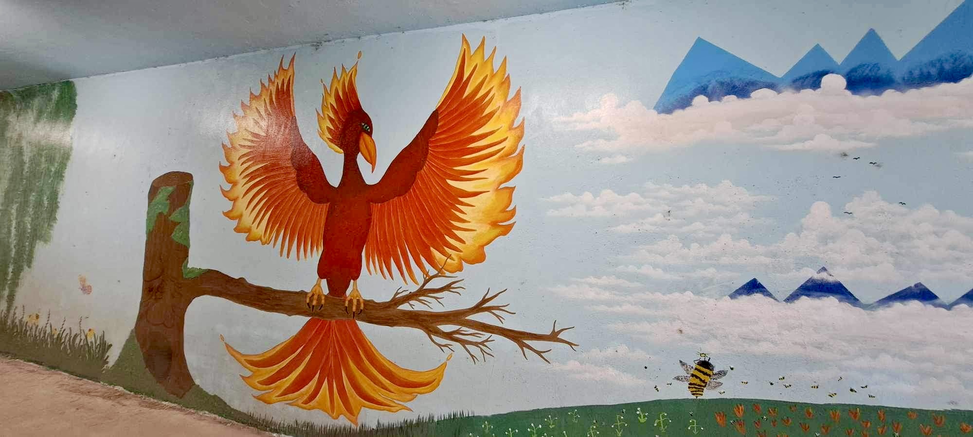
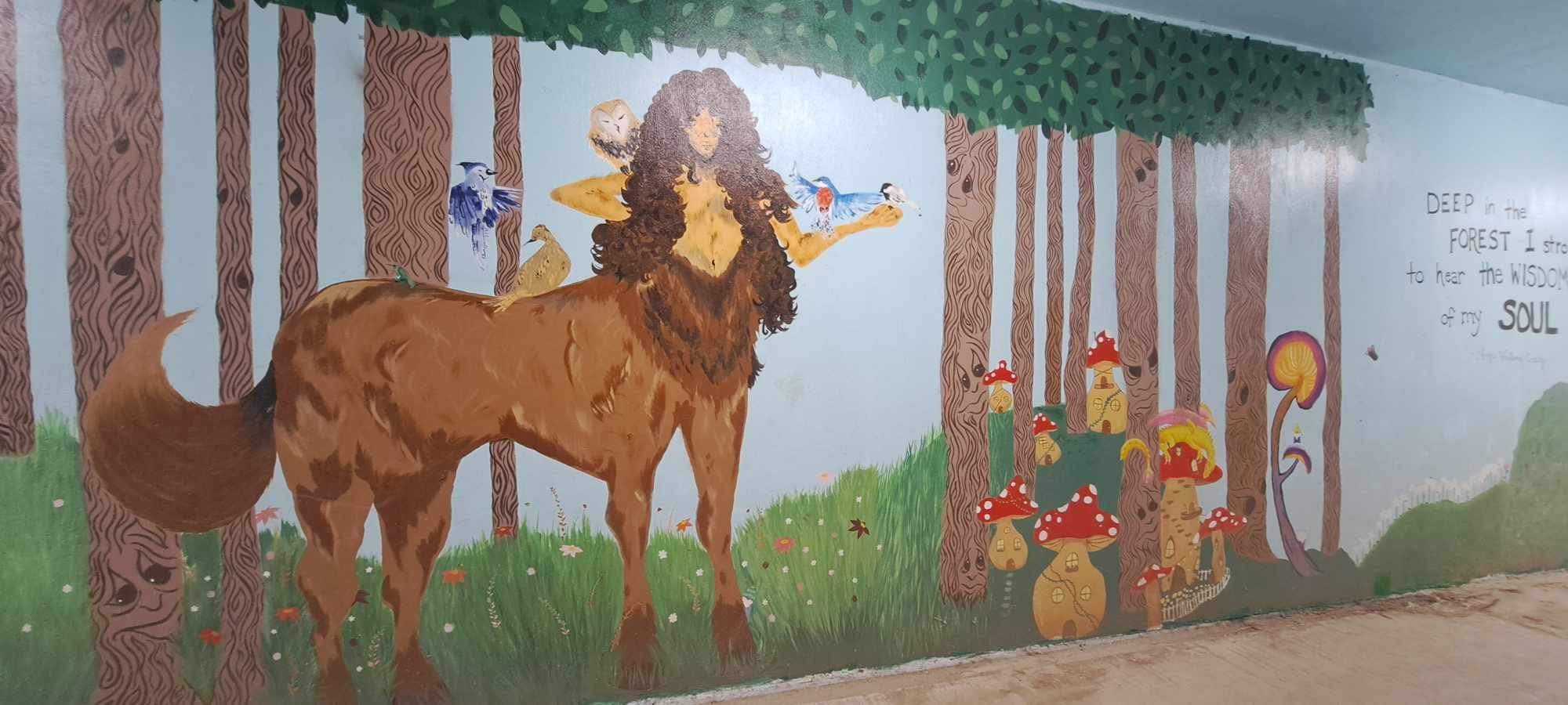
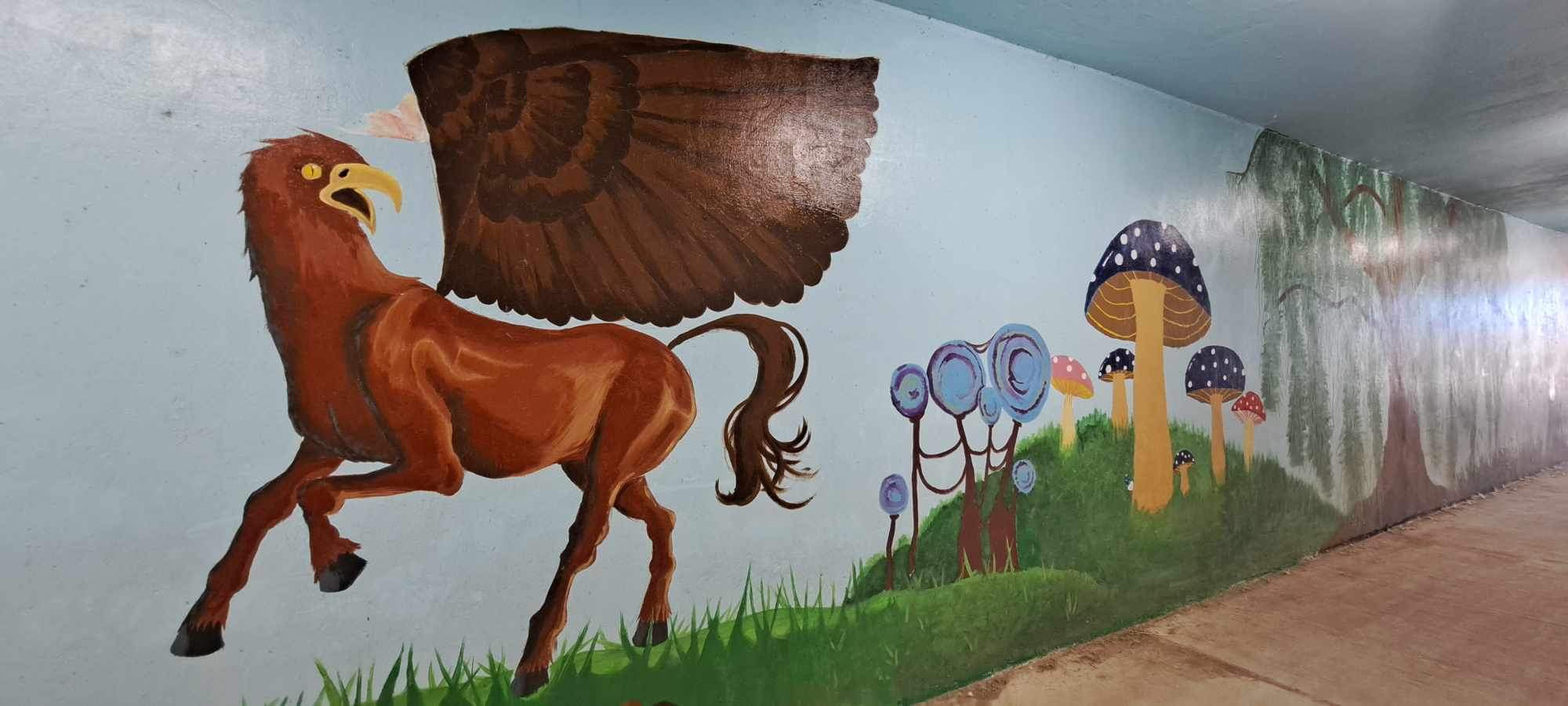
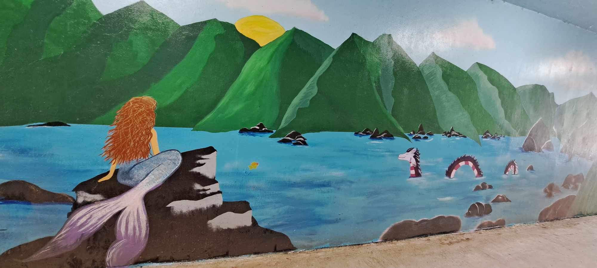
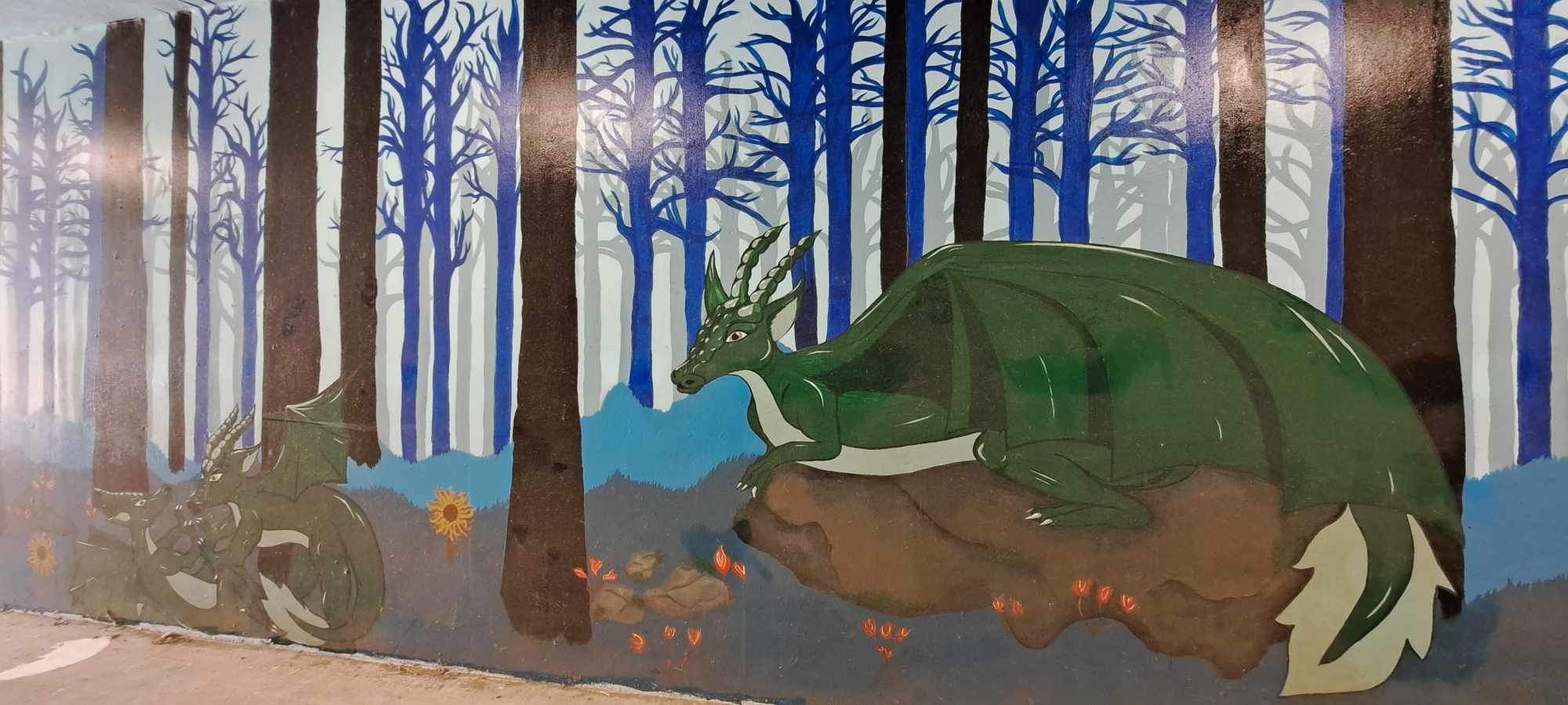
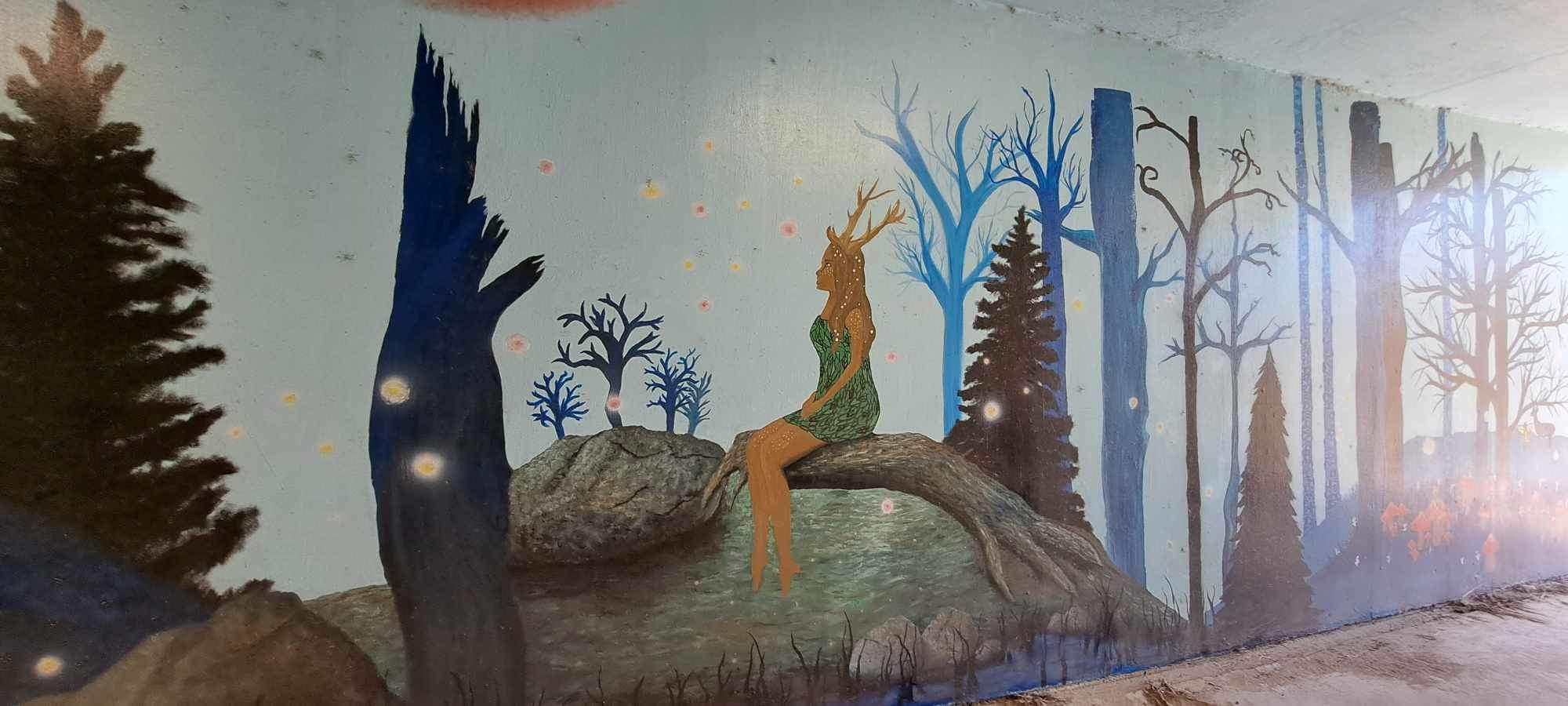
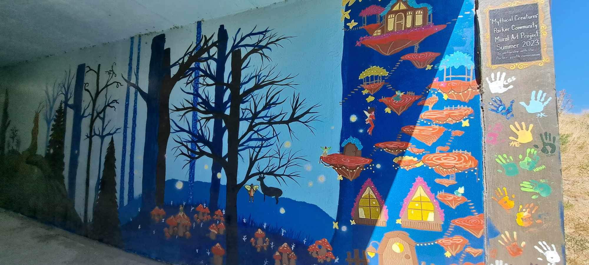
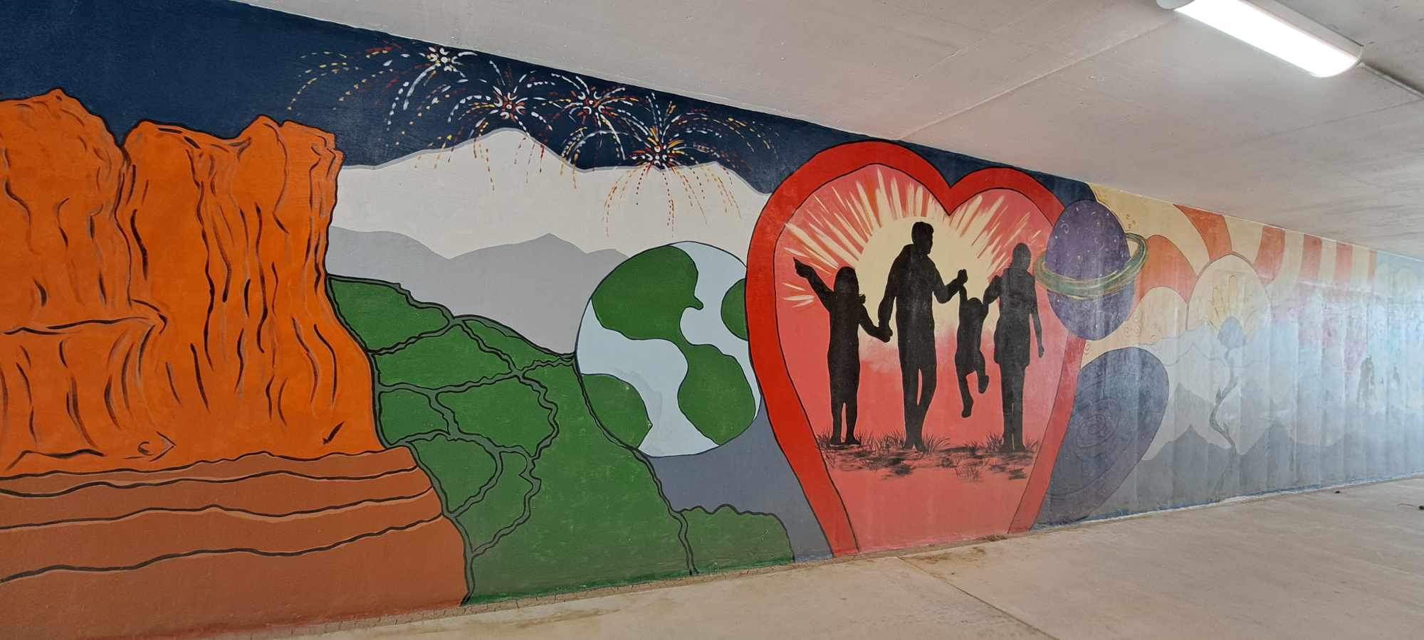
In Parker, some of the tunnels have been painted by local artists. I like it!


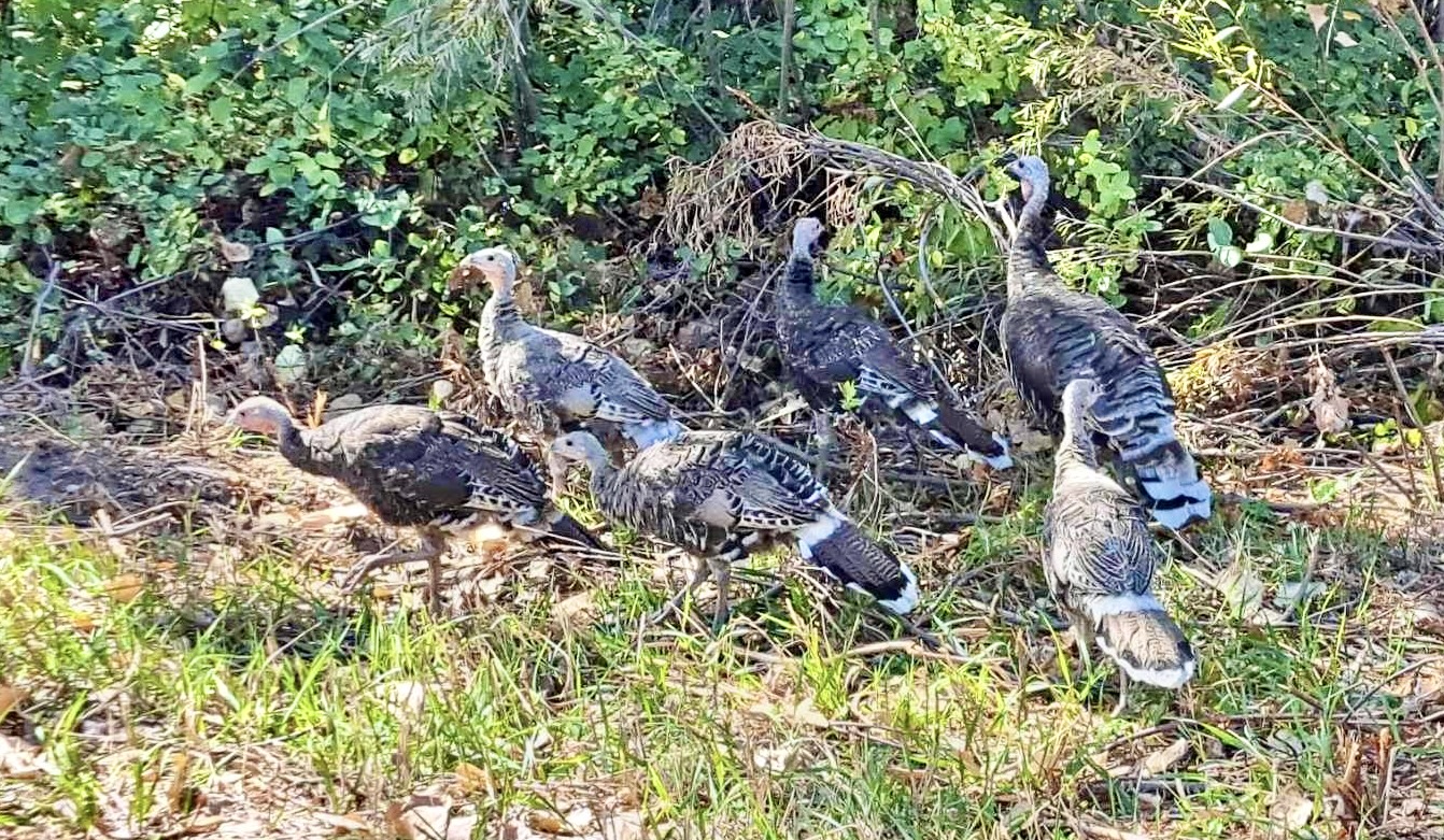
The East/West Trail terminates into the Colorado Front Range Trail, which runs north/south along Cherry Creek up to Cherry Creek State Park and beyond. Near the intersection of the two trails, just past the Bar CCC Reservoir, this flock of wild turkeys was hanging out.
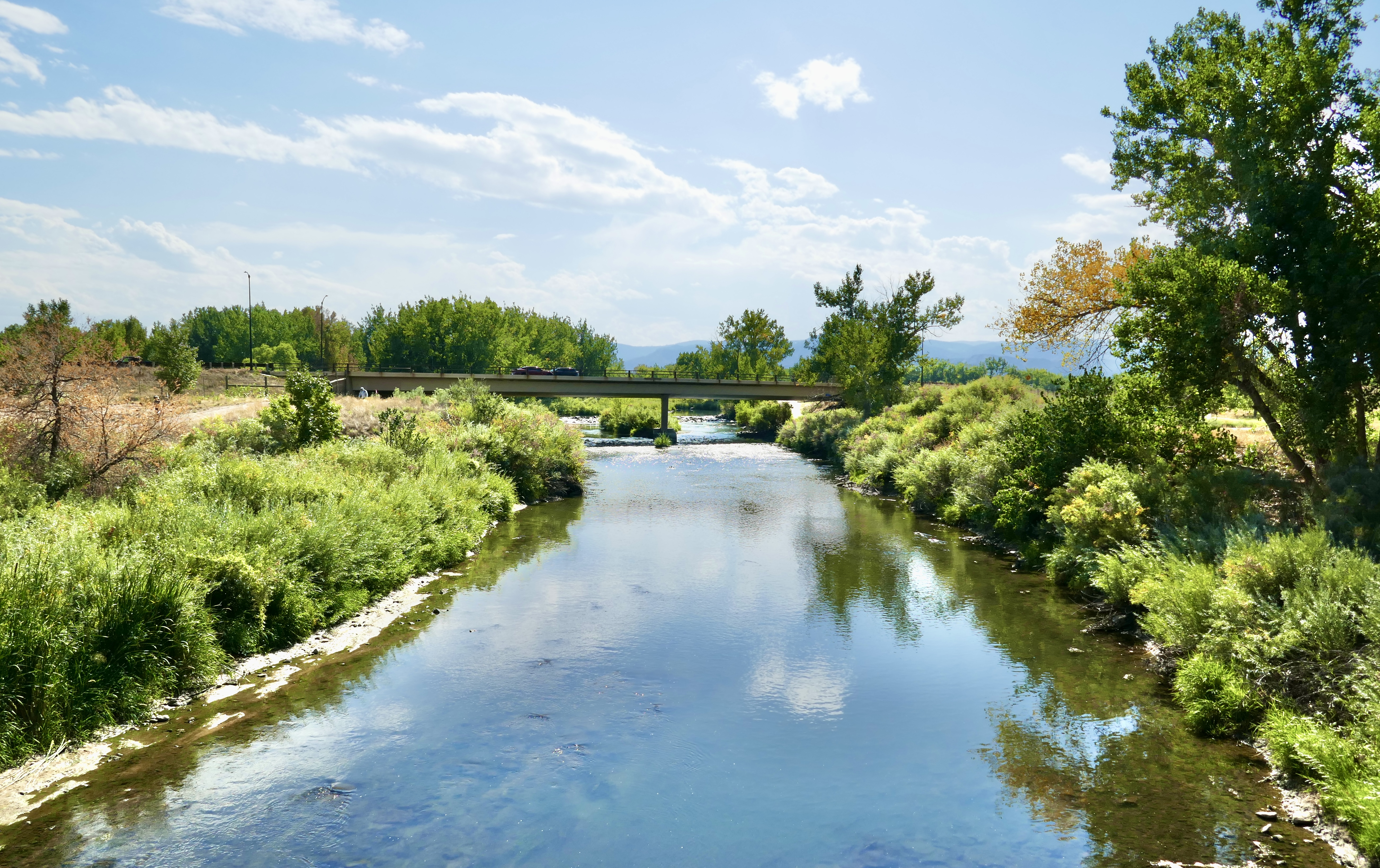
It’s a pretty stretch of trail.
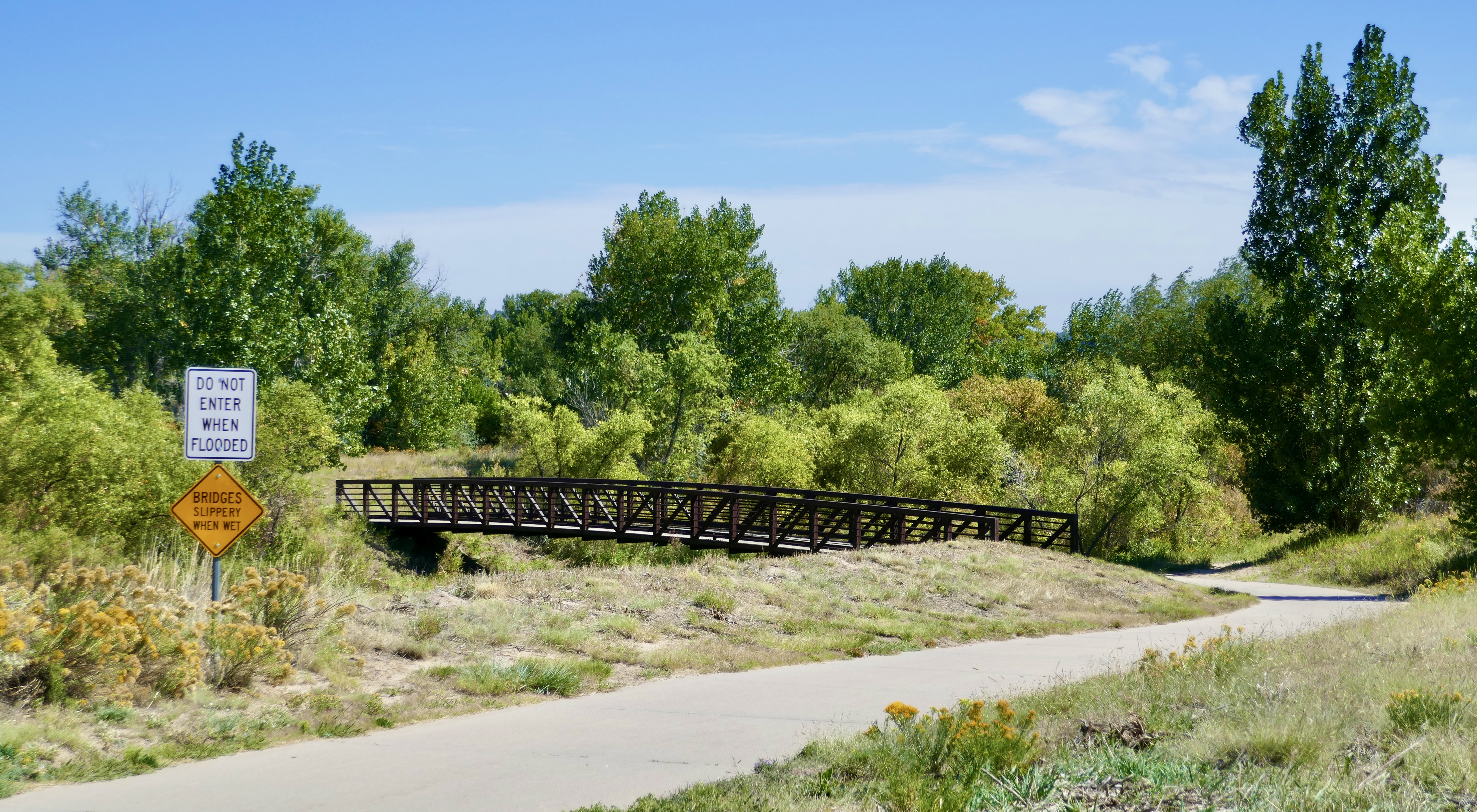
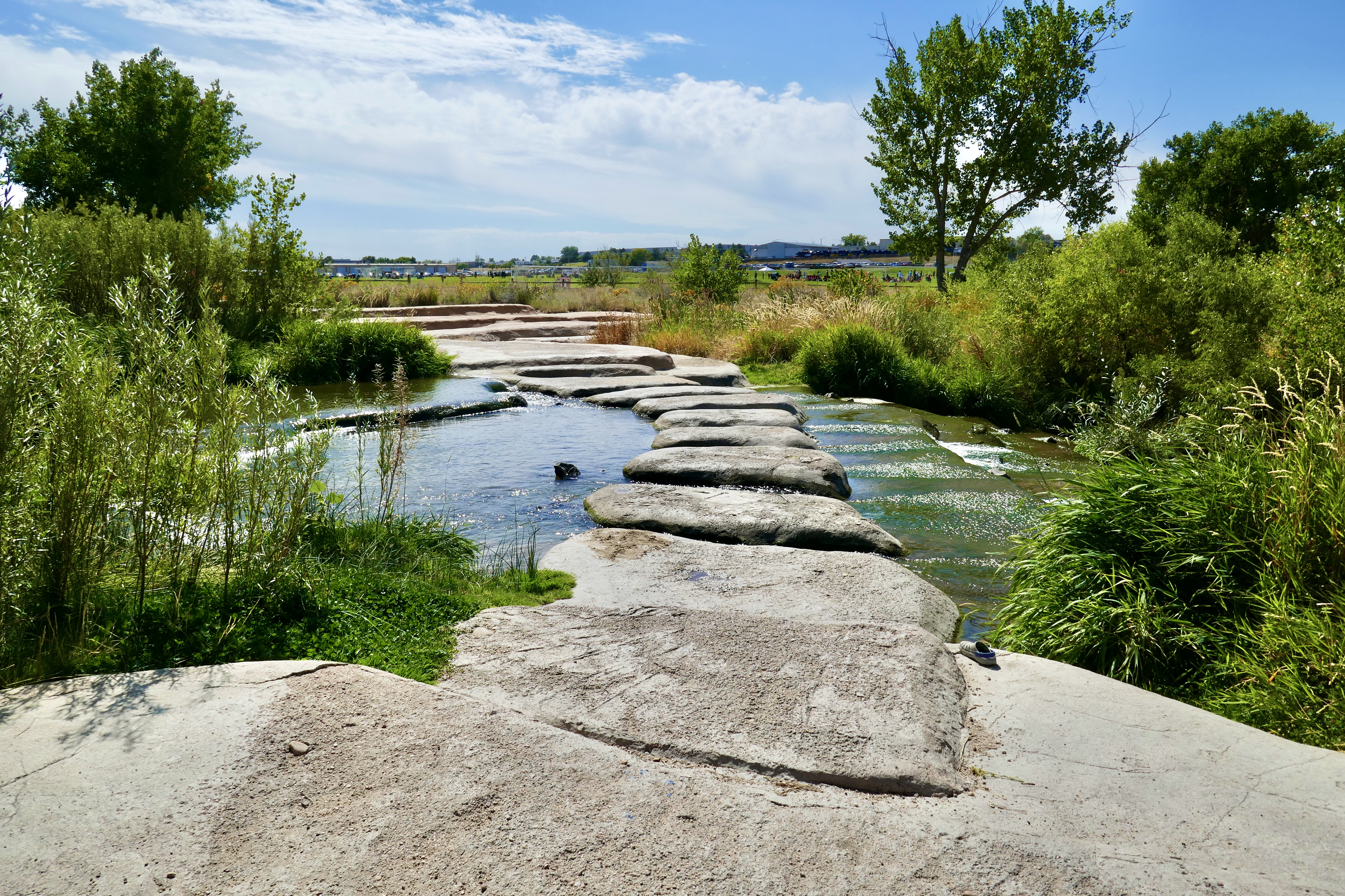
The stone bridge isn’t part of the DOT, but I stopped and played on it for a bit anyway.
Farther up the trail I passed a bakery/cafe that looked good, so I pulled up and enjoyed a really tasty French dip.

Segment 13 is unpaved and a bit rough, but scenic.


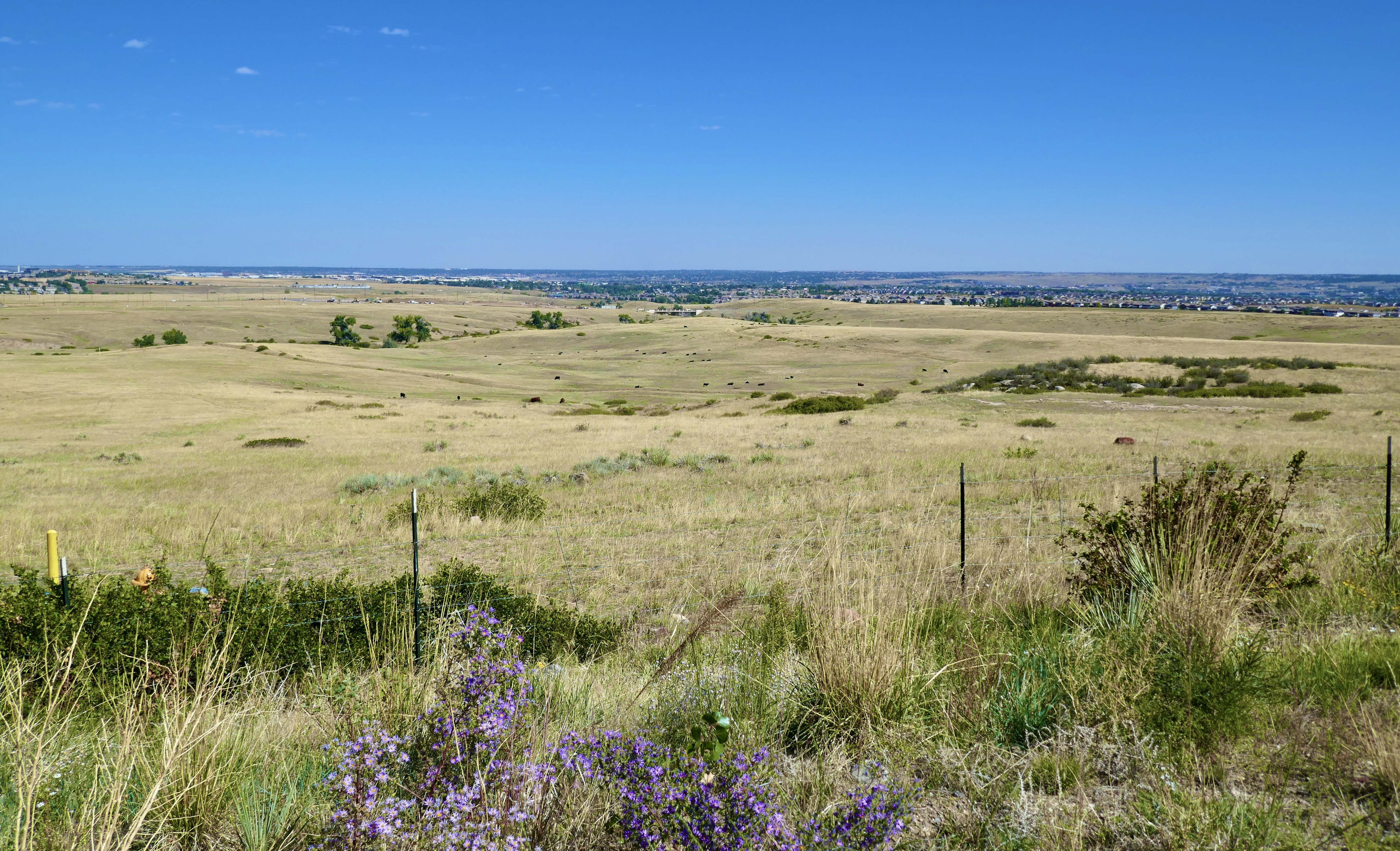
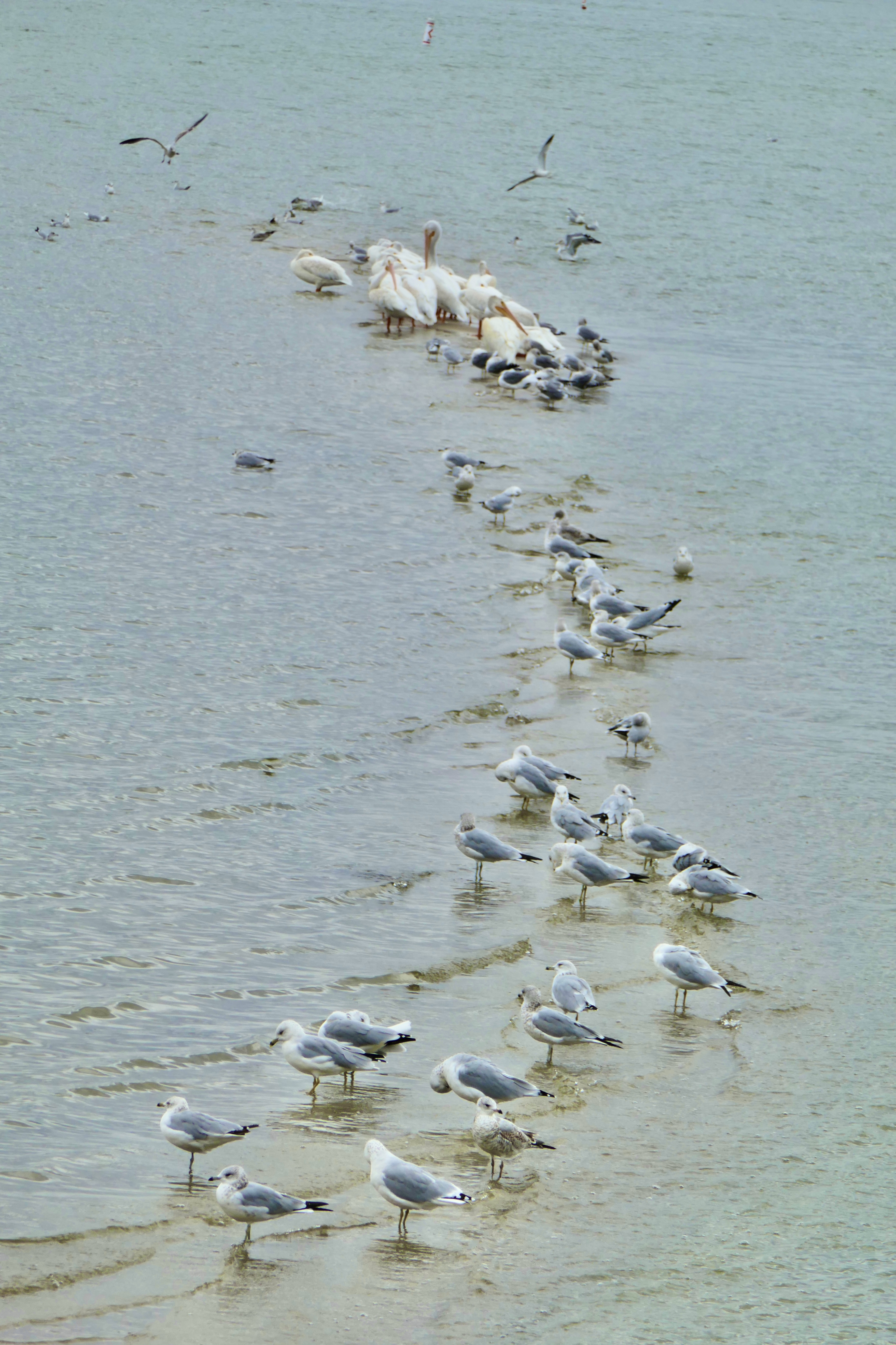
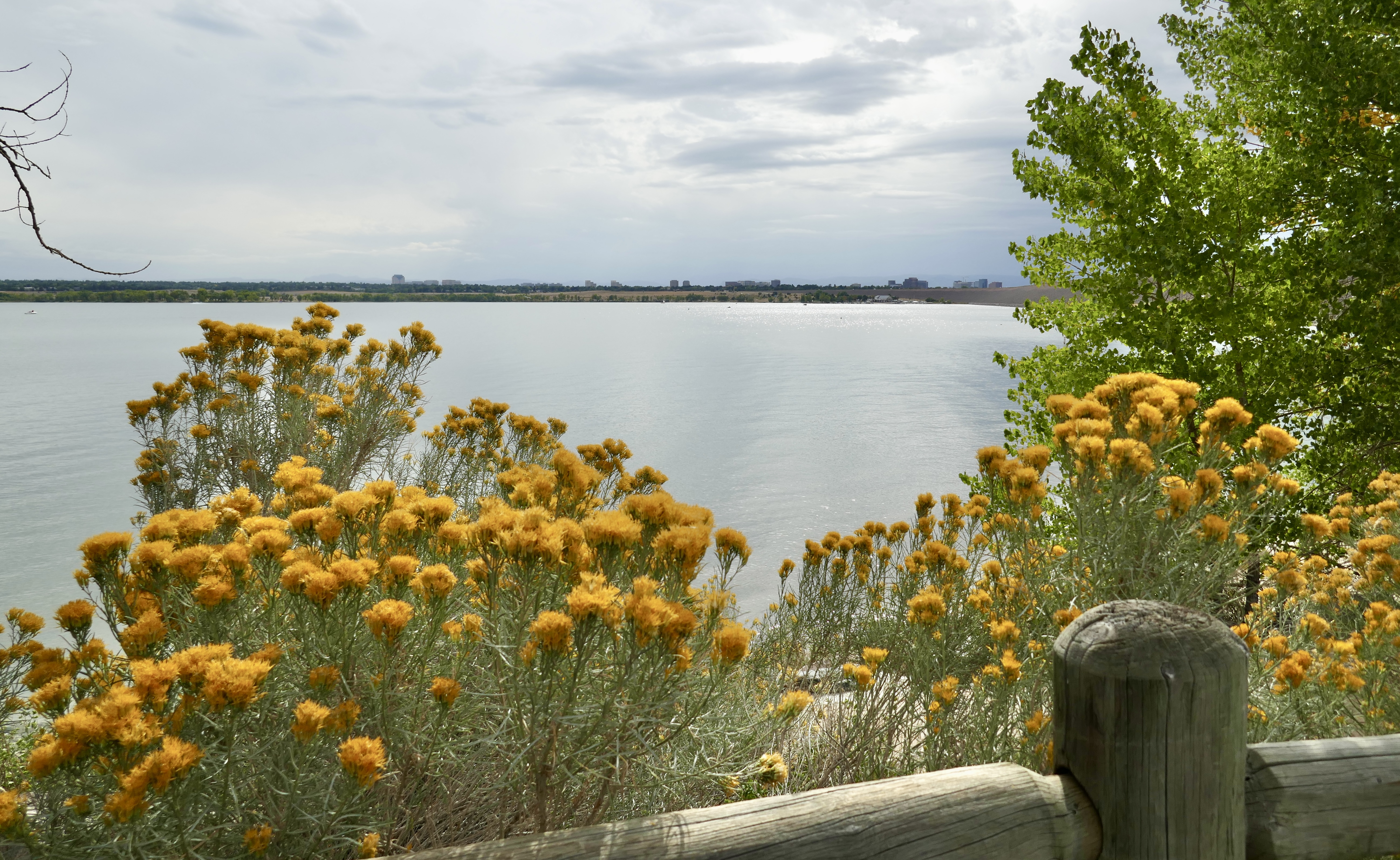
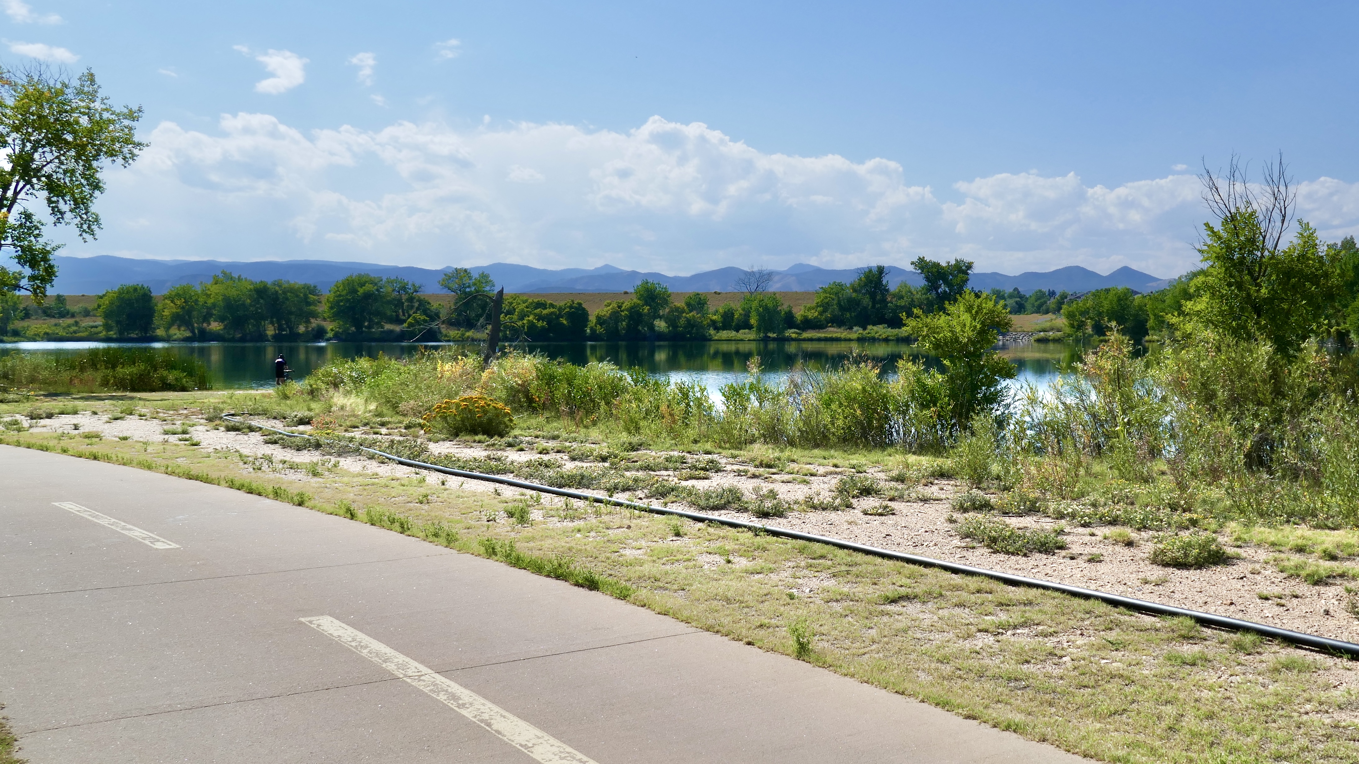
Cherry Creek Reservoir was looking pretty.
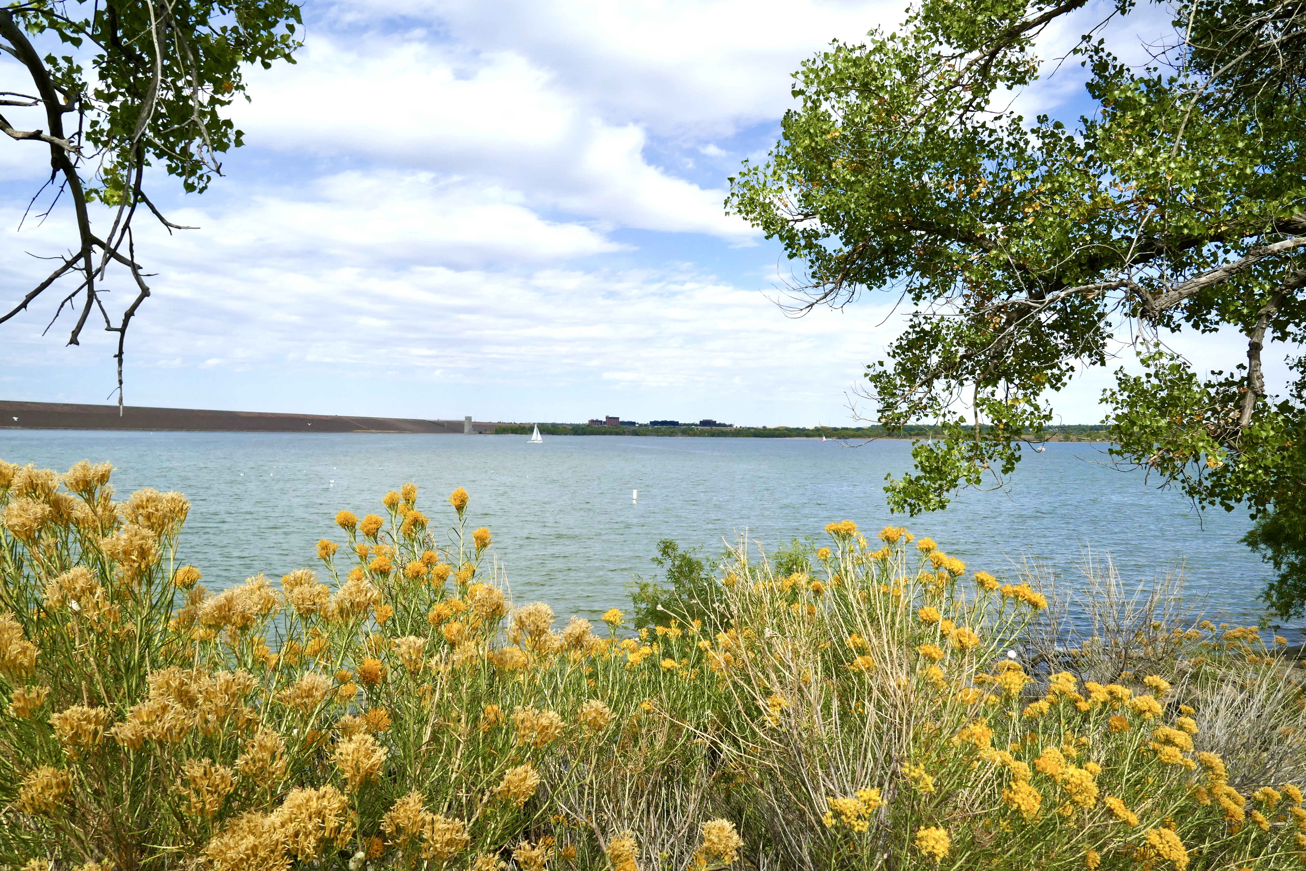

I’m not a huge fan of rabbitbrush, but it was popping that day. Perfect gold against the muted blue of the water.

For some reason, the bike trail from Cherry Creek State Park to where I left the DOT and rode home is shorter in my head than the drive from my house to the Park. Not time-wise, but geography-wise. It just seems farther when I’m driving it, no idea why.
Anyway, that was my adventure on the Denver Orbital Trail. I enjoyed it a lot, and will probably do parts of it again. I’m impressed by how accessible the “greater Denver metro area” is by bike, as long as you don’t try to go up into the mountains.
Next I’m thinking of riding the entire length of the High Line Canal Trail: 71 miles, 27 segments starting in Waterton Canyon and snaking north and east to 64th Ave in east Denver, almost to the airport. The logistics of that are trickier, though, because the first part isn’t near a light rail station, so someone would have to drive me to the first trailhead out in the boonies.
Next up: we summit our first 14er!
For most of last summer while I was riding the DOT, the R line was always running late because of track maintenance. It took three hours just to get from home to the Golden station for that Golden-to-Arvada loop, partly because of the chronically late R line and partly because I had to take the A to Union Station to connect with the W to Golden.
For my seventh loop, I wanted to start in Golden again and travel south. I wondered if I could make better time by riding my bike directly to Auroria West station on the W in Denver, via Cherry Creek Trail.
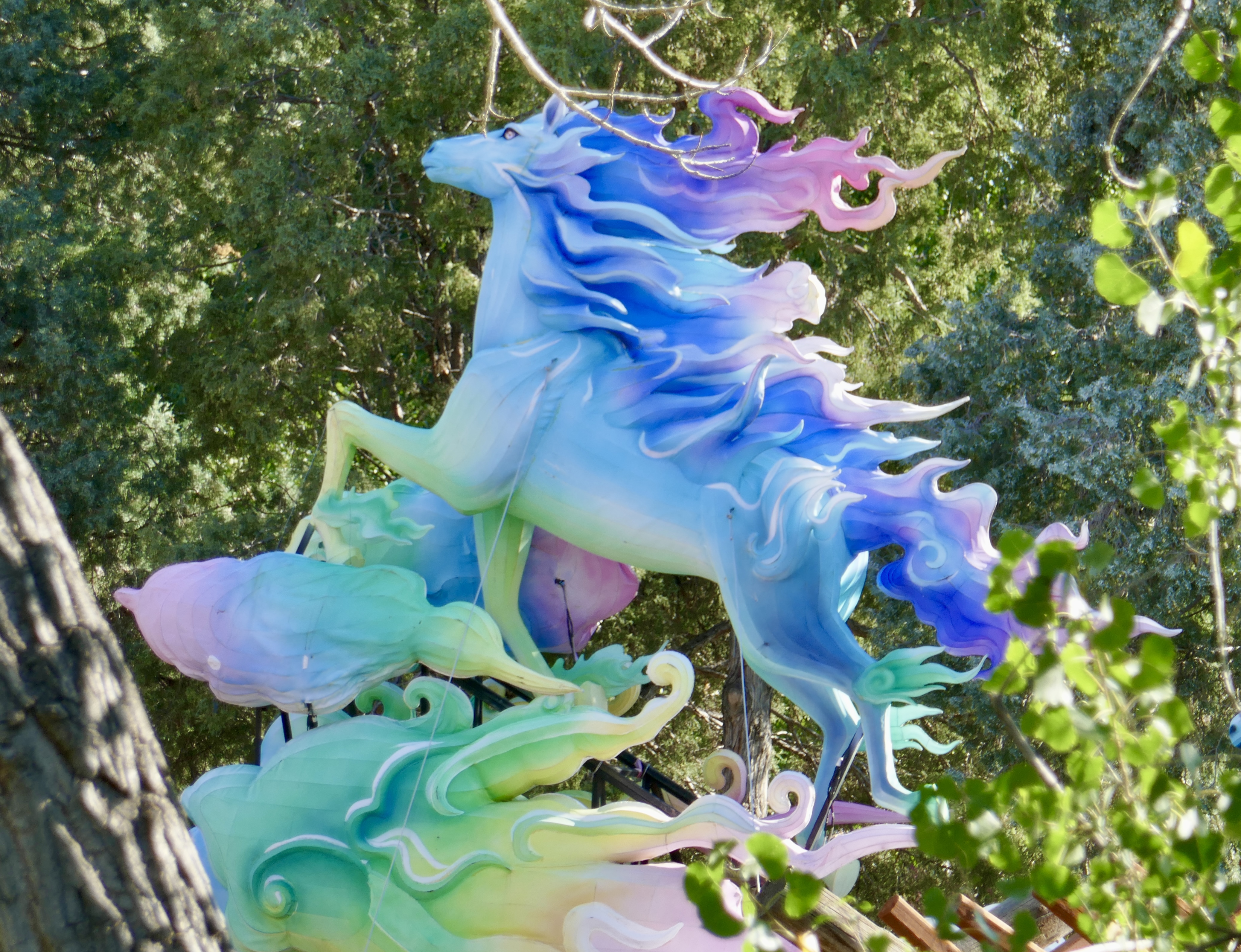
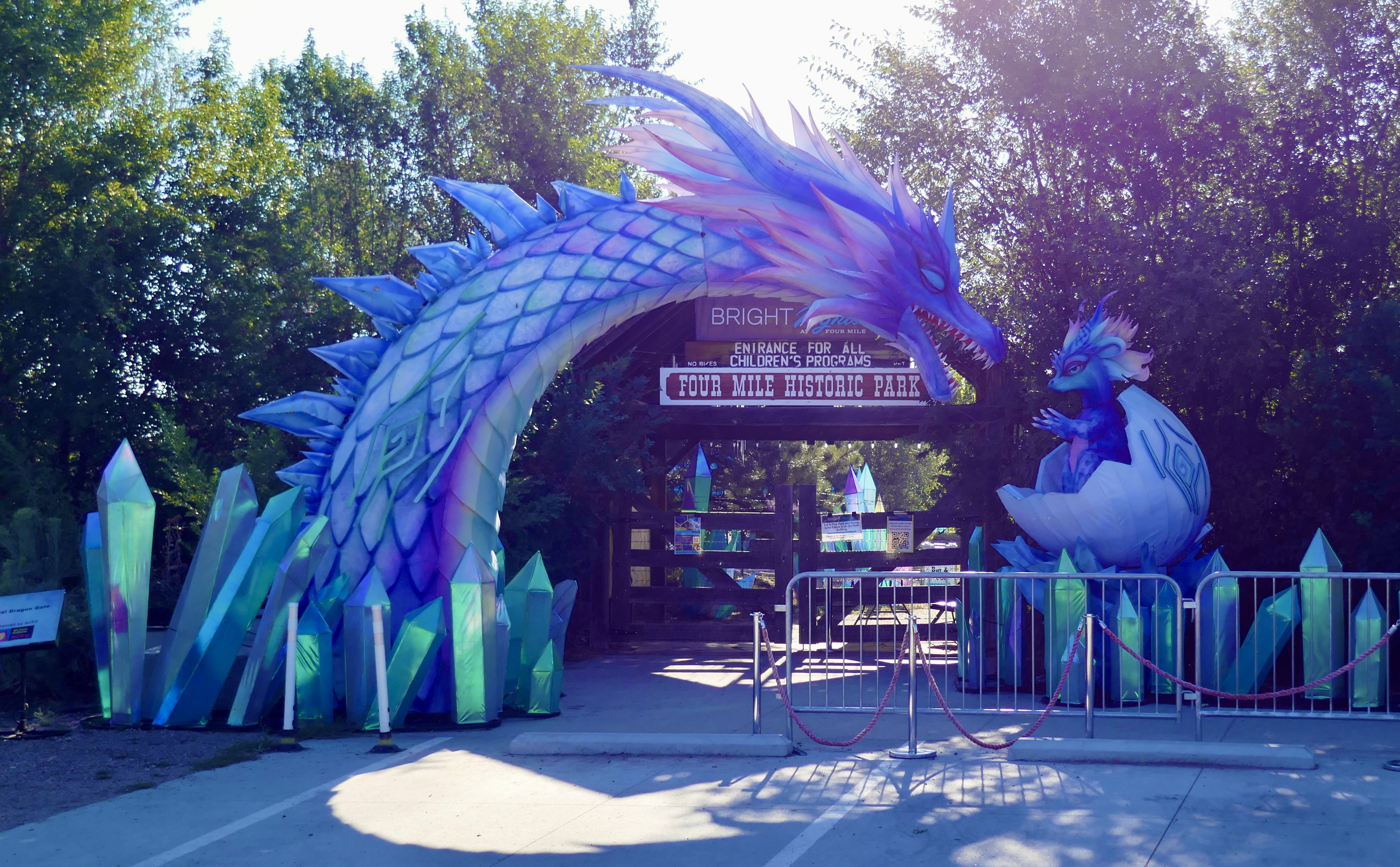
This is a pretty ride. I stopped to peek through the fence at Four Mile Park in Glendale, were I got to see some of the giant lanterns for the annual Bright Nights Lantern Festival.
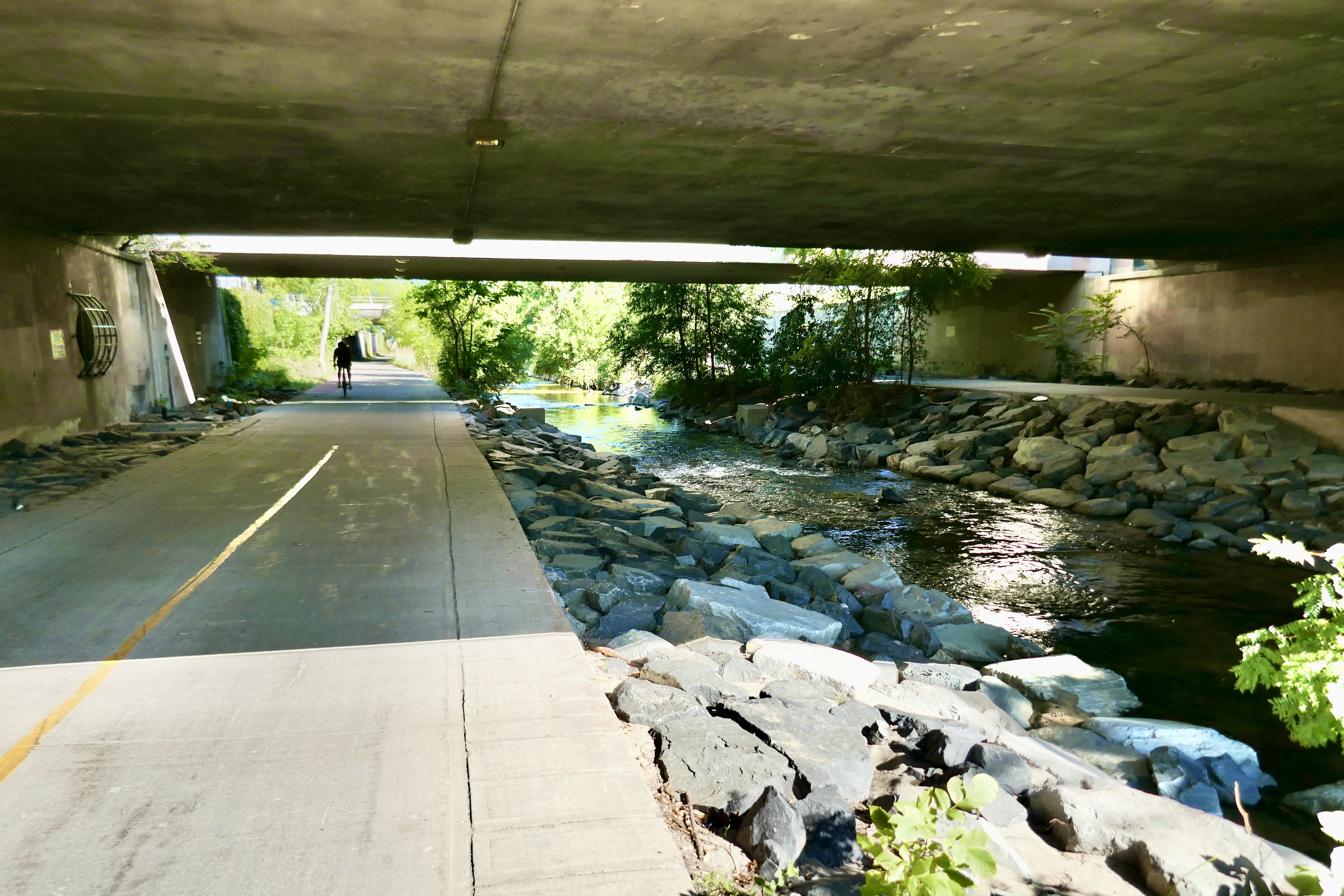
Following Cherry Creek northwest into Denver, I shared the trail with lots of pedestrians, scooters and other bicyclists. It’s much more scenic than the train ride!

I arrived at Auroria West station and took the W back to Golden station. Total travel time to get to Golden…about three hours. No time saved, but I did enjoy the bike route more.
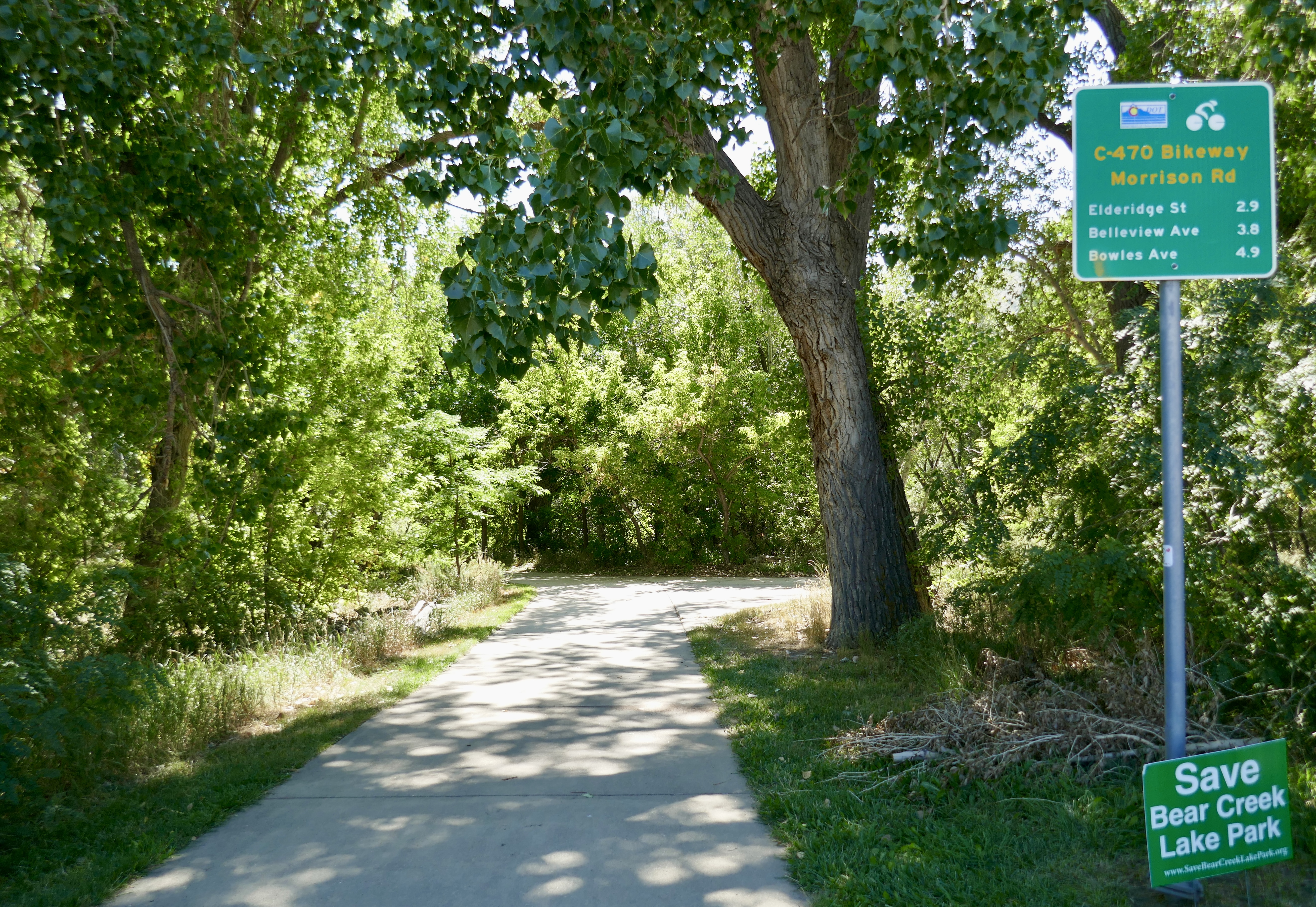
Like Segment 1, Segment 2 winds up into the foothills on steep, rough dirt trails that my commuter bike is not built for. I opted to take the C-470 Bikeway instead, which was mostly a good call, at least in the beginning.
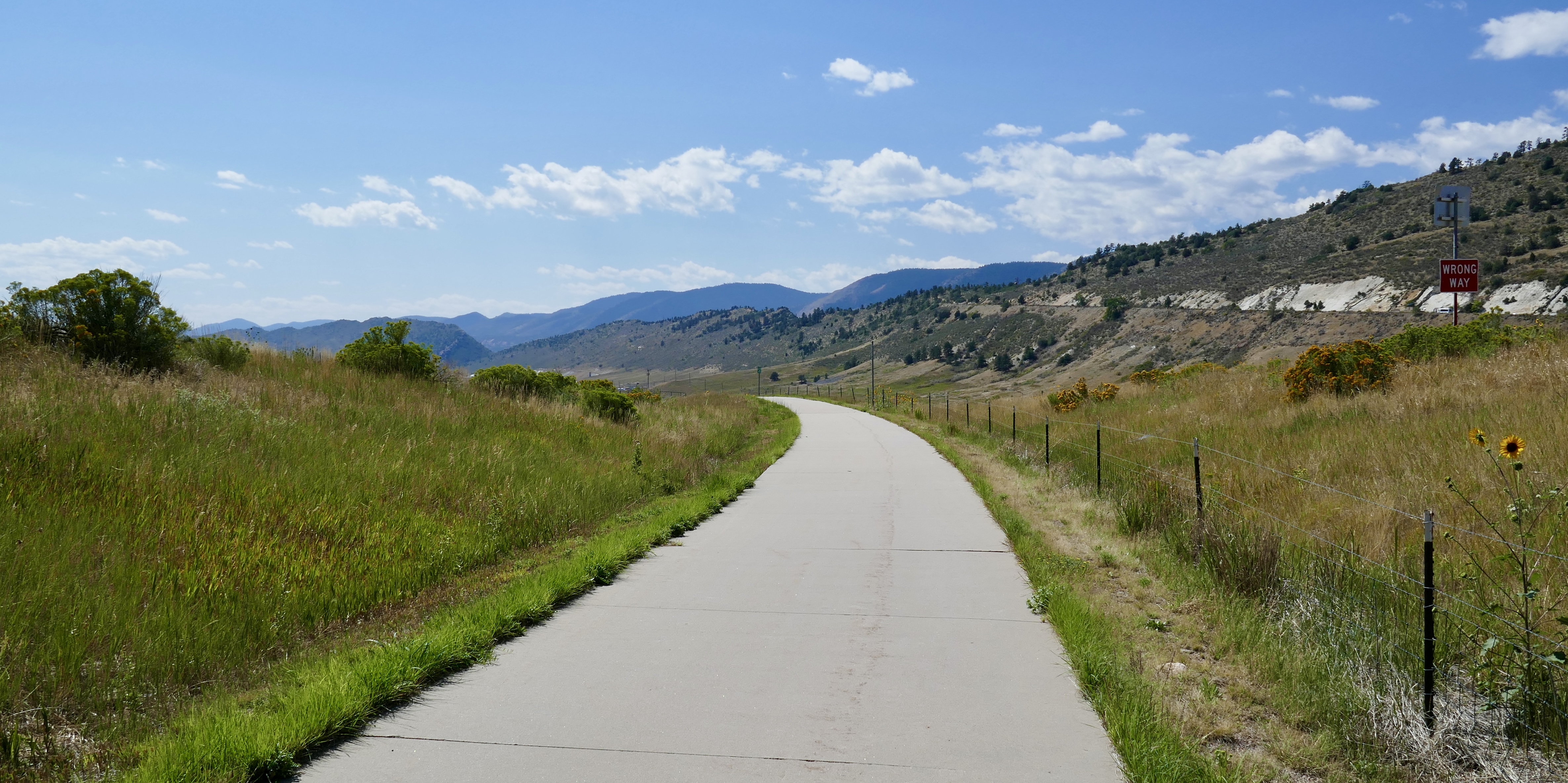

Segment 3 of the DOT hops onto the Bikeway near Bear Creek, and that’s where I picked it back up.

Bear Creek Lake Park looks like a nice place to cool off on a summer day.

Apparently there’s a controversial plan to enlarge the reservoir by 20,000 acre feet, which would put most of this park underwater. I can see good arguments on both sides of the debate.
The DOT returns to C-470 via Turkey Creek.


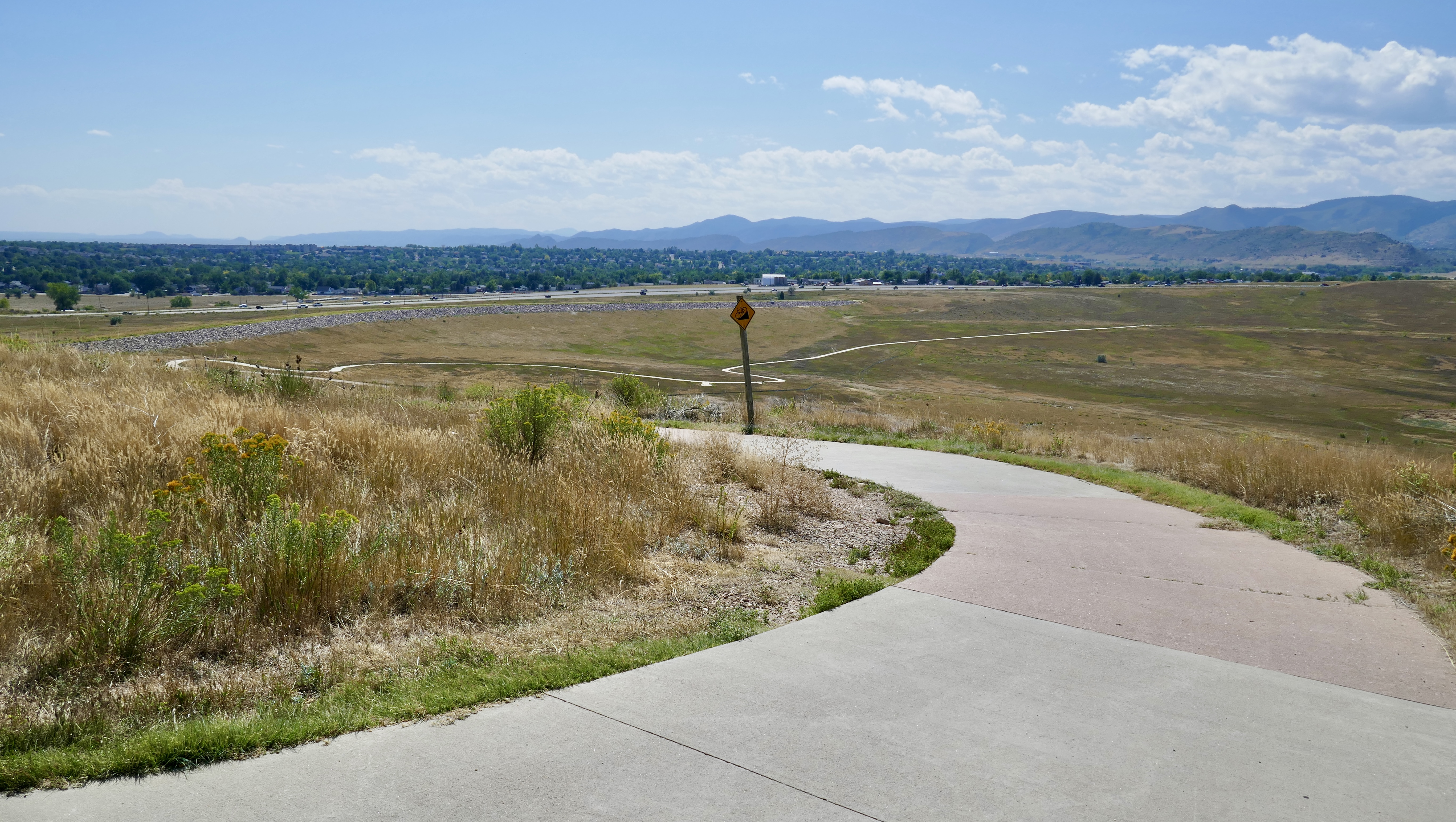
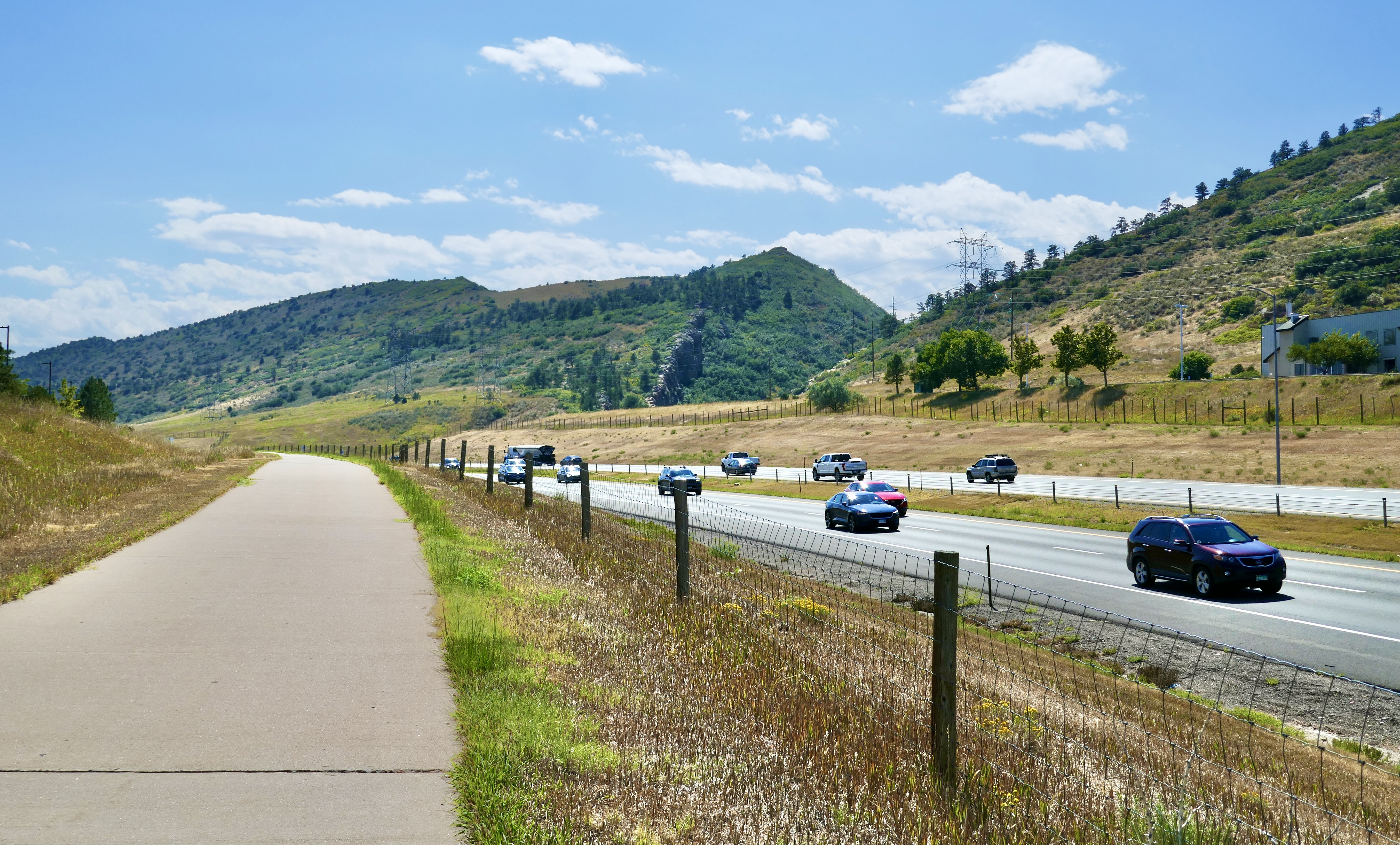
Right around here is where the ride stopped being fun for a while.

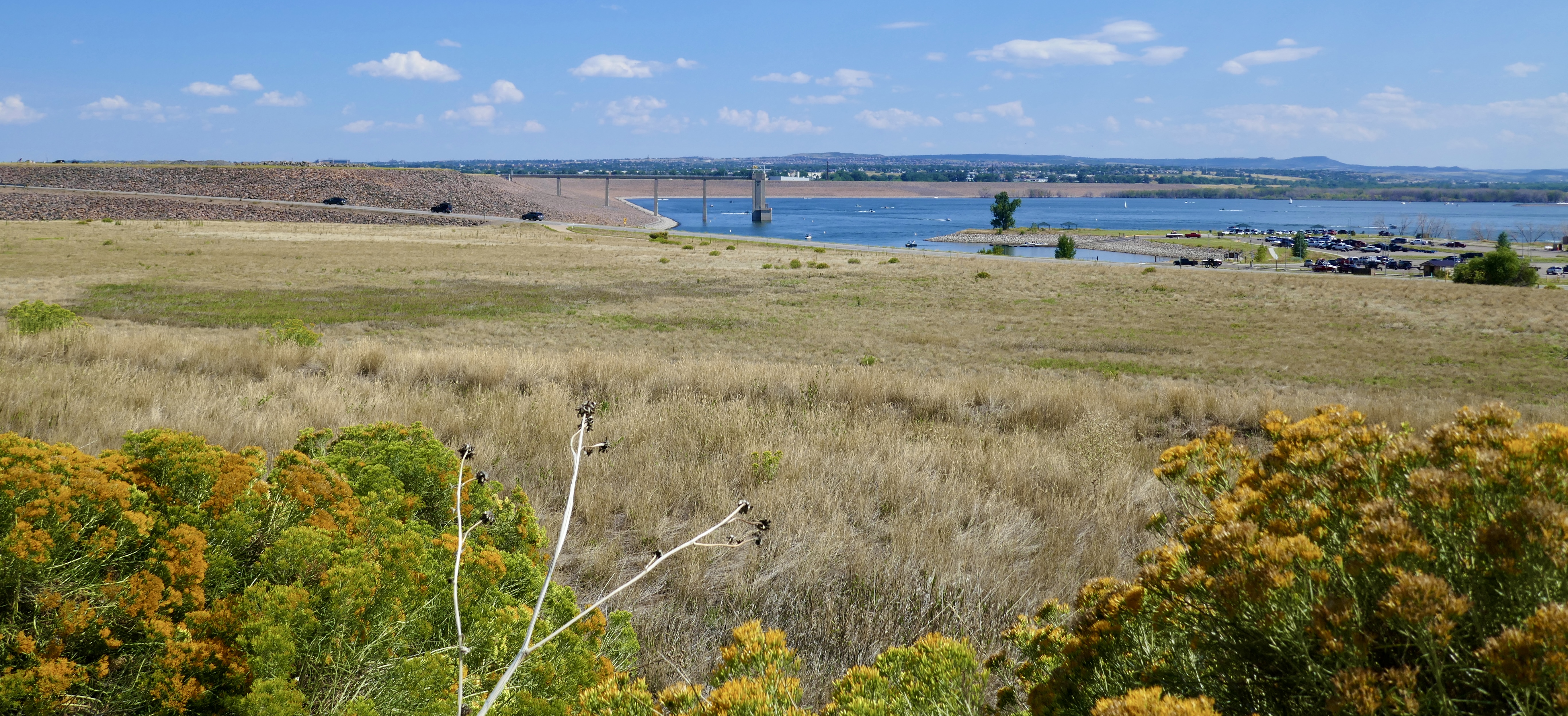
From here it was just nine miles of following a freeway with not much to look at other than cars. The DOT bails about halfway through and winds back up into the foothills, but I was locked in until the Chatfield Tunnel at Chatfield Reservoir.
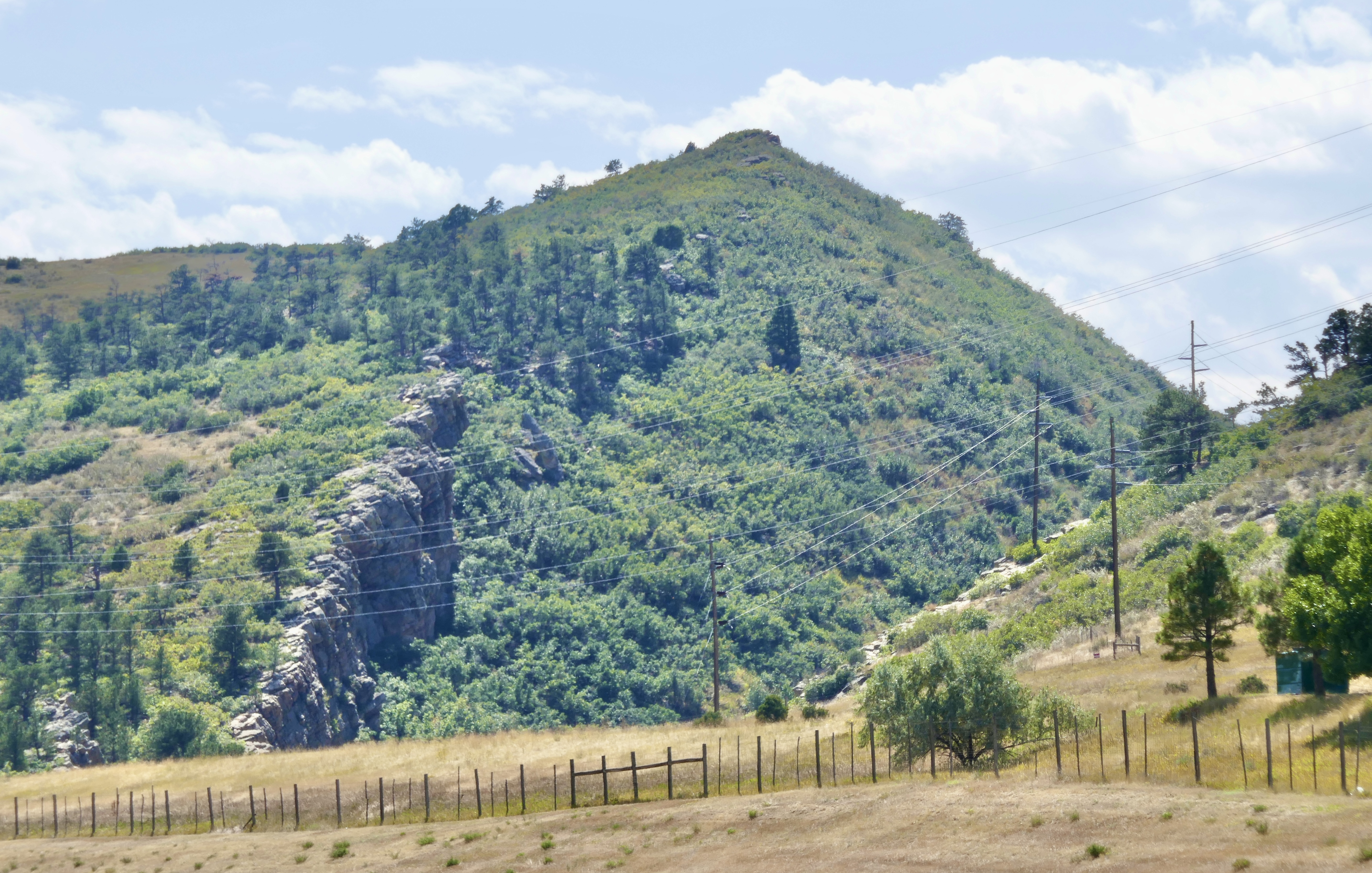
Then it got pretty again.
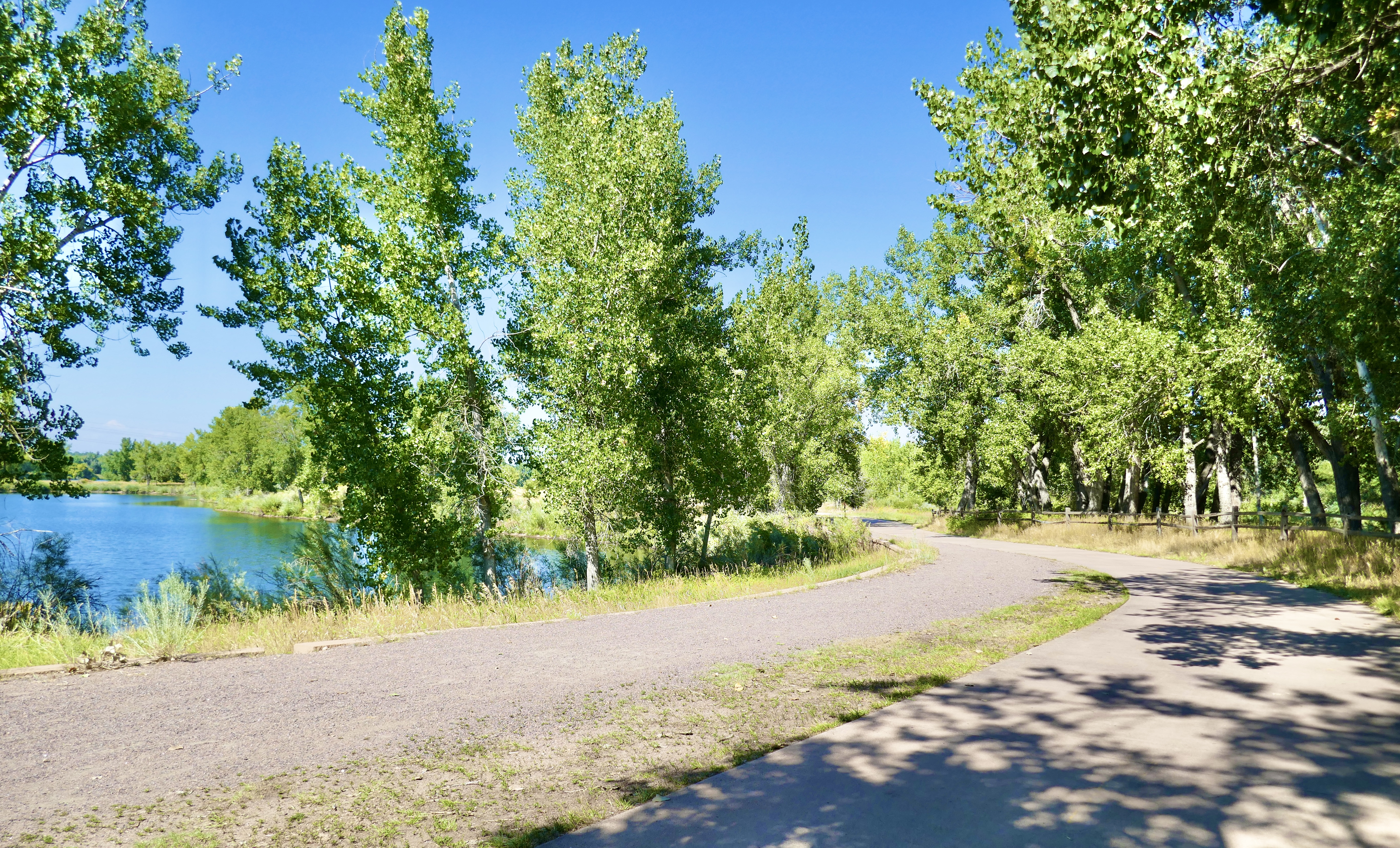
This loop took me almost to the end of Segment 7, where I left the DOT and followed the Platte River up to Mineral Station in Littleton.
Took the D line to I-25 and Broadway station, then transferred to the H line. That took me to Florida station, and from there it’s a short bike ride home.
Coming up: the final loop!
