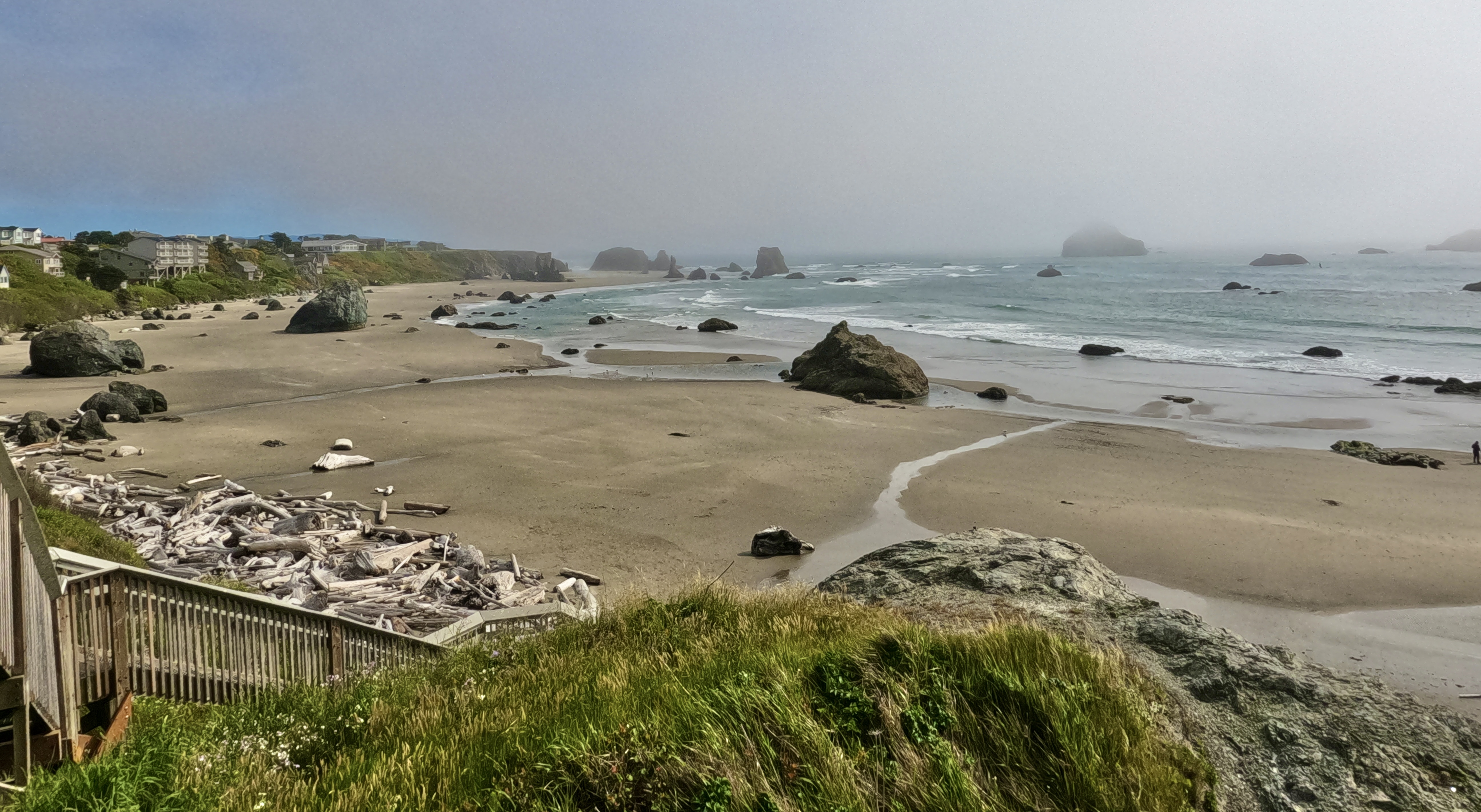
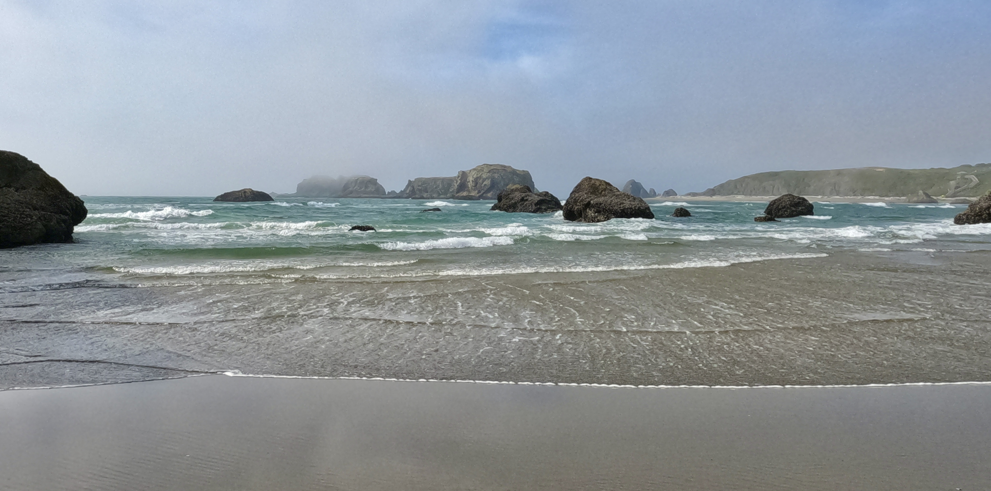
In Bandon, Oregon we visited Face Rock Creamery for some really good ice cream, and then headed down to Bandon beach to check out the famous rock formations and tide pools. We arrived at low tide, a great time to see both.
Of all the strange and lovely rocks on Bandon Beach, for some reason I like this one the best. Just a random boulder the size of a house. I love it.
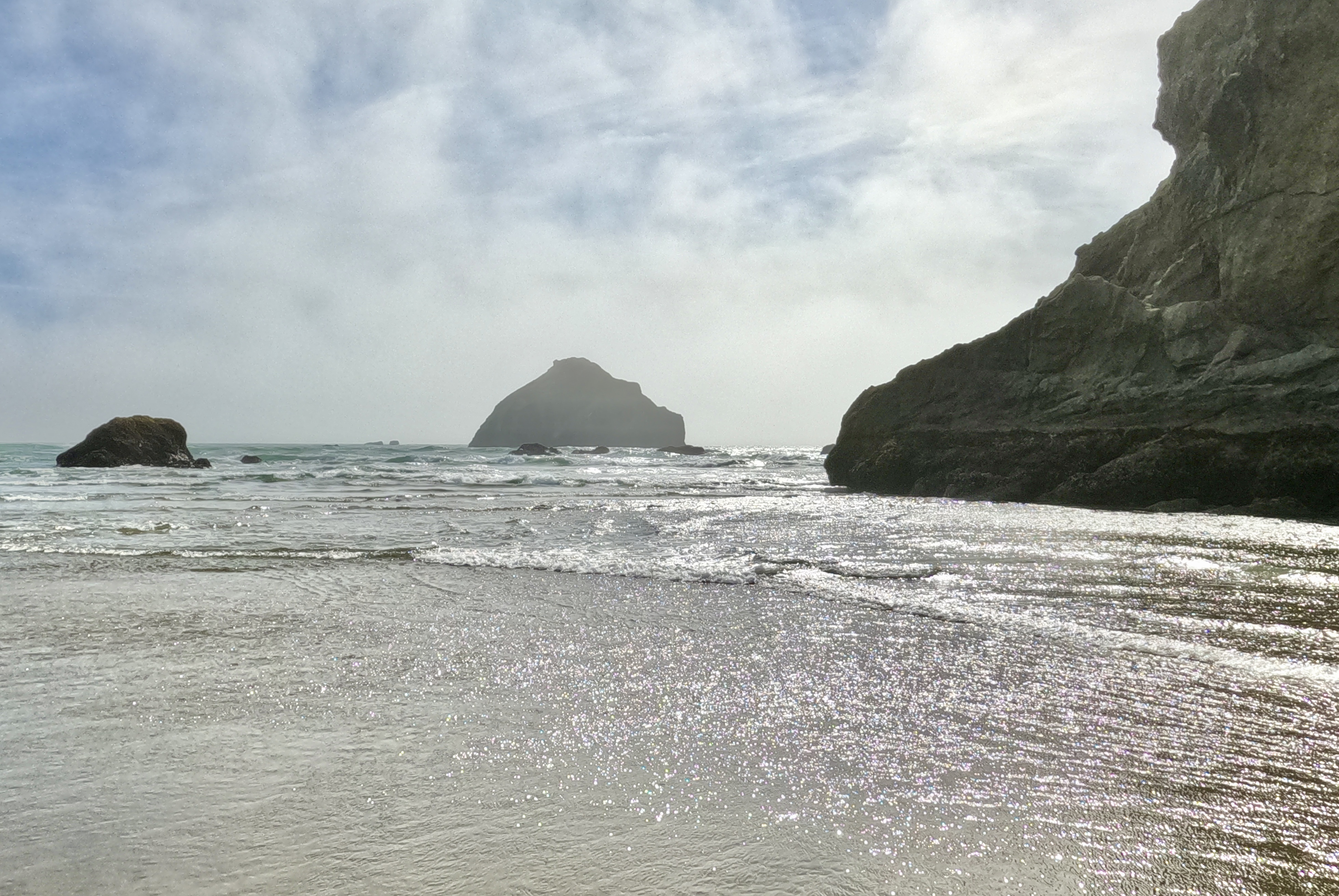
Here’s the Face Rock that Face Rock Creamery and other local businesses are named for. Looks like a giant taking a bath in the sea:
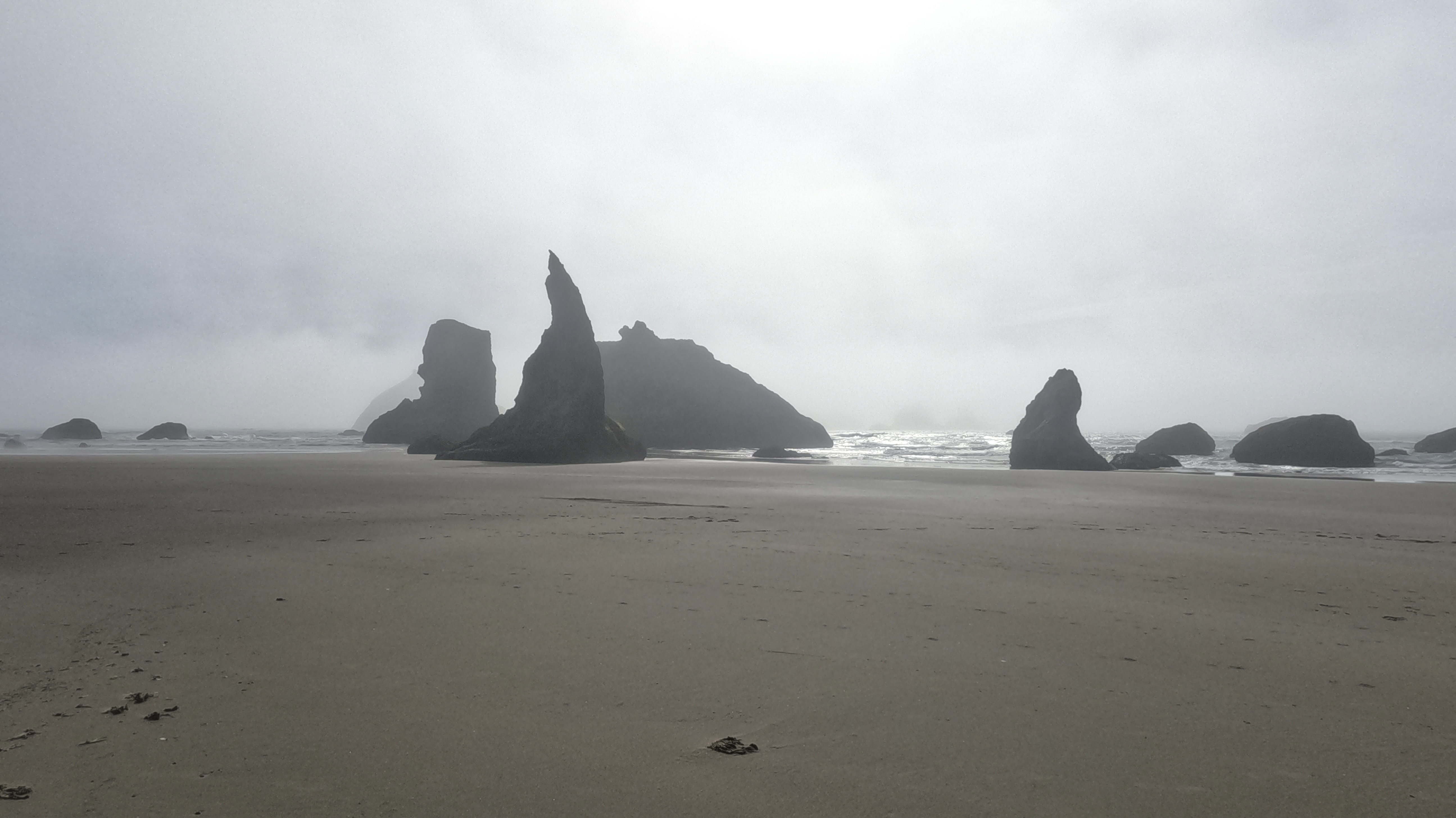
And here is my second-favorite rock on this beach, the shattered one in front that looks like a wizard’s hat or a crescent moon. I wonder what happened to the rest of it.
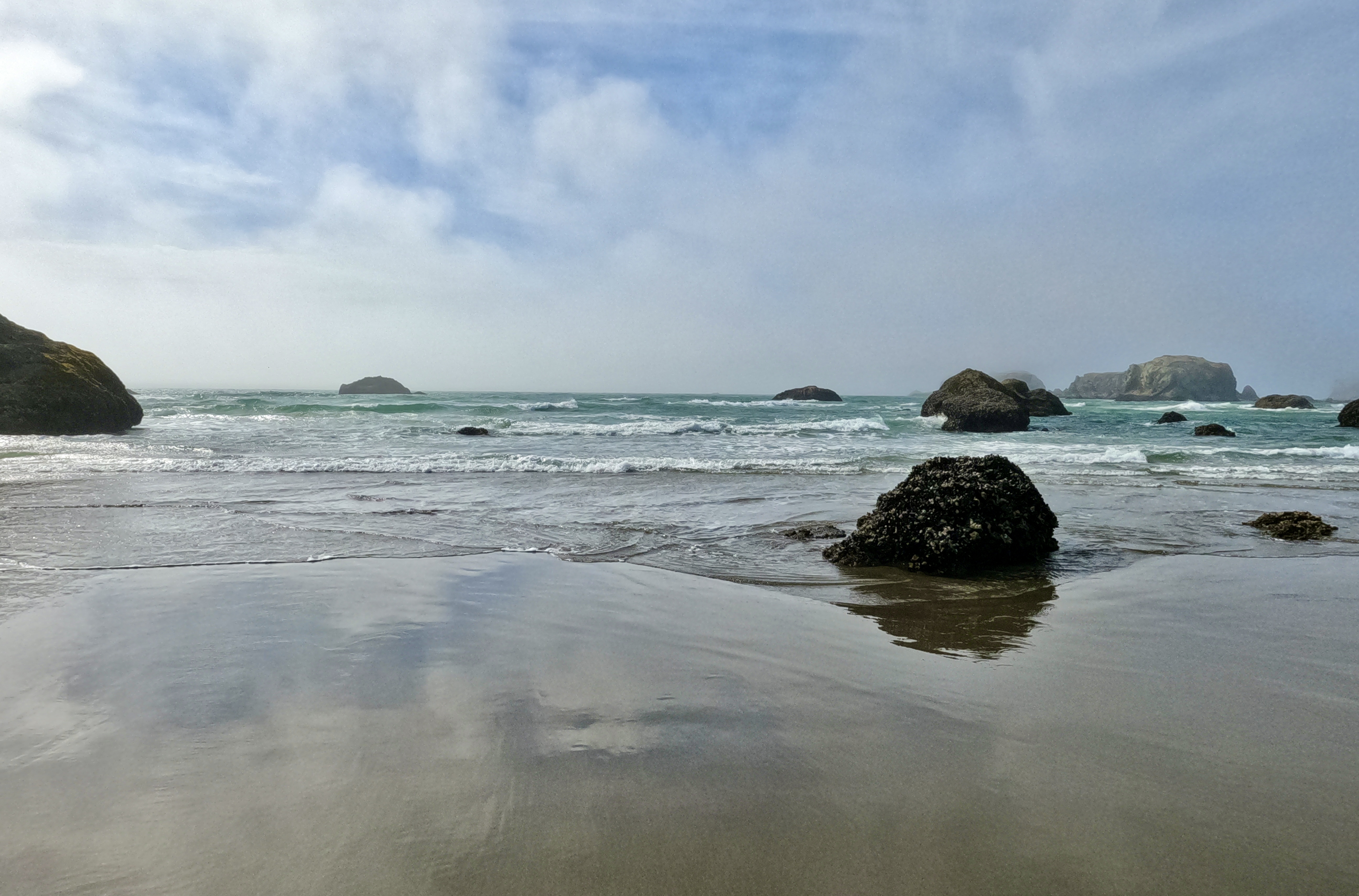
This is just a really pretty beach.
Sea stars were more plentiful here than at the other tide pools we visited.
We could have spent half the day exploring Bandon Beach, but we had reservations for that night at Jedediah Smith Redwoods State Park in California and didn’t want to fall behind schedule. After an hour or so we got our sandy selves back to the car and continued down the coast.
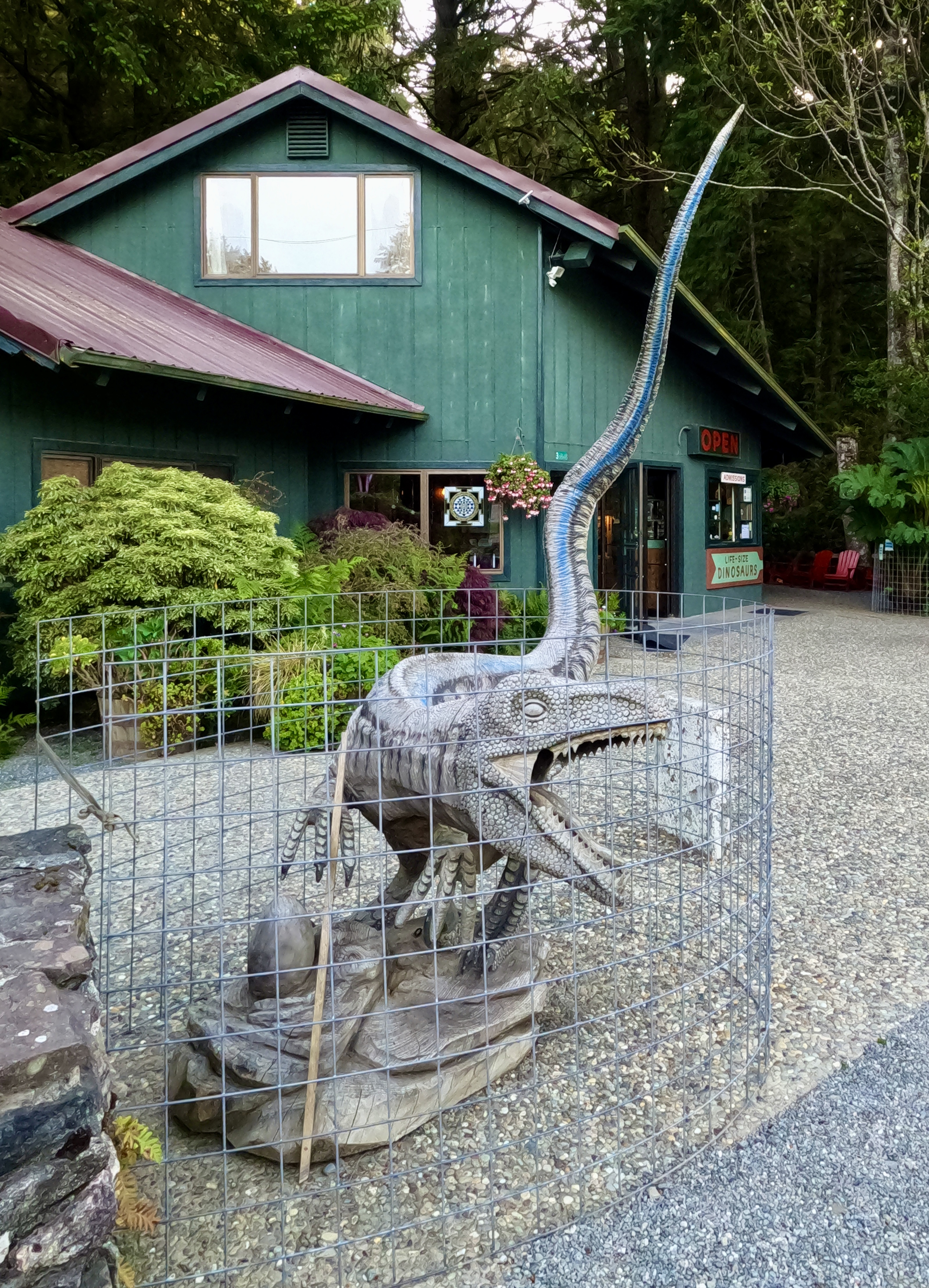
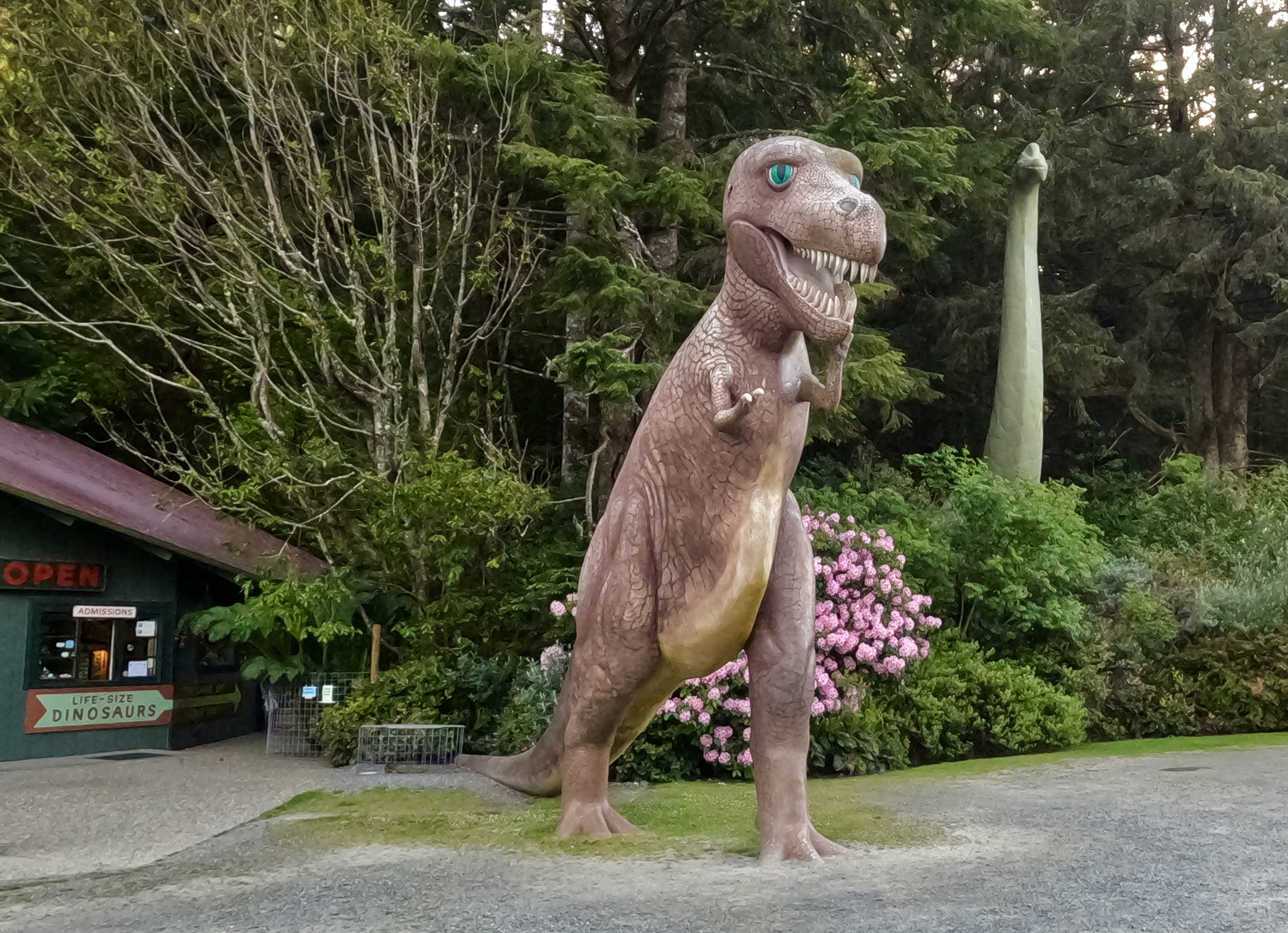
We pulled into the parking lot at Prehistoric Gardens, debating whether to buy tickets and take the tour.
In the end we decided we were all a bit older than the target demographic and moved on.
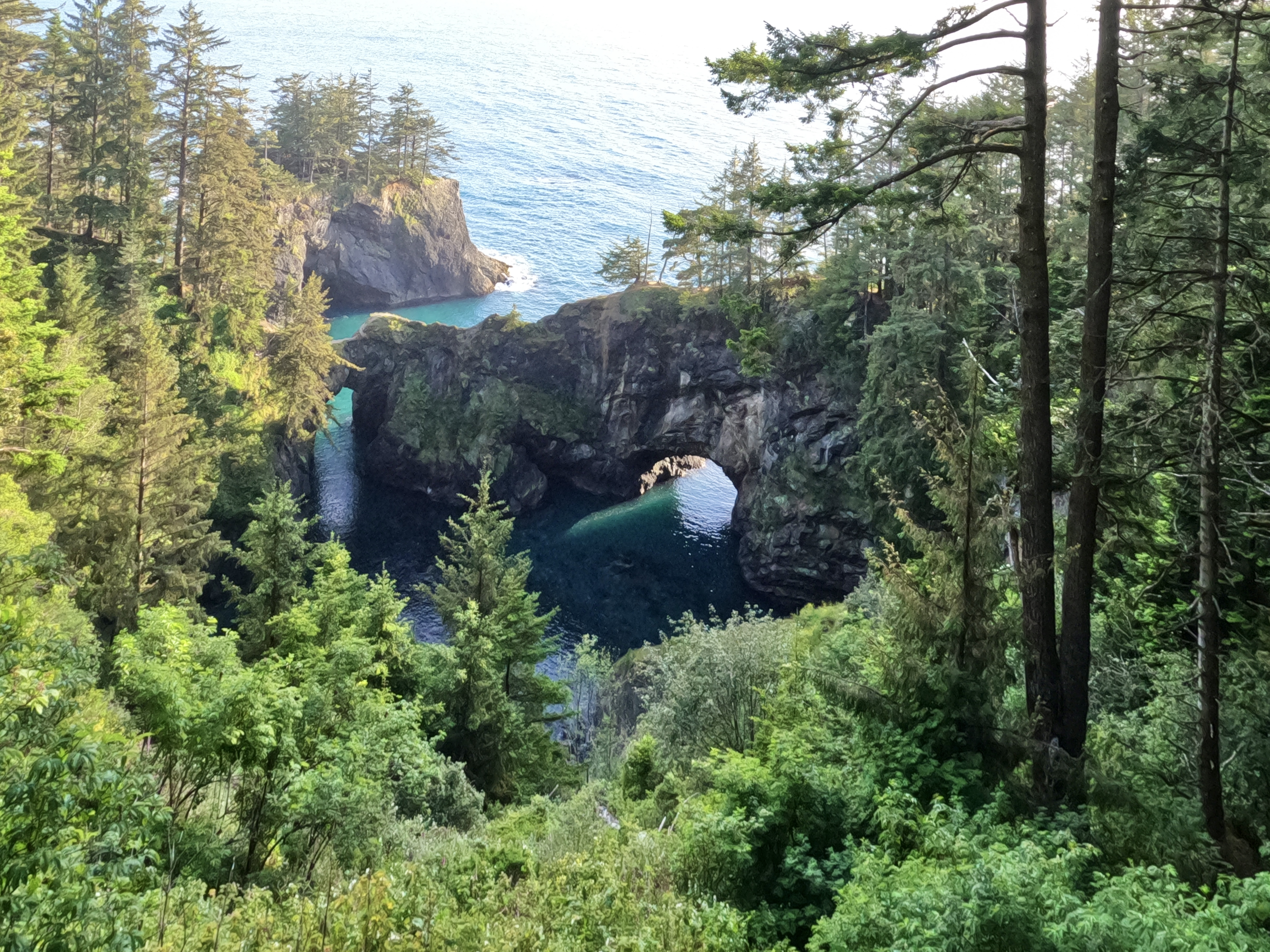
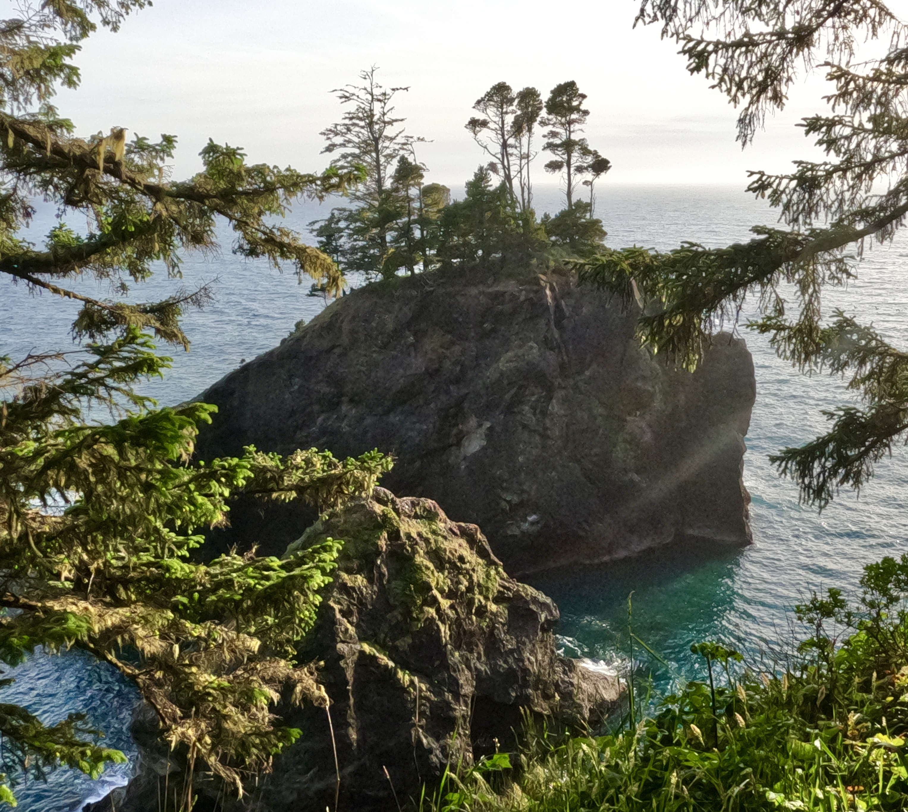
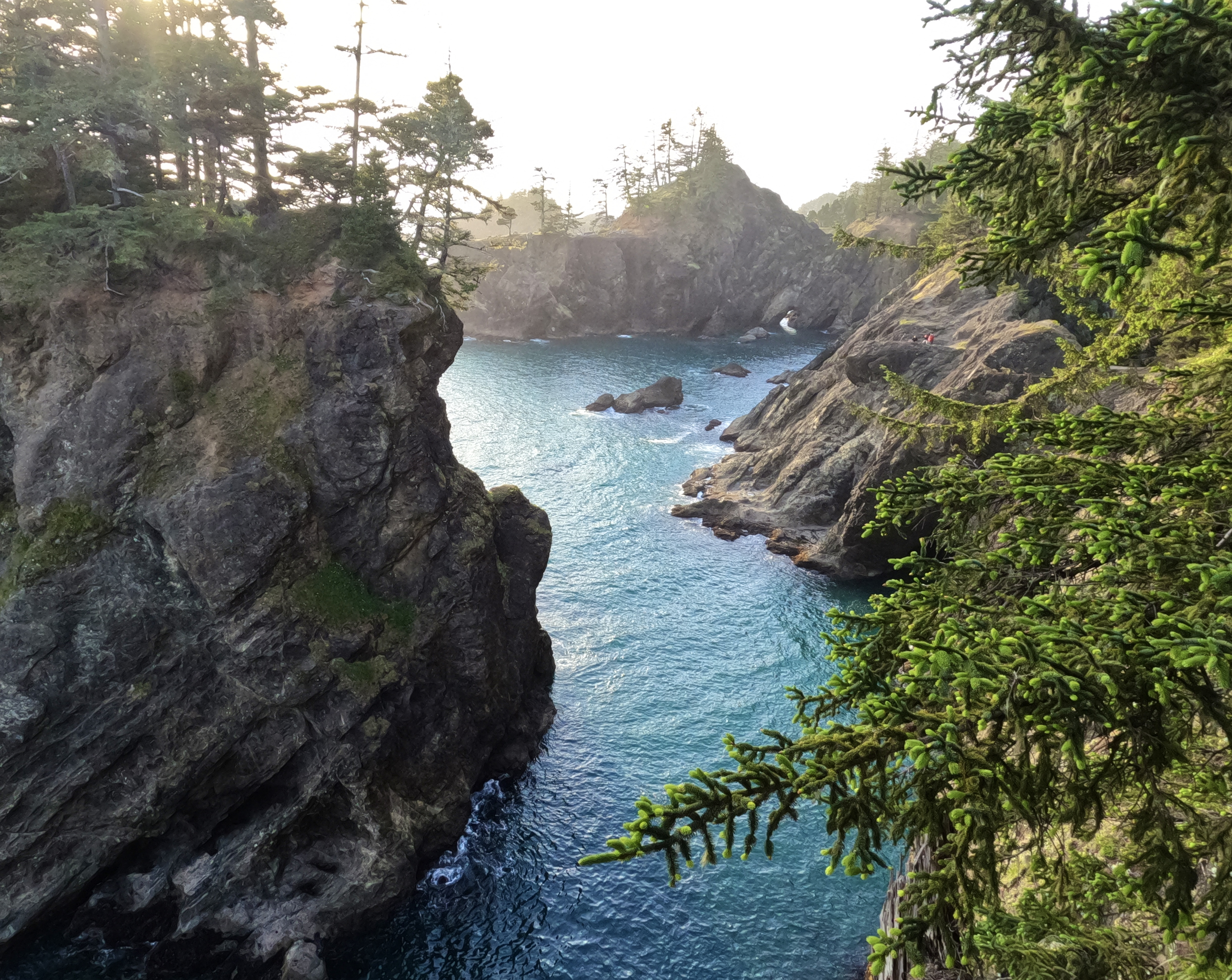
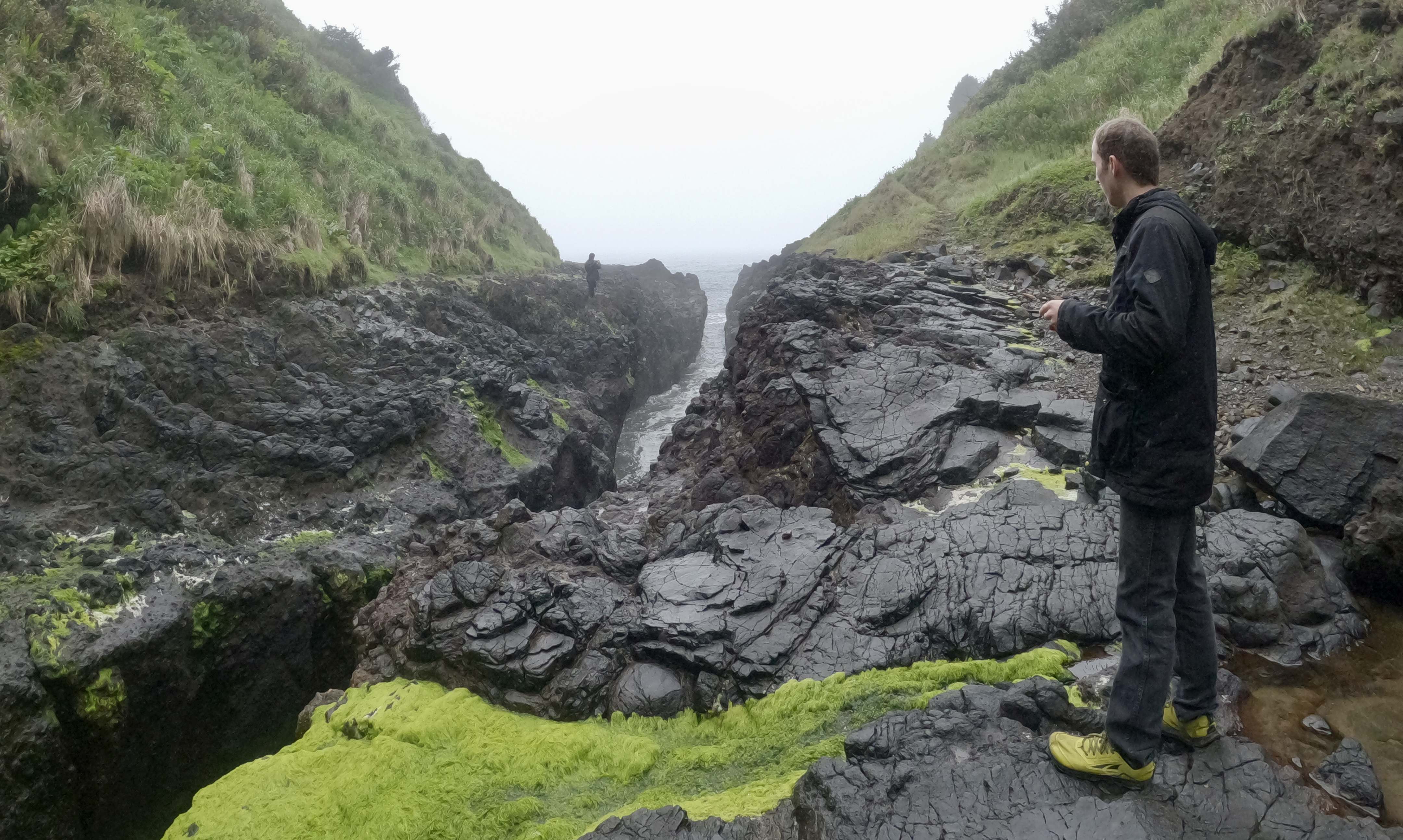
Just north of Brookings we came upon a place of otherworldly beauty. A place where tall trees thrive on seemingly bare rock, where the land thrusts stony fingers into the sea and the sea cuts round culverts through them.
It’s one of the loveliest places I’ve ever seen.
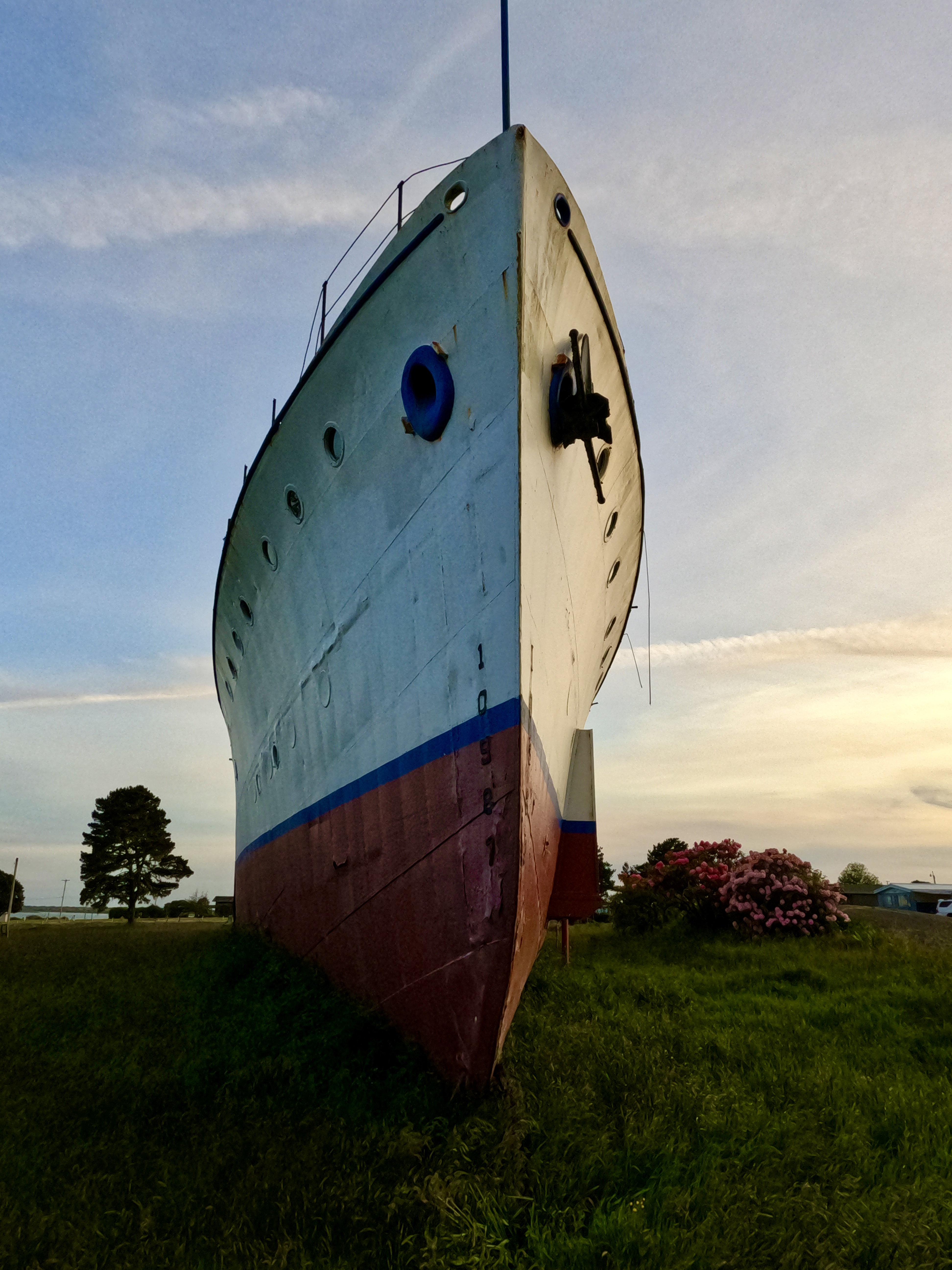
As we crossed into California, the landscape began to change. We had left The People’s Coast behind and were back in the land of billboards and shopping centers. We stopped to see a big ship that had once been the gift shop for a tropical-themed resort.
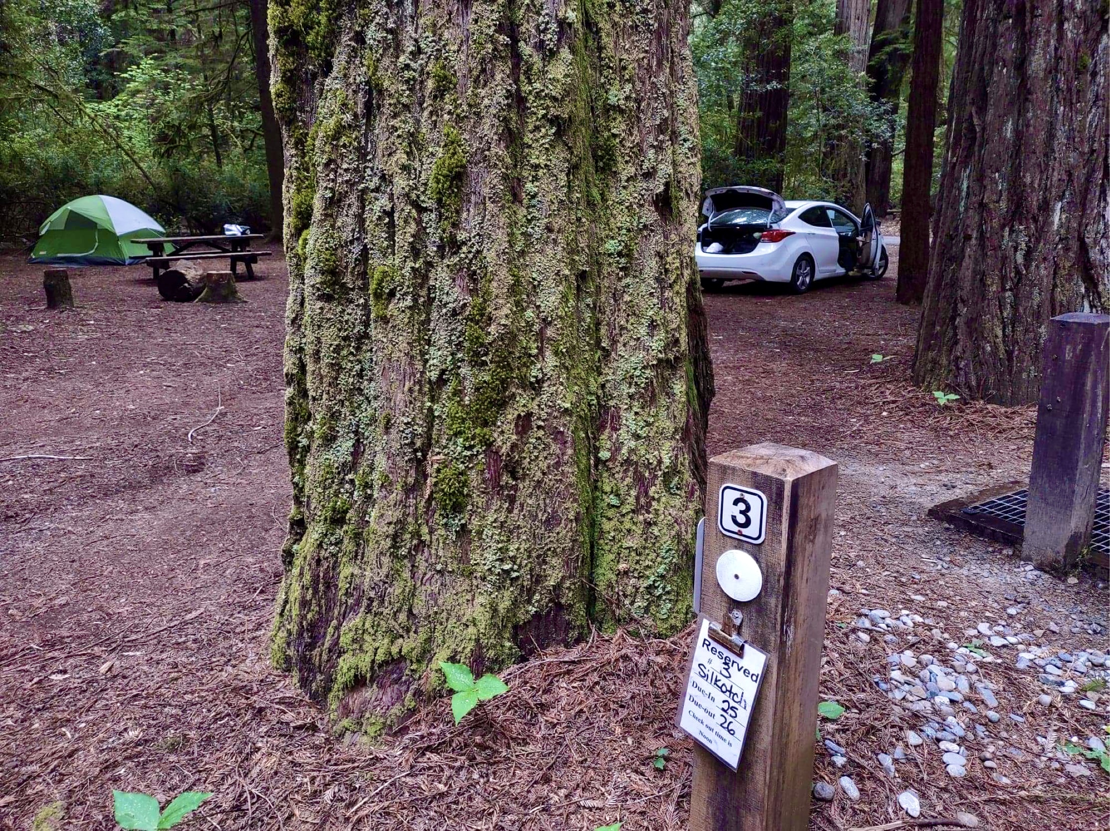
By now the shadows were lengthening and we were in danger of losing daylight. We hurried on to Jedediah Smith Campground, found our reserved site and set up camp in the forest-scented twilight.
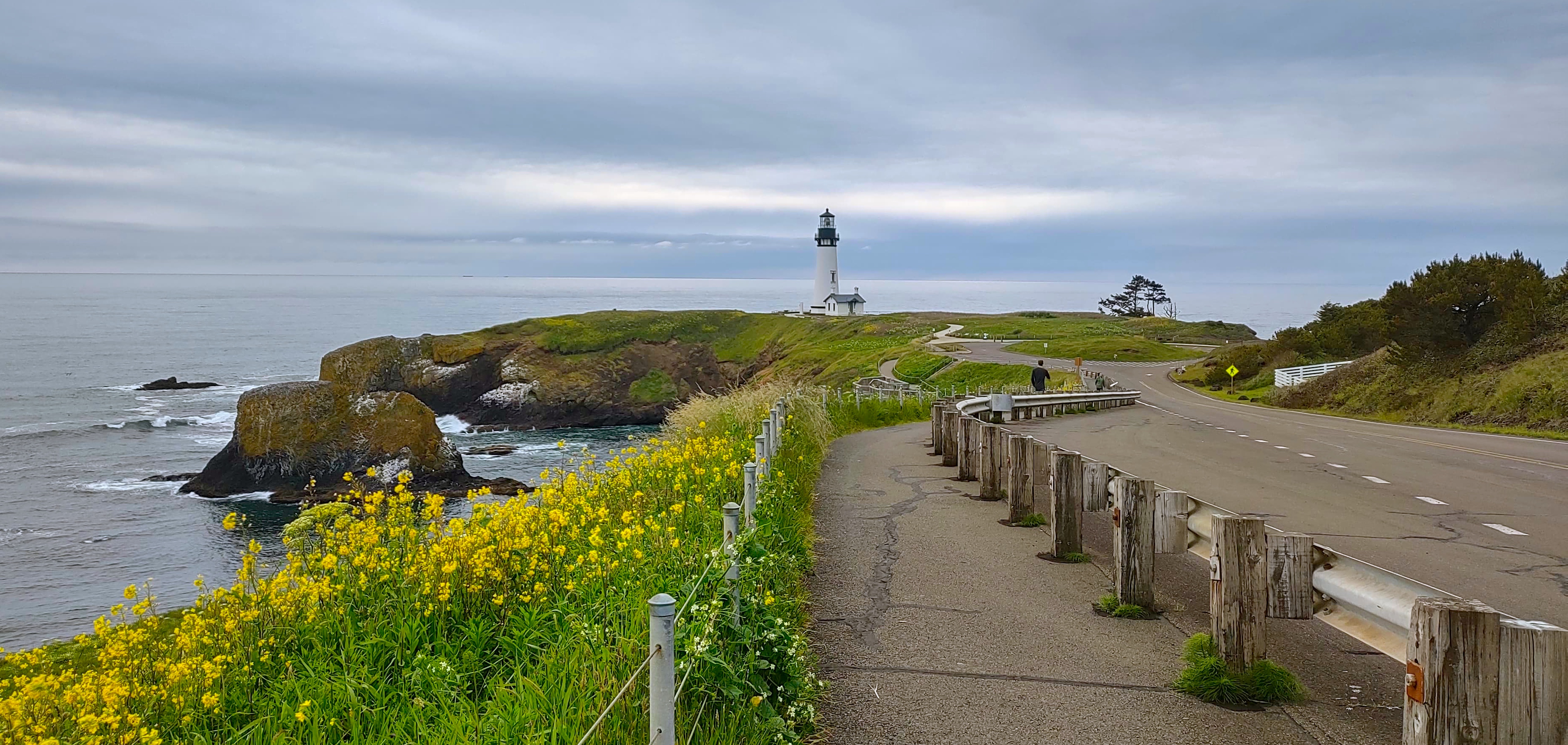
Eleven lighthouses stand guard along Oregon’s rocky coast. We stopped just north of Newport to see the tallest of them, on Yaquina Head. There’s a little fee station at the top of the road where you’re supposed to pay for day use, but it had closed for the day and the entry gate was locked. We parked on the side of the driveway and walked the mile or so to the lighthouse.
Luke for scale:
We – and by we I mostly mean Luke – worried that the car would get ticketed parked where it was. We met other walkers on the lighthouse road, but ours was the only vehicle there. So when we were done looking around, Luke jogged ahead back up the road to make sure the car was okay.
I was about three-quarters of the way back to the fee station when Luke came breathlessly around a bend in the road. “There’s a bunch of guys on motorcycles around our car! I hope they’re not motorcycle cops!”
“I don’t think motorcycle cops travel in packs,” I said, “Especially on quiet roads like these. Probably just a biker group touring the coast. I don’t think they’ll bother our car.”
The motorcycles were peeling back out toward the highway when we came around the last corner. Luke said, “Mom, did you leave the window down?”
“No…or…what the hell, it is down.”
The driver’s side window was indeed all the way open. I had rolled it down at the fee station and apparently forgotten to roll it back up.
The car was absolutely packed with valuables – iPads, MacBooks, camping and hiking gear, my wallet. Nothing had been touched or taken. Humans are okay sometimes.
We stopped in Newport to try the clam chowder at Mo’s Original Location. We had heard good things, and the chowder lived up to its reputation.
Tangent: The best clam chowder I’ve ever tasted is at a little kiosk in Disneyland’s New Orleans Square, just outside the Pieces of Eight souvenir shop. I’ve been chasing that dragon ever since we left California. All of the clam chowders we sampled in Washington and Oregon were objectively fresher and higher-quality than Disneyland’s, and very tasty, but it’s hard to compete with the magic of gustatory nostalgia.
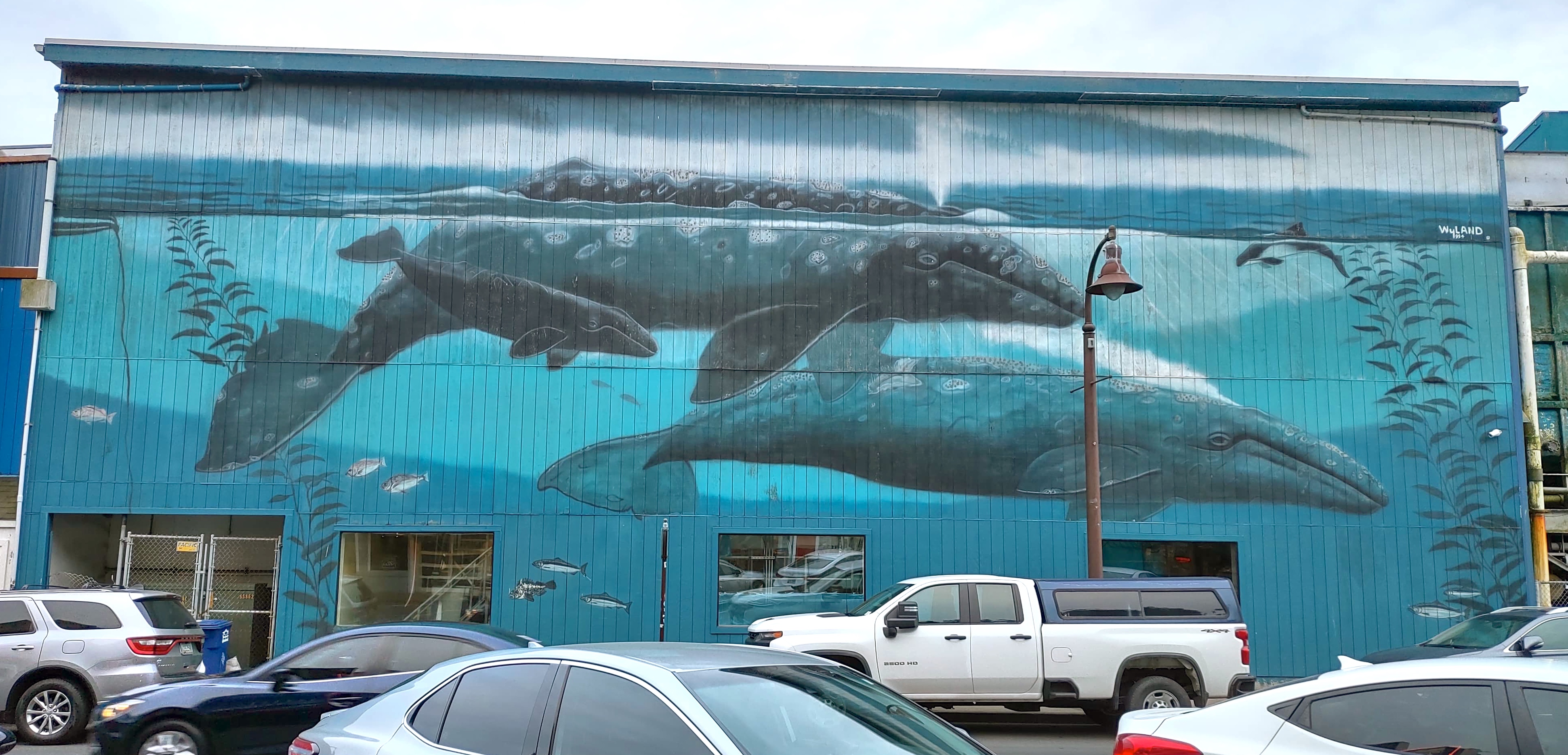
I like this mural we saw in Newport:
We watched for real whales all the way down the coast, since late May is still at the tail end of their migration season. We never did see any, but we did enjoy a few lively rounds of “Is that a rock or a creature?”
The original plan was to spend Tuesday night at a campground wherever we happened to end the day, but none of us were feeling it. Instead we searched along the highway until we found a motel with a vacancy. “The only room we have left doesn’t have an ocean view,” the clerk said apologetically. I assured him that it made no difference. The room was twice the size and half the cost of the one at Lake Quinault Lodge, with more amenities. Shoutout to The Dublin House Motel in Yachats.
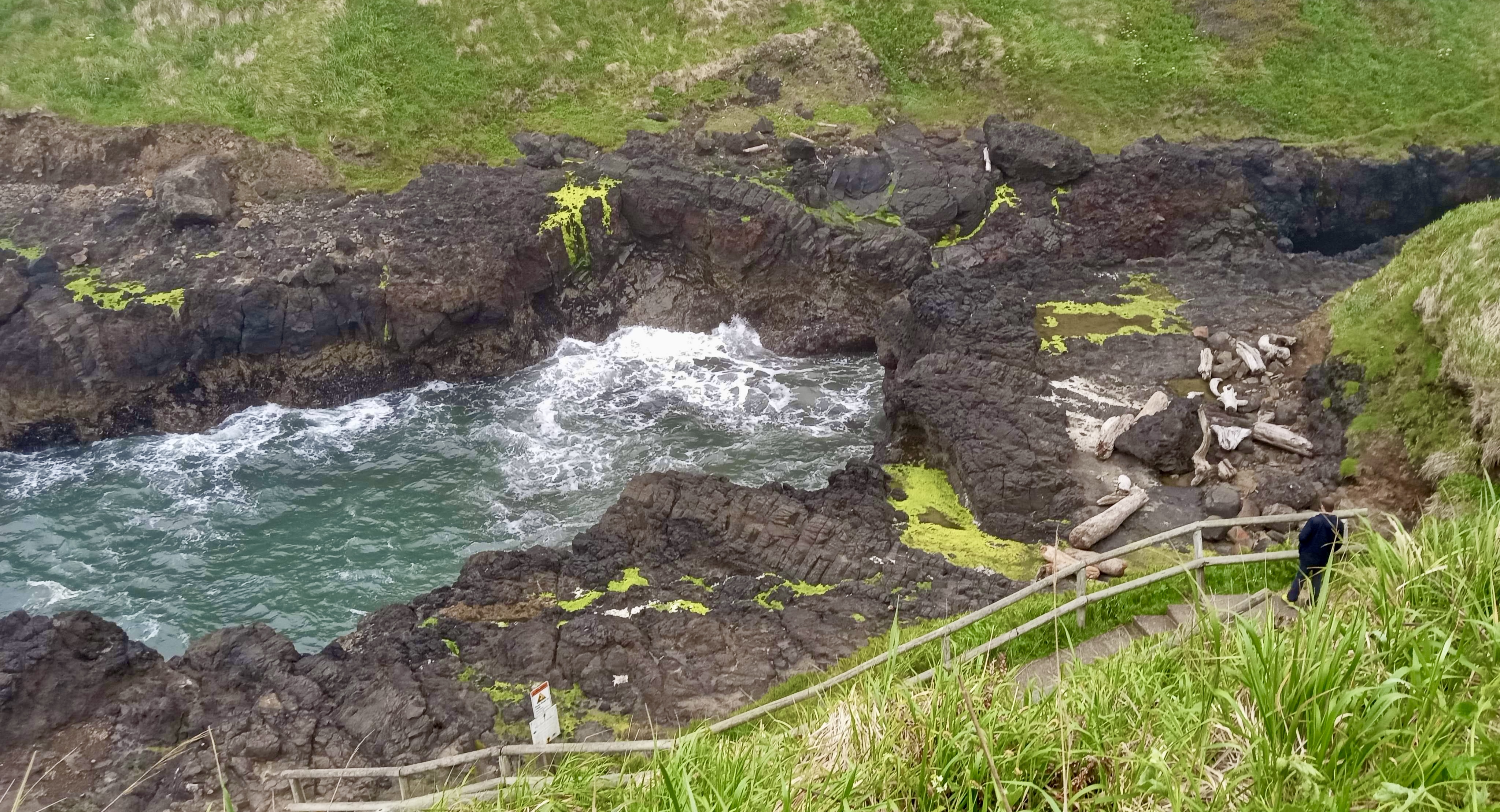
Our first stop Wednesday morning was the Devil’s Churn. The Devil apparently stores his kitchen accouterments along the Oregon shoreline.
The Devil’s Churn is hard to describe, and I wish I’d taken a video of it. It’s a narrow channel carved by a stream joining the sea. Waves roll into it and back out, so it’s nearly empty one minute and overflowing the next. From the highway it looks almost serene:
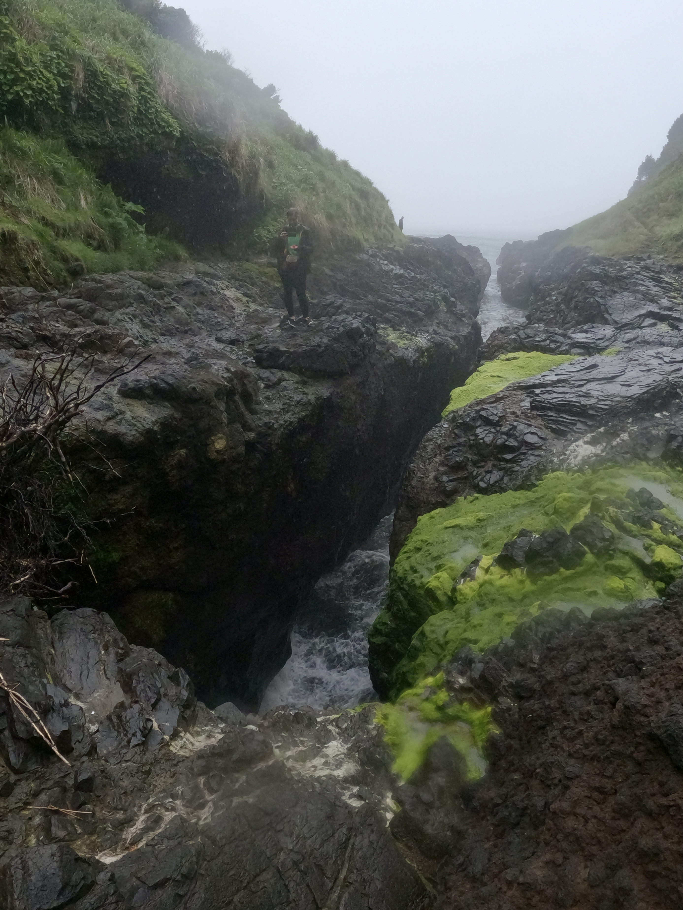
Luke for scale:
Up close it’s loud and violent and a little scary as the waves roil in the chasm and sometimes splash high into the air.
People have died here, washed into the Churn by the crashing waters. We kept our eyes on it and still got splashed unexpectedly. The sense of energy here is incredible.
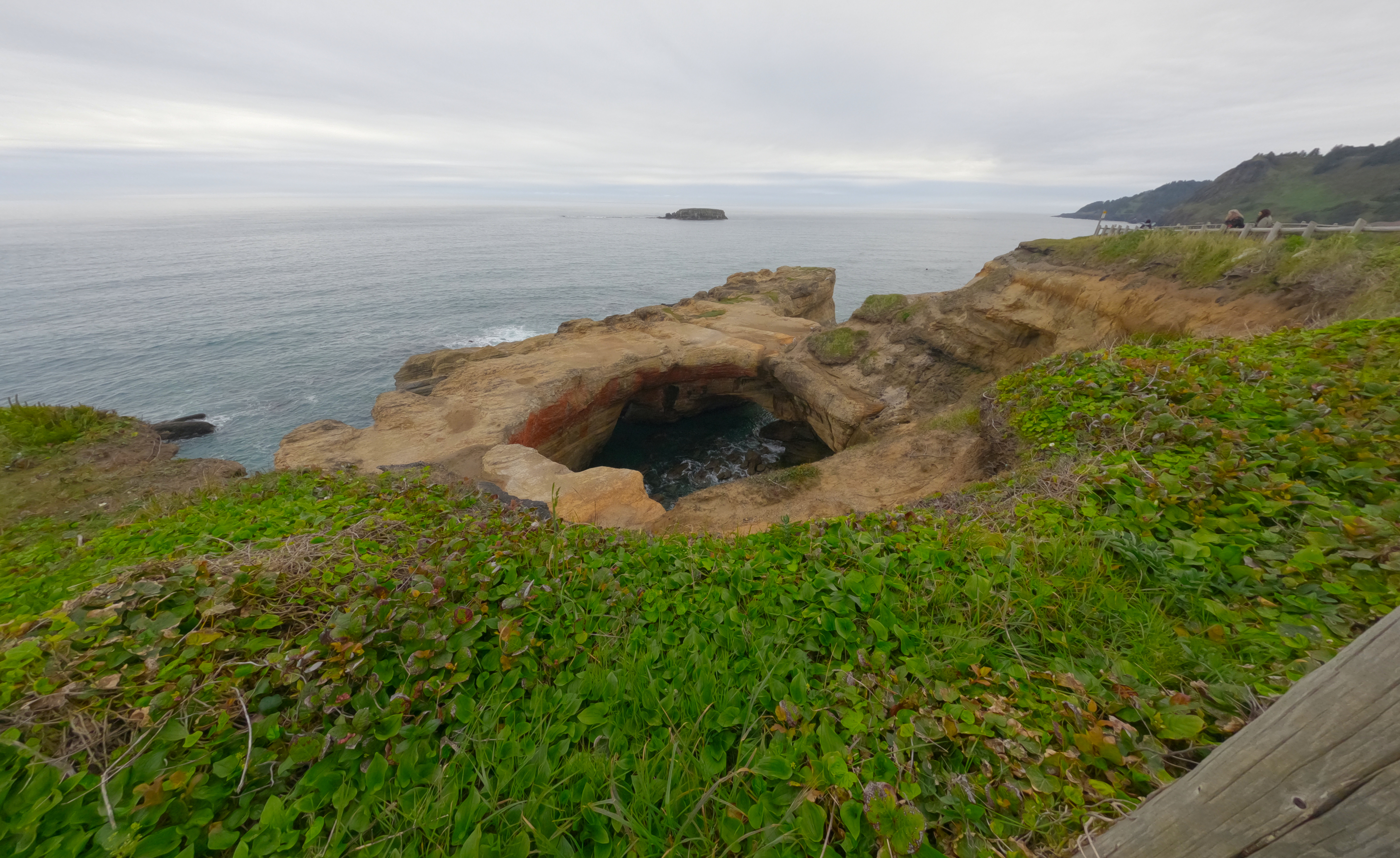
We continued down the coast to Thor’s Well.
In my last post I included a video that I had misidentified as the Devil’s Punchbowl. Elizabeth pointed out that it was in fact a video of Thor’s Well. I have relocated it accordingly:
The tide pools here are full of life. And here’s something the GoPro can do that my camera couldn’t: underwater photos.
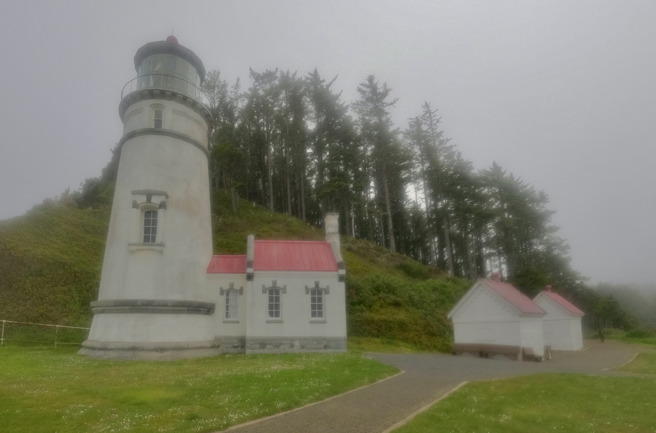
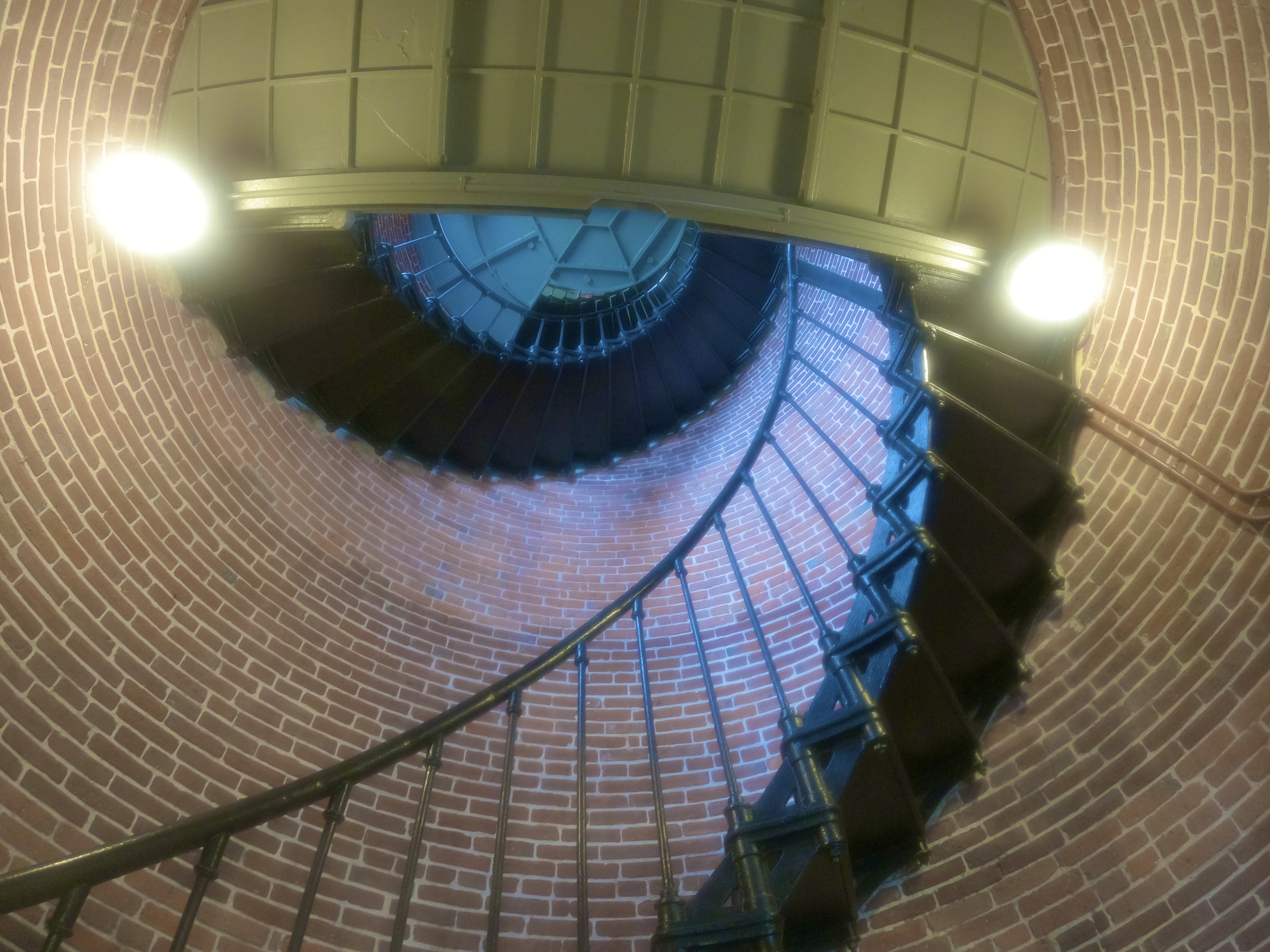
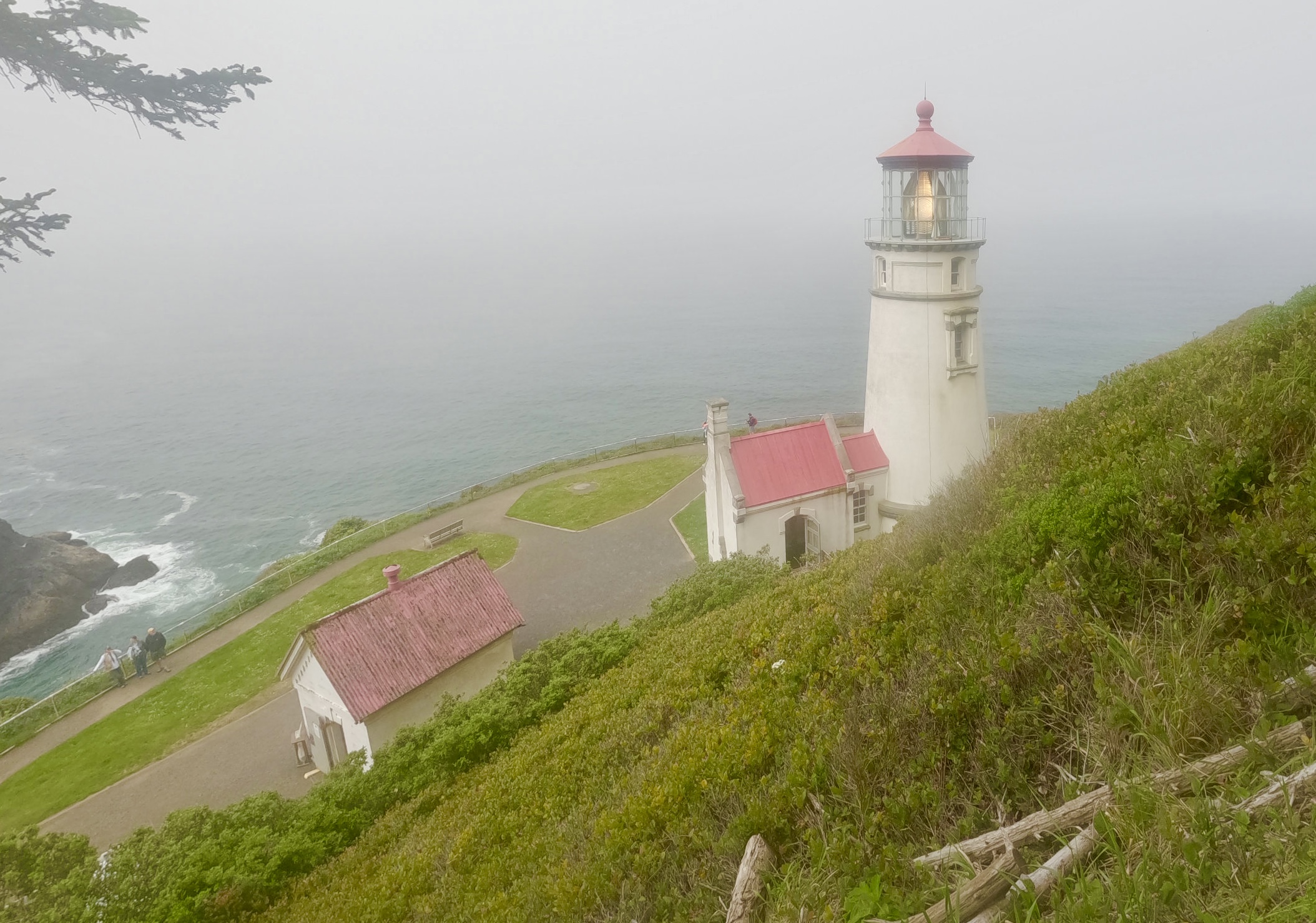
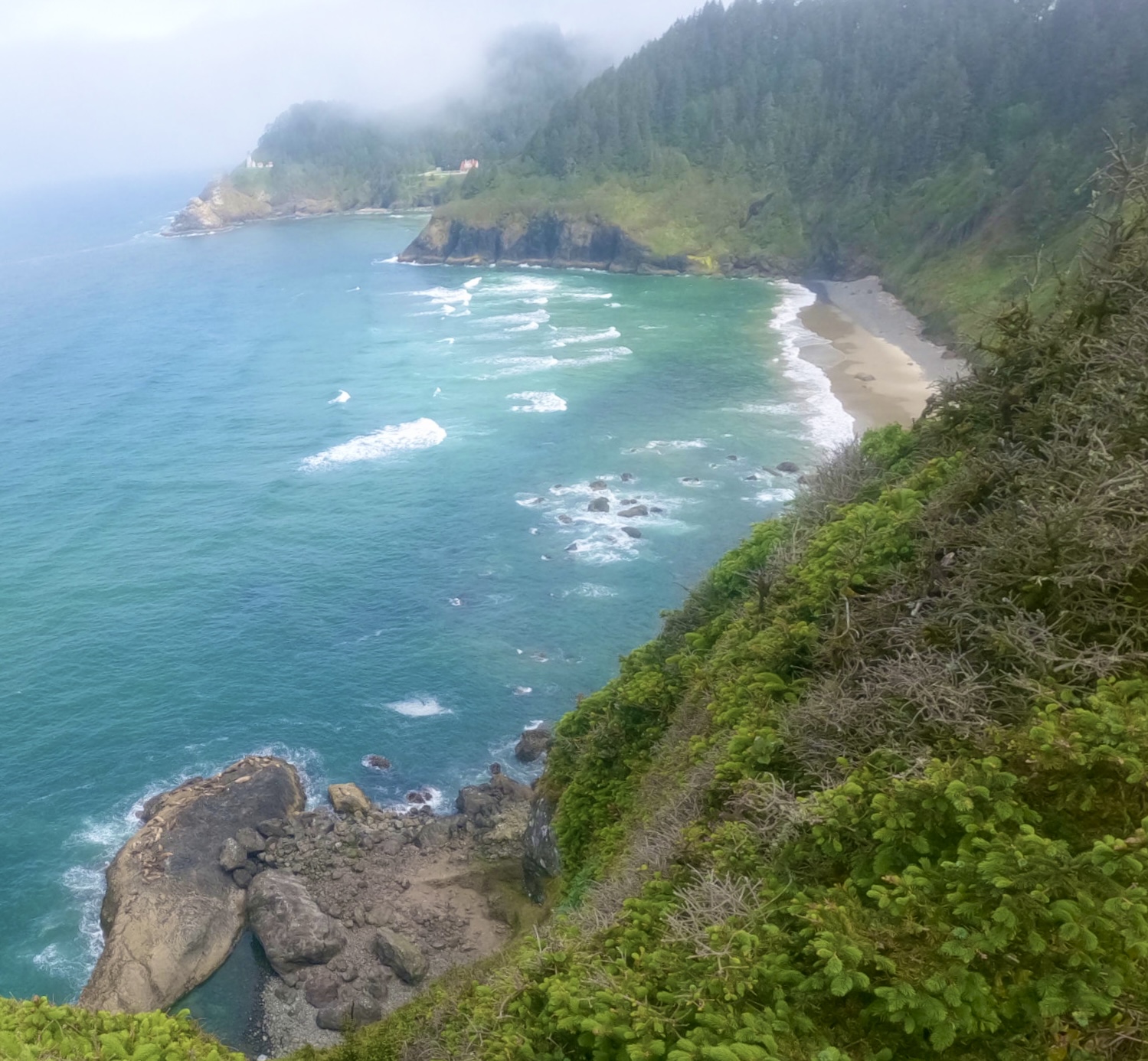
Next stop, Heceta Head Lighthouse.
We had arrived during proper visiting hours, so we paid our day use fee and got to speak with an attendant inside the lighthouse.
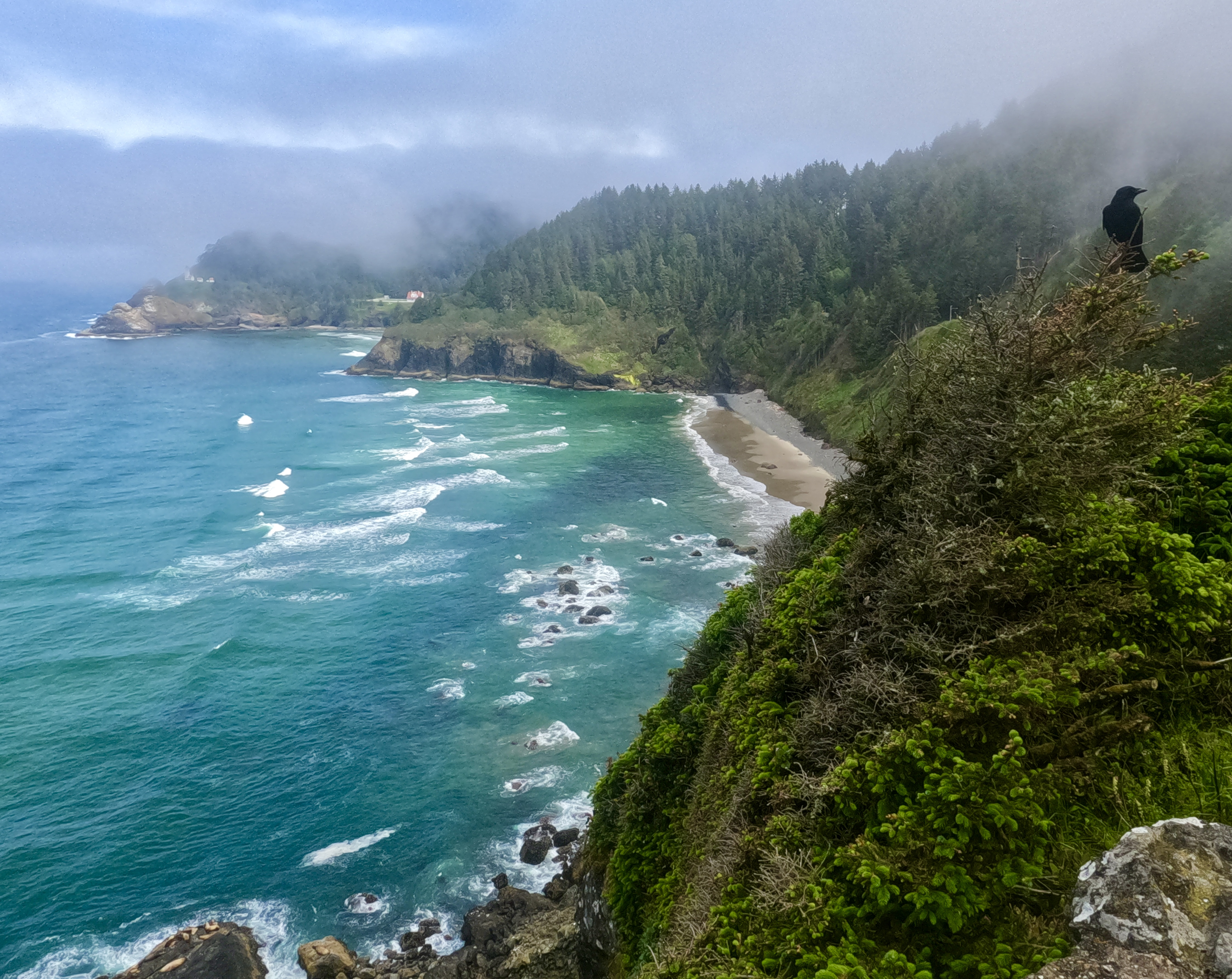
A little farther down the coast we pulled onto an overlook that offers another scenic view of Heceta Head. And here we saw sea lions sunning on a rock just below the turnout. This was the first time I really missed my camera with its lovely zoom lens. The GoPro failed miserably at capturing both the sea lions and the lighthouse in the distance.
Looks like a paint-by-number.
Got photobombed by a majestic raven.
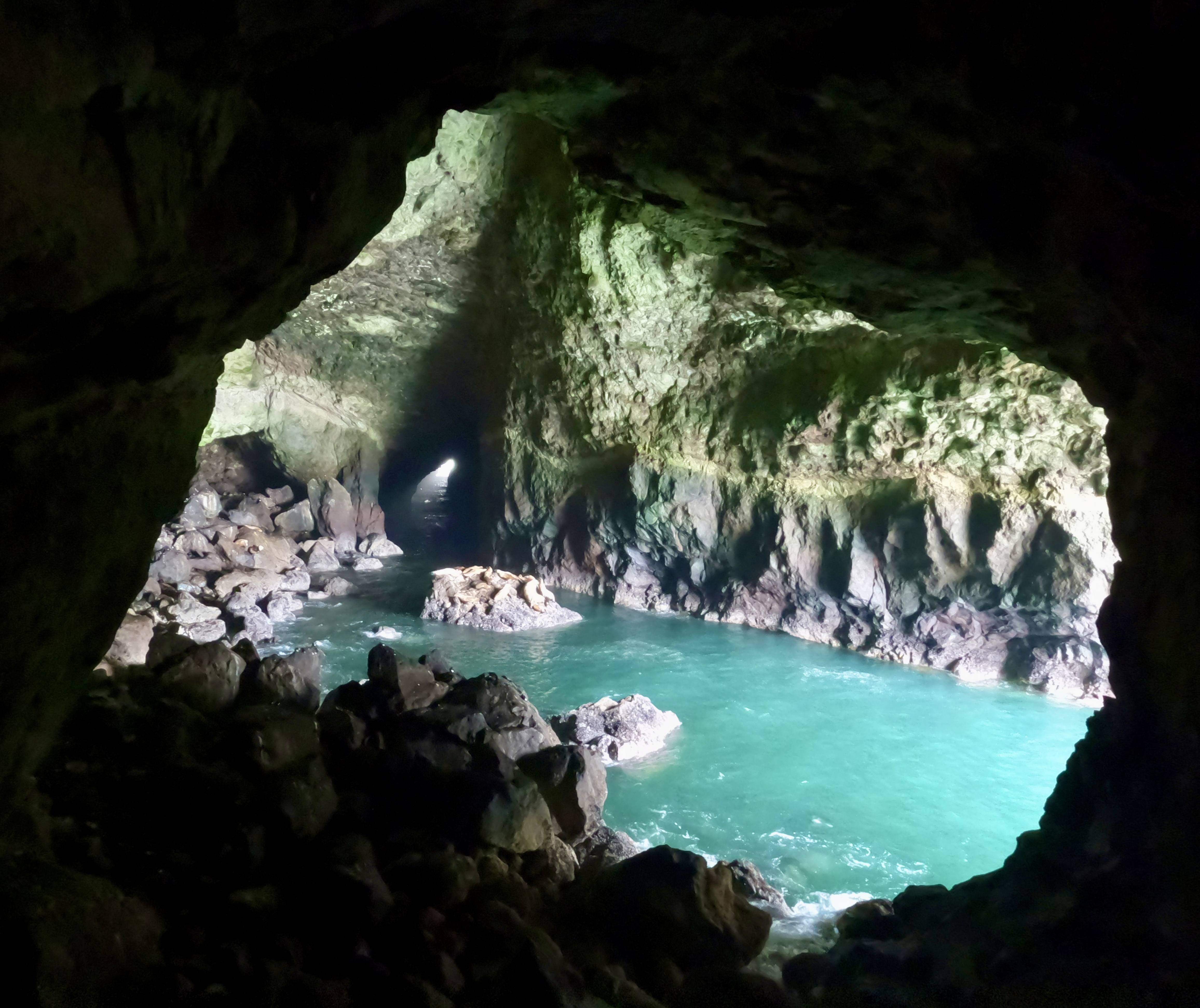
Next we came to “America’s Largest Sea Cave,” where you can buy a ticket to get a closer look at the sea lions in their natural habitat. The GoPro utterly failed to do it justice. Trust me, there are sea lions in all three of these pics:
They are vocal creatures. Interestingly, they made different noises depending on their surroundings. Inside the sea cave they sounded aggressive and “liony.” Frolicking in the surf they sounded playful. On the sand in that bottom pic they sounded like a herd of drunk cows. That was a fun stop.
Moving on to Florence, we took a small detour off the highway to visit a quiver of cobra lilies.
These carnivorous pitcher plants grow wild here.
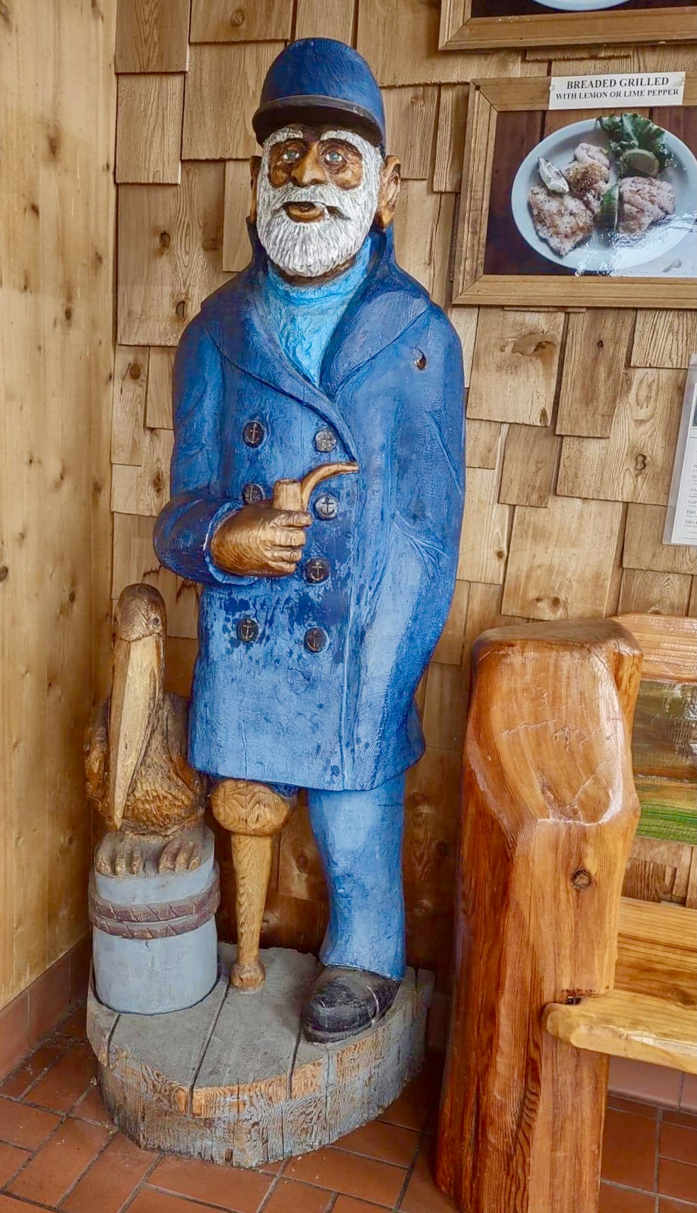
In North Bend we stopped at Captain’s Choice Fish House, an unassuming little place that served one of the best fish dinners I’ve had in my entire life.
A hand-rolled cigarette hangs from the mouth of the wooden fisherman in the foyer. Seriously, how high does this dude look?
Elizabeth ordered a seafood alfredo, Luke got the fish and chips, and I got fish and chowder. The waitress asked Luke and I what kind of fish we wanted: cod, red snapper or halibut. We both chose cod. Then she asked how we wanted our cod prepared, and offered a list of options. Luke got his fried, I got mine lightly breaded and grilled. It was A M A Z I N G. The chowder was delicious too.
A few days after I got back home, I was shopping at Costco and missing Oregon, so I impulsively grabbed some beer-battered cod from the freezer section. It tasted like disappointment.
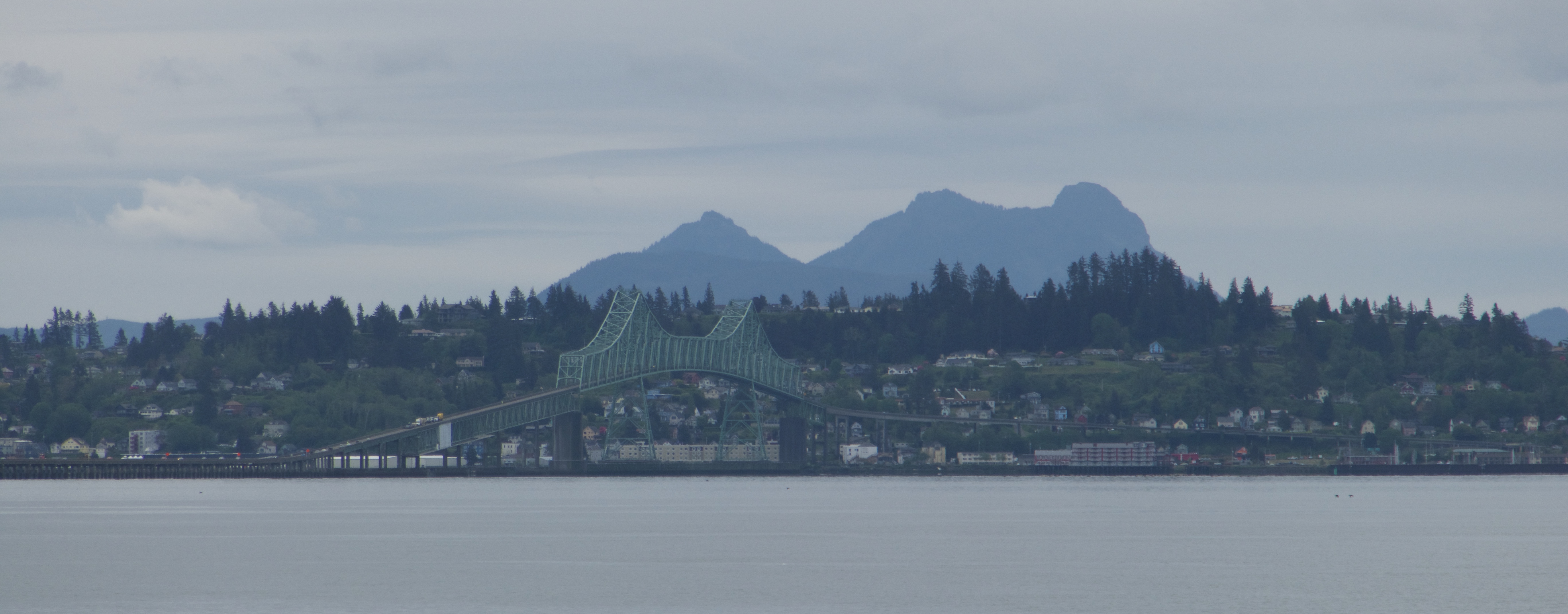
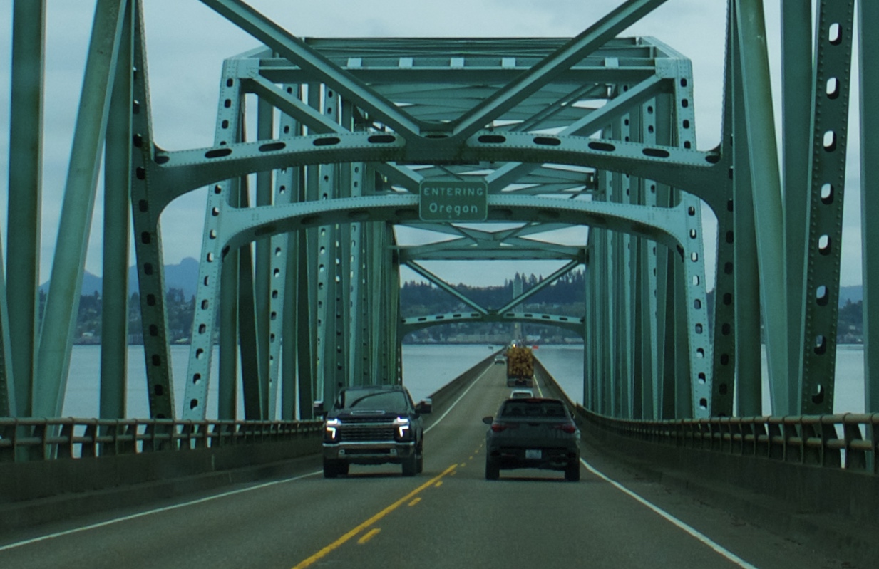
On Tuesday morning we left Lake Quinault Lodge and continued south on 101, crossing the Columbia River back into Oregon.
We had spent three days on the Olympic Peninsula and it had not rained once. As we drove through Astoria and headed down the coast, fat raindrops began to spatter intermittently against the windshield.
The Oregon coast is a magical place, partly thanks to a 1967 law that made the entirety of the Oregon shoreline public land. “The People’s Coast” is relatively undeveloped and pristine compared to the 101 corridors of Washington and California. It looks like what I had imagined Washington would look like before I went there. Northwest Oregon is greener, lusher, and in my opinion more beautiful than its neighbor to the north. I’m kind of in love with it.
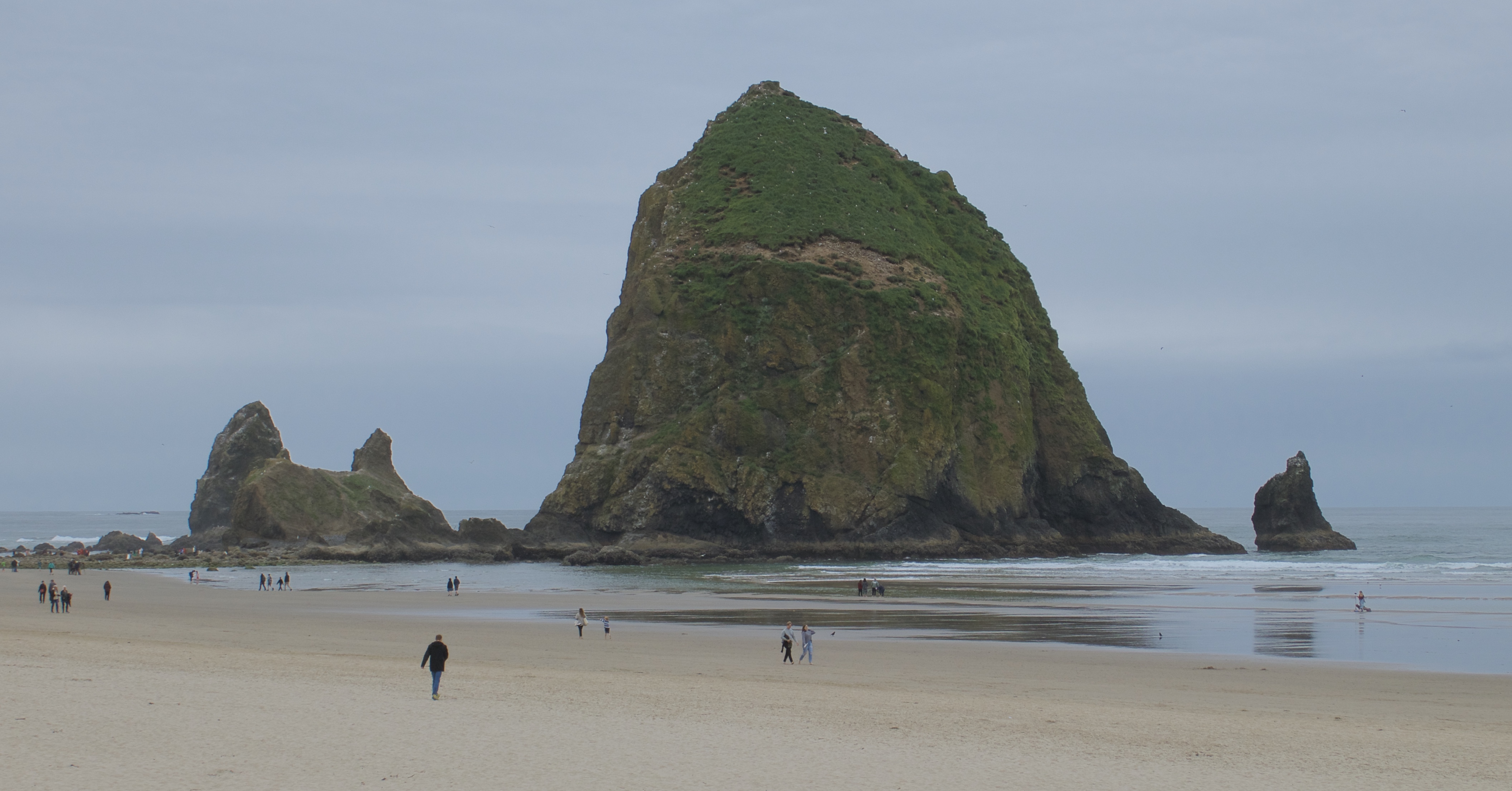
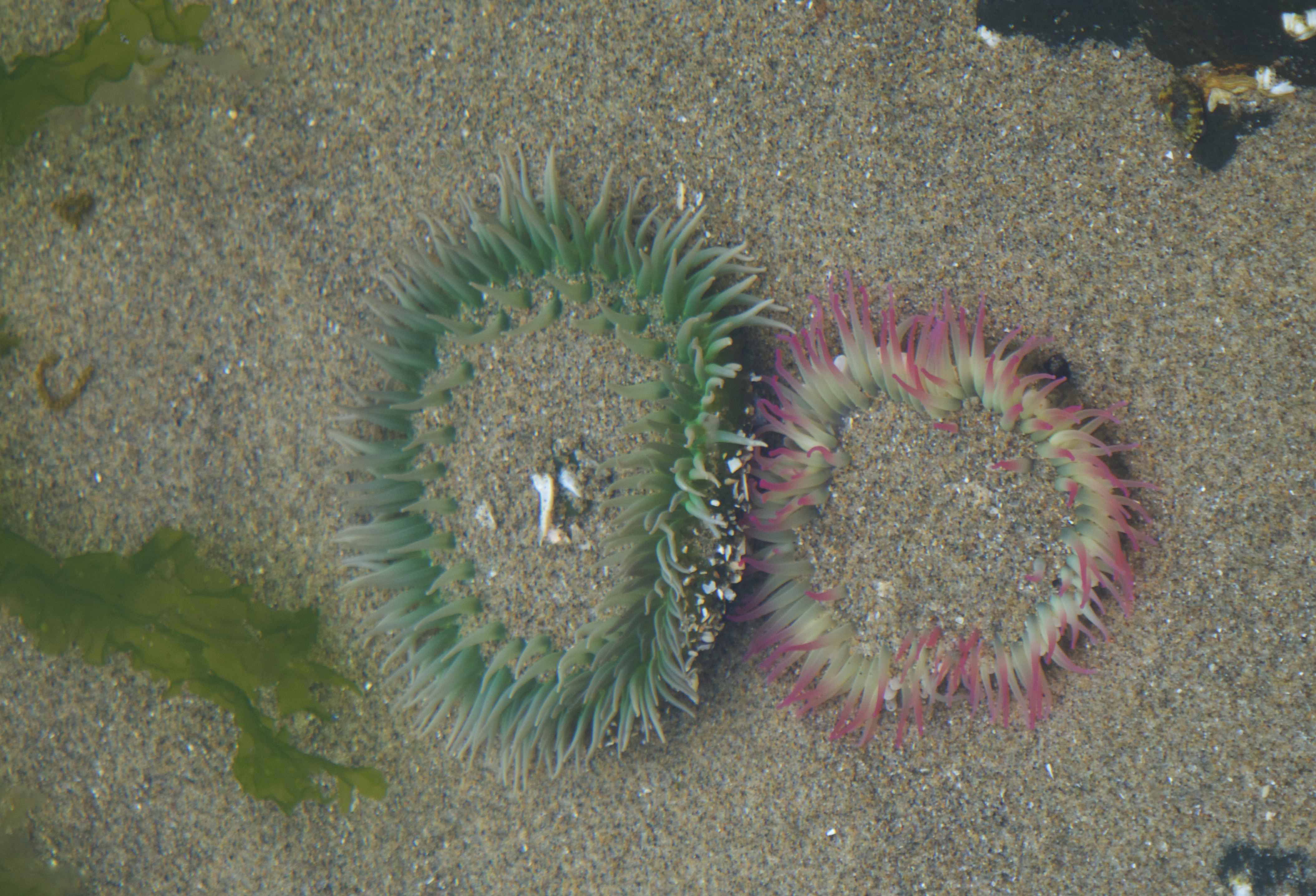
Our first stop of the day was Cannon Beach, known for its tide pools and for Haystack Rock, which is way bigger than it looks in photos.
This time we arrived at low tide!
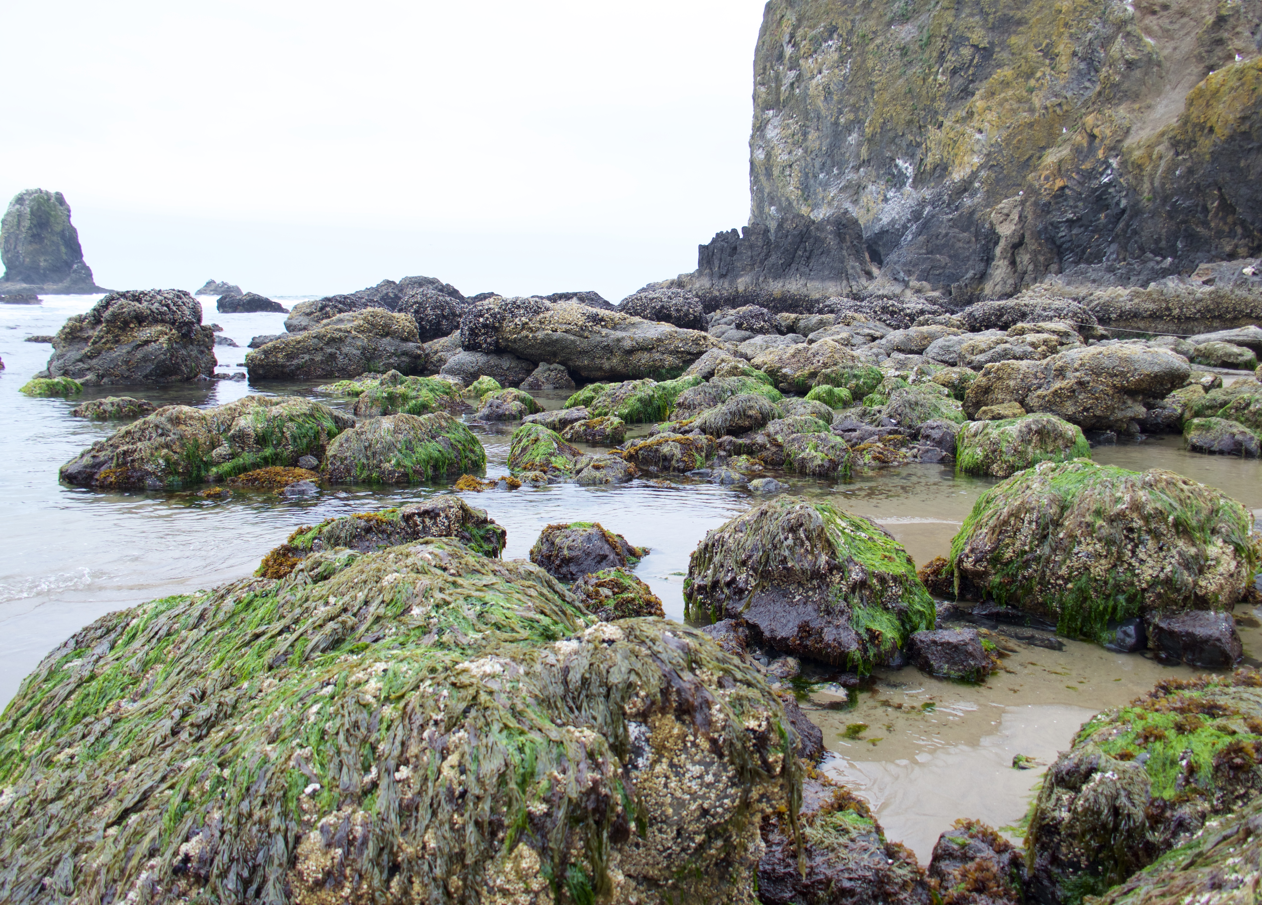
The Pacific coast from Alaska to Mexico has lost about 90% of its starfish population since 2013 to a plague of Sea Star Wasting Syndrome. These tide pools used to be filled Ochre Sea Stars, and now you have to look hard to find them.
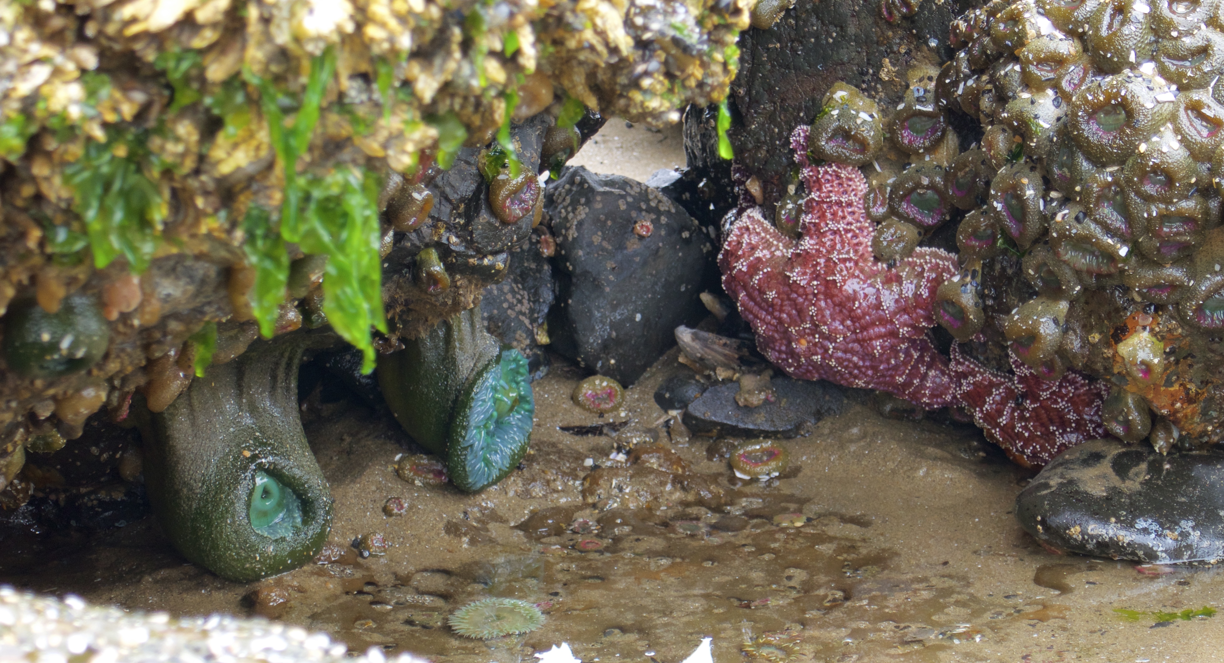
But there is plenty of other life to be found.
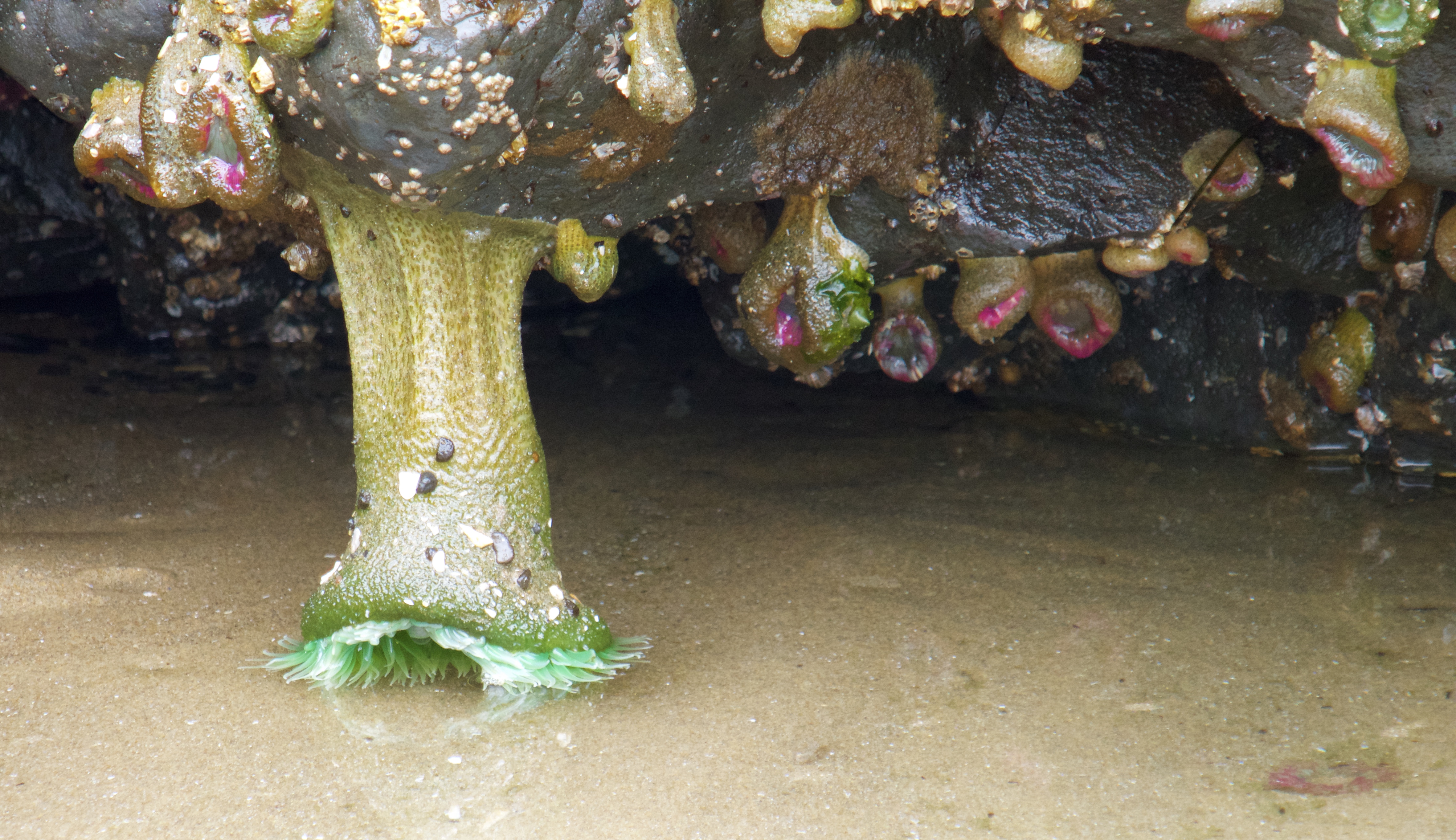
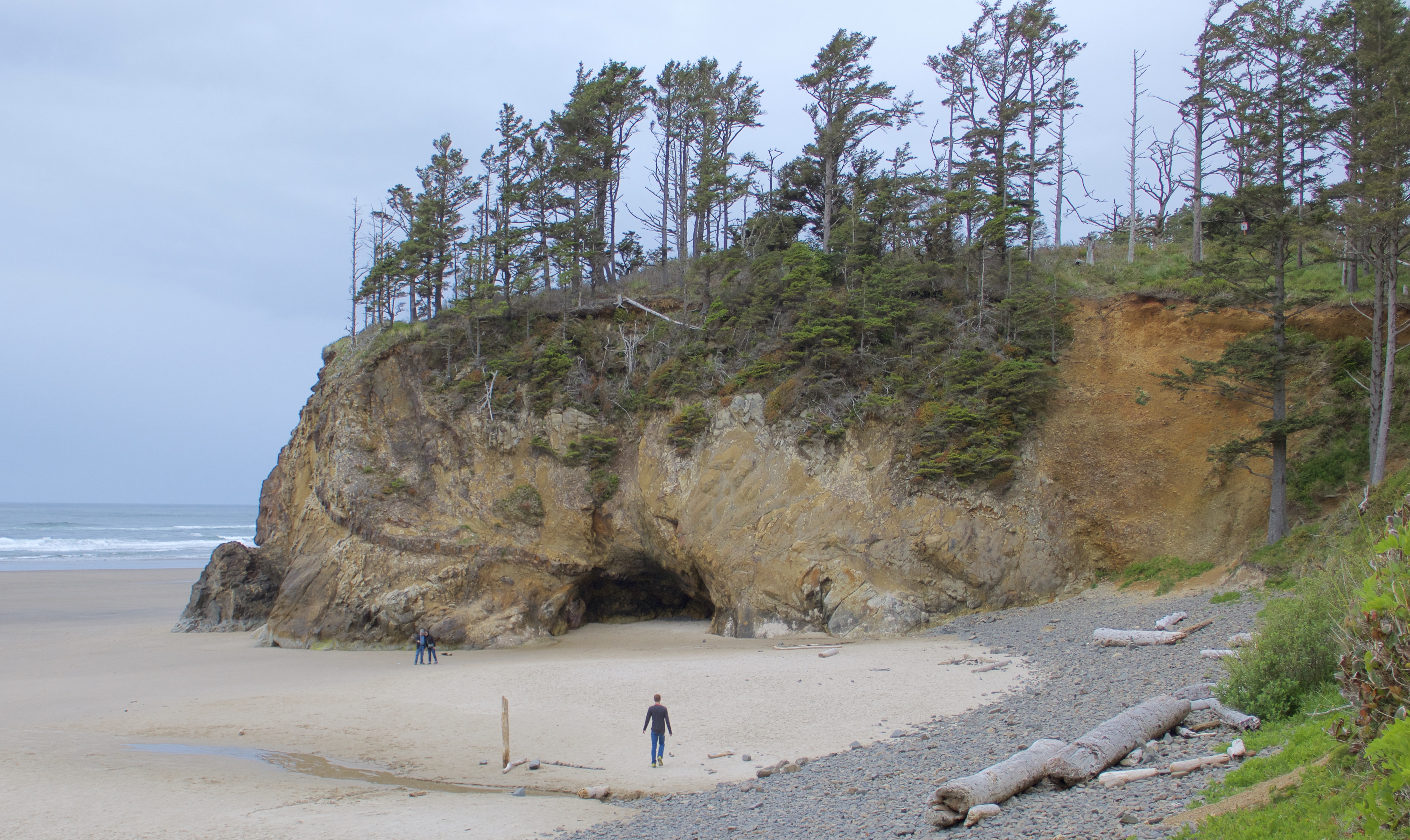
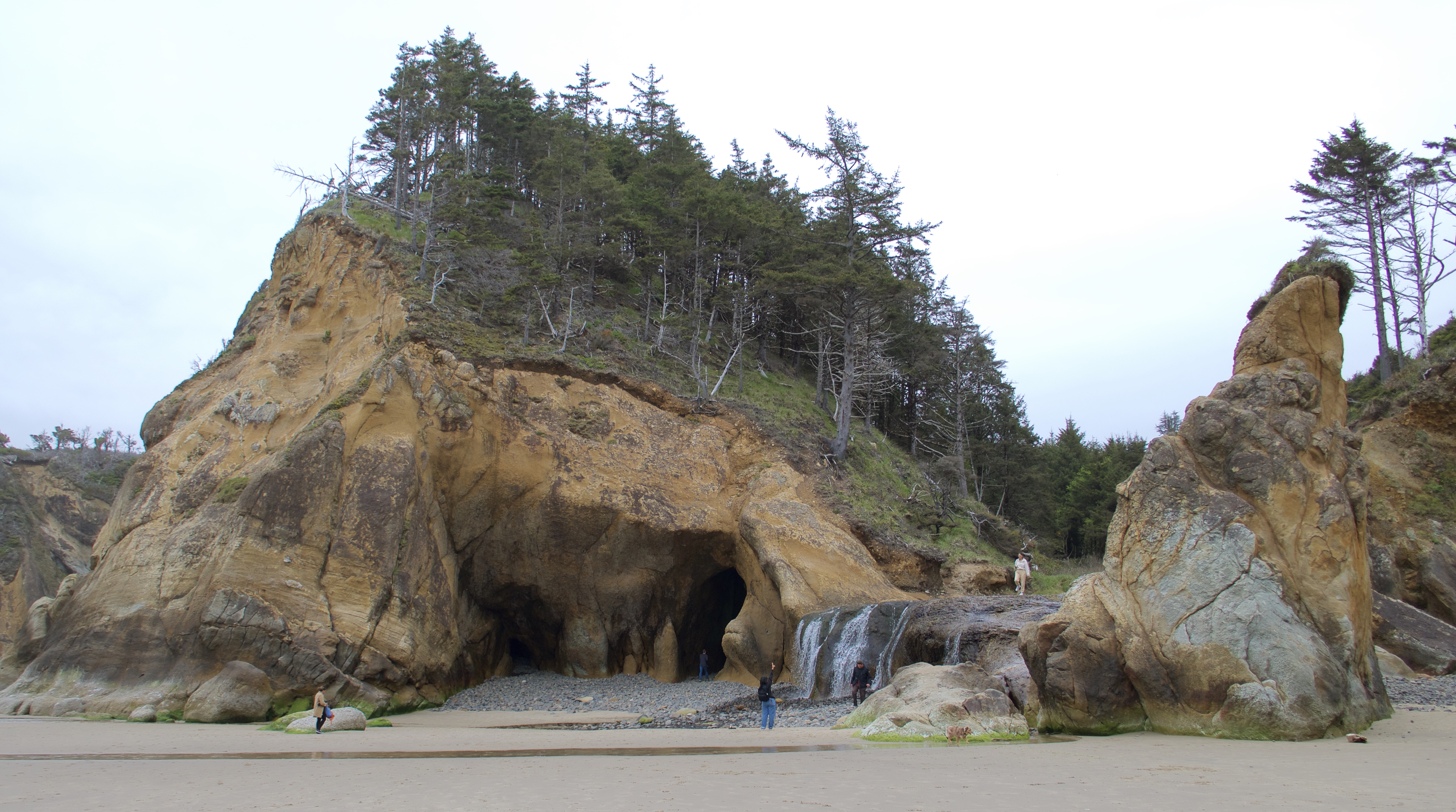
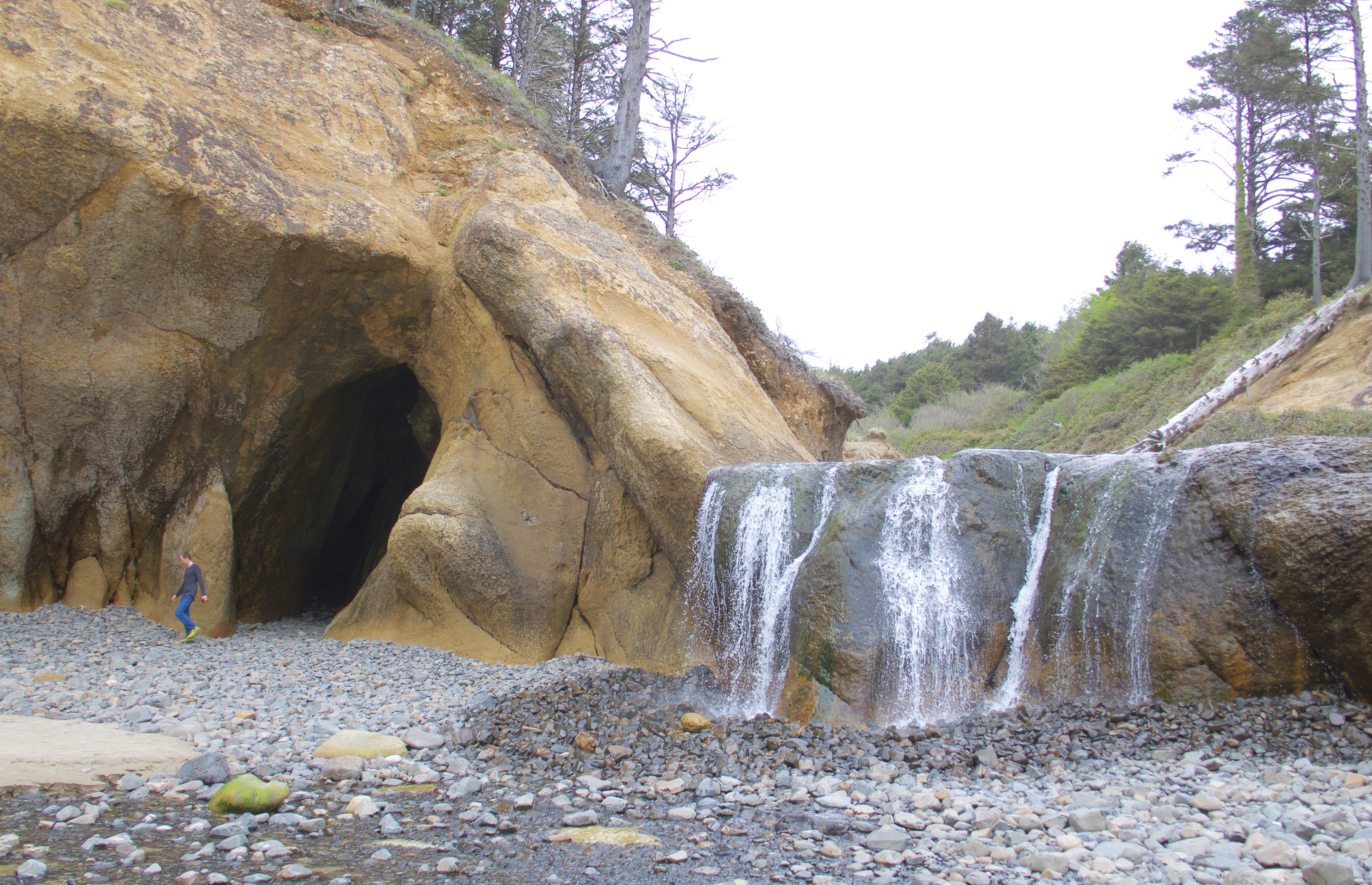
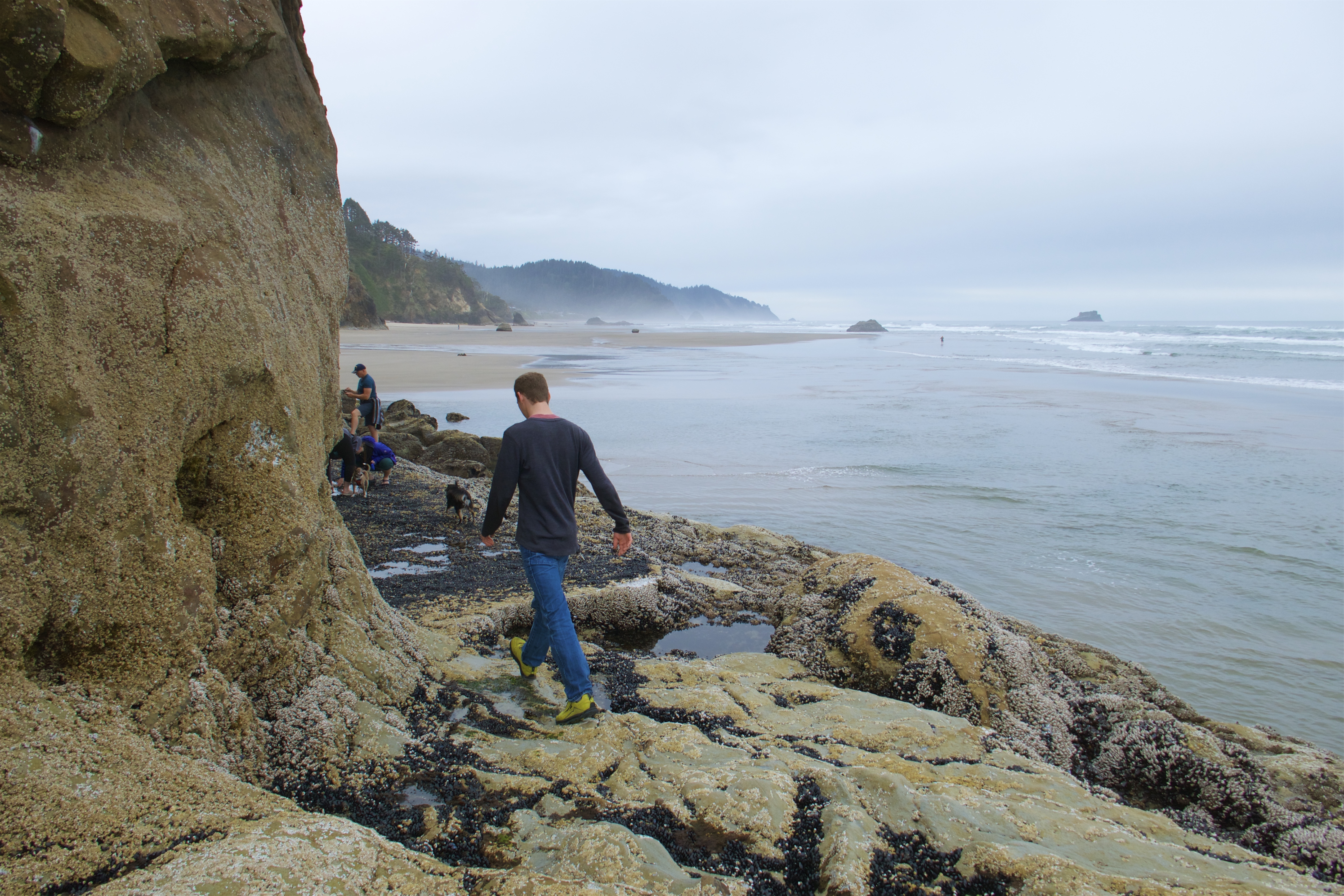
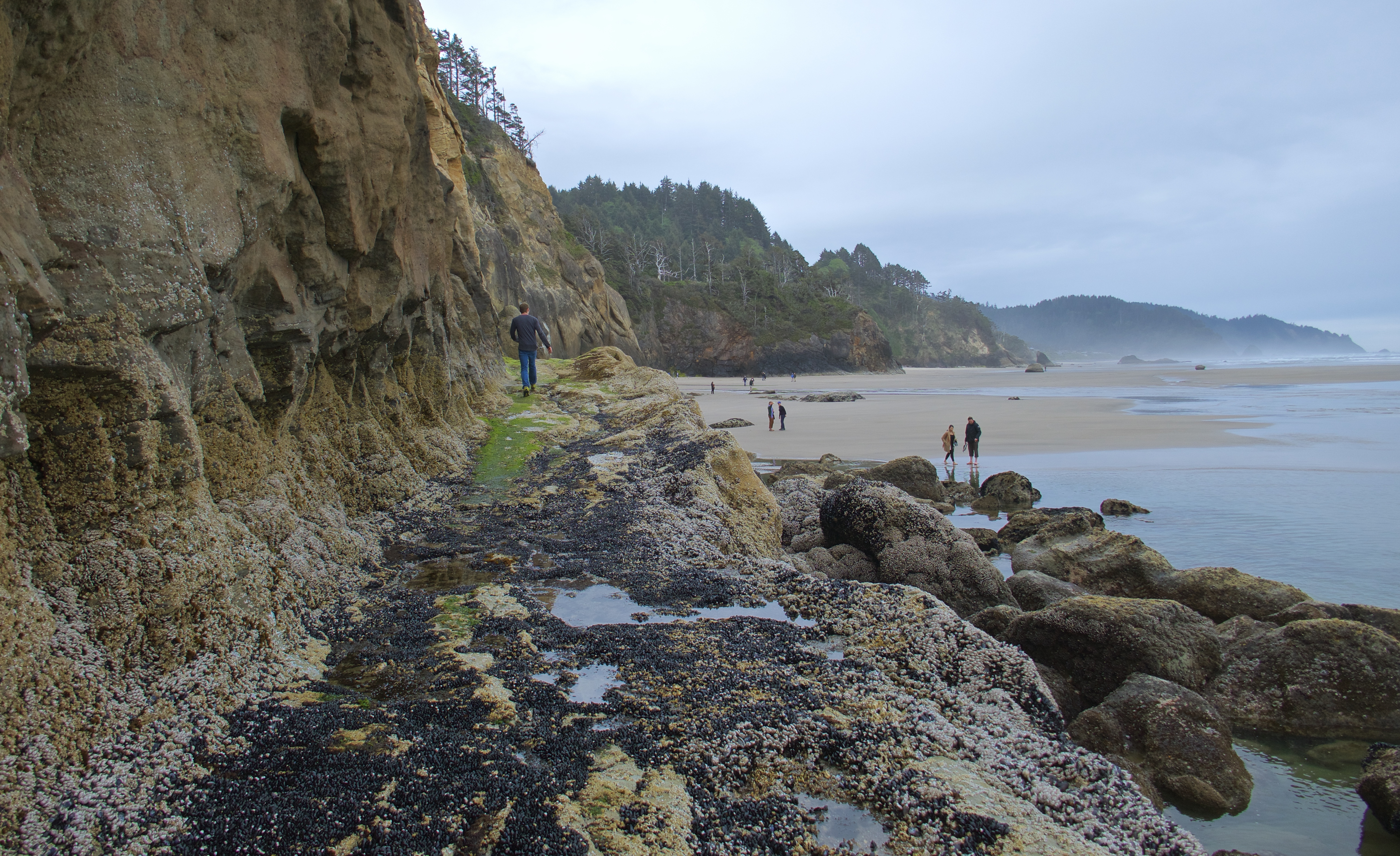
After Cannon Beach we visited Hug Point, where we found caves, a waterfall, and an old coach road!
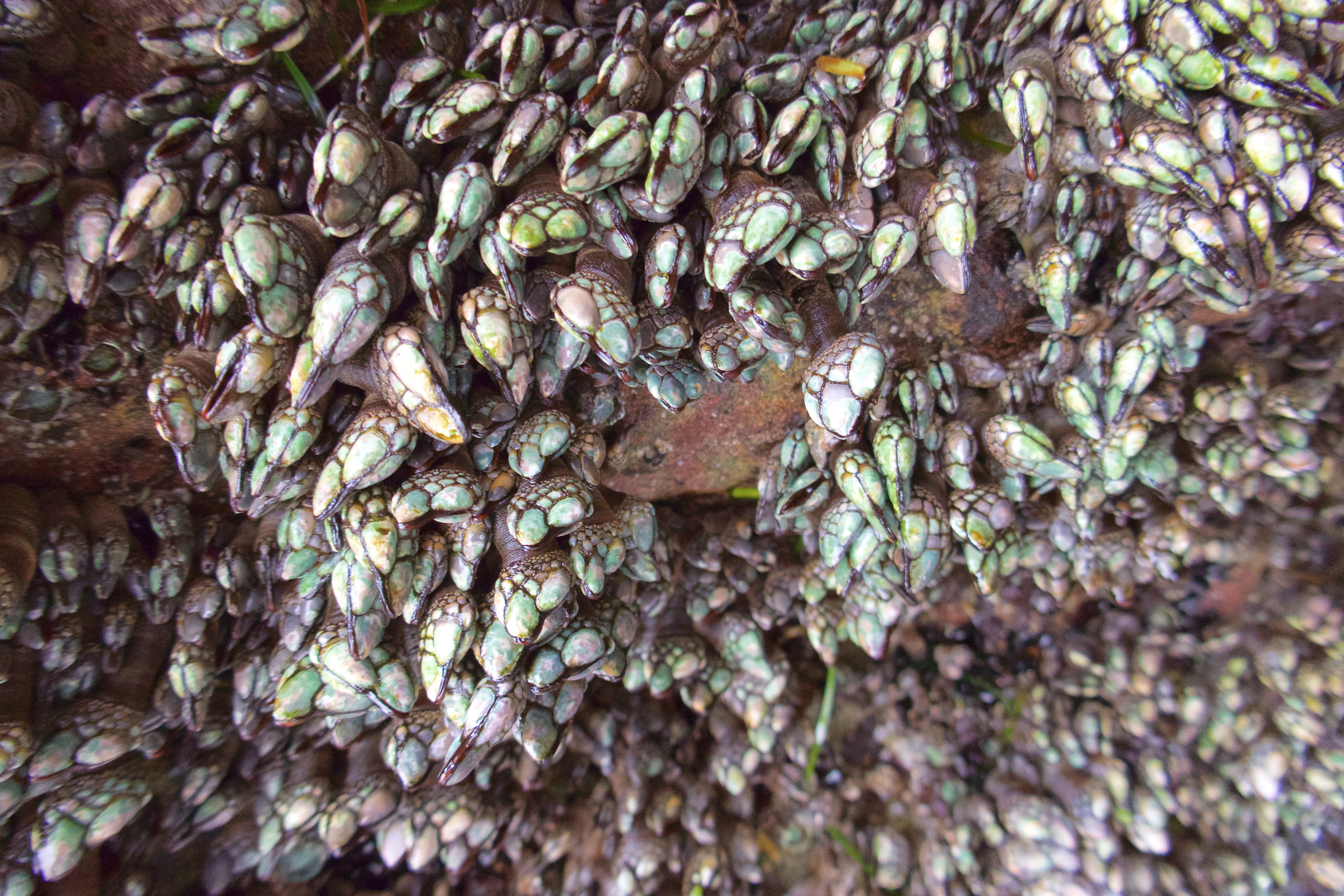
One of the caves looks like it’s encrusted with jewels.
These are gooseneck barnacles, and apparently they are a delicacy in some countries.
The greenish slope in the bottom left of this photo is the “onramp” to the old coach road:
Back before 101 was built in the late 1930s, people used the Oregon shoreline itself as a public highway. It worked out fine for the most part – unless you needed to get past Hug Point. The big rocky outcropping created a barrier that could only be bypassed at very low tides. So the coach road was carved into the outcropping, enabling traffic to travel up and down the coast even at high tide.
Imagine driving an old stagecoach on this road!
It was here at Hug Point that I set my phone, camera, keys and glasses on a patch of “safe” sand so I could play around a little in the water. Just as I was about to gather them up again, a rogue wave swept up the beach and rolled over them. The phone, keys and glasses were fine, but that was the end of the camera. I salvaged the memory card with its precious cargo of photos, and basically treated it like the Hope Diamond until I was able to create a backup. For the rest of the trip, the GoPro stepped up and did a pretty decent job.
We stopped in Rockaway Beach to see the Mechanical Bucking Corndog in front of the original Pronto Pup, where corndogs were invented. The Pronto Pup was closed and the quarter mechanism was out of order, but you can bet we all got our turn sitting on the corndog!
Photo courtesy of my crappy phone camera:
Our next stop was a tour of the Tillamook Creamery. We wandered through the exhibits and the viewing windows, got our free samples of cheese, and then bought an absolutely obscene amount of cheese-related food in the cafeteria. Grilled cheese, mac and cheese, cheese curds…we were eating leftover cheese curds for days. We would have gotten some ice cream, but that was a separate line and it was longer than we wanted to bother with.
We tried to visit Munsen Creek Falls, but Google Maps led us down a rough gravel road to a closed private gate, so we gave up on that idea. We consoled ourselves with a bag of saltwater taffy from a shop in Depoe Bay, and continued down the coast to the Devil’s Punchbowl.
EDIT: I have removed my video of Devil’s Punchbowl, because Elizabeth has reminded me that it was actually of Thor’s Well, a bit farther down the coast. Video will be reposted in its proper spot.
Knocking out the Hurricane Ridge hike on Saturday afternoon instead of Sunday morning put us comfortably ahead of schedule on our planned itinerary. We indulged in a 5-star breakfast of hot ramen and cold pizza and broke camp.
We passed another ONP visitor center on the drive back to Hwy 101, but it hadn’t opened yet. No worries, plenty of others where we could get our park stamps and postcards.
Returning to the highway in Port Angeles, we followed it around to Olympic Hot Springs Road. This access road is closed to vehicles about two miles in because of a 2017 washout that has never been repaired. We would have liked to see the Glines Canyon Dam Spillway Overlook, farther up the road past the closure, but we didn’t want it enough to walk to it. We were here for the Madison Falls trail, which is as far as the road still goes.
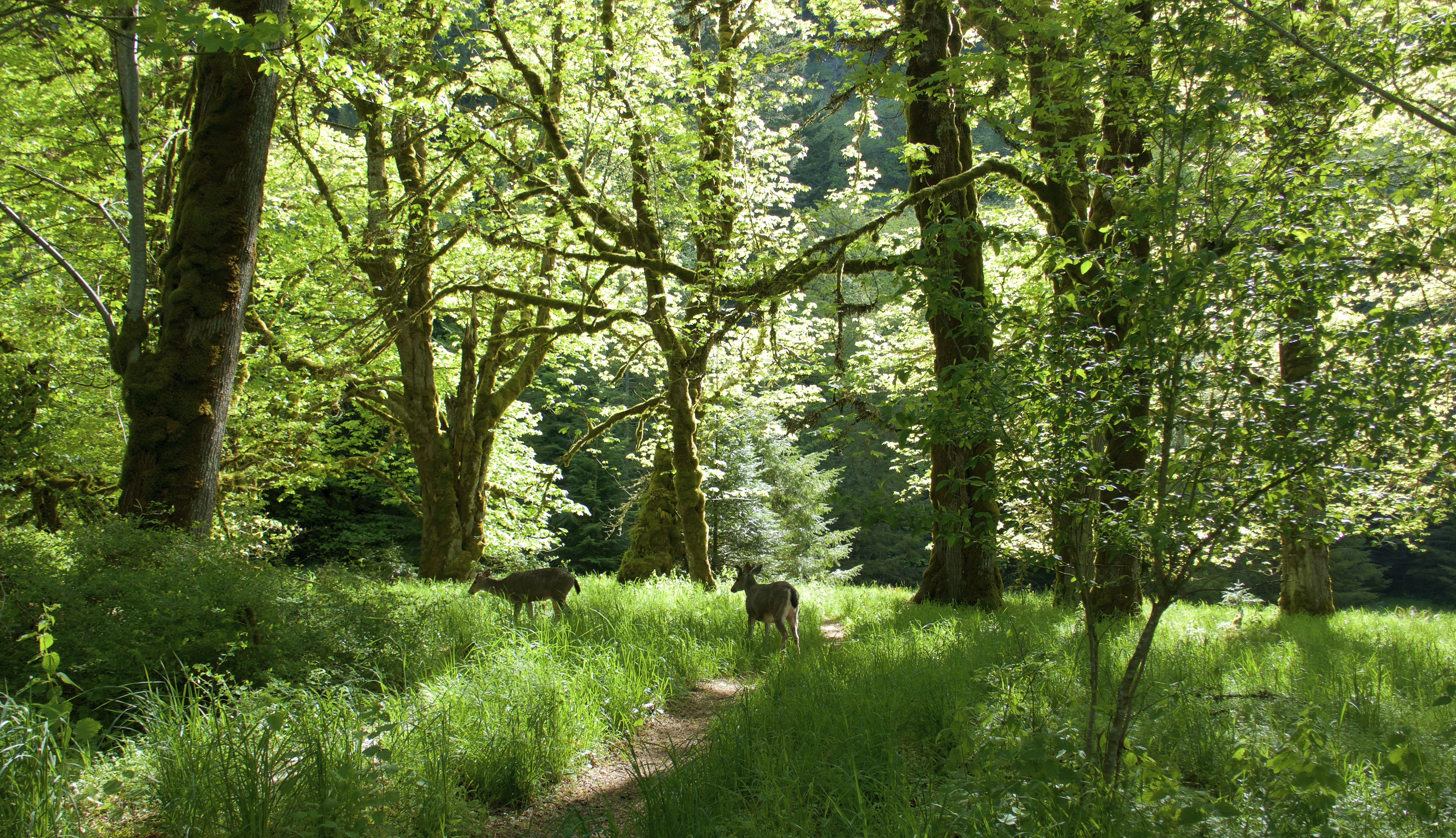
I think ONP must be a giant network of river valleys. It seemed like every road or trail we took ran beside a creek or river with looming walls of forest rising on each side. Olympic Hot Springs Road follows the sparkling-clear Elwha River.
From the parking lot we found a short, paved trail through lush forest that glowed in the morning sunshine.
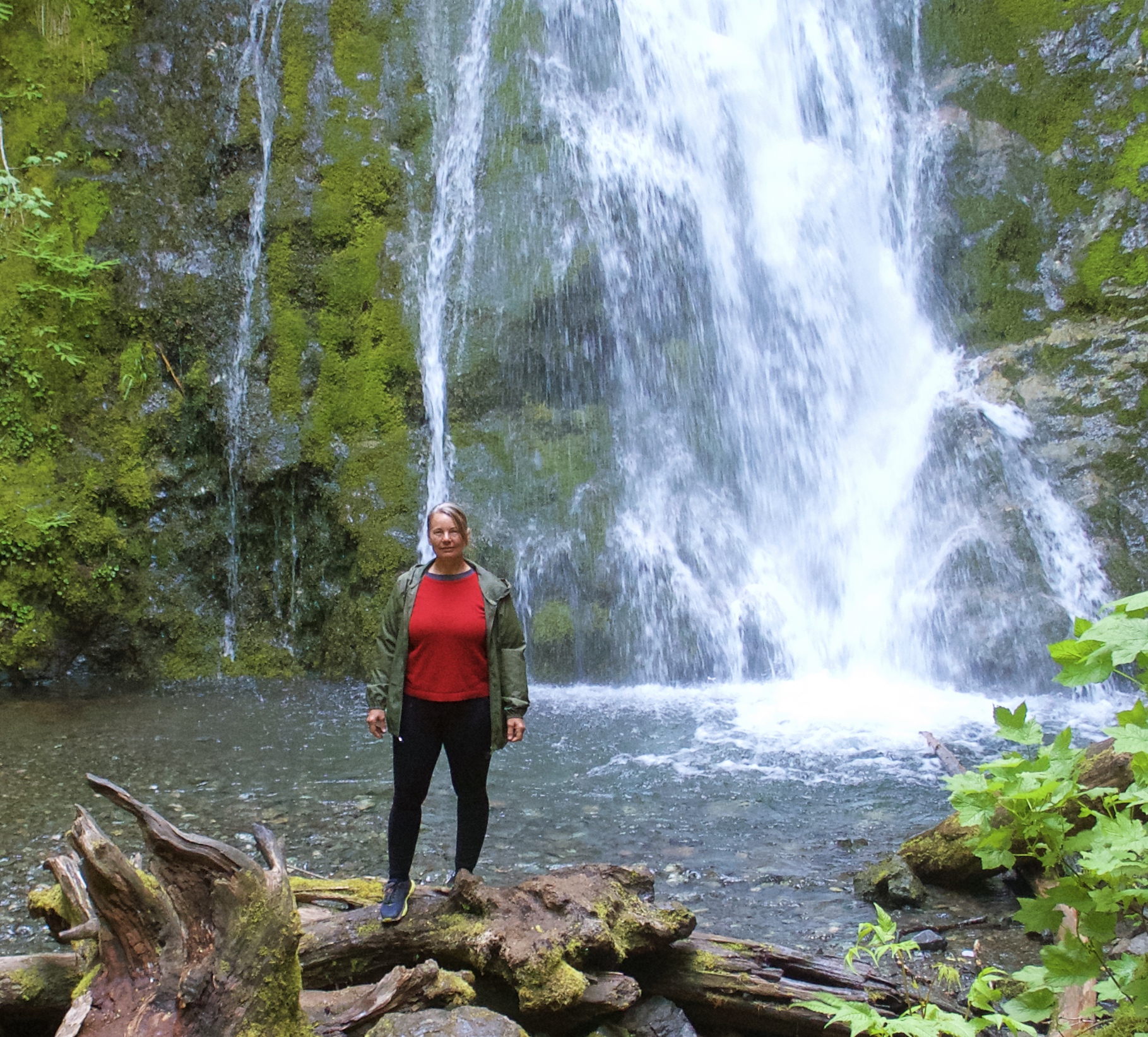
Madison Falls is very pretty; well worth the short walk.
It’s too bad photos and even videos can’t really capture the power of waterfalls. We saw some great ones, and none of them are represented well in these pics.
Luke found a cave.
After the Falls, we played in the river a bit and then drove back to the highway.
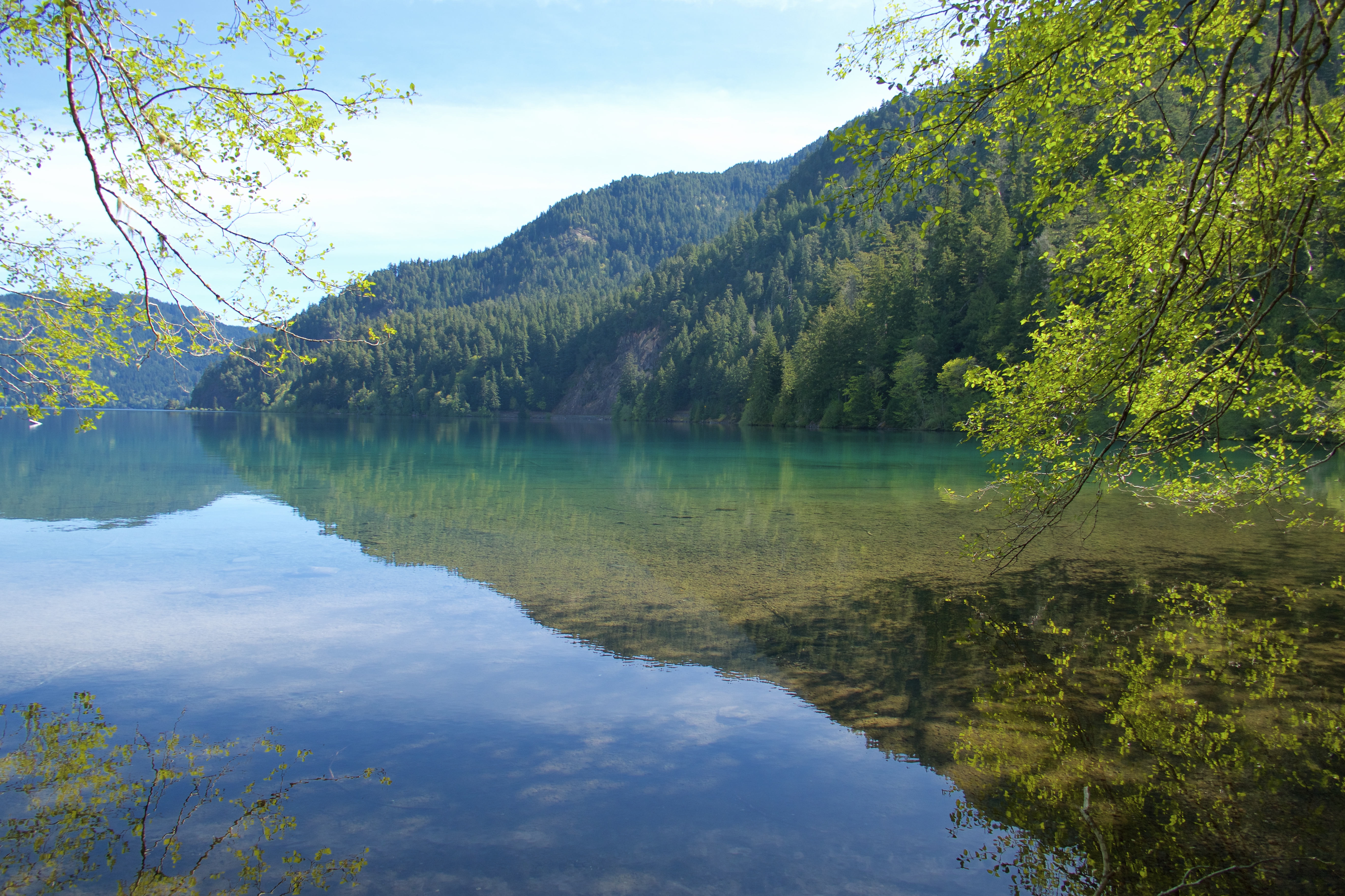
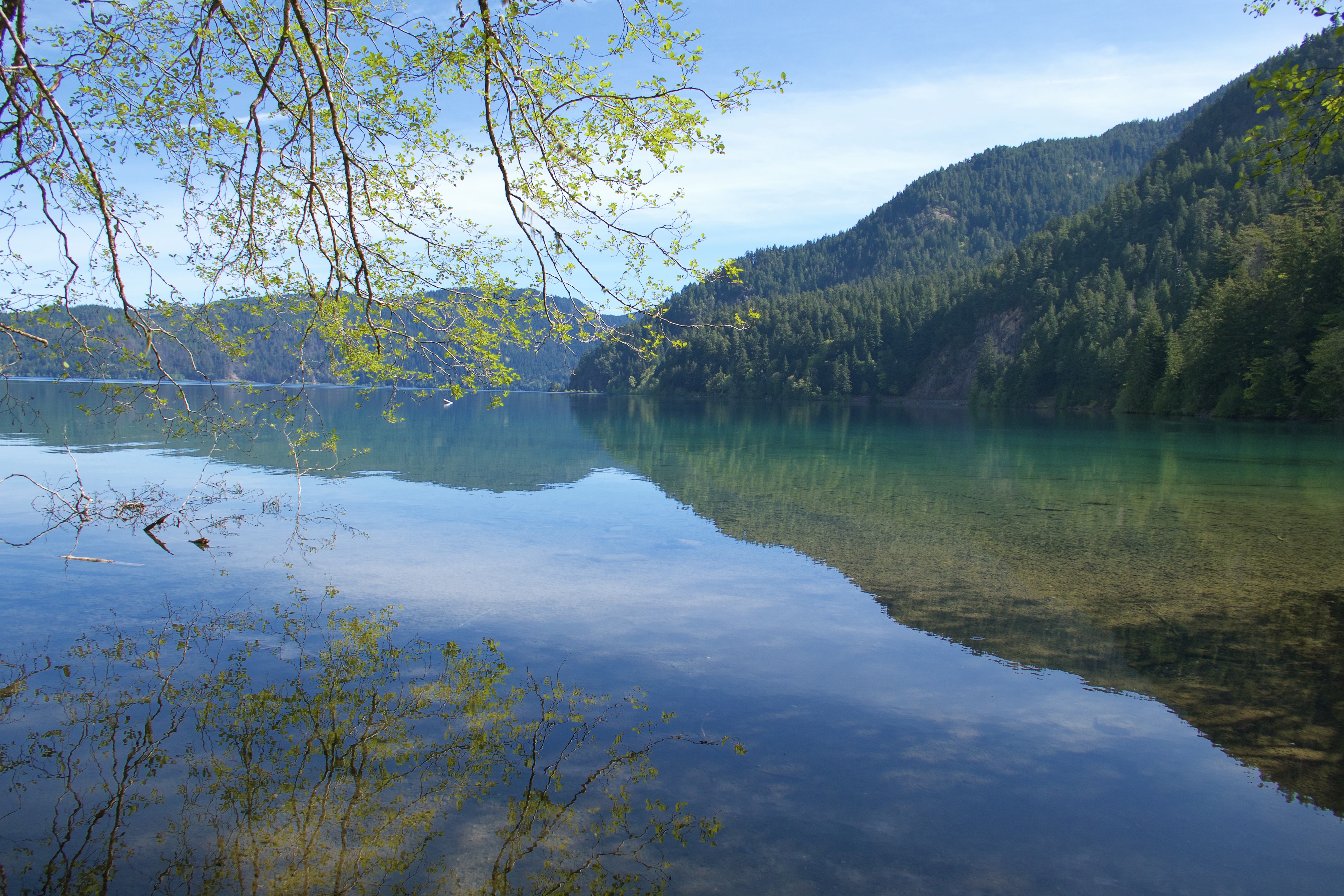
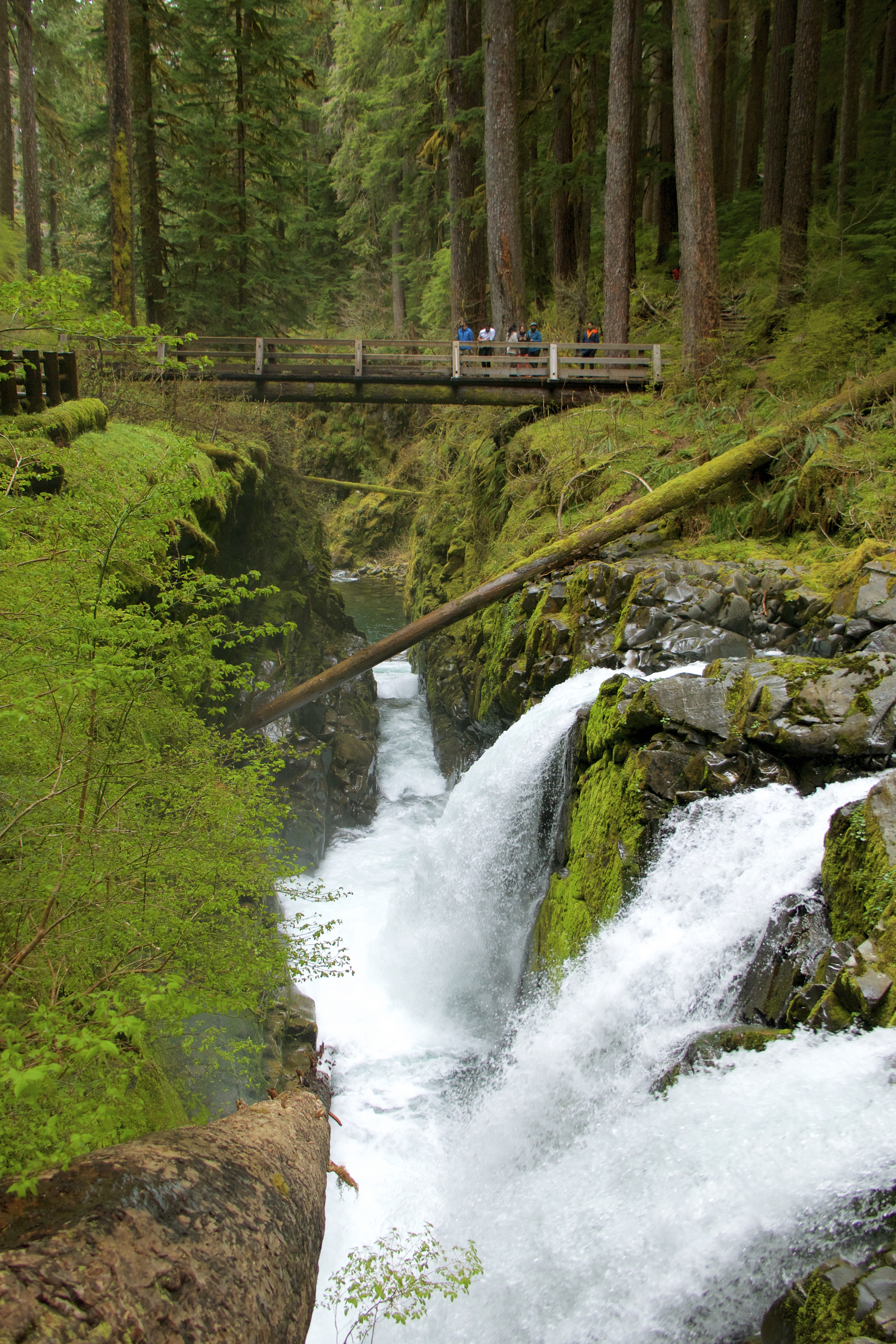
Our next stop was Lake Crescent, near the Marymere Falls trailhead. The waters of Lake Crescent are so crystal clear that they look like an optical illusion.
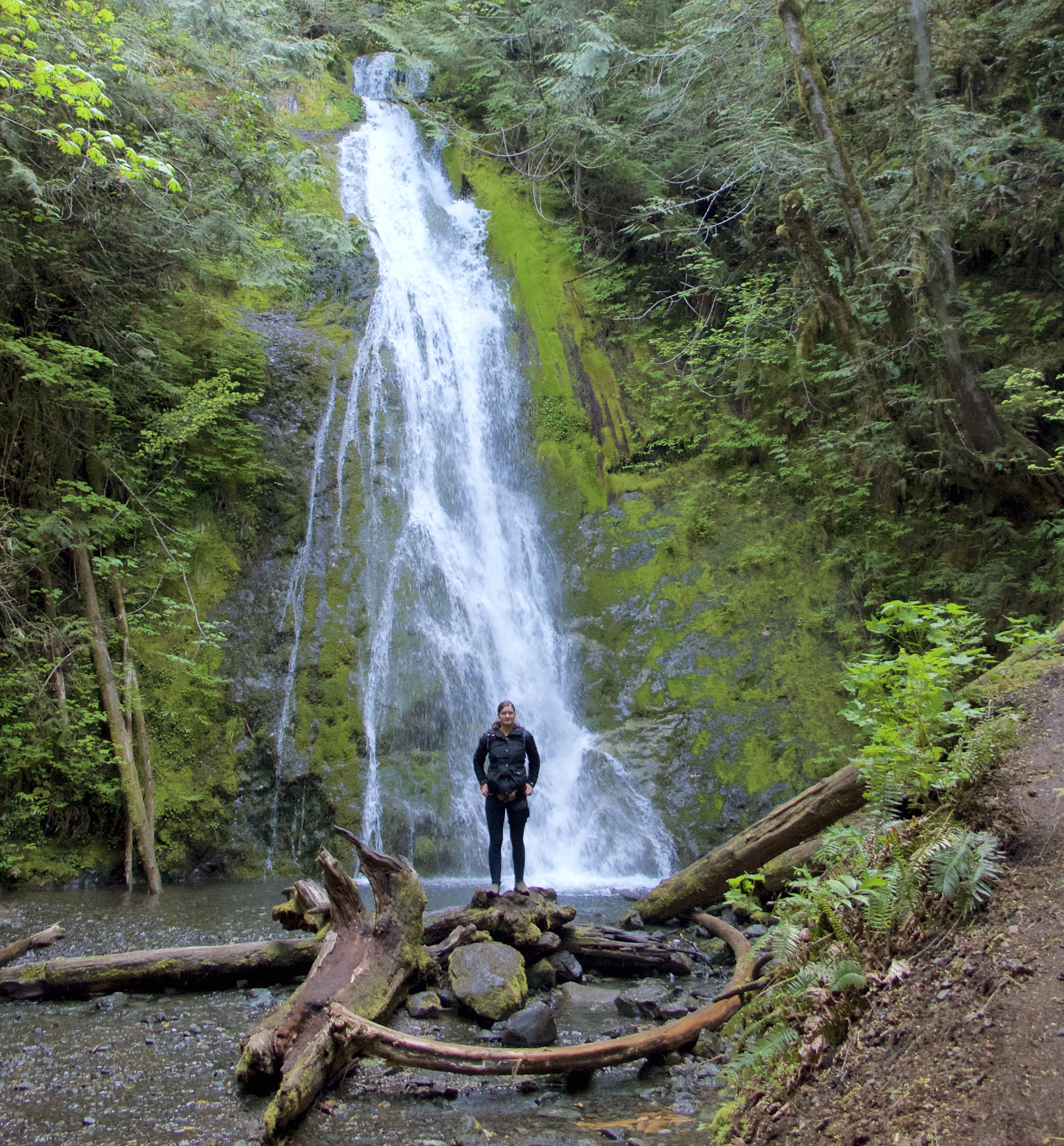
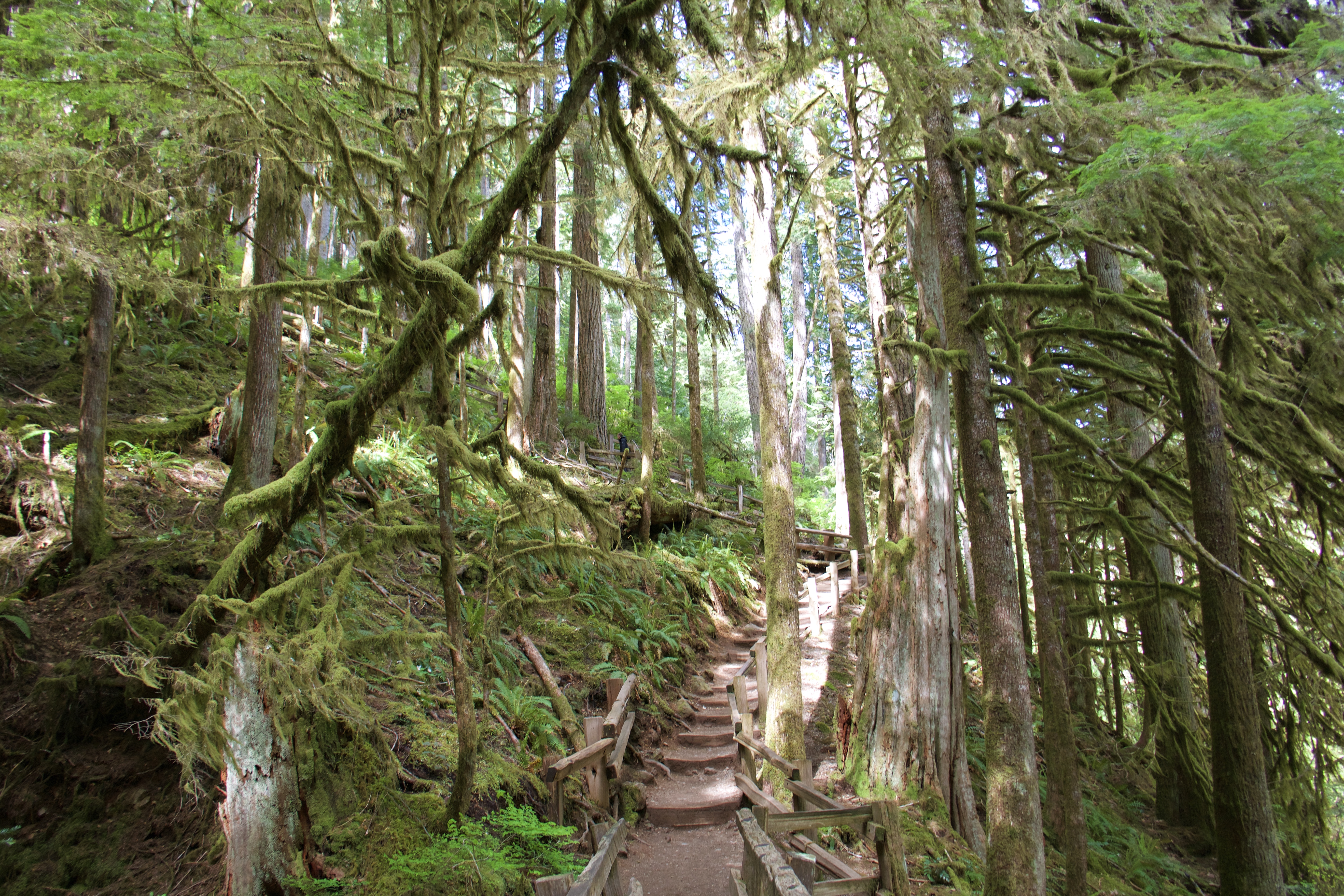
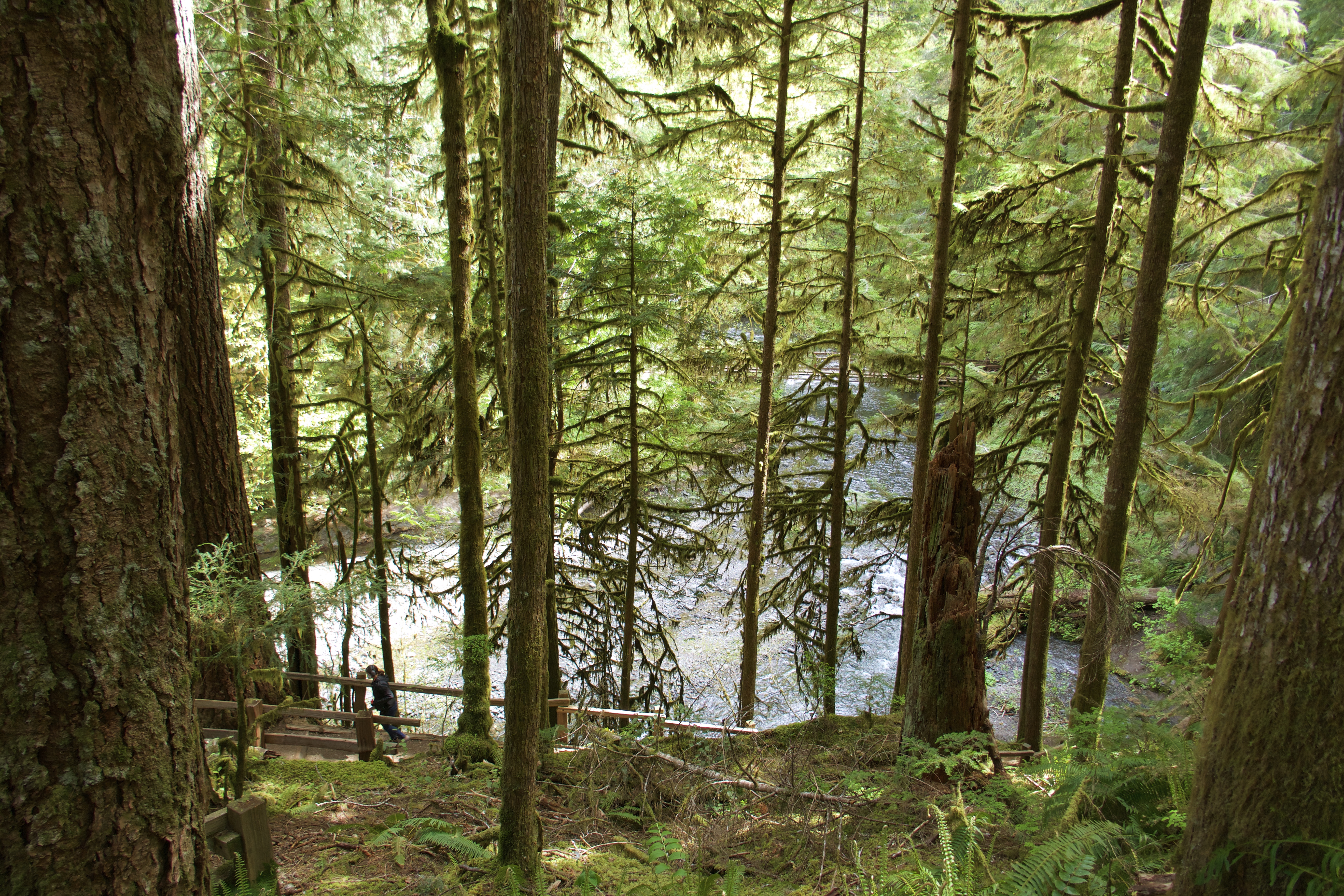
The trail to Marymere Falls is about a mile long and unpaved, following Barnes Creek through dense, mossy forest and across various wooden bridges and staircases.
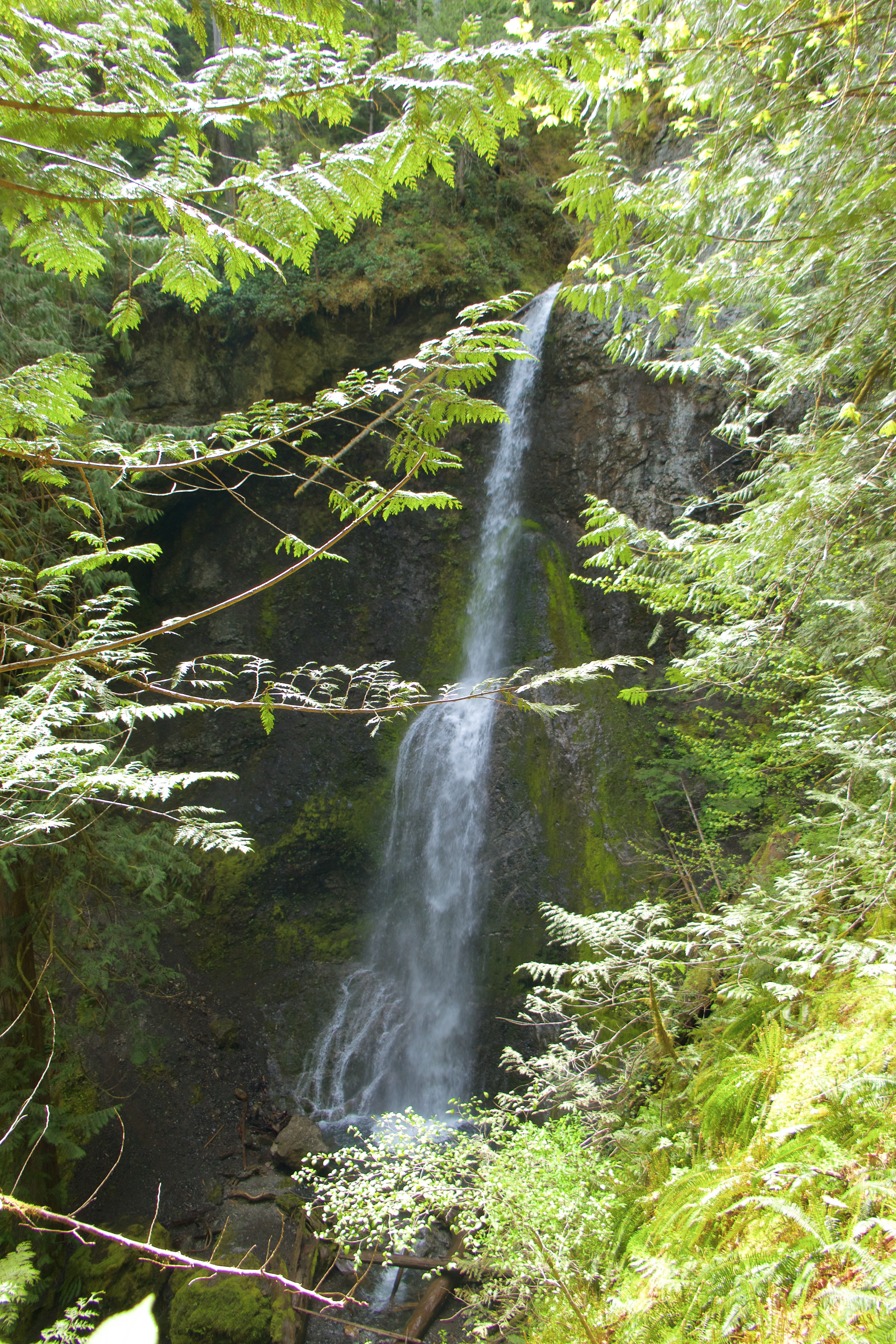
Marymere Falls is hard to photograph well. It’s a lot bigger than it looks in this pic.
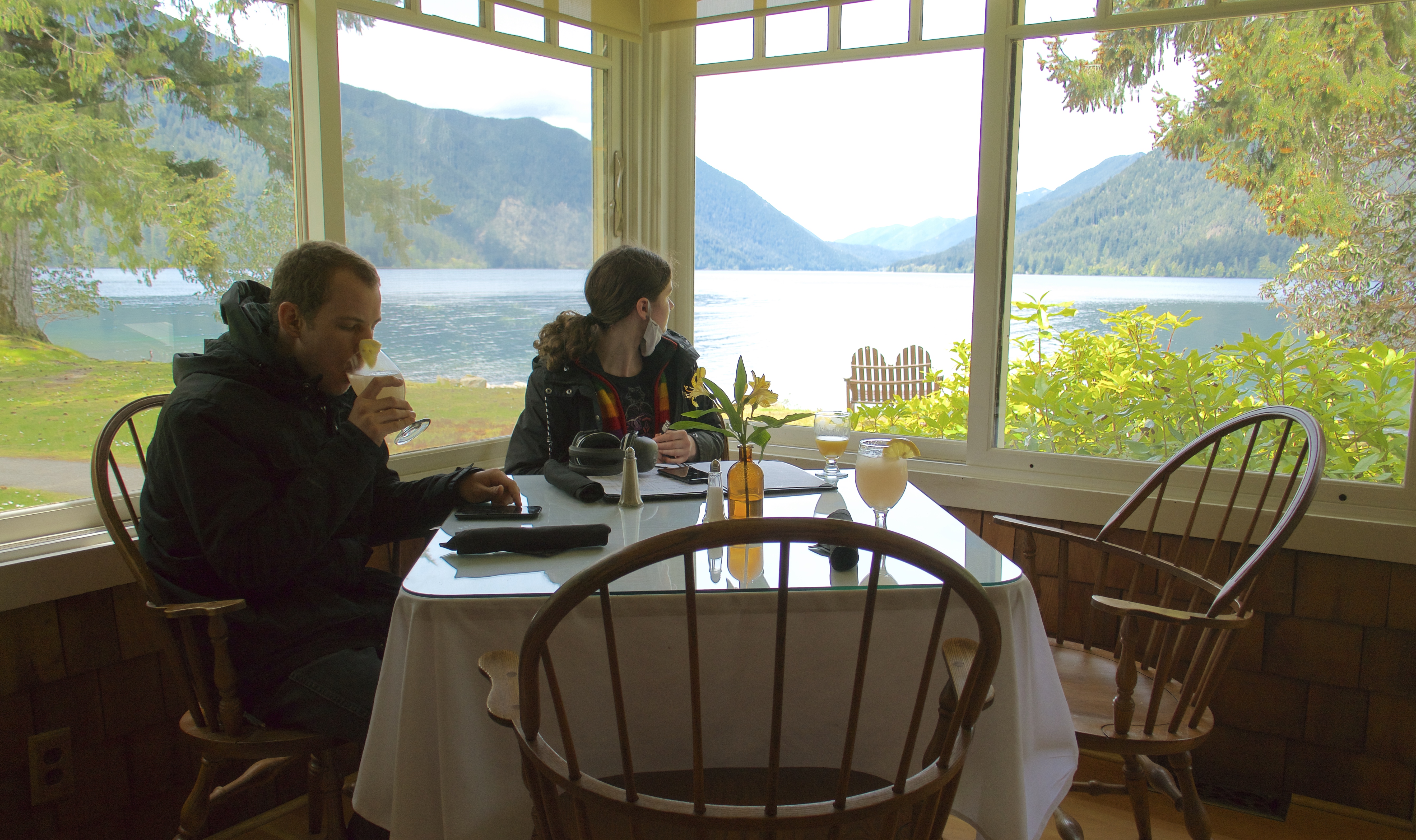
By then we’d worked up an appetite, so we drove up the road to Lake Crescent Lodge for lunch.
This meal began a trend that continued for as long as we followed the Pacific coast: fresh seafood and berry cobblers. Wild berries are ubiquitous and prolific in the Pacific Northwest; we saw them everywhere. And they are preserved and served in delicious cobblers in almost every restaurant we visited.
This was also the meal where we discovered that we’re not fans of raw oysters. But I highly recommend the lodge’s lavender lemonade, it’s amazing.
We had planned to spend Sunday night at Fairholme Campground on the shores of Lake Crescent. But we were so far ahead of schedule that it made no sense to stop. Luckily Fairholme is another first-come-first-served campground, so there were no reservations to forfeit. On to the next access road, a Forest Service road that follows the Sol Duc River and connects to Sol Duc Hot Springs Rd. We stopped in at Sol Duc Hot Springs Resort to reserve a soak in their hot pools later in the afternoon. Then on down the road to the Sol Duc Falls trailhead.
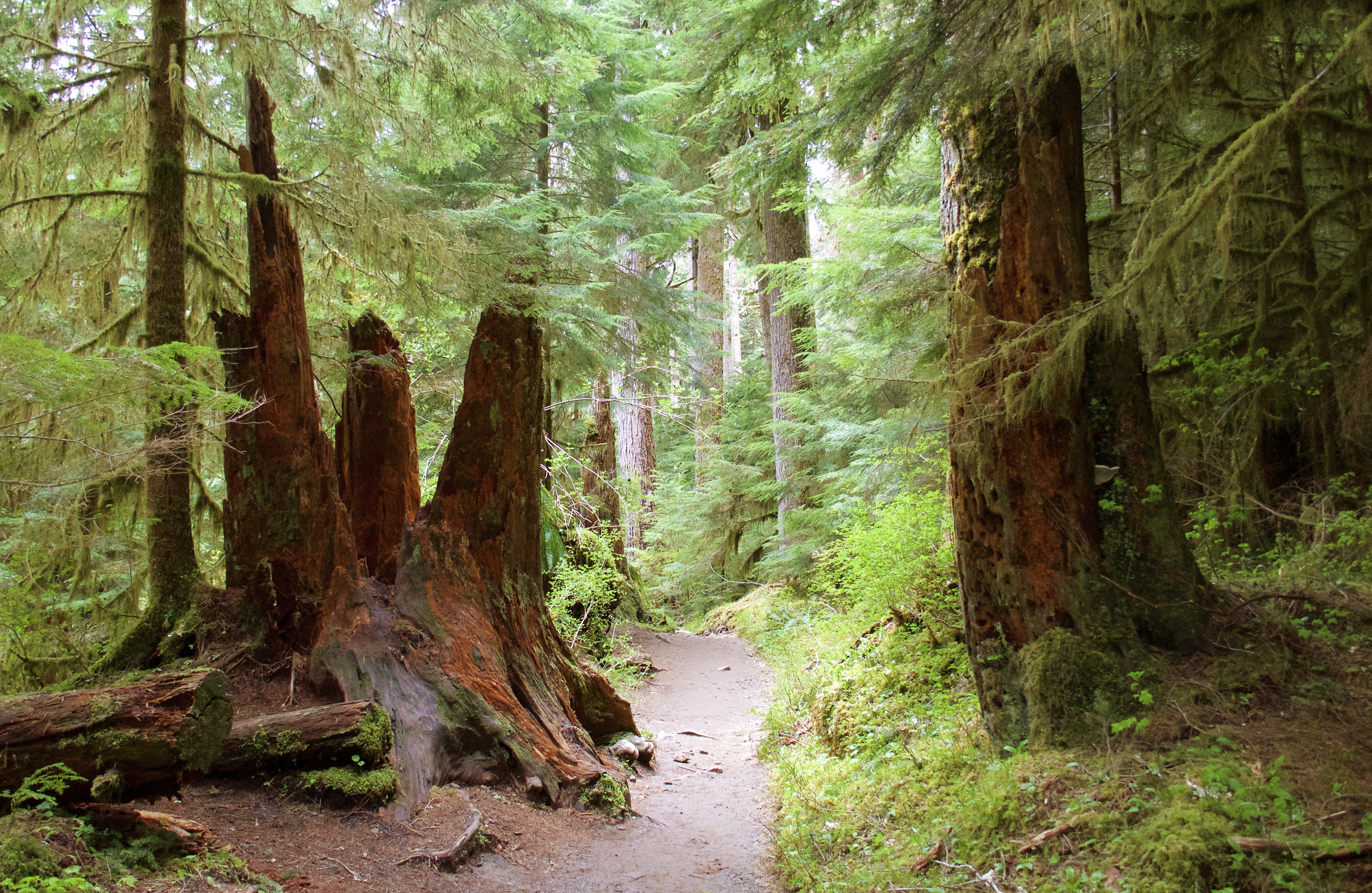
The farther south we drove, the more lush and jungly the trails became. I started to wish for rain, because I feel like that’s the best way to experience these rainforesty woods. The weather alternated between sunny and misty overcast, but no actual rain.
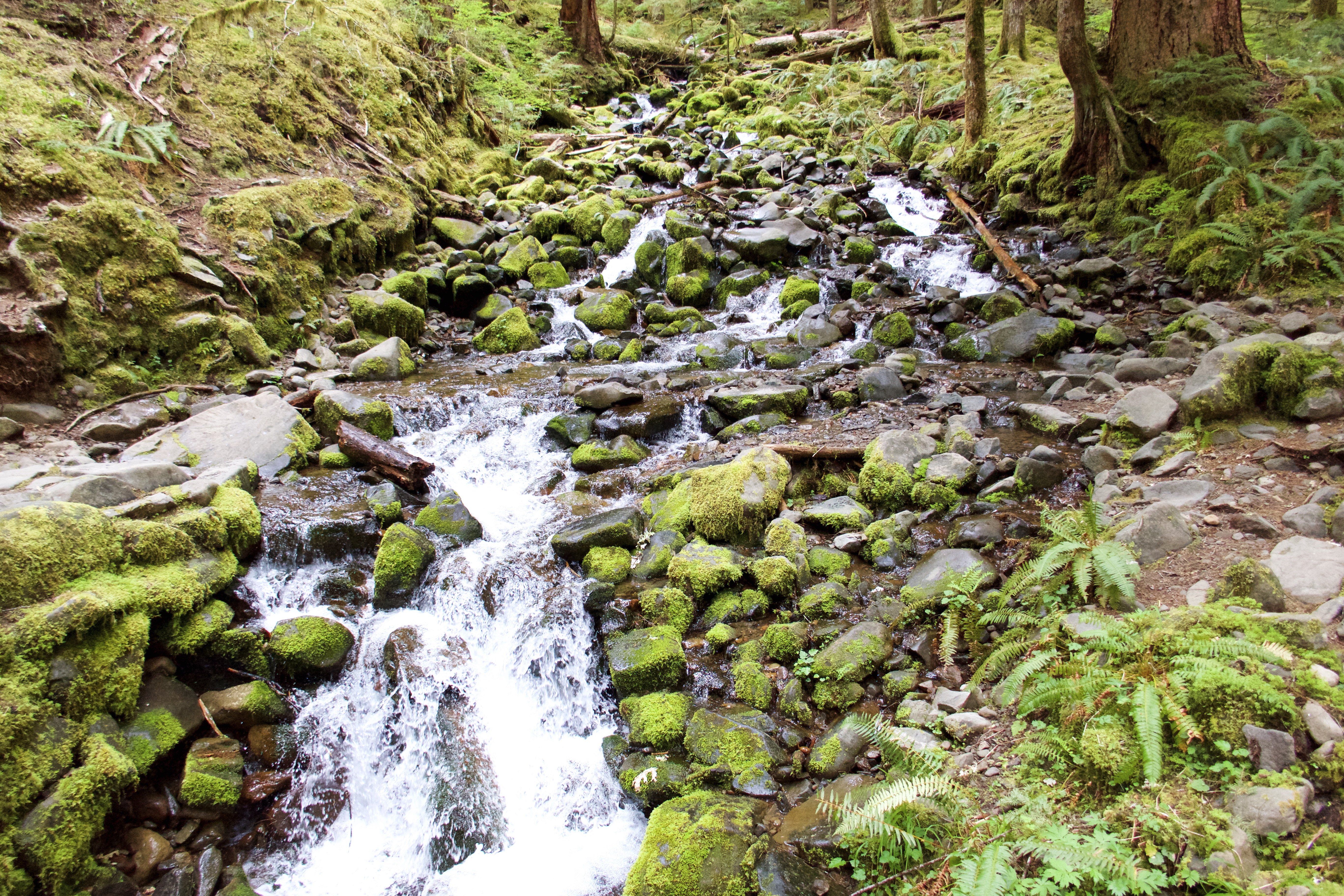
The trail to Sol Duc Falls is just under a mile and very tropical.
A pretty creek crossing:
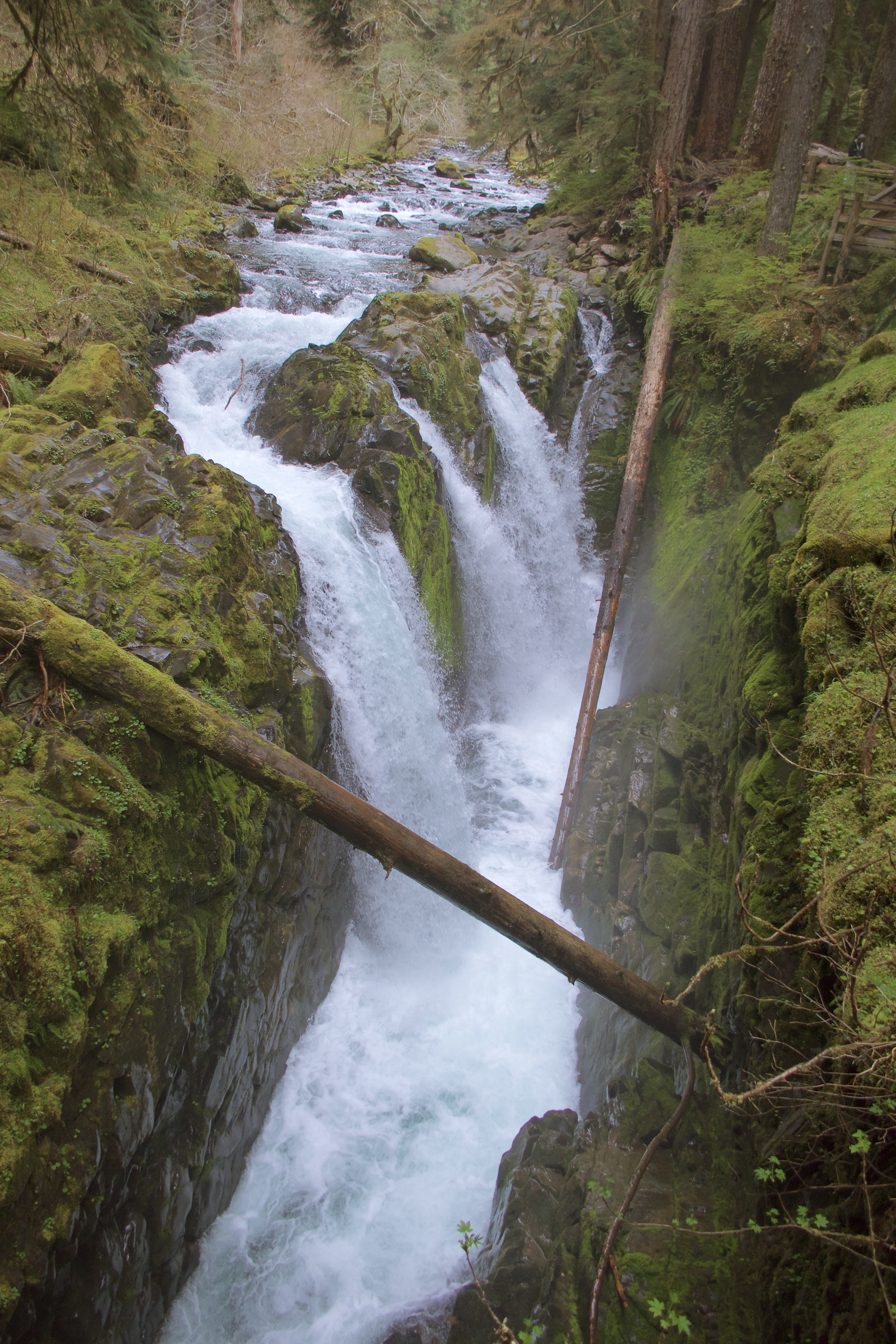
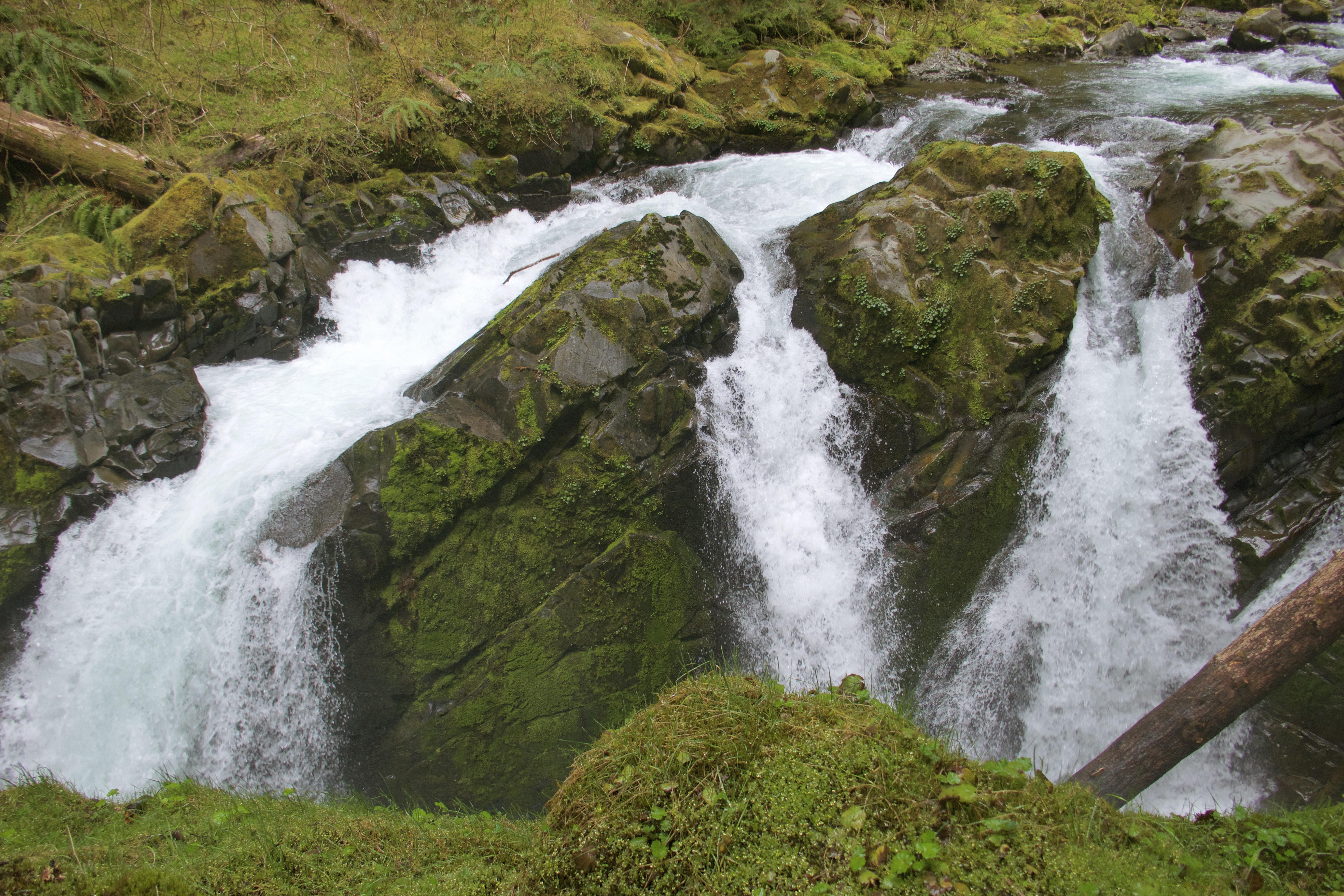
Sol Duc is another beautiful, hard-to-photograph waterfall.
After the Falls we returned to the resort for a blissful 90 minutes in the hot springs. The hot untreated pools smelled like sulfur and felt like heaven.
I forgot to mention in my last post that we did stop at a TA travel center in Snoqualmie for showers. We aren’t complete barbarians. And we showered at the resort before we got in their pools. In case any of my gentle readers were worried.
Thus refreshed, we headed back to the 101. It was late in the afternoon by then, and we were starting to think about where to spend the night. We drove through the town of Forks, where the Twilight vampires live, passed up a few campgrounds because it wasn’t quite time to stop yet, and then took the access road toward the Hoh Rainforest. This worked out perfectly: there is a visitor center, a campground and several trailheads all in a clump here. Had no problem finding an empty site at Hoh Campground. We were so tired and relaxed from hikes and hot springs that we didn’t bother to set up the tent, just put our open food into the campsite bear box and slept in the car.
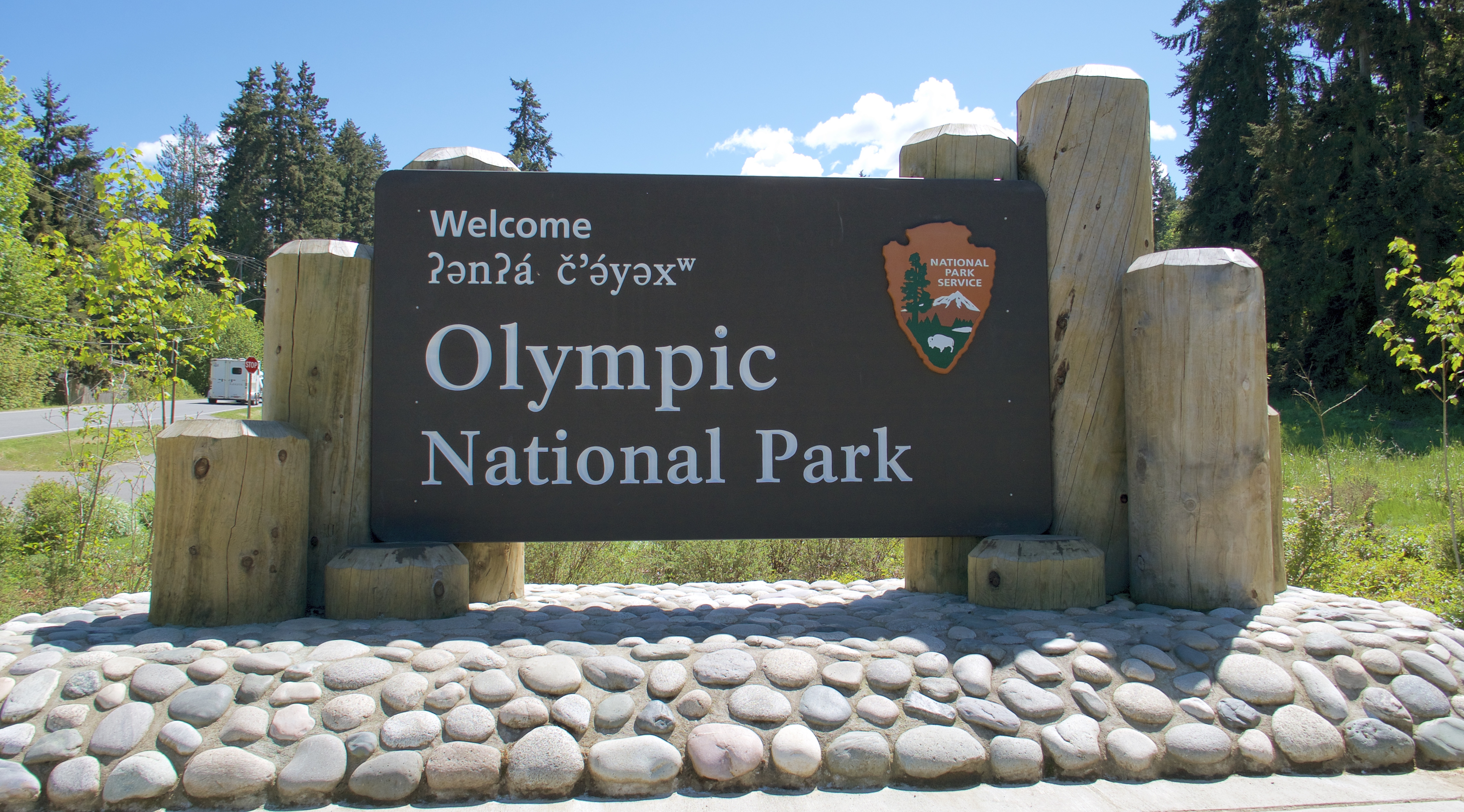
Olympic National Park has no main road passing through it. Instead Highway 101 encircles it on three-and-a-half sides, extending narrow access roads like fingers into the park’s different ecosystems.
From the ferry we drove northeast to Hwy 101, followed that to Port Angeles and then took the first of the fingers, Hurricane Ridge Road, up to our campground in the foothills of the Olympic Mountains. Heart o’ the Hills Campground is first-come-first-serve, and we weren’t sure how busy the park might get on a Saturday in mid-May. We were anxious to secure a spot before the campground filled up.
We needn’t have worried. We never encountered any real crowds or lines or full campgrounds during our time there. It’s a beautiful park and I’m glad we visited in what is apparently the off-season.
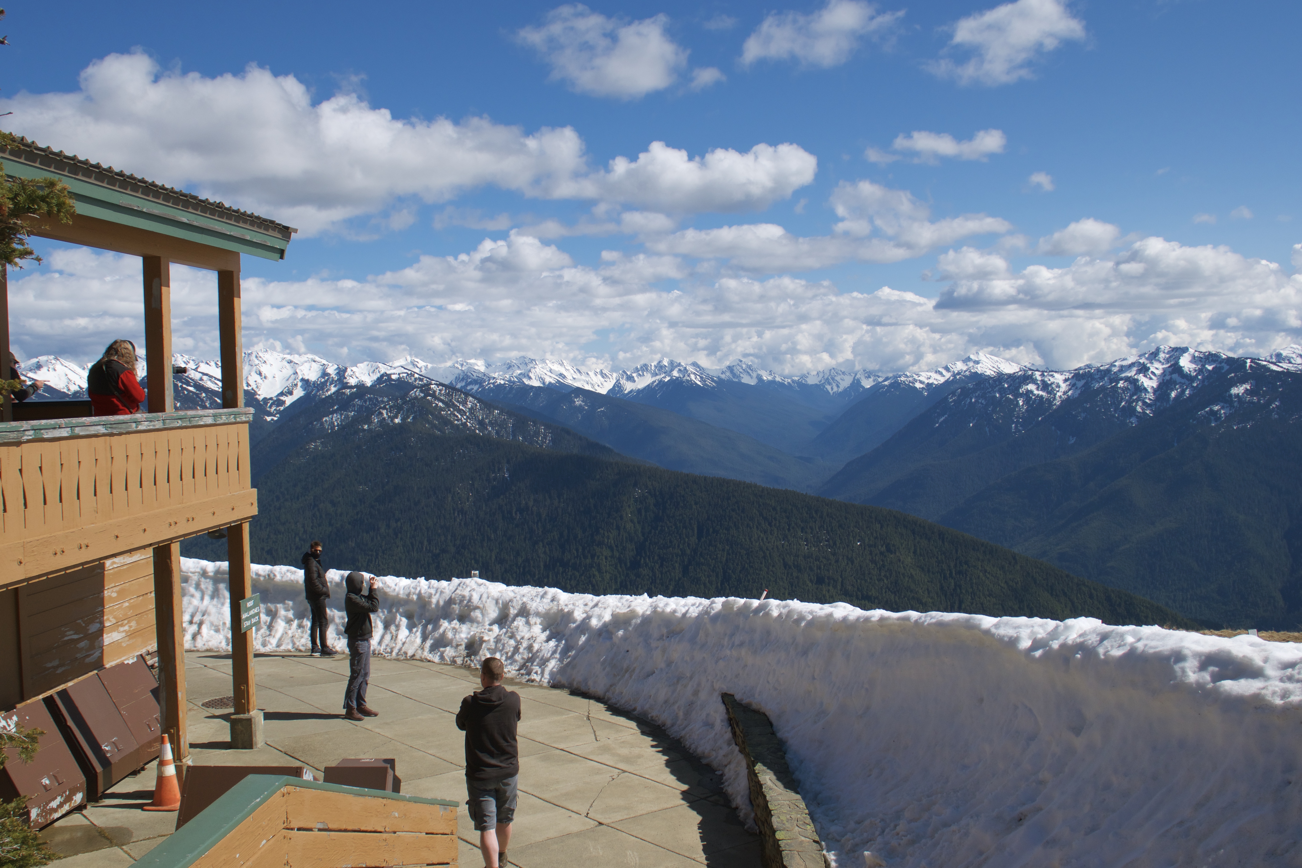
By the time we’d set up camp it was mid-afternoon, still sunny and mild. The forecast called for clouds rolling in later in the day and hanging out for several days after that. I wished we could do the Hurricane Hill hike that day instead of the next, but it’s almost always a bad idea to start a climb in the afternoon in the mountains. We decided to just drive up to the Hurricane Ridge Visitor Center to check out the views from there, since it might be our last chance to see them while the visibility was still good.
The drive up was quite a lot farther than we expected. Port Angeles is of course at sea level; our campground was a little higher at 1771 ft elevation. Hurricane Ridge Visitor Center sits up at 5242 ft, at the top end of a steep and winding road.
The parking lot was clear but surrounded by feet of snow.
The road to our trailhead was also clear, but still closed to vehicles and unlikely to open in the next few days.
None of us really wanted to do the drive again in the morning. We asked a ranger what our chances were of completing the Hurricane Hill hike before the clouds rolled in that afternoon. He said the weather looked pretty stable and he saw no reason why we shouldn’t give it a try, as long as we were prepared to turn back if the situation changed.
By unanimous agreement, we immediately girded our loins for the ascent.
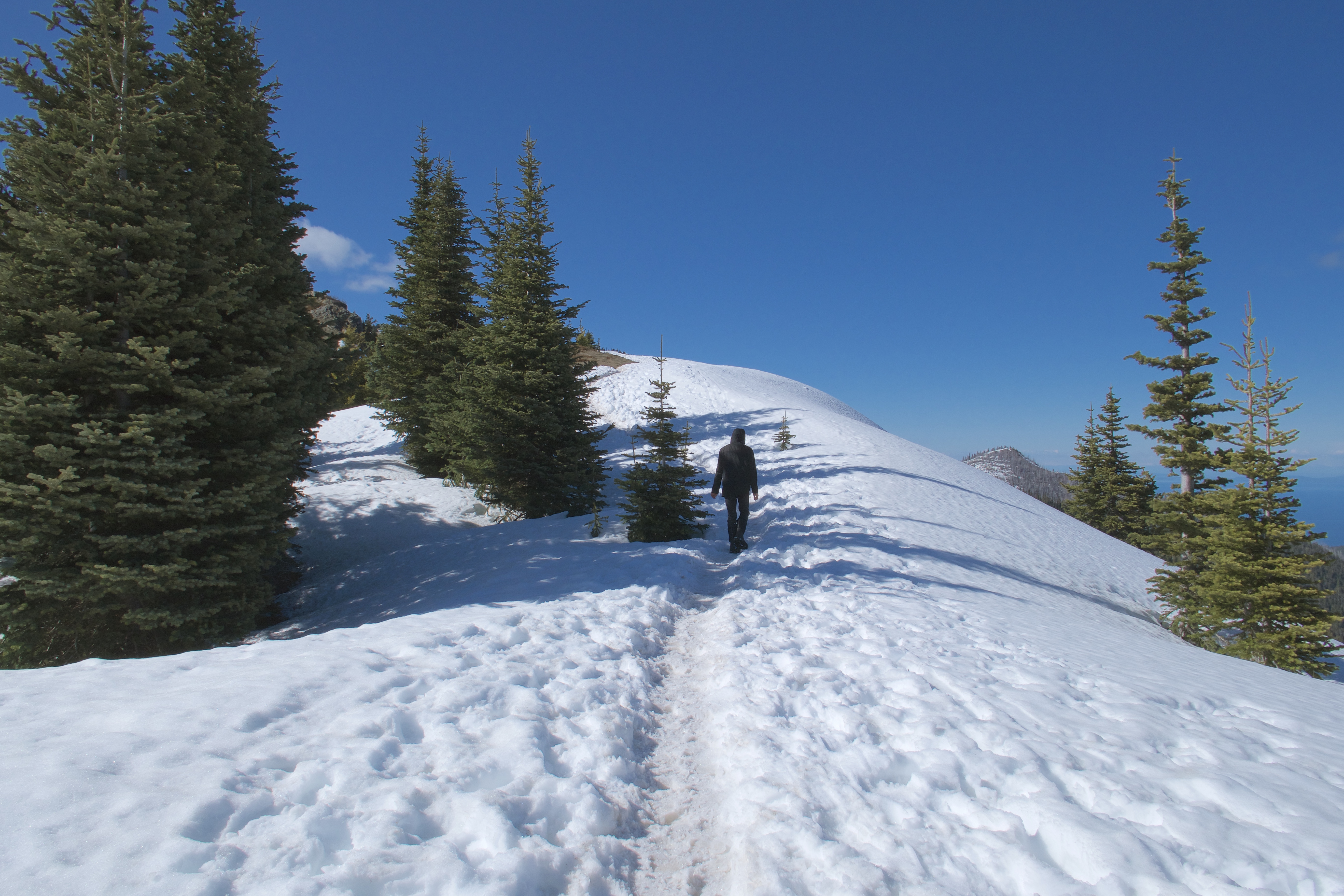
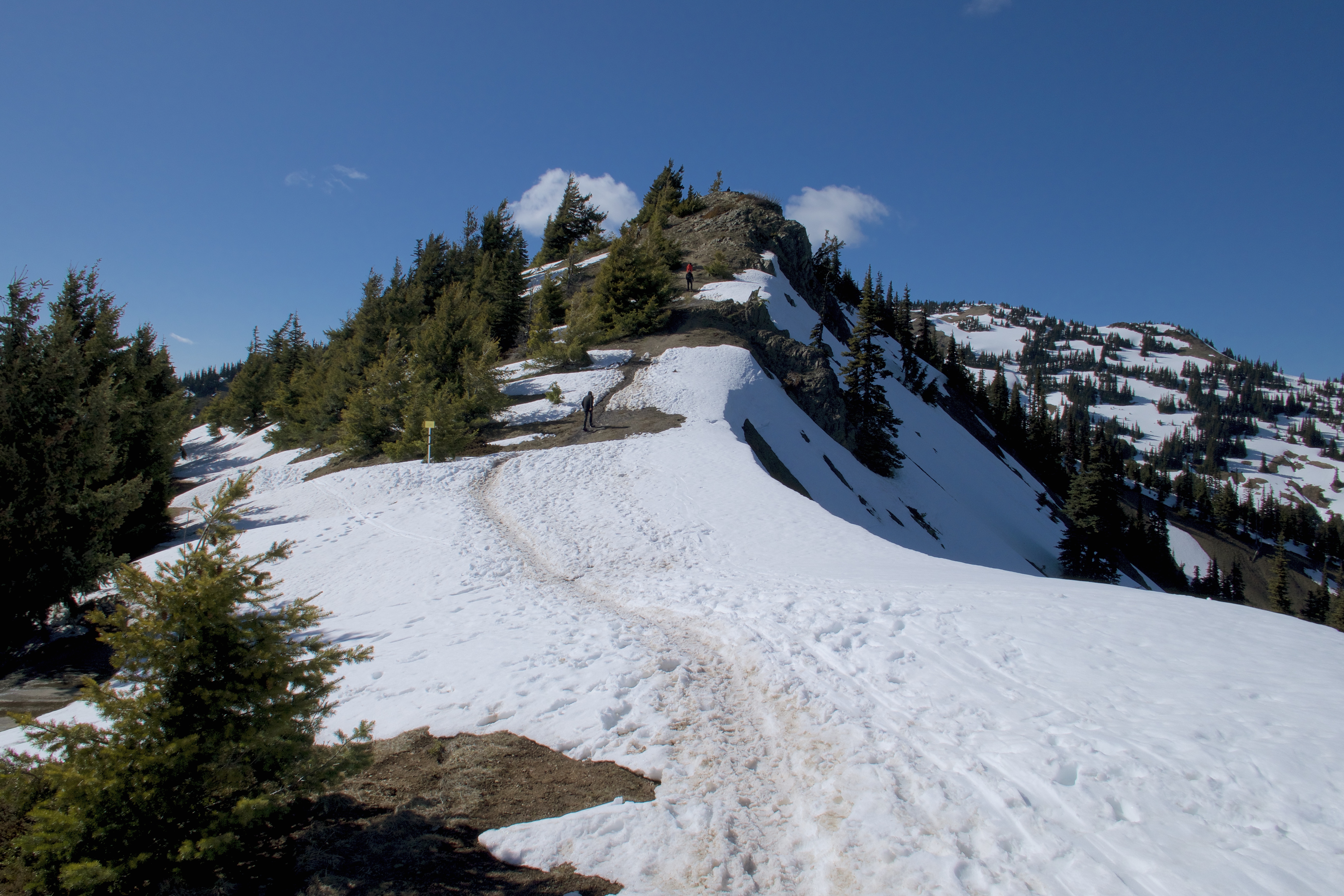
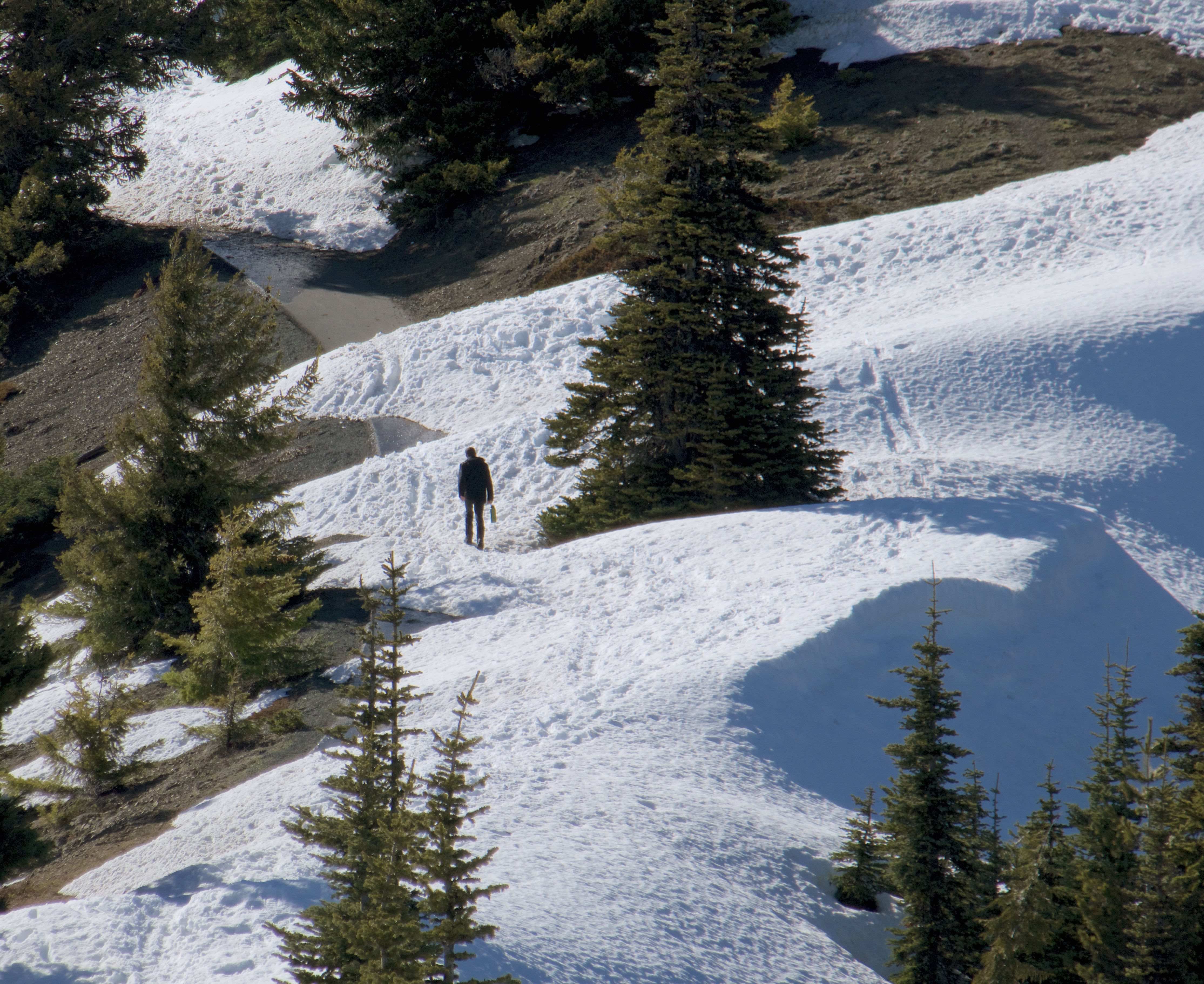
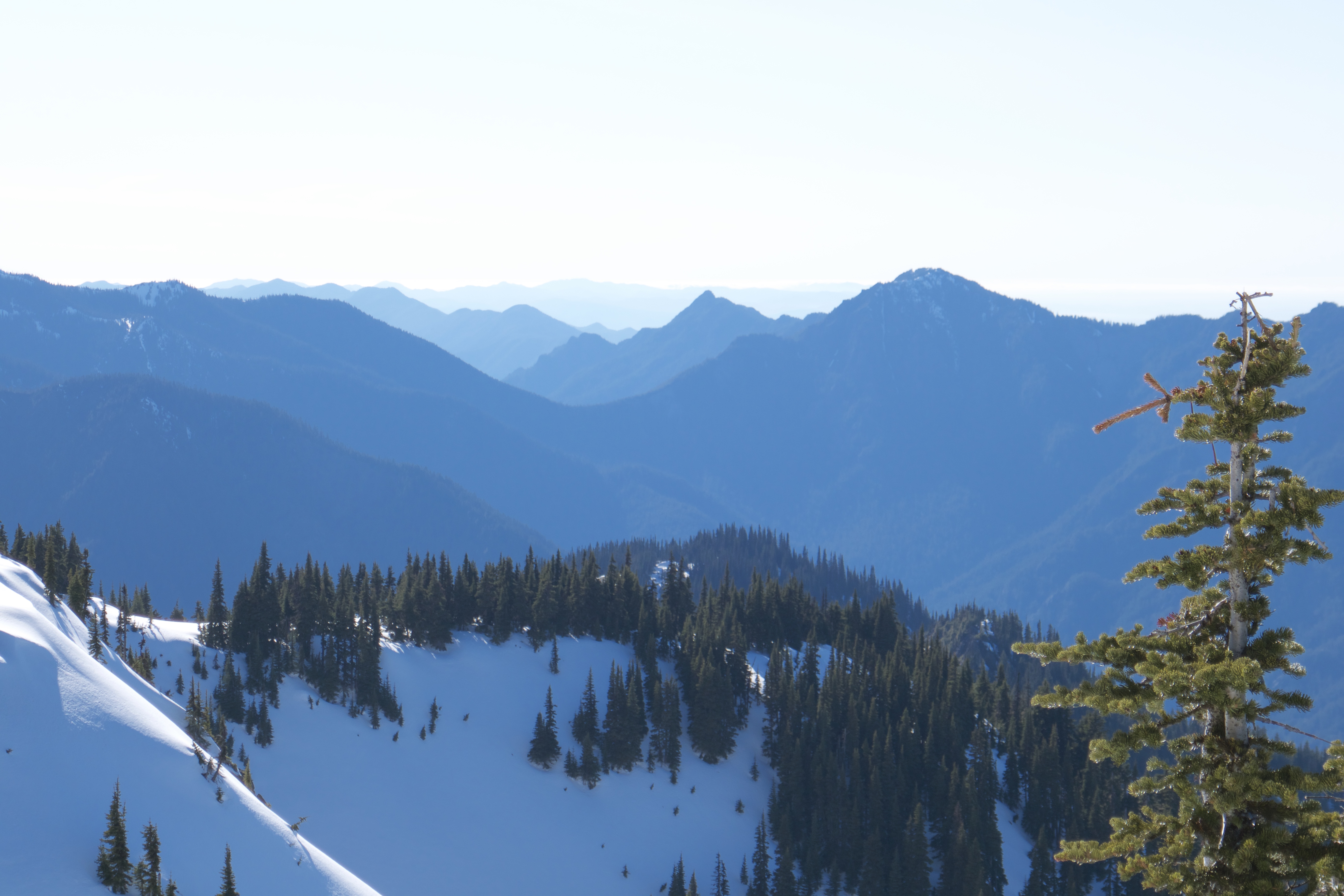
The walk to the trailhead is about a mile and a half of paved, gentle climb. In the spots where the snow borders weren’t too high to see over, the views were gorgeous.
The trail itself is another mile and a half, much steeper, and mostly buried in snow when we were there. But since it follows a gusty ridgeline the snow wasn’t as deep as on the lower slopes, and it got enough foot traffic to pack down nice and solid. Crampons would have been nice, but we managed fine in just boots.
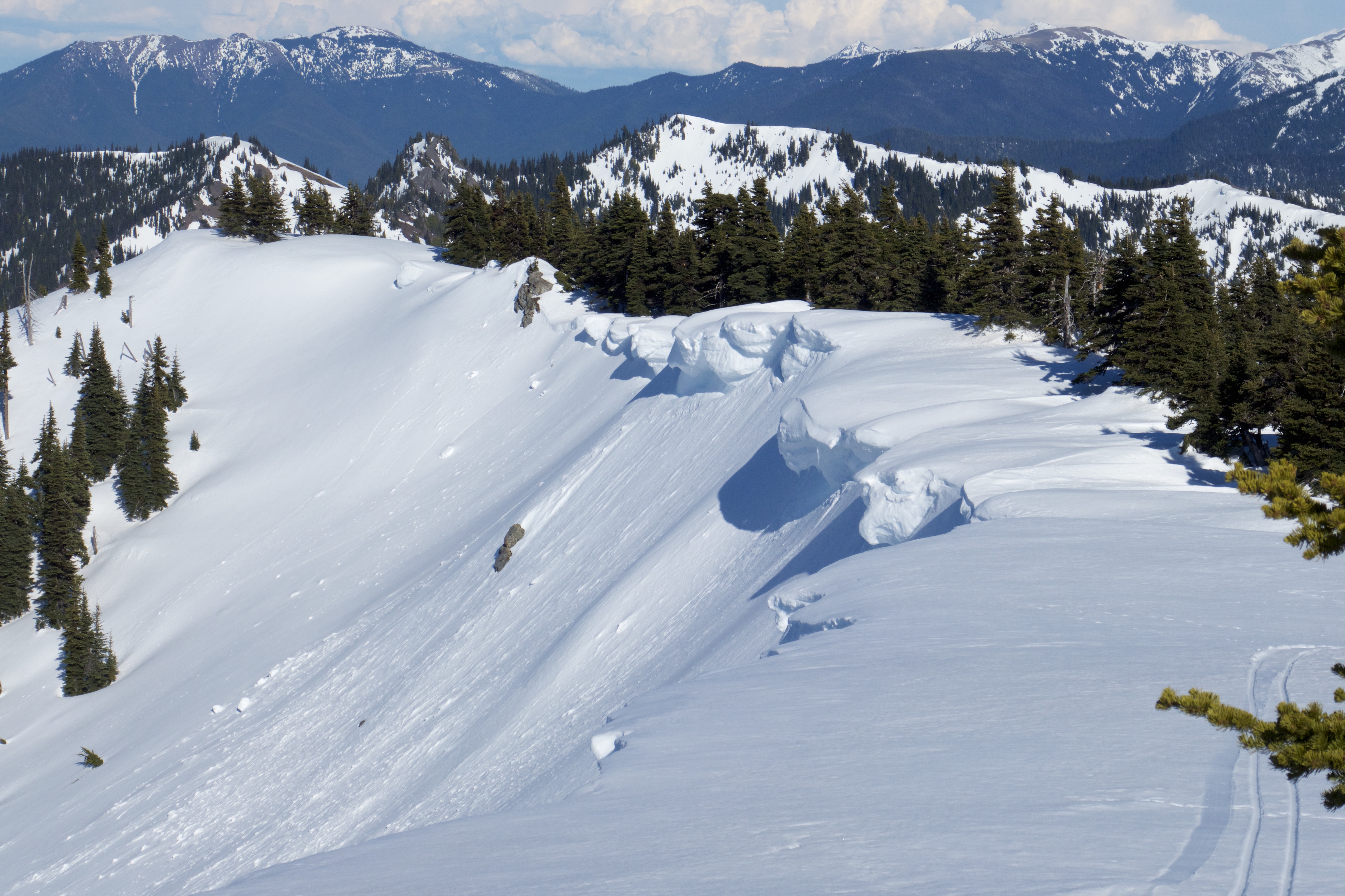
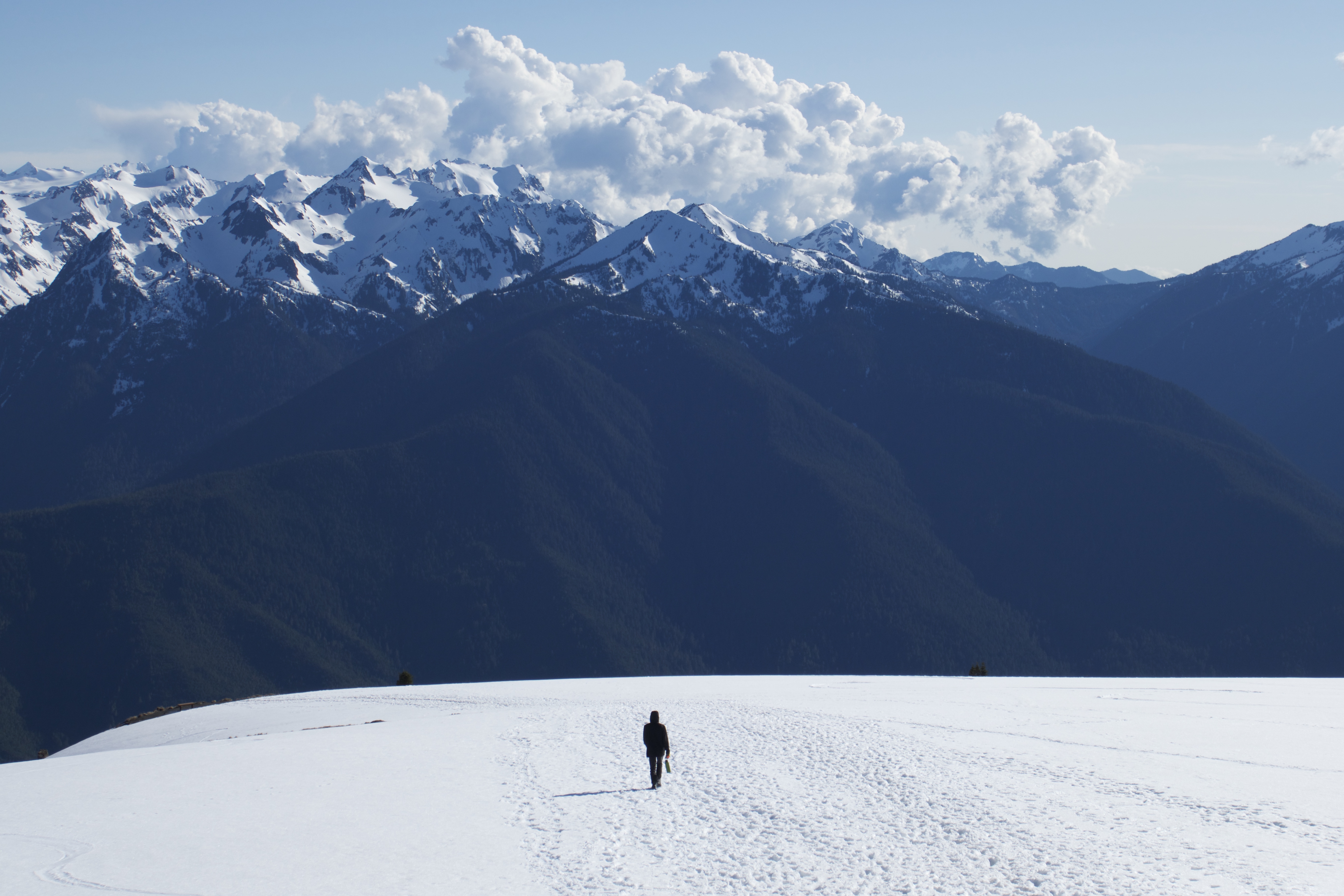
The views continued to be gorgeous.
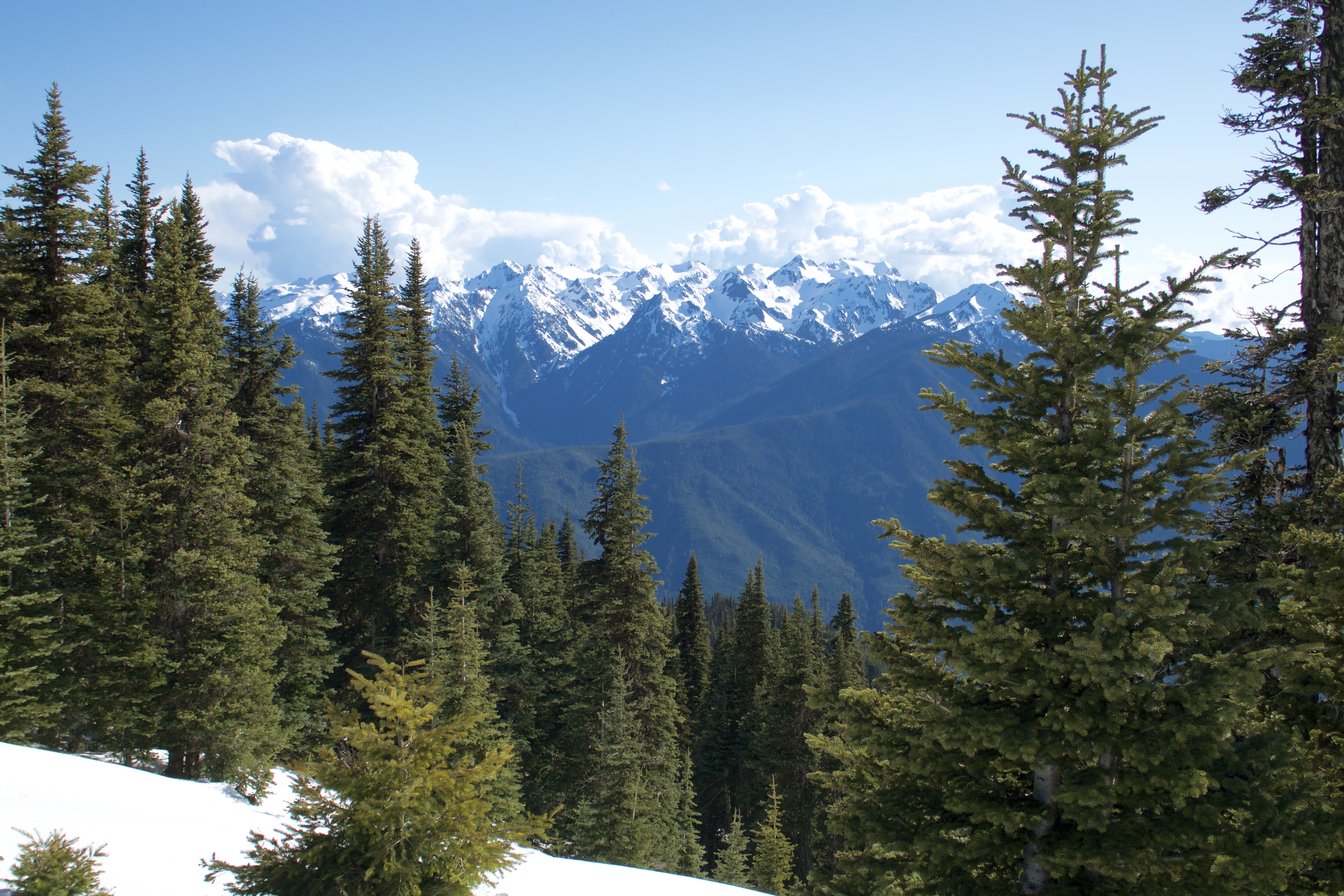
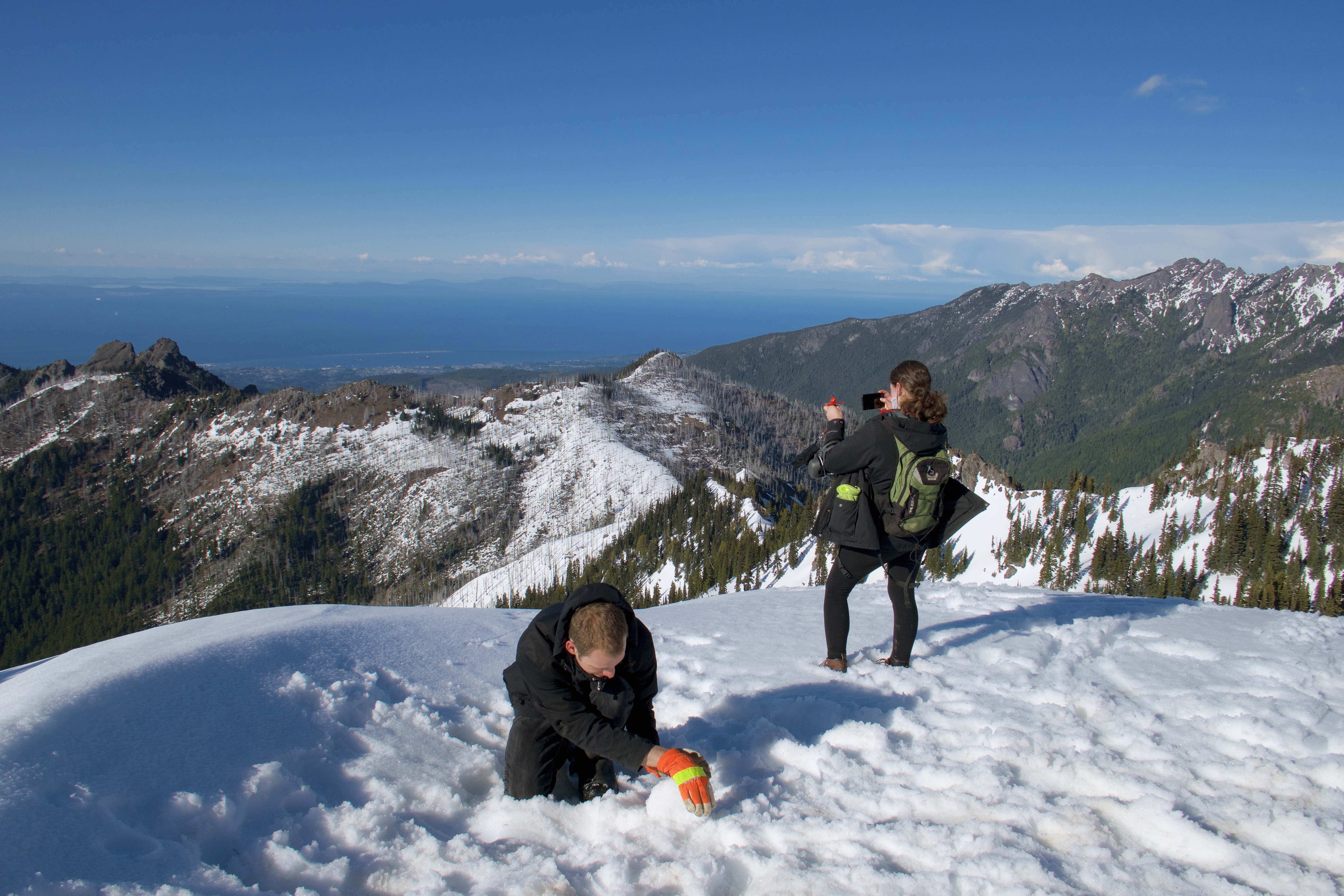
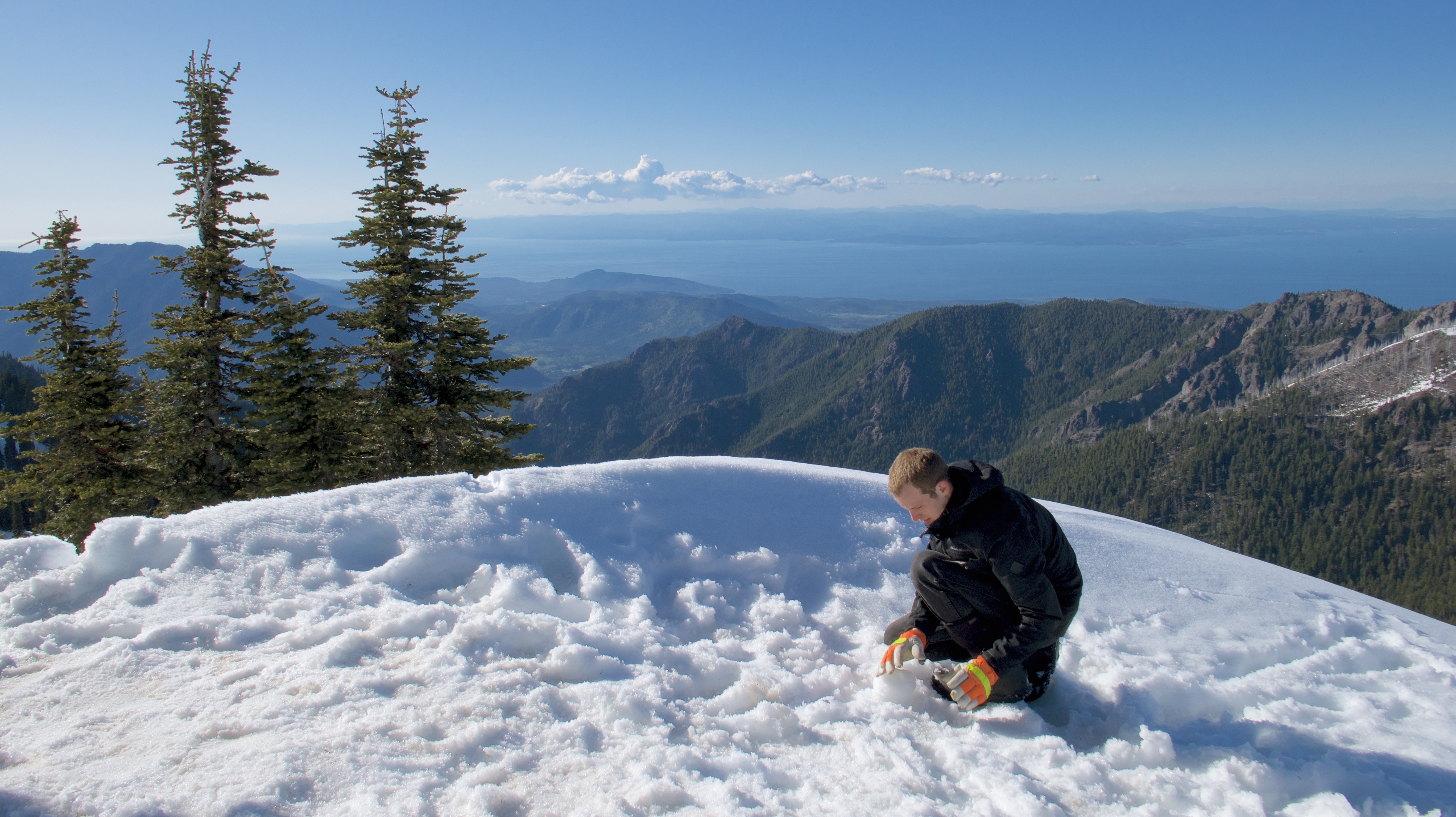
But the top of Hurricane Hill is the real payoff. It’s breathtaking. You can see Port Angeles and across the Salish Sea to British Columbia.
One of those peaks behind me is Mount Olympus, but I never did figure out which one.
Altogether about six miles round-trip. Perfect weather from beginning to end.
I think tourists must be feeding the local wildlife. This little birb came down and cheeped at me like a hungry hatchling.
When I didn’t give him anything he flew away with a look of disgust like I’d wasted his time.
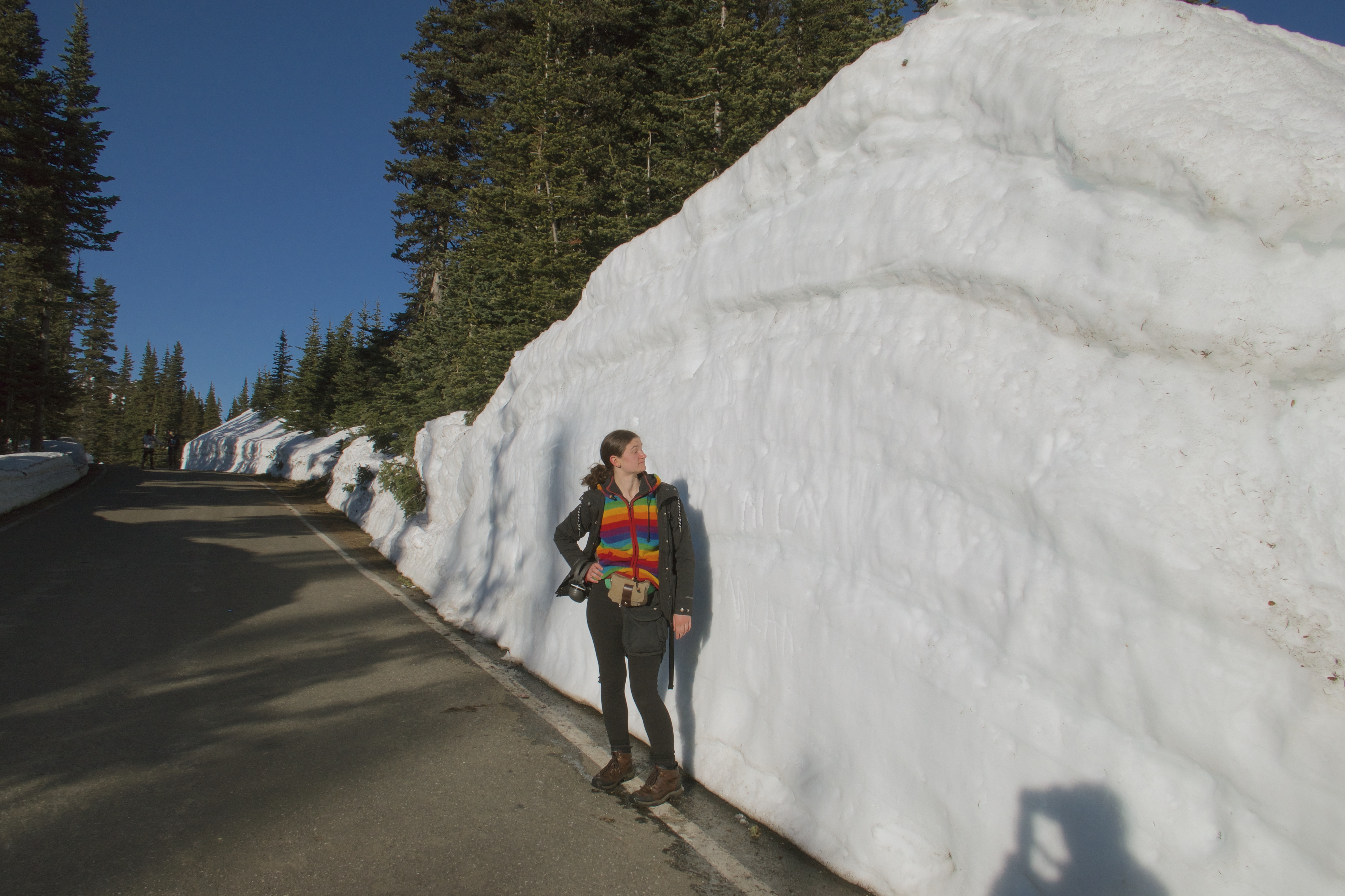
Snowdrifts along the roadside:
The visitor center was closed by the time we got back to the car. We had been in such a hurry to start the hike, we hadn’t even gotten our national park passport stamp. But there are several other visitor centers in the park, so we weren’t worried about it.
We drove all the way back down to Port Angeles and picked up two pizzas from a nice little artisan place right on the waterfront.
We ate the pizzas at our campsite (but not in our tent, because that’s how you get bears) and turned in for the night. And were reminded that our nice little SunDome is a summer tent and does nothing to keep out the cold. Luckily we had brought warm jammies and more blankets than even I had thought we would need.
And that was our first day in Olympic National Park. More to come!