
The plan was simple: Get off work the Friday afternoon of Veterans Day weekend, load up the car, take a nap, then drive eight hours northeast to Guadalupe Mountains National Park. Arrive around sunrise. Spend Saturday adjusting to the 5,700+ ft elevation and enjoy a brilliant show of fall color on the Devil’s Hall trail. On Sunday, climb to the summit of Guadalupe Peak, the highest point in Texas at 8,751 feet above sea level. Drive home on Monday.
Guadalupe Mountains National Park is intentionally designed to be remote and relatively untrammeled, to protect the ancient, tiny (and shrinking) pockets of forest sheltered within its canyons. There are no paved roads through the park; the only way to explore it is on foot, or on horseback in some areas. There is no camp store other than the Visitor Center gift shop, so if you run out of food or ice or other necessary supplies, the nearest stores are in White’s City or Carlsbad, both in New Mexico and a minimum of 30 minutes away. There is no electricity or showers at the two frontcountry campgrounds, and no amenities at all in any of the backcountry campsites. You cannot make a reservation to camp in the park, all sites are first-come-first-served. If the frontcountry campsites were all full when we arrived, we would hang out till the 11-am checkout time, grab the first site that was vacated and set up camp before heading out to Devil’s Hall.
Since buying ice or food is not an option at GMNP, we replaced our ancient, cracked cooler with a larger and better-insulated model. The park is surrounded by oil rigs and fracking wells, which in our experience usually means that the tapwater will taste terrible. We are kind of water snobs and did not want to risk it, so we also picked up a 5-gallon insulated water dispenser. I upgraded my regular waist pack to a daypack, and Luke bought a multi-day pack in case we could not secure a frontcountry spot at all and had to pack into a backcountry site. Our tent is too big to be ideal for backpacking, but dividing its components into three separate bundles, one for each of us, makes it very manageable. Water was our biggest concern, especially since at this point in the planning phase we were sweating through the relentless inferno of a Texas heatwave with no end in sight. Running out of water in the mountains is no joke. We also bought light, packable rain jacket/windbreakers, since mountaintops can be chilly and windy even in summer. If all went according to plan, we would spend our Veterans Day weekend taking in some of the finest Autumn scenery and mountain vistas that Texas has to offer.
Spoiler: All did not go according to plan.
When Elizabeth was a wee bairn, she used to get stressed out when events did not unfold as expected. I used to tell her, “Be the rubber ball, not the glass ball.” The idea is simple enough for a small child to understand. If a glass ball is dropped or thrown, it shatters. But a rubber ball just bounces back and keeps rolling along, undaunted and undamaged. The glass ball is fragile, the rubber ball is nearly indestructible. “Be the rubber ball,” I would urge little Elizabeth when life got too unpredictable for her comfort.
The entire Guadalupe Peak expedition was very much a rubber ball sort of undertaking.
The first twist came about two weeks before the big weekend, when an unseasonal cold front loomed unexpectedly into the forecast. Suddenly we were planning for frosty conditions instead of worrying about keeping our food cold. No problem. I picked up a couple of merino base-layer tops, one midweight and one heavyweight, and a small camp stove for making hot drinks and heating meals. We decided to leave the insulated water dispenser at home, since icewater probably wouldn’t be high on our list of necessities. We brought all our hydration in packable jugs and insulated flasks. Packing up to a backcountry campground was no longer an option, since we didn’t want to spend another several hundred dollars on packable winter bedding. But at this point we were 100% committed to climbing that mountain, so I figured if all else failed we would find a nearby motel. Luckily all of the forecasts said that Sunday would be the clearest day of the weekend, so our basic plan was unchanged.
The Monday before we were due to leave, my supervisor said that he was mistaken about Veterans Day being a paid holiday at our company. But he was sympathetic to my situation, and approved my request for an unpaid personal day off. No problem.
The next day, Luke’s boss announced that there was a big task coming in, and everyone would be required to work on Veterans Day. No getting out of it.
I chewed over all of our options, and finally decided that I would drive home Sunday night instead of Monday. Luke could sleep on the way home and still make it to work on Monday morning, and I could spend Monday recovering at home. Nooo problem.
It was either Thursday night or Friday morning when the forecast suddenly changed. Still cold, but now Saturday would be the only clear day of the weekend. Sunday would be completely overcast.
For us, climbing mountains is mostly about the views. There is little point in summiting a peak if you cannot see anything from the top. We would just have to go up on Saturday, and deal with the altitude change and sleep deprivation as best we could. Noooo problem.
Friday in Austin was miserably cold and drizzly. After work we packed up, dressed in our warmest layers and tried rather unsuccessfully to nap. I think I dozed off for maybe an hour. It would have to be good enough. I brewed a pot of yerba maté so strong it tasted like coffee, grabbed a jar of dark-chocolate-covered espresso beans, and off we went.
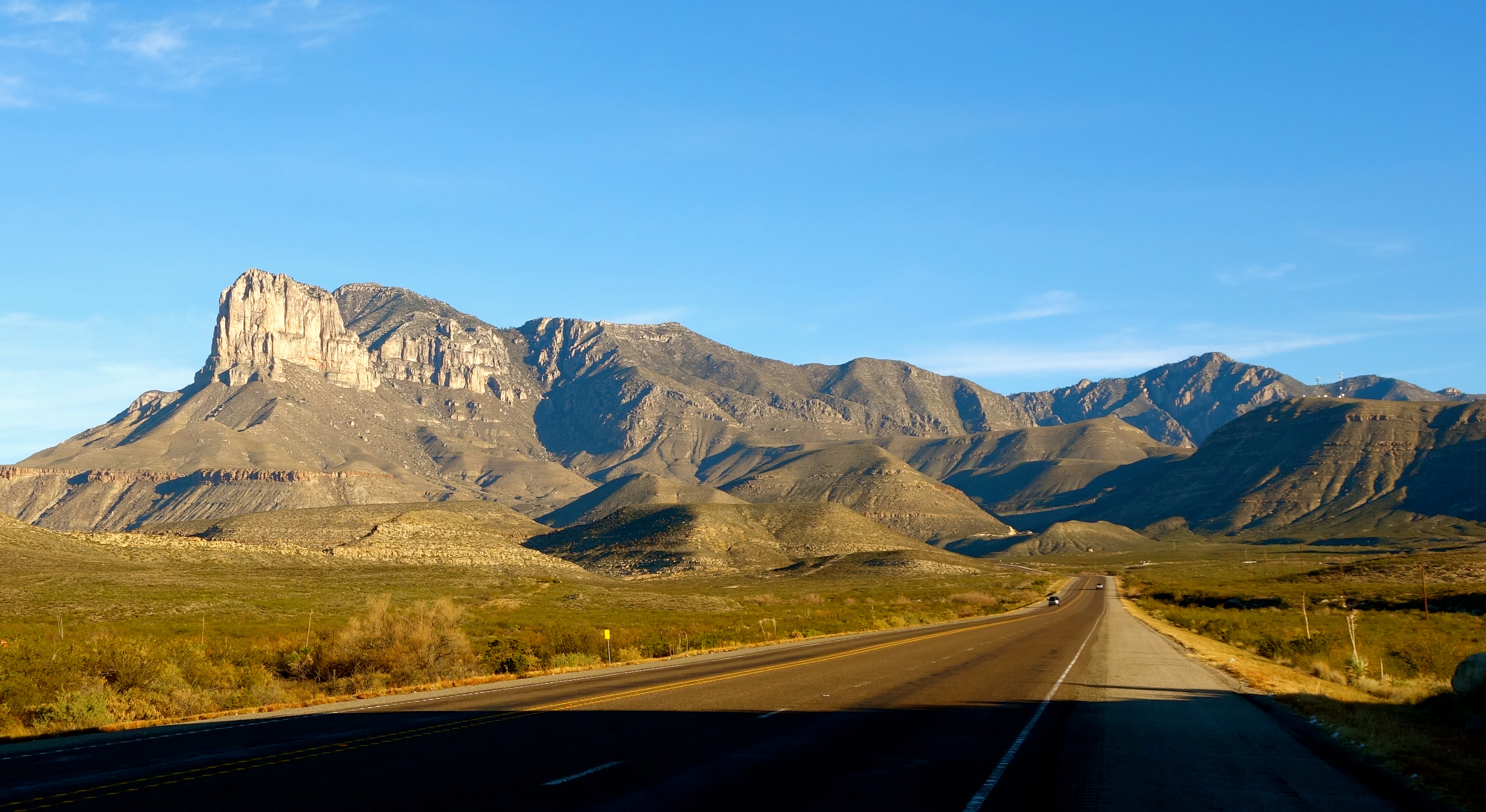
Eight hours later, the sun was just rising as the Guadalupe Mountains came into view.

The day was gloriously sunny and mild. We could not have gotten better weather for this hike.
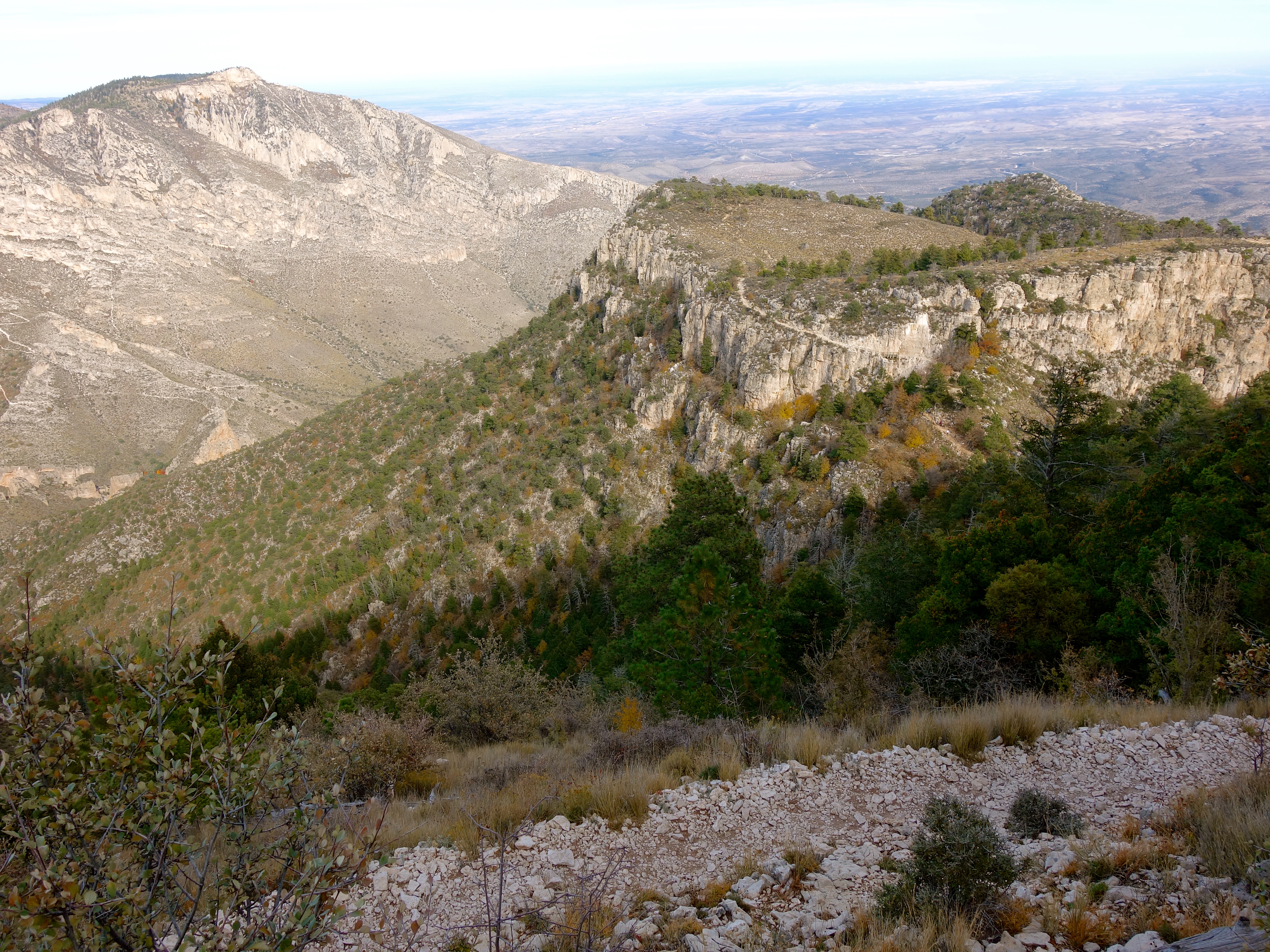
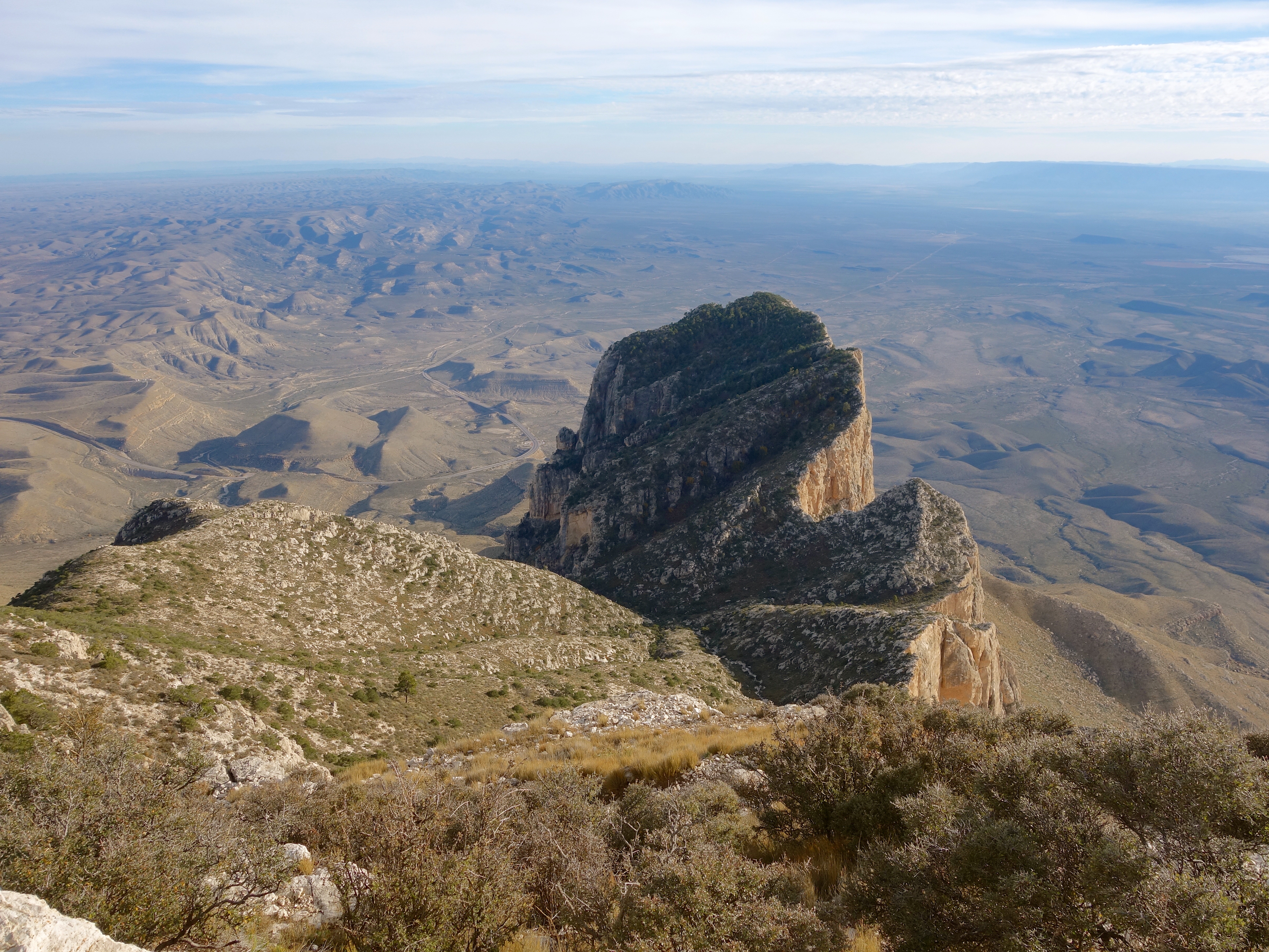
The white rocky outcropping in the picture below is El Capitan, and the rounded summit just behind it is Guadalupe Peak.
The park was already teeming with guests, mostly hikers who had come to see the fall colors in McKittrick Canyon and Devil’s Hall. The frontcountry campground was full, and we could not wait around to see if a spot would open up. Guadalupe Peak Trail is a 6-to-8-hour round-trip journey, and we’re not fans of hiking unfamiliar trails after dark. We found a restroom, exchanged our now-too-warm clothing for lighter layers, and then I asked a park ranger at the Visitor Center if there were any other frontcountry camping options in the area.
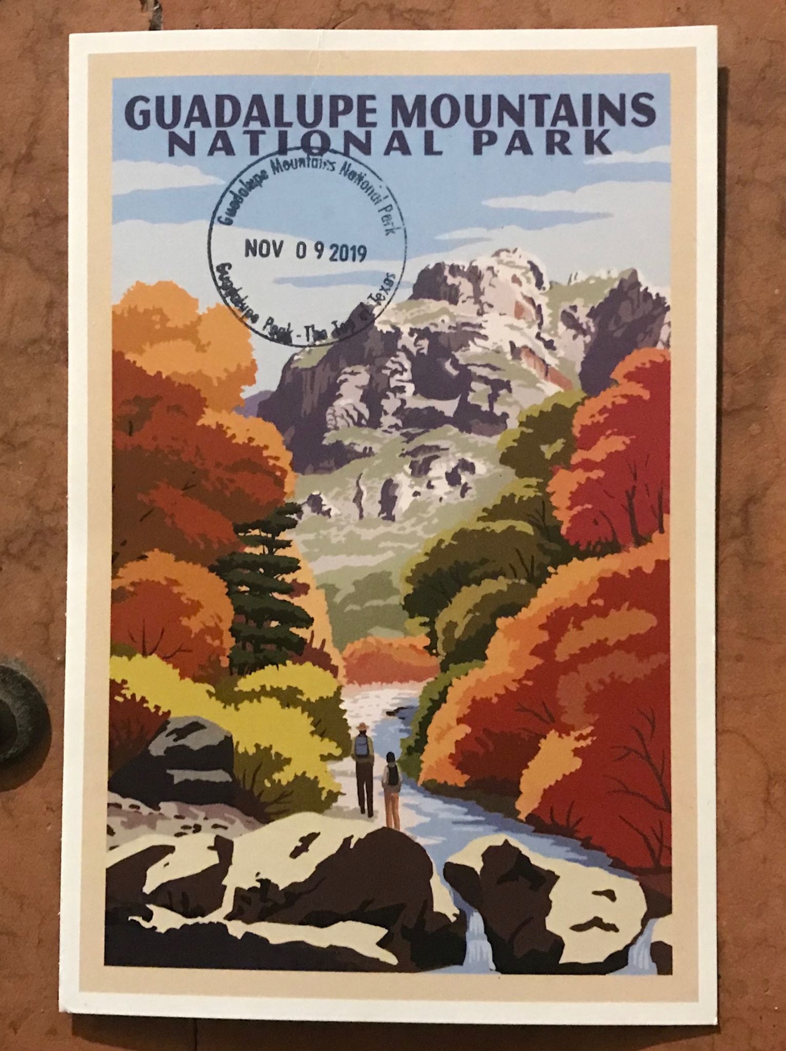
Quick tangent! I just recently learned about the National Park “passport” stamps. If I had known about them sooner, we could have started our collection at Carlsbad Caverns and the Grand Canyon. There are six Guadalupe Mountains stamps to choose from, one for each of the park’s most popular destinations. I bought a pretty postcard at the Visitor Center, found the Guadalupe Peak stamp and officially started our collection.
Anyway, the park ranger said there was a free, very primitive campground just up the road. We could set up our tent there and then park in the day-use parking lot next to the Visitor Center. “But it will fill up today,” she warned me. I thought she was talking about the campground, but in retrospect she must have been talking about the parking lot. If I had that moment to do over again, I would have snagged a spot in the parking lot, headed straight up the mountain and let the camping situation sort itself out later. But at the time that seemed like a bad idea, so off we went to secure a spot in the primitive campground.
“Just up the road” turned out to be 27 miles up the road and across the border into New Mexico. And the “primitive campground” turned out to be a rocky parking lot next to a field. There were a handful of RVs parked around the edges of the lot, and two tents already set up at the edge of the field. I’m like 85% sure that one of the tents was a homeless camp. There was an unleashed pit bull wandering around that one. We were already having second thoughts about camping there. But the nearest motel was in Carlsbad, and we just wanted to get on the trail. We set up the tent to hold our spot and drove back to the park.
I had been careful on the drive out to keep our fuel levels above half a tank, but in the final approach to the park there had been no places to fill up. Now, thanks to our 60-mile detour to the “primitive campground,” we no longer had enough fuel to get us to the closest gas station on the route home. At some point we would have to drive to White’s City after all, to fuel up for the drive home. No problem.
Of course, just as we got back to the park entrance, they were closing the gate. All parking lots full. Closest place to park was the Pinery Trailhead turnout off the highway. It meant walking a mile just to get from the car to the Guadalupe Peak trailhead, but you know, no problem. Be the rubber ball.
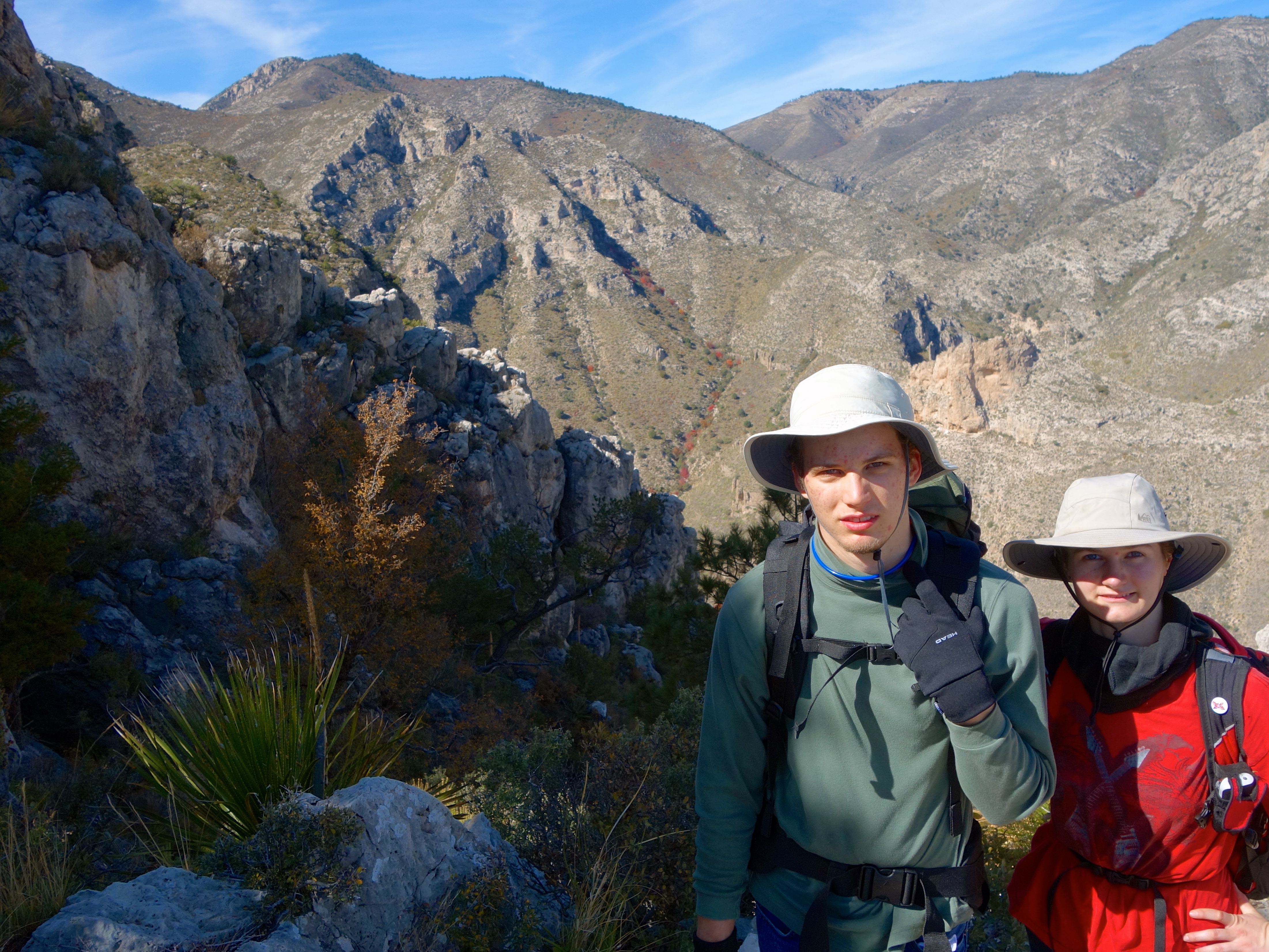
So we parked at the turnout, walked to the trailhead and started up the mountain.
The first section of trail is a series of steep switchbacks up the East slope. You gain a lot of altitude very quickly.
We discovered right away that our climbing muscles have gotten soft in Texas. That initial ascent was brutal.
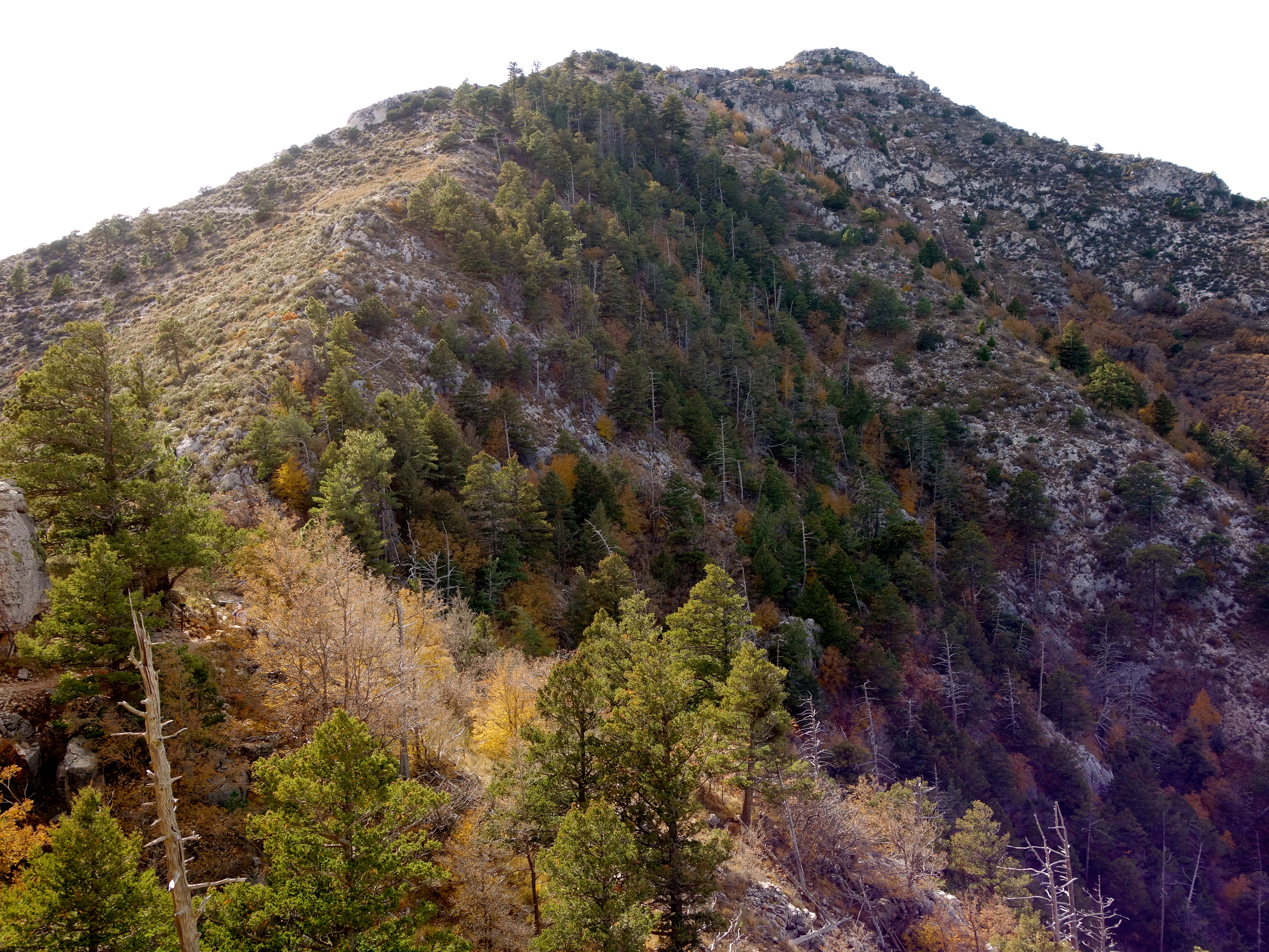
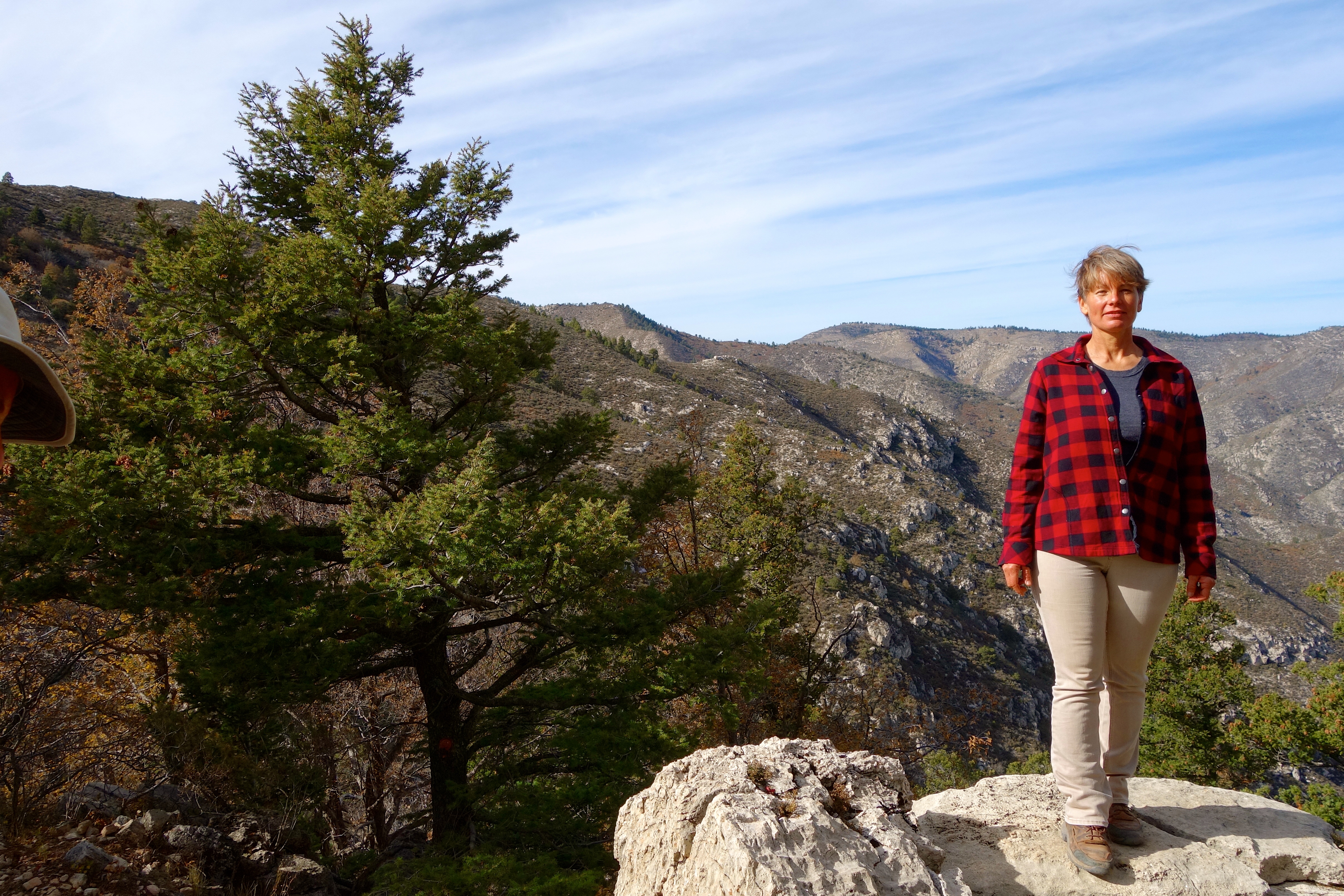
But after about a mile and half, the trail curves around to the North slope and gets less steep and way more scenic.


It’s the prettiest hike I’ve been on since we moved to Texas.

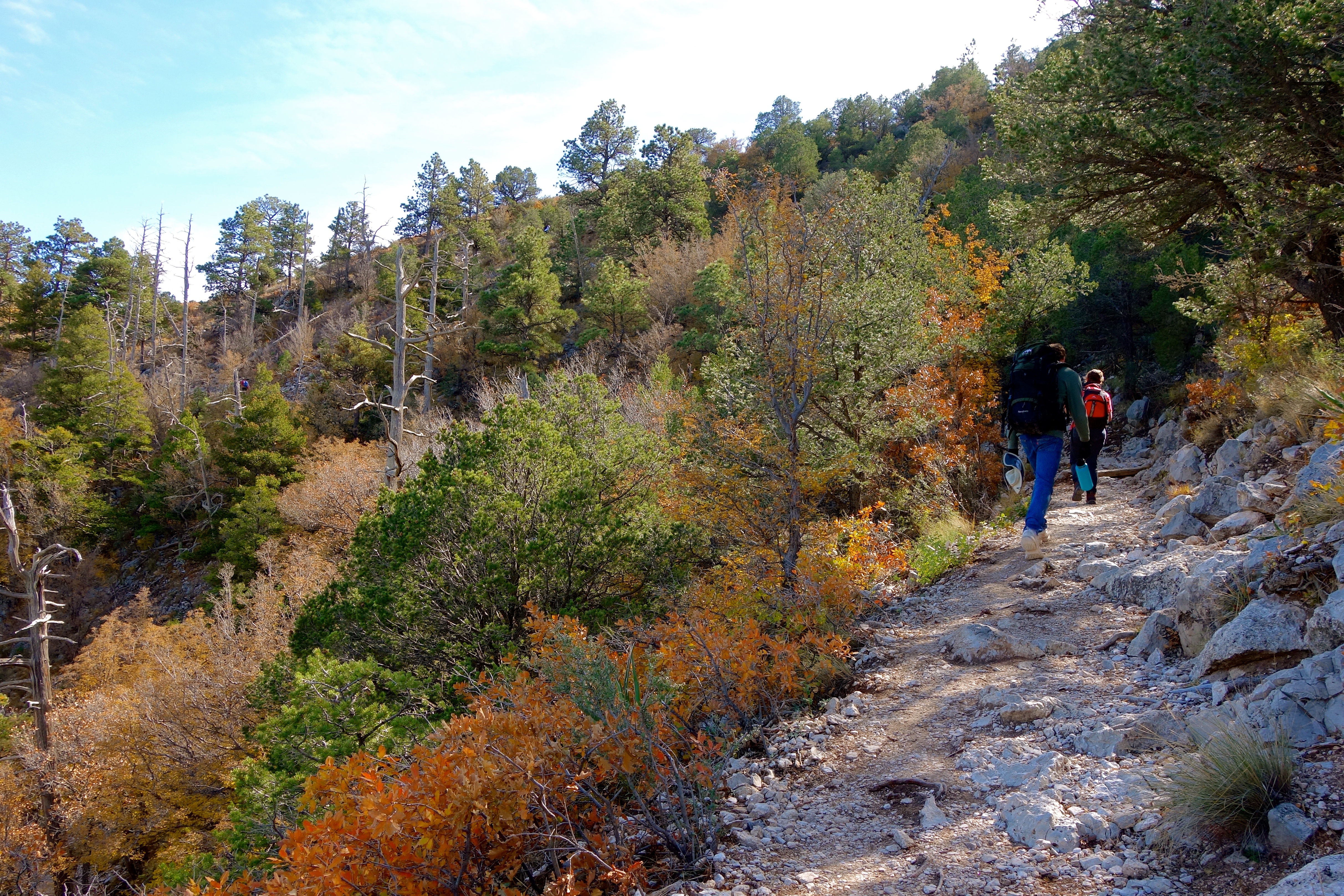
It’s not an easy hike. I don’t recommend attempting the summit unless you’re in reasonably good shape. But any part of the trail above that first 1.5 miles of switchbacks is worth the effort it takes to get there, just for the scenery.
So up we went.
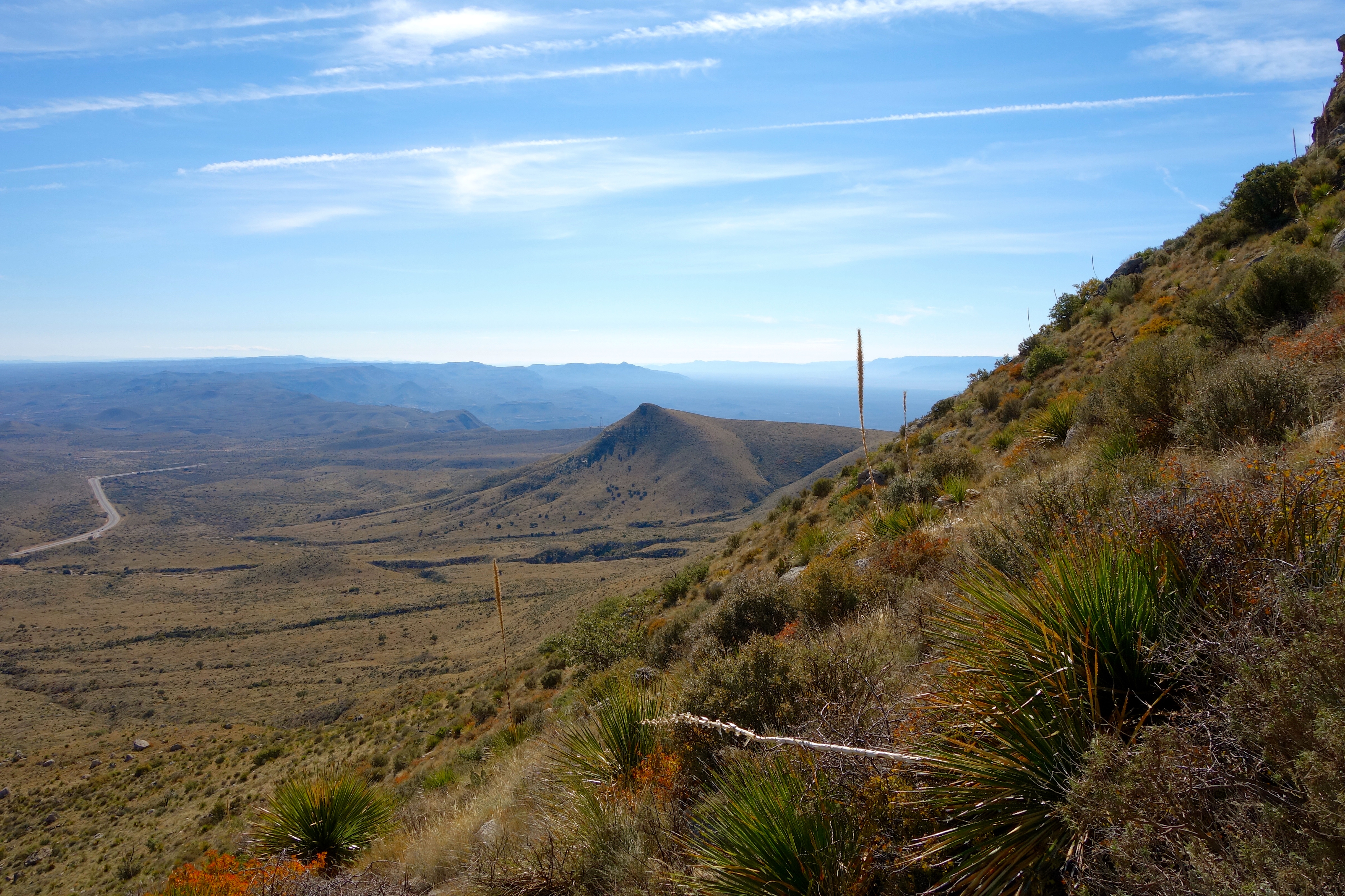
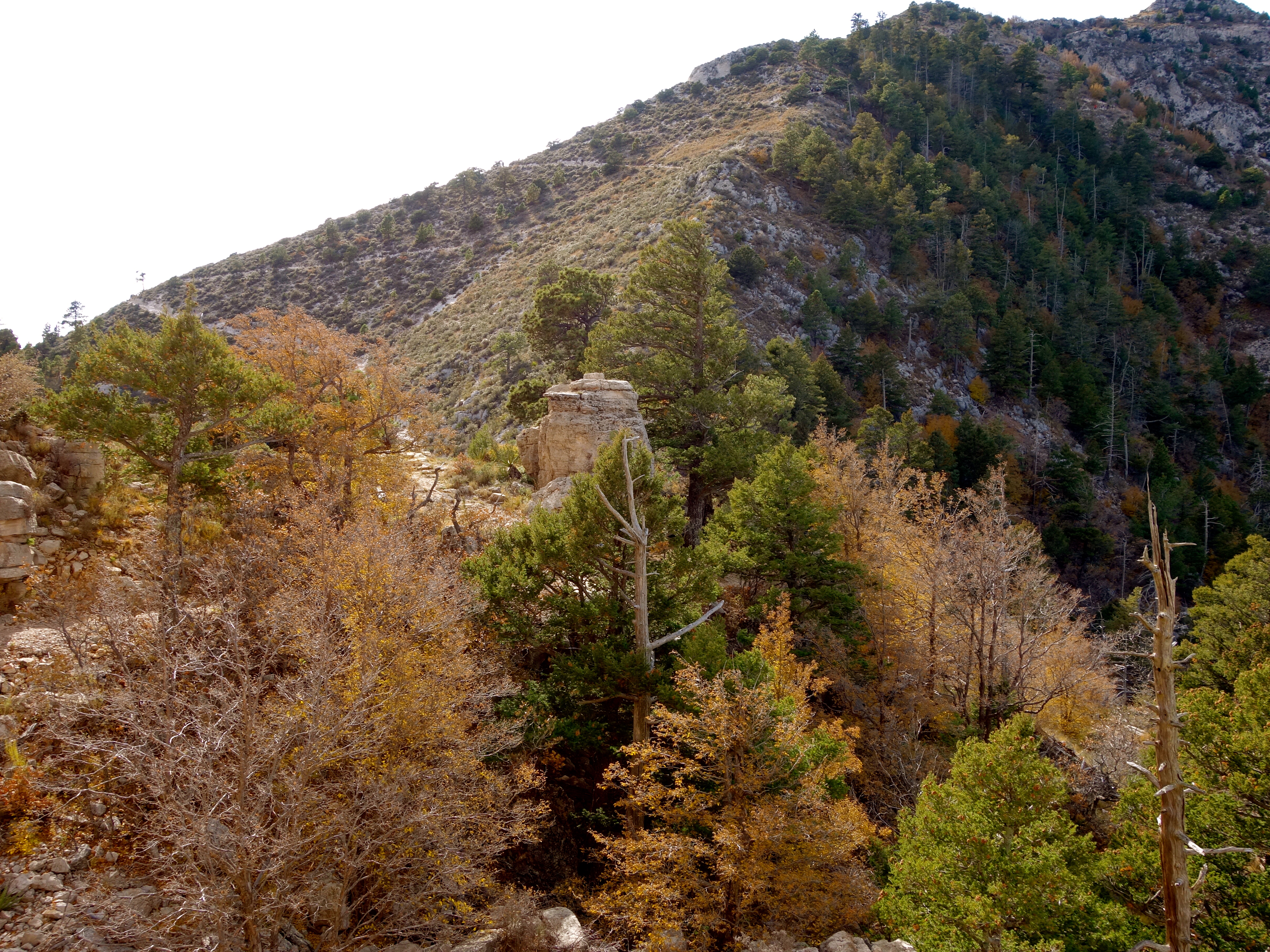
About three miles up, we came to a false summit and the backcountry campground for this trail. I am glad we did not attempt to haul our tent and bedding and a night’s worth of supplies up this mountain. That would have been a serious ordeal.
Beyond the false summit, we could now see the Final Boss:
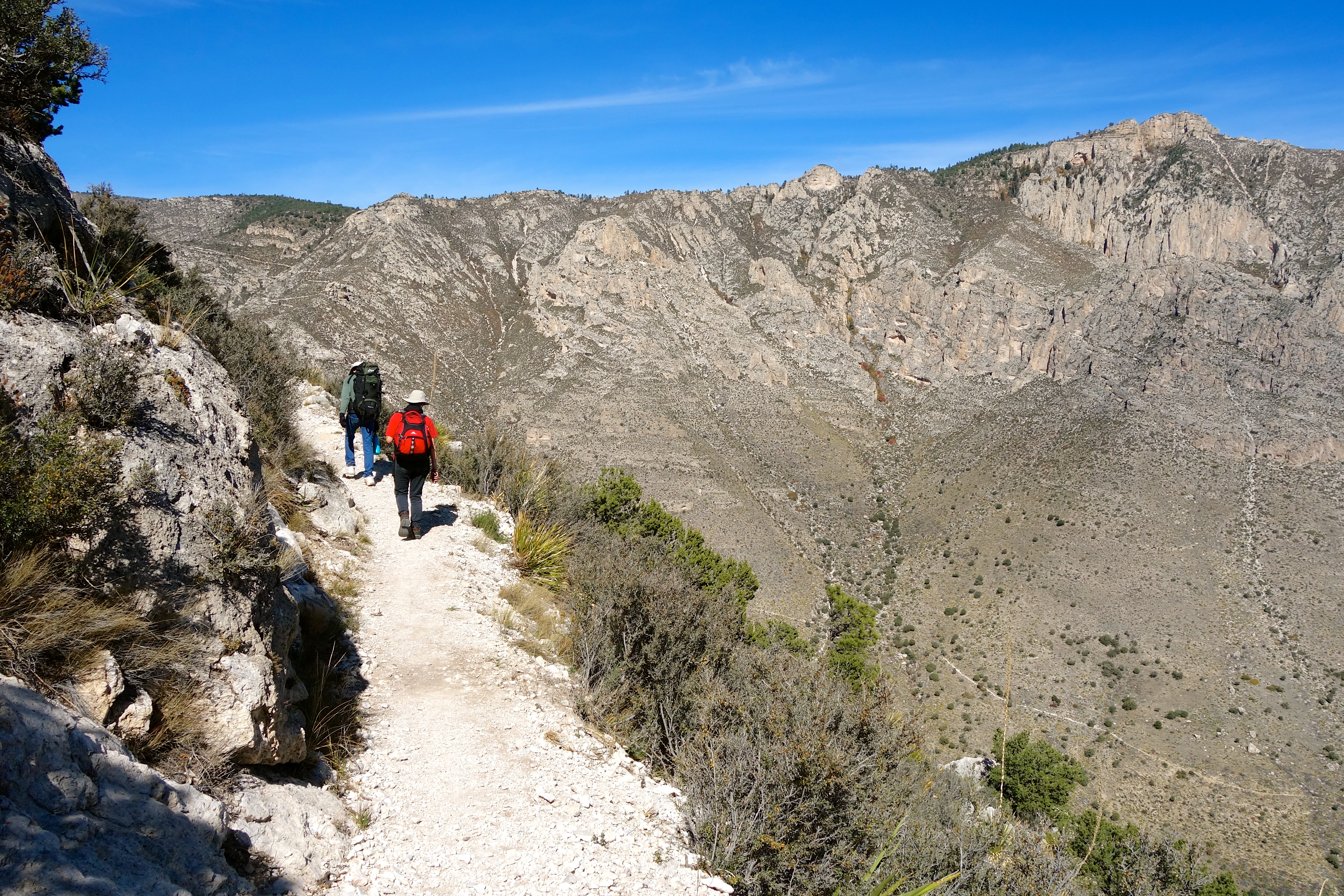
But to get there, we first had to cross a damaged section of trail over a ravine…
…on the highest bridge in Texas.
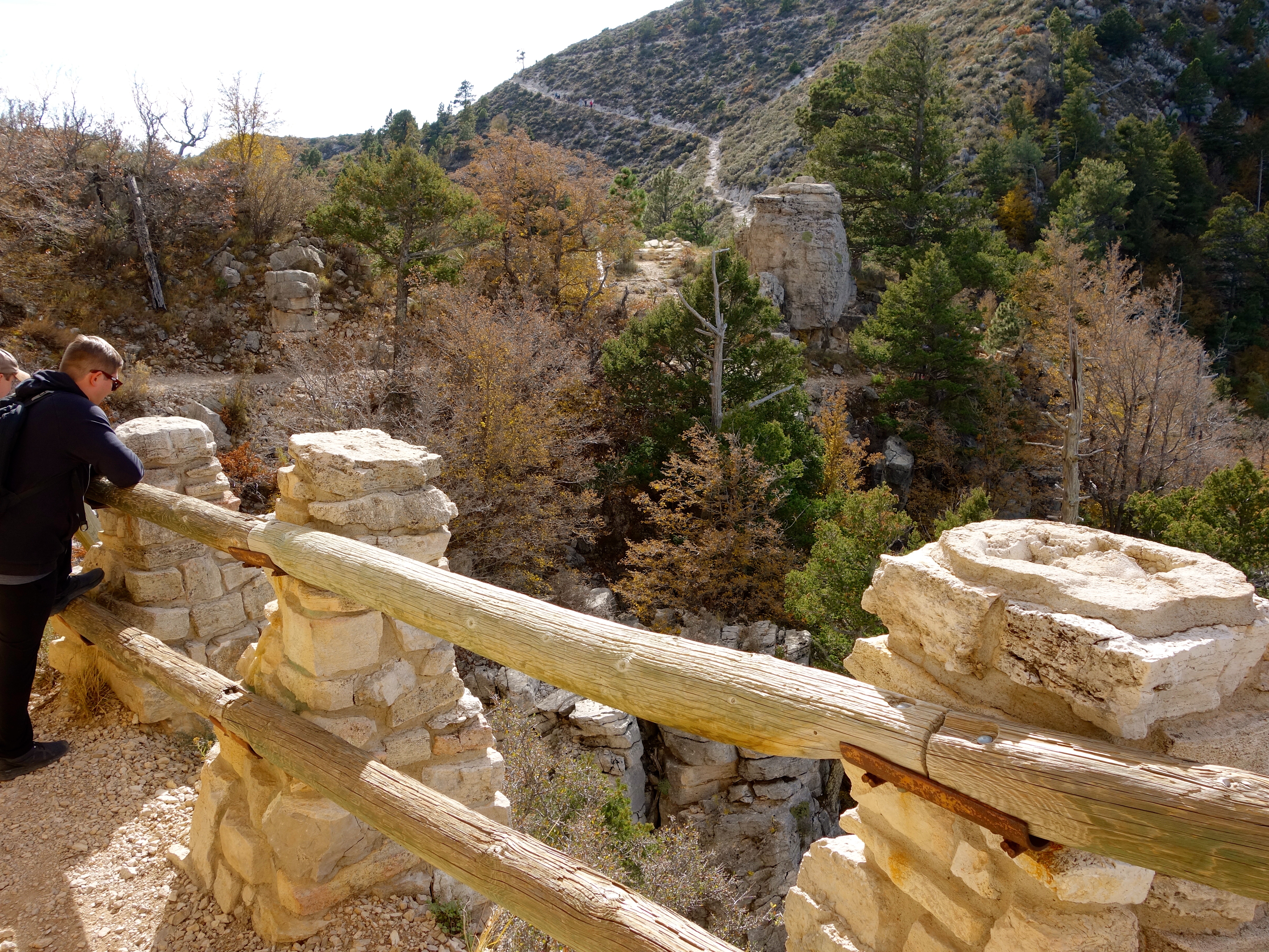
I have a better view of the bridge from the return descent, but I like to keep things in chronological order.
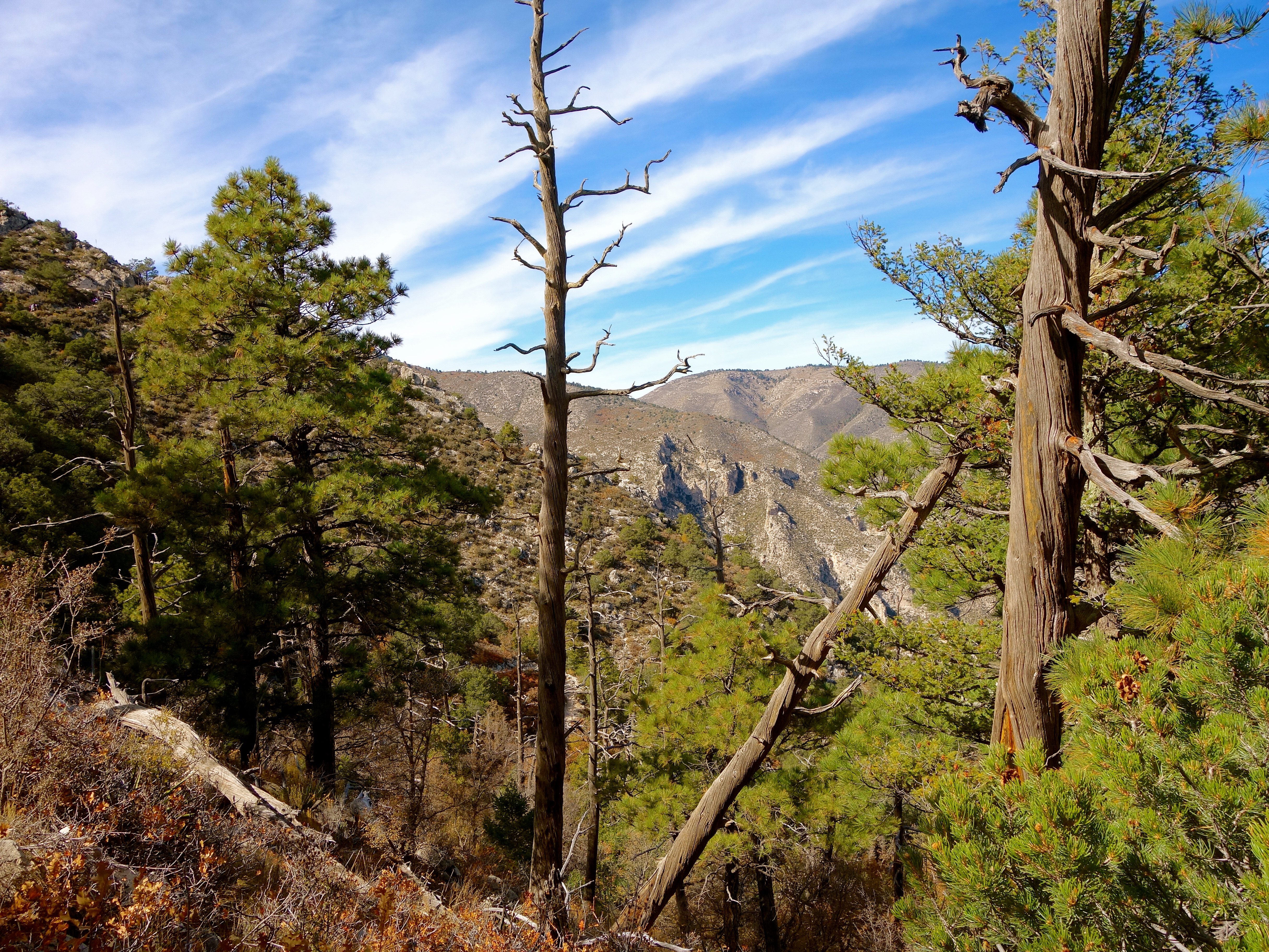
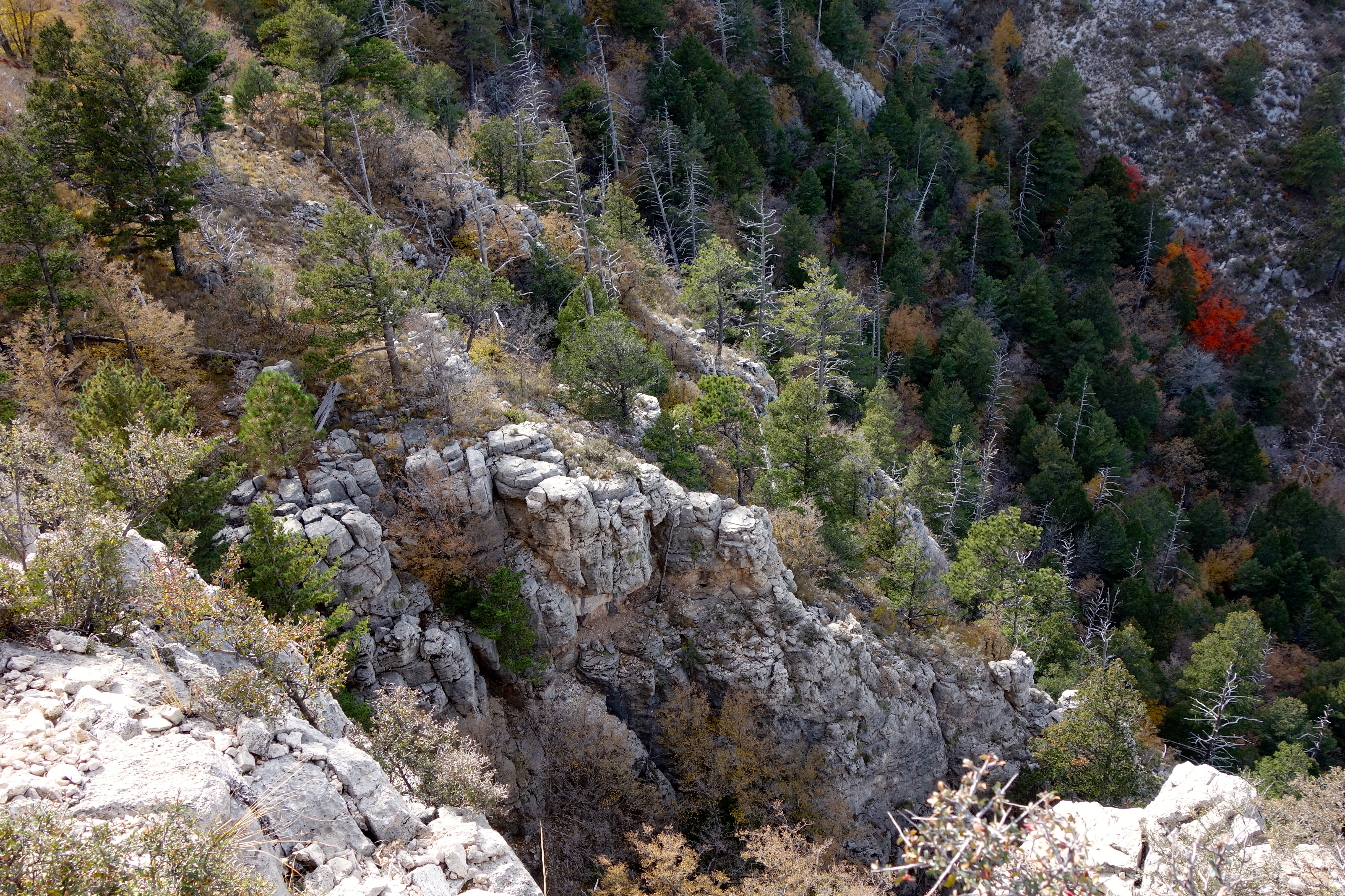
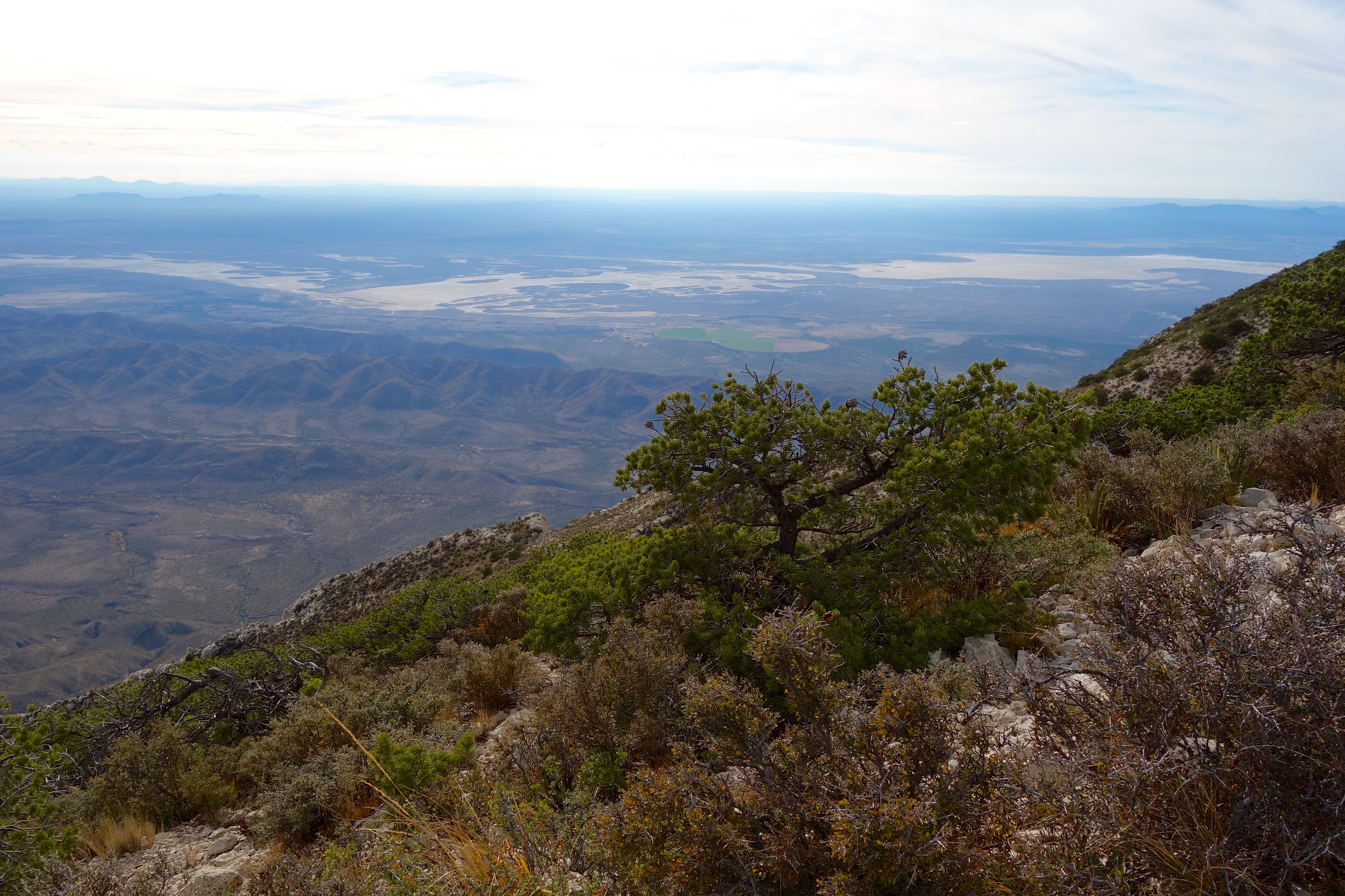
Once we crossed the bridge the trail started to get steep again, but the views kept getting better.
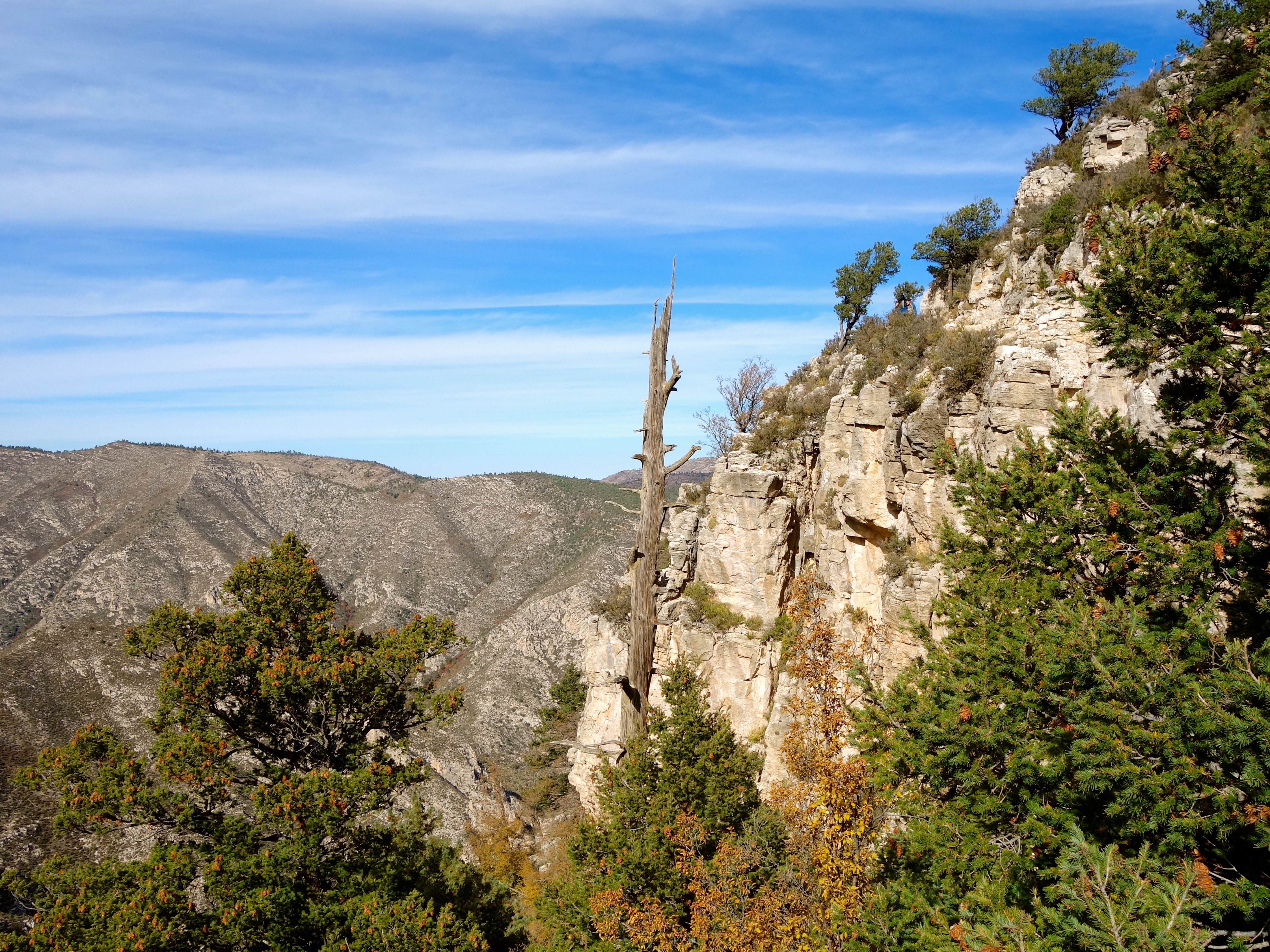

We took a lot of rest breaks. The woodsy peak in the shot below is the backside of El Capitan.
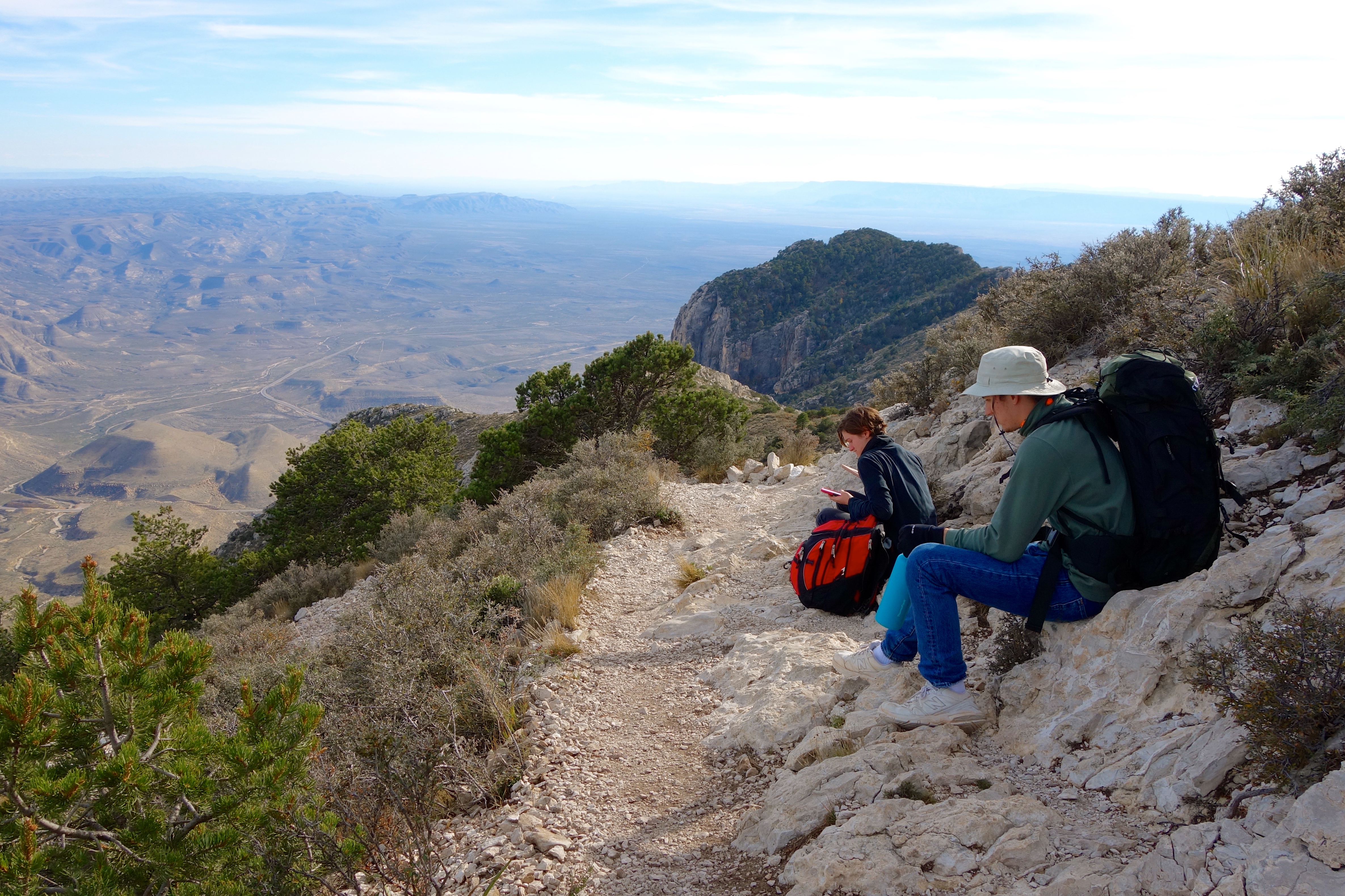
Looking back down at the false summit, from near the top of the real summit. Those tall pines on top mark the backcountry campground. Brrr!
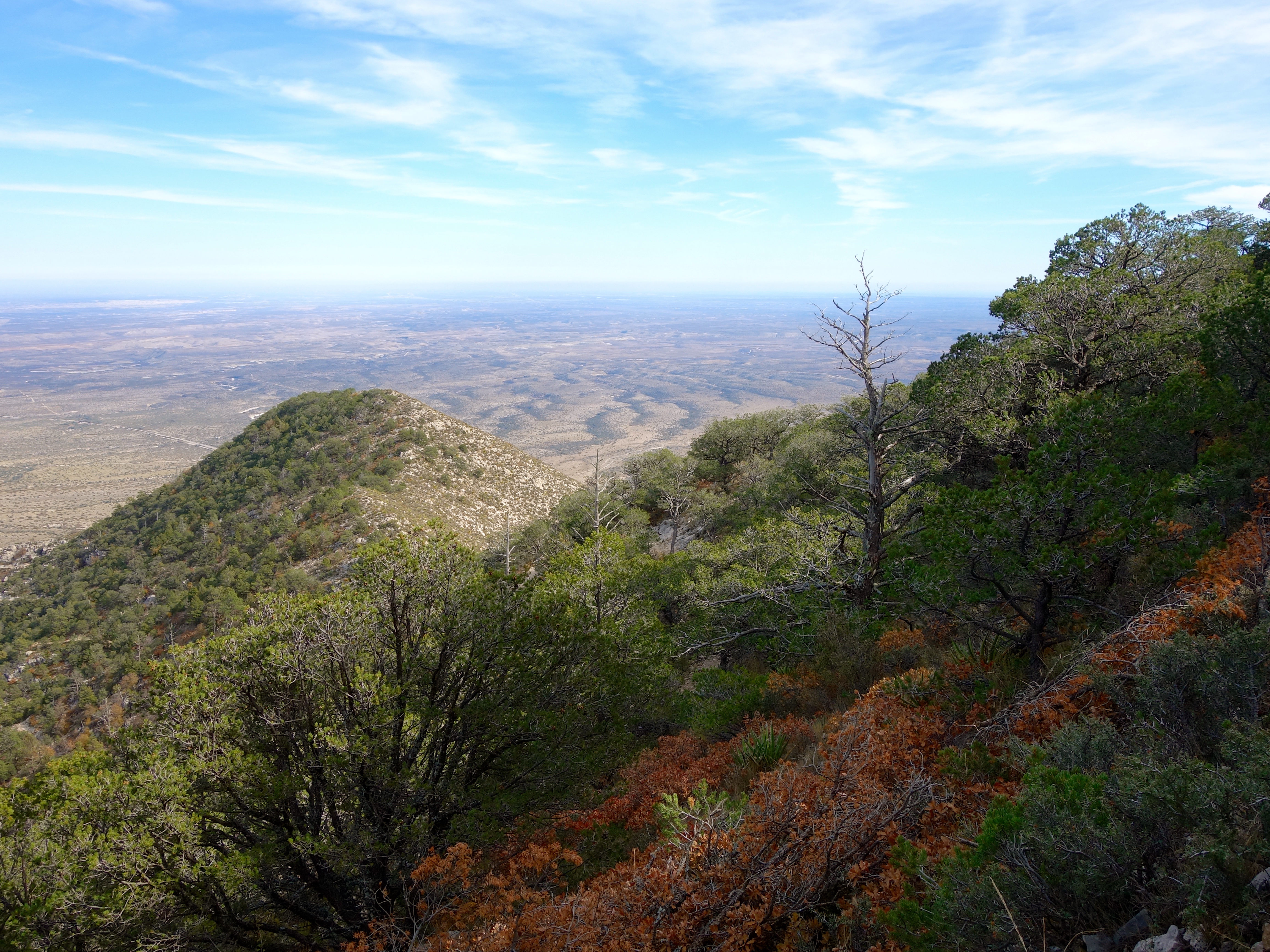
Up…
And up…

And up. We needed our jackets now; there was a chilly wind up there.
The trail gets difficult again near the top. Steep, narrow, rocky. There are places where you have to climb with your fingers and toes. Just below the summit, I ran out of energy. We stopped in the shelter of some boulders, out of the wind and off the trail, and ate the sandwiches that we had packed to eat at the top. Some hikers on their way back down said that they should have done that themselves, because the wind made eating more difficult on the summit.
Thus refueled, we made the final ascent.
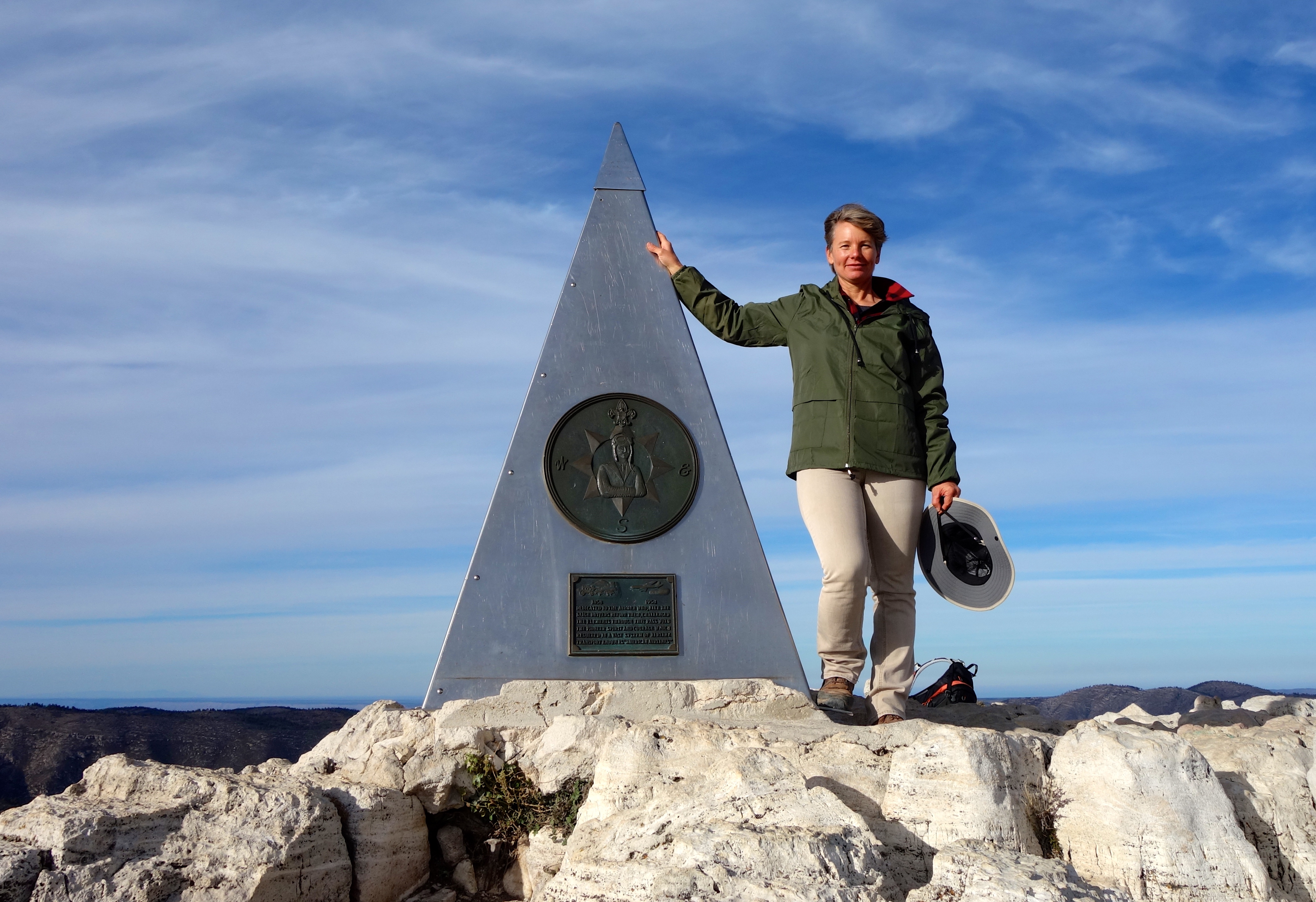
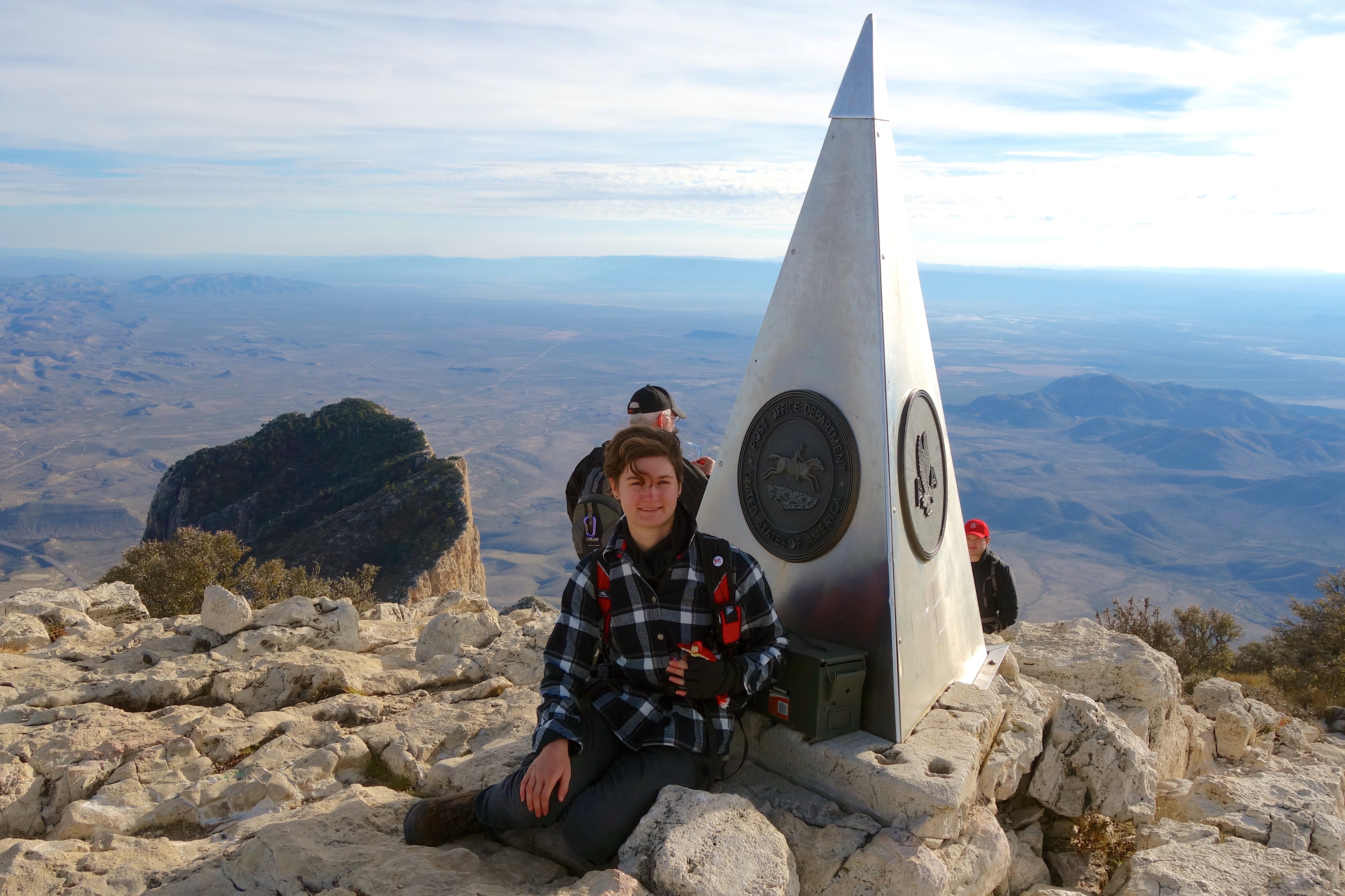
There is a Butterfield Stage monument at the top that predates the peak’s National Park status, and a logbook in a metal ammunition box.

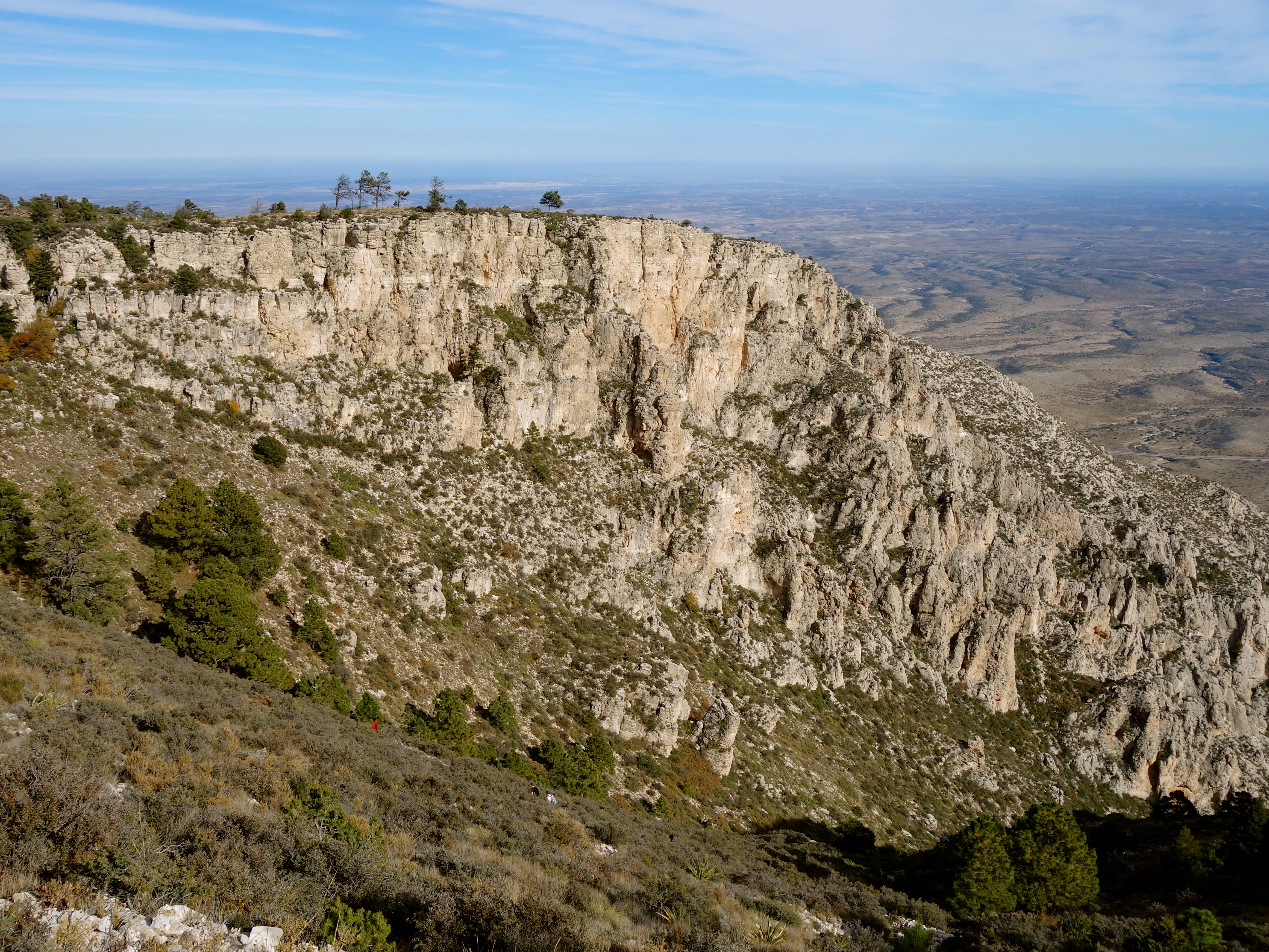
We signed the book, and relaxed for a while to enjoy the view. El Capitan looks like a mitten from above.
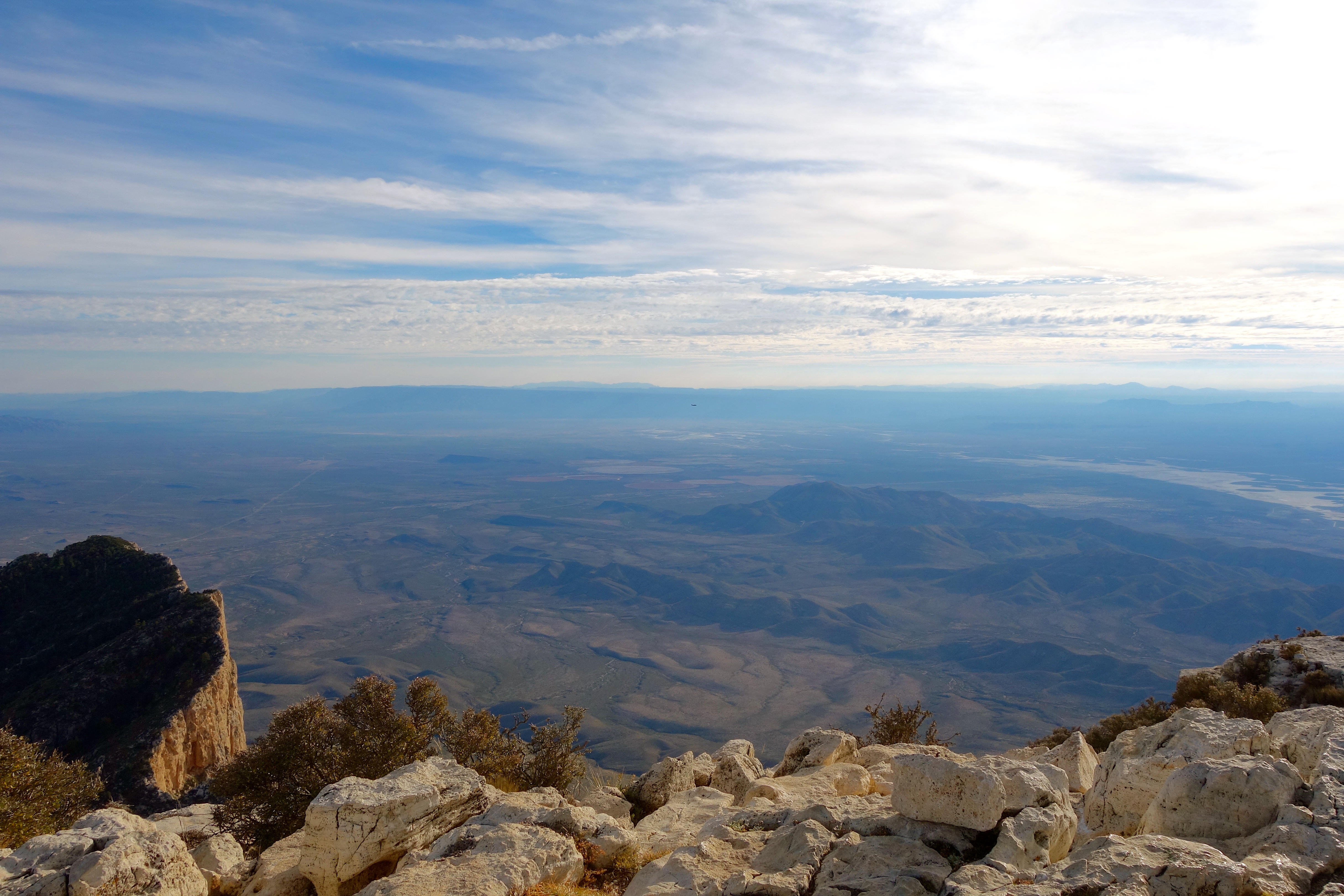
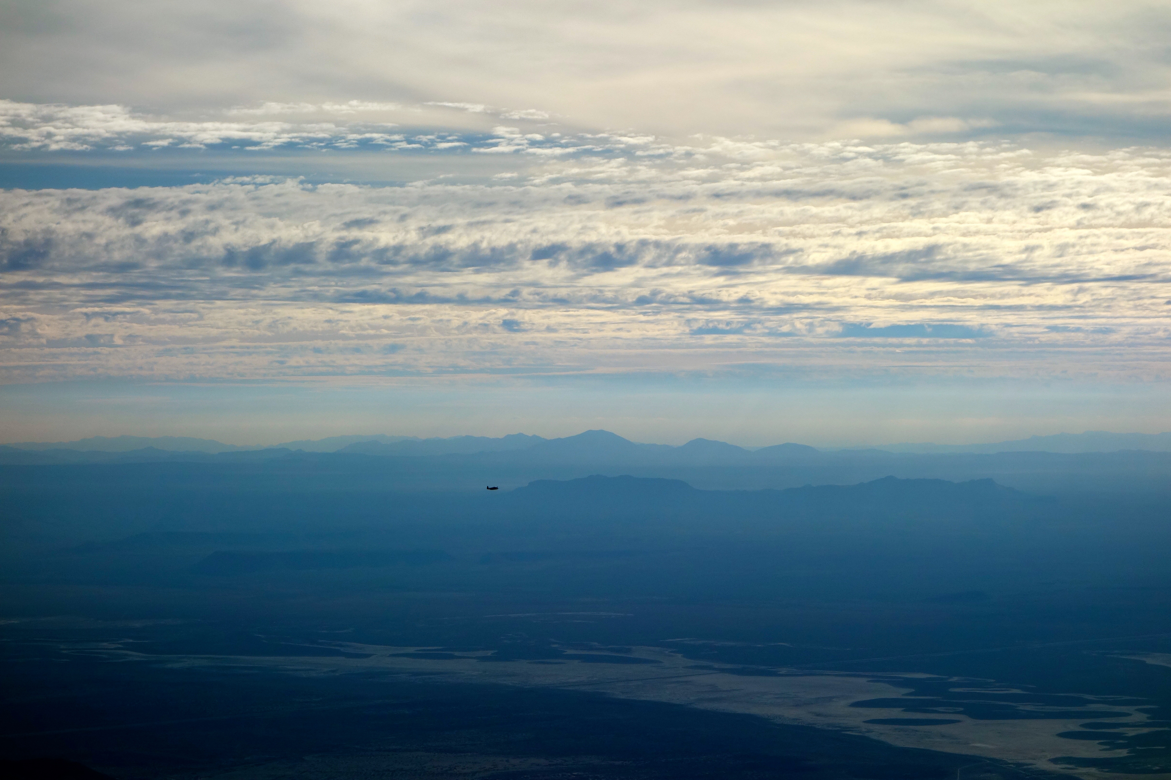
A plane flew past, below the level of the summit. Just a spectacular view.
Victory was ours!

Pingback: Above, Below and Just Beyond Texas, Part II | An Invincible Summer
Good morning,
I hope that you and your family are happy and healthy.
I would be obliged if you take a look at my site. It was launched this week.
Thank you for your time.
LikeLiked by 1 person
https://wonderofwords965217016.wordpress.com
LikeLiked by 1 person
Pingback: Thankful, 2020 | An Invincible Summer
Pingback: DOT by Bike and Rail: Commerce City, Thornton and Northglenn | An Invincible Summer